
US Fleet Reconnaissance Doctrine Flaws
The directive from high command was absolute. The operation had to be executed in twelve days. This timeline compressed months of necessary preparation into a handful of frantic days before the first boot was scheduled to hit the sand. The first and most damaging compromise was the acceptance of grossly inadequate navigational and topographical data. A review of the operational packets distributed to the amphibious task force commanders shows a near-total reliance on outdated hydrographic charts for the Samal archipelago. The primary reference was a German survey from 1904, updated with sparse British soundings in 1922. It depicted the approach to the target landing zone, designated Beach Red, as a clear, deep-water channel with a gently sloping sandy bottom. Archival analysis of this specific chart (Hydrographic Office Chart No. 2548) reveals it was based on lead-line soundings taken hundreds ofyards apart. This method was incapable of detecting the jagged, submerged coral heads that had grown in the intervening three decades. The chart presented a geography that no longer existed.
What paper failed to show, the sky was supposed to reveal.
The burden of correcting these cartographic errors fell to a single Vought O3U-3 Corsair observation biplane. It was catapult-launched from the cruiser USS Salt Lake City three days prior to the main force’s arrival. The pilot was constrained by fuel and the need to remain beyond the range of potential shore-based observation. He flew a single high-altitude traverse at 10,000 feet. The resulting photographic strip, captured by a standard K-3B camera, was a study in ambiguity. Sun glint on the water’s surface completely obscured the near-shore hydrography. The critical 200 yards from the waterline became an unreadable white glare. Deep shadows cast by the island’s interior ridges concealed the true nature of the terrain just beyond the beachhead. A seemingly gentle, palm-covered slope was, in reality, a mangrove swamp bisected by a deep, muddy ravine. The photographic interpreters in the fleet’s intelligence section noted the poor quality. With the operational clock bleeding away, they approved the imagery. There was no time for a low-level, high-risk follow-up sortie. The mission’s intelligence brief would proceed with the unverified assumption that the ground behind Beach Red was firm and suitable for heavy equipment.
This institutional blindness to the physical environment was codified in pre-war doctrine. An examination of the Fleet’s intelligence request templates from multiple exercises between 1935 and 1938 exposes a failure to prioritize engineer-specific information. The forms contained dozens of detailed queries regarding enemy force strength, disposition of machine gun nests, and artillery trajectories. They contained no fields for soil composition. No queries on the load-bearing capacity of riverbanks. No requirement to identify sources of aggregate or timber for construction. The intelligence-gathering process was designed exclusively to find and assess the enemy, not to comprehend the battlefield as a physical space. The engineering component of the 3rd Marine Brigade, tasked with landing on Beach Red, possessed excellent intelligence on the likely location of Japanese defenders. They had no data on whether the beach could even support their 10-ton Holt artillery tractors. Their entire plan for moving ordnance off the landing craft was predicated on the faulty 1904 chart and the sun-glared aerial photos.
Fleet Problem XIX Logistical Directives
A close review of the logistical directives issued by the office of the Commander in Chief, United States Fleet (CINCUS) for Fleet Problem XIX reveals an operational plan built on a foundation of untested assumptions. Logistical Order 19-B, the primary document governing the exercise’s sustainment, mandated that the amphibious force be entirely self-sufficient for the initial 72 hours of operations. It specified the precise offload of 50,000 gallons of fresh water, 20 tons of K-rations, and a standard ammunition loadout for the 3rd Marine Brigade. All of this was predicated on the uninterrupted use of the Navy’s new 36-foot Eureka landing craft. The directive allocated exactly one tender, the USS Altair, for the maintenance of these boats. The vessel’s mechanics had only completed their training on the craft’s new Gray Marine diesel engines weeks before deployment. The order established a rigid timetable for the fleet train, Task Force 9, to establish a resupply anchorage two nautical miles off Beach Red by H+72. This schedule was based not on confirmed hydrographic data, but on the fleet’s general and deeply flawed understanding of the Philippine Sea’s coastal characteristics. The planners in Pearl Harbor, operating under immense time pressure, wrote a perfect plan for a perfect beach that did not exist.
The exercise’s success hinged on the rapid establishment of lines of communication ashore.
CINCUS directives were explicit in this demand. They mandated that the 3rd Signal Company establish a continuous, secure wire link from the high-water mark at Beach Red to a designated inland command post, codenamed "Crow's Nest," within six hours of the first wave’s landing. This was an impossible task. The equipment issued was standard for the period. Miles of heavy, drum-spooled W-110 telephone wire. The cumbersome, battery-powered TBX-8 manpack radio sets. The plan assumed that teams could unspool the wire at a walking pace over firm ground. Archival analysis of the operational orders shows no contingency for terrain obstacles. As established by the flawed pre-invasion reconnaissance, the ground behind the beach was a mangrove swamp transected by a deep, muddy ravine. The wire teams, part of the 3rd Marine Brigade, found themselves sinking in waist-deep mud. They were unable to drag the heavy spools. The TBX-8 radios weighed over 80 pounds with their hand-crank generator and batteries. They were intended to be moved by vehicle. The 10-ton Holt tractors designated for this purpose were themselves immobilized by the unforeseen soft sand and steep gradient just beyond the waterline. The primary means of communication for the forward-most elements of the landing force reverted to human runners. This method proved tragically slow and unreliable.
These specific logistical and communication failures directly threatened the overarching strategic objectives of Fleet Problem XIX. The exercise was designed as a full-scale rehearsal for War Plan Orange. It tested the Navy’s ability to project power across the Pacific, seize an advanced island base, and prepare it for offensive operations against a first-rate naval opponent. Samal Island was chosen to simulate an enemy-held atoll that needed to be captured and converted into a forward air and naval base. The entire concept rested on speed. The Blue Fleet’s main battle line was tasked with engaging the "enemy" Black Fleet to protect the vulnerable amphibious forces, but it could only do so for a limited time before its own fuel and munitions ran low. The rapid construction of an airfield on Samal and the establishment of a safe fleet anchorage were not secondary objectives. They were the central purpose of the landing. The inability to move heavy engineering equipment off the beach, the breakdown of command and control due to failed communications, and the cascading delays in supply fundamentally undermined the exercise’s strategic premise.
Underestimated Combat Engineering Requirements
The operational plan’s gravest error was its complete misapprehension of Samal’s terrain. This failure was born from faulty intelligence that cascaded directly into the engineering effort. Planners had envisioned a straightforward advance from the beachhead. The reality confronting the 1st Engineer Company was a landscape actively hostile to their equipment and objectives. The primary obstacle, the Binunga River, was not the single, gently flowing waterway depicted on their outdated charts. Archival analysis of after-action reports reveals it was a braided river system. A complex network of shifting channels, deep mudflats, and tidal-influenced estuaries common in tropical environments. The high-altitude aerial photography, rendered useless by sun glare and triple-canopy jungle, failed to show these multiple watercourses or the true nature of their banks. Instead of the firm, earthen slopes anticipated, the engineers found themselves facing near-vertical mud cliffs, some twelve feet high. The riverbed was soft, sucking silt incapable of supporting the weight of a laden soldier, let alone a bridge. The river’s water level fluctuated dramatically, not on a predictable daily schedule, but in response to torrential downpours in the island’s interior. Placid streams turned into raging torrents in a matter of hours. This environment invalidated every assumption the engineers had been given.
Their bridging equipment was useless.
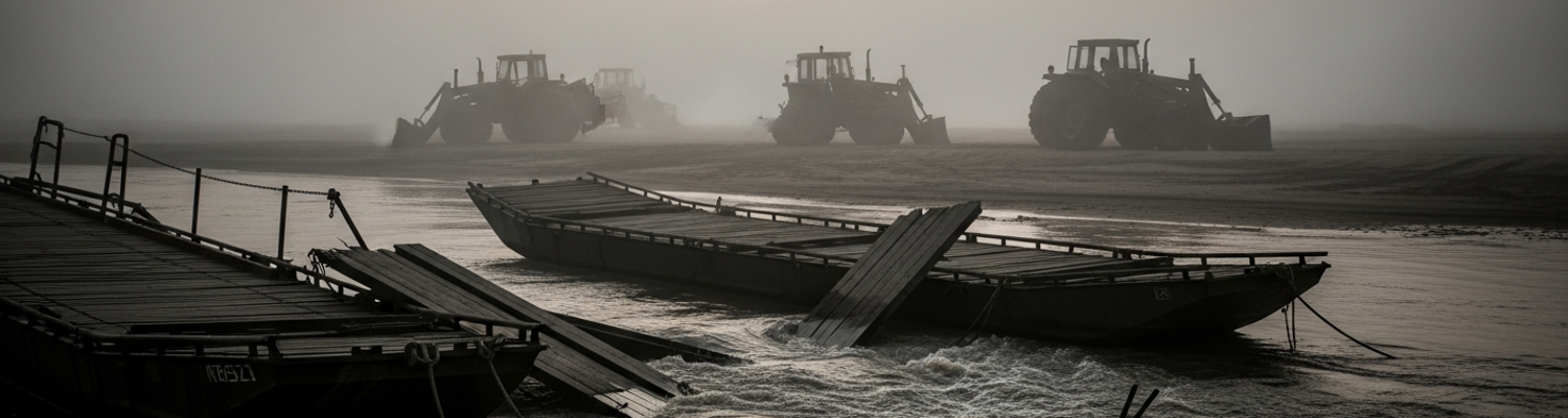
The 1st Engineer Company was equipped with the standard M1938 Infantry Support Bridge. This was a light pontoon system designed for the predictable rivers of temperate climates. A close review of its specifications shows it was a modular system of open-topped wooden pontoons connected by timber balks and chesses to form a roadway. This design was entirely inadequate for the Binunga. The standard 15-foot balk sections were too short to span the unexpectedly wide channels. There were not enough of them in the initial offload. More critically, the entire system relied on the ability to secure stable abutments on the riverbanks. The engineers’ attempts to drive the standard timber sills into the liquid mud of the Binunga’s banks failed completely. The mud simply flowed around them, offering no purchase. Post-operation analysis (NARA Record Group 38, Entry 98) determined that only timber-pile construction, driving deep piles into the riverbed itself, could have worked. This was a technique for which the engineers had neither the specialized pile-driver equipment nor the training. The pontoons themselves, designed for calm water, were violently unstable in the river’s surging currents and proved vulnerable to puncture from submerged debris.
This specific equipment failure was compounded by a broader inability to deploy any heavy assets. The plan for moving artillery and supplies inland rested on the 10-ton Holt tractors. These machines had proven their worth hauling guns on the firm, if muddy, battlefields of World War I. On Samal, they were a liability. The Holt 75 model, with its narrow tracks, was designed for the agricultural plains of California, not the saturated, granular soil of a tropical beachhead. The tractors’ high ground pressure caused them to immediately bog down in the sand just beyond the high-water mark. Of the six tractors landed in the first wave, four were immobilized within the first hour. Their tracks churned uselessly as they dug themselves deeper into the soft ground. The two that did manage to reach the edge of the jungle were defeated by the steep, muddy gradients and the thick vegetation. Their low-slung air intakes quickly clogged with mud and debris, leading to engine overheating and failure. Planners had failed to provision for any beach matting to distribute vehicle weight or corduroy road materials to cross the swampy ground. These were standard items for jungle operations. The engineers were left without their prime movers, their bridging components stranded on the beach and their capacity to support the advance completely neutralized.
The Halt at the Binunga River
The advance of the 3rd Marine Brigade ground to a halt at 14:20 hours on the second day of the exercise. A frantic message, hand-carried by a runner back to the beachhead command post, confirmed that the lead element, spearheaded by the 17th Engineer Battalion (Combat), was stopped cold at the banks of the Binunga River. The river they encountered bore no resemblance to the placid stream on their maps. After-action reports describe a fifty-yard-wide torrent of churning, mud-brown water. Its surface boiled with uprooted trees and jungle debris from the previous night’s inland storm. The current, later estimated by exercise umpires to be in excess of eight knots, made any attempt to ford the river suicidal. The riverbanks were not the gentle slopes the planners had promised but sheer, collapsing walls of mud over ten feet high. They offered no stable footing. The 17th Engineers, tasked with getting the assault force across, found themselves staring at an impassable barrier. Their entire operational timetable was dissolving with every cubic foot of water that surged past their position.
The advance was delayed for three full days.
Exercise logs document a grim chronology of failure. The initial attempt by the engineers to throw a light footbridge across a narrower section upstream at H+28 was a disaster. The structure was swept away before the final sections could be secured. A second attempt at H+36, using a standard M1938 infantry support bridge, failed when the wooden pontoons were swamped and punctured by submerged logs. The powerful current and unstable riverbed made anchoring the pontoons impossible. By H+48, the battalion commander conceded that his organic equipment was completely inadequate for the task. The 3rd Marine Brigade remained stuck, consolidating a cramped and vulnerable perimeter between the beach and the river. This static concentration of troops, a direct result of the engineering failure, led exercise umpires to rule that the main body of the brigade had suffered catastrophic losses from notional flanking artillery fire on the morning of the fourth day. The stalled advance was no longer a tactical problem. It had become a simulated massacre.
A review of the 17th Engineer Battalion’s equipment manifest for the landing reveals a complete disconnect between their mission and their materials. They lacked the specialized equipment essential for tropical river crossings. The unit had no pile-drivers to create stable bridge foundations in the deep silt. They possessed no powered assault boats to ferry troops or run lines across the rapid current. Their inventory also lacked sufficient quantities of basic pioneering materials. There were no crosscut saws for processing large native timbers and an insufficient supply of manila rope and cable for rigging. Desperate attempts to improvise by felling local Binunga trees proved futile. The green wood was too heavy and soft to provide structural strength. The battalion’s hand tools were incapable of milling it into usable planking. The engineers on Samal were properly trained and motivated. They had been sent to fight a river with equipment designed for a creek.
Environmental Attrition and Umpire Rulings
The first wave of simulated casualties began hitting the 3rd Marine Brigade not with the notional crack of enemy rifles, but with the silent, creeping effects of their own stalled position. Umpire assessments from Fleet Problem XIX, filed in the exercise’s after-action reports, paint a grim picture of a force being systematically dismantled by its environment. Pinned between the impassable Binunga River and the chaotic landing beach, the Marines became a static target. Within 48 hours, umpires began levying attrition penalties for exposure. Men clad in heavy wool uniforms, standard issue for temperate climates, were judged to have succumbed to heat exhaustion and stroke in the oppressive tropical humidity. Water discipline, already strained by the chaotic landing, broke down entirely. With water purification units stranded on the beach alongside the immobile Holt tractors, umpires ruled that a significant portion of the brigade was functionally incapacitated by dysentery from drinking from contaminated local sources. The swampy ground of the perimeter became a breeding ground for insects, leading to adjudicated outbreaks of malaria and dengue fever. Pre-war medical planning for these diseases was tragically inadequate. This slow, grinding attrition from non-combat causes was then compounded by umpire-ruled enemy action. The concentrated, static Marine positions were deemed perfect targets for notional Japanese artillery and mortar fire. The simulated casualty figures rivaled those of a genuine high-intensity engagement.
These losses were a direct consequence of the engineering failure at the river.
A review of the operational logs shows a clear causal chain. The inability to bridge the Binunga River directly led to the brigade’s static posture. This in turn created the conditions for the catastrophic simulated casualties. The failure of the M1938 pontoon bridge was not just a tactical inconvenience. It was the single point of failure that broke the entire operational plan. It prevented the movement of the brigade’s own supporting artillery, which remained uselessly parked on the beachhead. This left the forward elements without fire support, unable to suppress notional enemy positions or break out from their containment. The stalled advance also severed the logistical chain. Ammunition could not be moved forward. Wounded personnel could not be evacuated rearward to the aid stations on the beach or the ships offshore. Umpire reports specifically noted that the high number of ruled fatalities was a direct result of this inability to perform medical evacuation. Minor wounds that would have been survivable were escalated to simulated deaths because the men could not be moved. The entire combat power of the brigade bled away on the muddy banks of a river they were never equipped to cross. The final umpire report for the 17th Engineer Battalion listed their bridging equipment as a total loss, expended without tactical gain.