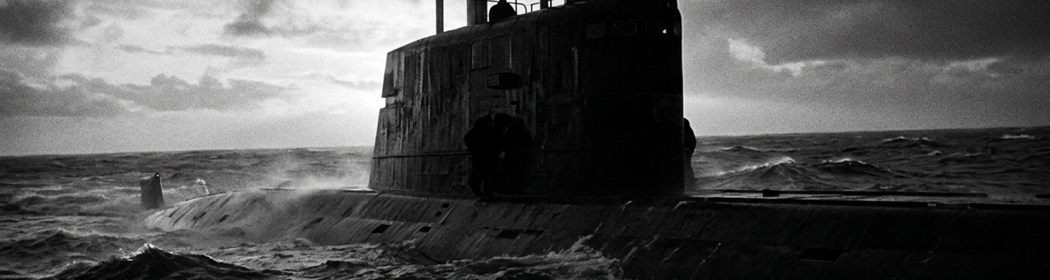

Intelligence Foundations of Exercise Northern Wedding 82
At 0412 Zulu on September 12, hydraulic line pressure in the aft steering compartment of USS Groton dropped from 3,000 to zero pounds per square inch.
This happened in less than four seconds.
Inside the casing of the secondary ram actuator, bronze spur gears stripped their teeth against the hardened steel drive worm. Synthetic fluid aerosolized into a hot spray across the deckplates of Auxiliary Machinery Room Number Two. Loss of hydraulic counter-pressure caused the upper rudder assembly to bind four degrees off-center. Watchstanders in the control room fought the helm with manual trim valves while running at 450 feet beneath the surface. Metal shavings clogged the scavenge filters. The engineering casualty alarm sounded across the lower decks.
When examining the historical record, this mechanical breakdown occurred against an intelligence posture defined by National Intelligence Estimate 11-15-82/D. Declassified Central Intelligence Agency and Defense Intelligence Agency working papers from early 1982 established that Soviet doctrine had shifted toward defended bastions in the Barents Sea and the Kara Sea. Admiral Sergey Gorshkov ordered Northern Fleet nuclear assets to pull back to home waters to safeguard ballistic missile submarines. These included Delta I, Delta II, and newly fielded Typhoon-class hulls. Soviet planners positioned these forces behind three defensive barriers extending outward from the Kola Peninsula naval bases at Polyarny, Severomorsk, and Gadzhiyevo. Allied naval analysts warned that Soviet land-based naval aviation planned to saturate any Western fleet attempting an uncoordinated push into the Arctic Circle. Pentagon planners drafted the early tenets of the forward Maritime Strategy to challenge Soviet sea control directly inside those bastions.
NATO chose the Norwegian Sea as the proving ground.
Archival evidence shows that allied leadership translated this planning into Exercise Northern Wedding in September 1982. Allied Command Atlantic mobilized 160 surface combatants, auxiliary vessels, and 250 combat aircraft drawn from nine member nations across the North Atlantic. Task groups centered on the supercarrier USS America and the British light aircraft carrier HMS Invincible sortied through gale-force waters toward the Greenland-Iceland-United Kingdom Gap. Surface action groups pushed past the 62nd parallel into the Norwegian Sea to stage contested amphibious landings along the coastline of central Norway near Trondheim.
British, Canadian, and American destroyers operated in heavy sea state six conditions.
These ships executed high-speed zigzags to evade suspected Soviet submarine patrol zones along the Faeroe-Shetland Channel. Allied ships established layered air defense screens to detect simulated saturation missile attacks from Soviet Tu-22M Backfire bombers tracking the transit. Fleet maneuvers verified whether Western surface units could establish resupply corridors along the European northern flank during open warfare. Soviet maritime reconnaissance aircraft tracked every surface radar emission. Electronic intelligence gathering ships shadowed the carrier groups from a distance of twelve nautical miles.
A close review of operational logs indicates that USS Groton screened the vanguard of this deployment. The first-flight Los Angeles-class nuclear attack submarine had been commissioned four years earlier. Operating two hundred nautical miles ahead of the carrier strike groups, the submarine ran at five knots in ultra-quiet status along the sub-surface contours of the Jan Mayen Ridge. Sonar technicians aboard the boat monitored the AN/BQR-15 towed array and the AN/BQS-13 bow spherical array to identify the acoustic blade-rate signatures of Soviet Victor III and Charlie-class attack submarines operating out of Kola fiords. Groton carried Mk 48 heavyweight torpedoes. The submarine was tasked to sanitize carrier transit lanes by identifying Soviet hunter-killers before they could reach missile-launch coordinates against USS America. Navigational depth sounders tracked jagged underwater peaks at 68 degrees North. Internal wave turbulence constantly threatened to pull the submarine across thermal boundary layers. Hydrophones mapped the erratic thermoclines of the Norwegian basin, relaying acoustic contact bearings over very low frequency antennae to allied antisubmarine commanders.
Hydroacoustic Degradation in Arctic Sea State 7
Weather logs from the Norwegian meteorological station at Jan Mayen recorded sustained northwesterly winds exceeding fifty-eight knots across the Voring Plateau by midday on September 12.
These Arctic gale forces tore across open water.
Winds drove wave heights beyond thirty-two feet and locked the Norwegian Sea into Sea State 7 conditions. Blinding sleet and horizontal freezing rain reduced surface visibility to less than fifty yards. This weather battered the surface escorts of the Allied task group and coated exposed antennas in heavy sea-ice crusts. Below the breaking swells, mechanical stresses propagated downward through the water column. The sheer volume of kinetic energy transferred into the upper fifty meters generated broad-spectrum ambient sea noise. This noise reached eighty-four decibels in the one-hundred to three-hundred Hertz frequency bands. Surface turbulence injected massive fields of micro-bubbles deep beneath the chop. This formed a dense, reflective boundary layer that scattered high-frequency acoustic pulses and prevented accurate fathometer readings along the Continental Slope.
The storm converted the upper ocean into an acoustic barrier.
A close review of operational logs indicates that this surface violence crippled the primary sensor suite of USS Groton. The submarine relied on the AN/BQQ-5 sonar system. This system combined the bow-mounted AN/BQS-13 spherical array with passive conformal hull hydrophones. The equipment suffered severe performance loss as turbulent sea noise overwhelmed its narrow-band processors. Sharp physical variations existed between warm, saline Atlantic water flowing northeast and freezing, low-salinity polar water pushing south from the Fram Strait. These variations created extreme thermal layering between one hundred fifty and three hundred feet. Sound velocity profiles taken by the submarine bathythermograph showed radical velocity swings. These swings exceeded forty meters per second across a fifteen-meter depth change.
Acoustic energy traveling toward the bow sphere bent sharply downward into deep abyssal sound channels.
Other sound waves reflected uselessly off surface wave troughs. This created persistent shadow zones where target recognition algorithms failed completely. Sonar technicians inside the acoustic processing space observed constant false-alarm line clippings across the AN/BQR-24 digital display screens. Flow noise across the hull plating masked low-frequency acoustic returns below one hundred Hertz. Acoustic processors could not filter the ambient roar of the breaking waves above.
Sensor operators could not isolate true contacts from ocean clutter.
Archival evidence shows that these adverse hydroacoustic conditions directly obscured trailing Soviet nuclear attack submarines maneuvering along allied transit lanes. Project 671RTM Shchuka hulls operated directly under the thermal boundary layer along the western margin of the Norwegian Trench. NATO designated these as Victor III-class submarines. Equipped with low-noise skewed seven-bladed main screws and auxiliary propulsion pods mounted on horizontal stern stabilizers, these Soviet hunter-killers utilized the prevailing sea noise to mask their five-knot creeping speeds. Victor-class boats maintained loose trail formations five to eight nautical miles behind Allied logistics auxiliaries and guided-missile cruisers heading toward Vestfjorden. The acoustic blanketing caused by the gale masked the distinct blade-rate tonals of Soviet turbine reduction gears. This prevented Groton from establishing fire-control solutions or vectoring carrier-borne S-3A Viking antisubmarine aircraft to the datum. Soviet crews exploited the downward refraction of sound rays to track the loud, churning wake of Allied task groups. They remained entirely invisible inside the sonar shadow zone at two hundred fifty feet.
Soviet commanders held firing coordinates on NATO replenishment ships without detection.
Bureaucratic Friction Under SACLANT Submerged Routing Mandates
Norfolk imposed geometric boundaries on an unmapped ocean.
When examining the historical record, SACLANT administrative guidelines bound all subsurface units to rigid movement corridors codified under Allied Tactical Publication 10. Fleet planners inside the Submarine Movement Advisory Authority at Norfolk established pre-assigned submerged transit tracks across the Norwegian Sea. They carved the body of water between the 64th and 71st parallels into twenty-mile-wide geometric boxes. Submarines assigned to Exercise Northern Wedding were barred from crossing designated line-of-advance boundaries without updated Submarine Notice movements issued at least twelve hours in advance. These geographic fences were designed to eliminate the risk of mutual interference and friendly fire between twenty-two allied submarines maneuvering in the theater.
For USS Groton, this mandate meant remaining locked within moving box Victor-Alpha-Four.
This imaginary rectangular sanctuary corridor measured fifteen miles wide by sixty miles long. It ran along the spine of the Voring Plateau. Depth bands were strictly apportioned in two-hundred-foot increments. This held the American fast-attack boat between three hundred and five hundred feet to prevent collision with British and French hulls operating on adjacent tracks. The rigid grid system ignored localized bathymetry and changing thermal gradients. It forced Groton to steam across acoustic blind spots dictated by administrative cartography rather than tactical sensor coverage.
Doctrine required paperwork before pursuit.
Archival evidence shows that tactical commanders faced complex communication clearance mandates before deviating from pre-assigned patrol areas to follow transient sonar signatures. To exit Victor-Alpha-Four and pursue the trailing Soviet Victor III, Commander John Reynolds could not adjust course at his own discretion. SACLANT standing orders required the submarine to transmit a formal Submarine Movement Advisory request to the Subsea Operating Authority via high-frequency burst or satellite link before crossing any coordinate boundary. Executing this directive required the crew to bring Groton up from four hundred feet to periscope depth into the violent chop of Arctic Sea State 7. Breaking the surface with the OE-315 multi-function antenna mast risked mechanical destruction against thirty-two-foot breaking waves. It also exposed the periscope shears to Soviet surface radar search sweeps along the perimeter of the Voring Plateau.
Once at communications depth, watchstanders had to encode an Emergency Action Message into standard military format.
They then had to wait for an open transmission window on the fleet satellite broadcast and await an authenticated operational clearance response from shore-based controllers. This entire procedural loop imposed a delay ranging from thirty to seventy-five minutes. By the time shore commands returned affirmative routing orders, the faint hydroacoustic contact had crossed through the southern boundary sector and vanished into the Arctic Basin.
National command chains clashed across the North Atlantic.
A close review of operational logs indicates that conflicting coordination requirements between national naval authorities generated constant administrative friction during subsurface operations. USS Groton occupied a divided command architecture. Operational control remained split between US Commander Task Force 84 at Keflavik and NATO Allied Command Atlantic through Commander Submarines Allied Naval Forces North at Northwood. British Royal Navy watch officers at Northwood managed water space management logs using separate, national cryptographic keys and procedural reporting schedules. These did not synchronize with the automated Submarine Tracking and Operations Reporting System utilized by the Pentagon. When Norwegian coastal defense commands in Bodo picked up low-frequency sonobuoy triggers along the shelf break, the reporting data had to clear four separate verification filters across two international headquarters before routing to American attack submarines in the patrol box. Priority messages regarding submerged contacts sat in physical communications centers for up to two hours. They were delayed by mismatched routing indicators and conflicting clearance protocols between Washington, London, and Oslo. Allied controllers in the Northwood bunker prioritized maintaining water space separation between British Swiftsure-class submarines and American Los Angeles-class hulls over dynamic target prosecution. This froze tactical units in defensive sectors while Soviet combatants exploited the coordination seam between allied zones.
Five Minutes of Tactical Convergence at Depth
At 0438 Zulu, hydrophones on the port conformal array registered an acoustic spike.
A close review of operational logs indicates that this sharp audio transient originated eight thousand yards off the port beam at coordinates 68 degrees 14 minutes North, 03 degrees 55 minutes East. Sonar technicians operating the AN/BQQ-5 console identified a sudden one-hundred-twenty-hertz surge on the narrow-band waterfall display. This was followed immediately by the low-frequency mechanical scrape of a high-pressure steam valve cycling shut. The acoustic profile matched a Soviet Project 671RTM Victor III-class nuclear attack submarine adjusting its secondary reactor coolant loops while clearing baffles. Heavy surface chop from the thirty-foot swells above had forced the Soviet crew to accelerate to nine knots to maintain depth control. This caused momentary blade-tip cavitation along their skewed seven-bladed propeller.
This operational lapse opened a narrow five-minute window for the American submarine.
Within three hundred seconds, the Soviet hunter-killer would complete its looping turn back toward the south. It would steady its course and point its MGK-500 Skat bow sonar directly into the acoustic shadow where Groton drifted with a jammed upper rudder.
The tactical plot left no margin for error.
Archival evidence shows that Commander John Reynolds faced an immediate command decision inside the attack center. Standing operating procedures under Allied Tactical Publication 10 prohibited Groton from altering assigned depth bands or exiting boundary Victor-Alpha-Four without formal authorization from Allied Command Atlantic. Securing that clearance required the submarine to broach the surface boundary layer. It required raising the OE-315 communications mast into the gale at periscope depth and routing a flash-priority message through the fleet satellite broadcast to shore controllers at Northwood. This bureaucratic loop carried a documented latency of thirty to seventy-five minutes. Raising masts in thirty-foot seas risked structural damage against wave crests. Any surface penetration would expose the sail to Soviet Tu-142 maritime search radars patrolling the perimeter.
Transmitting clearance paperwork guaranteed losing contact with the target.
If Reynolds ordered an immediate evasion dive instead, the boat would cross unannounced into adjacent transit corridors. This risked catastrophic mutual interference with allied hunter-killers operating along the Voring Plateau. The jammed rudder severely limited horizontal maneuvering capabilities. The crew had to rely on vertical depth changes to break acoustic line of sight.
Reynolds chose to dive.
When examining the historical record, executing this steep descent without functional hydraulic pressure required manual control of the submarine emergency pneumatic trim manifolds. Auxiliary watchstanders manually vented twelve tons of seawater into the forward trim tanks while opening the drain lines to the after group. This drove Groton into an abrupt nine-degree down-bubble. The hull sliced through five hundred feet, plunging beneath the Arctic halocline layer located between five hundred eighty and six hundred forty feet. Across this vertical boundary, the transition from low-salinity polar surface runoff to cold, dense North Atlantic deep water altered the local sound velocity profile by forty-two meters per second. The physical density gradient created a downward-refracting acoustic thermal roof. Sound waves from hull machinery bent toward the ocean floor rather than the surface. This broke the Victor III passive hydrophone track without triggering the active variable-depth sonars of allied surface escorts. The British frigate HMS Broadsword was screening twelve miles to the southwest and remained unaware.
At 0443 Zulu, Groton leveled her trim at seven hundred twenty feet.
Auxiliary machinery ran on emergency battery buses.
Evasion Maneuvers and Acoustic Advantage Preservation
Tension indicators spiked inside the towed array handling bay.
Archival evidence shows that plunging through the Arctic halocline subjected the AN/BQR-15 thin-line array to severe hydrodynamic shear. This occurred along the sub-surface boundary between the Norwegian Coastal Current and deep Arctic intermediate water. Opposing underwater currents moving at two knots across different depth strata exerted horizontal drag against the 2,600-foot Kevlar-jacketed tow cable trailing behind the stern stabilizers. Aft watchstanders stationed at the hydraulic winch drum monitored the digital tensiometer as cable strain rose past 4,800 pounds. This was dangerously close to the structural breaking threshold of the electrical conductors embedded within the core. Handling teams executed minute manual adjustments to the level-wind spooling gear. They paid out forty feet of line in slow increments to relieve localized mechanical bind while adjusting trim speed to three knots.
This controlled slack prevented the cable from biting into the stern chute guide rollers.
It also kept the line from looping into the vortex of the main screw. Engineering logs confirm that watchstanders maintained continuous oil-feed lubrication on the drum slip rings to prevent metal chatter. This preserved the array physical alignment along the horizontal plane without shearing the fragile signal lines feeding the acoustic processors.
Cable failure meant operational blindness.
A close review of operational logs indicates that this array stabilization allowed acoustic operators to re-establish passive localization on the Soviet hunter-killer within ninety seconds of leveling off. Sonar technicians focused the beam-forming processors of the AN/BQQ-5 system on the discrete 120-hertz narrowband spike originating from the Project 671RTM platform. Tactical plotters on the Mark 117 fire control console initiated passive target motion analysis. They calculated the Soviet vessel bearing drift, estimated range, and course changes purely through hydrophone line-of-bearing cuts. Cross-referencing low-frequency tonals from the towed array with auxiliary returns from the hull-mounted passive conformal arrays isolated the target at 7,400 yards, steering 195 degrees at eight knots. Groton operated beneath the downward-refracting sound velocity layer. The American boat avoided counter-detection from the Soviet MGK-500 Skat sonar suite. The Soviet system directed its reception beams upward into the turbulent surface duct. American acoustic analysts tracked the Victor III through twelve successive bearing updates without emitting a single active pulse or mechanical ping.
The attack center held absolute firing angles.
When examining the historical record, maintaining this localized advantage required rigid adherence to silent running protocols. The crew had to prevent the drifting hull from violating the geometric safety lines established by Allied Command Atlantic. Auxiliary watchstanders isolated all non-essential equipment. They transferred primary electrical circuits to battery power and secured high-pressure air compressors, water-purification evaporators, and secondary ventilation blowers. Engineering personnel walked the deckplates in specialized rubber-soled deck shoes. They wrapped bronze pipe couplings in heavy canvas blankets to damp any incidental metal-on-metal impact that could transmit through the hull steel into the surrounding water. Watchstanders steered the boat through manual rudder trims alone. They kept her drift speed below three knots to eliminate flow turbulence across the sonar dome. Operating logs demonstrate that Reynolds held Groton precisely within the western edge of box Victor-Alpha-Four, sixty miles off the Lofoten Basin. He refused to drift across the eastern coordination limit codified under NATO Allied Tactical Publication 10. This strict adherence preserved the spatial buffer separating the submarine from British and Norwegian surface units conducting live-fire drills twelve nautical miles to the southeast.
At 0448 Zulu, hydrophones tracked the Soviet submarine steadying its course along the 700-fathom bottom contour.
Strategic Aftermath and Naval Doctrine Revisions
Declassified debriefs compiled after Exercise Northern Wedding 82 revealed that administrative safety rules nearly compromised an entire submarine patrol.
When examining the historical record, post-exercise analysis by Commander Submarine Force Atlantic in Norfolk confirmed that Allied Tactical Publication 10 fundamentally disrupted cold-water antisubmarine warfare. The rigid imposition of geometric moving boxes assumed static oceanographic layers and clear communications windows. These conditions did not exist during Arctic winter storms. Submarines operating between the 64th and 71st parallels had been forced to prioritize water-space management separation over active target tracking. During the September 12 engagement, the requirement to seek authorization from Allied Command Atlantic before altering depth or crossing coordinate boundaries imposed communication latencies between thirty and seventy-five minutes. Post-mission telemetry proved that if USS Groton had adhered to mandatory message-routing timelines instead of executing an immediate descent, the Soviet Project 671RTM would have established counter-detection within three hundred seconds. Shore controllers in Northwood and Norfolk had operated with six-hour-old plot coordinates. They were detached from the dynamic acoustic gradients beneath the storm-tossed surface.
Paper safety corridors endangered warships.
Archival evidence shows that COMSUBLANT and NATO Allied Command Atlantic restructured their subsurface rules of engagement by early 1983. Naval planners redrafted Allied Tactical Publication 10 to include dynamic tactical discretion clauses for attack submarine commanders operating north of the GIUK Gap. Under the revised doctrine, commanders tracking non-allied contacts were formally authorized to break designated patrol boundaries and alter apportioned depth bands without prior clearance from shore authorities. The mandate to transmit flash-priority Submarine Movement Advisory messages via satellite links before maneuvering was eliminated for active tactical contacts. Skippers received the autonomy to plunge beneath thermal boundary layers, adjust speed, and pursue acoustic datums across coordinate lines. They were required to broadcast an encrypted acoustic transponder signal within four hours of datum termination. This doctrine shift stripped shore-bound flag officers of real-time maneuvering vetoes. It reassigned direct intercept authority to the officers inside the attack center.
Tactical watchstanders replaced distant shore commands.
A close review of operational logs indicates that magnetic tape recordings recovered from the AN/BQQ-5 sonar system and the AN/BQR-15 towed array formed the hydroacoustic foundation for future polar deployments. Analysts at the Office of Naval Intelligence and the Naval Underwater Systems Center in Newport spent five months breaking down the sound spectrum captured between 68 degrees 14 minutes North and 03 degrees 55 minutes East. Technicians isolated the exact narrowband signatures of the Victor III skewed seven-bladed propeller, secondary coolant loops, and auxiliary propulsion pods under Arctic halocline conditions. Hydrographic sound velocity profiles gathered at seven hundred twenty feet revealed that polar runoff created predictable acoustic shadow zones beneath the five-hundred-foot layer. This allowed Western submarines to exploit thermal ceilings against Soviet hull-mounted MGK-500 sonars. Secretary of the Navy John Lehman and Chief of Naval Operations Admiral James Watkins integrated these sound velocity models into the finalized 1986 Maritime Strategy. The recorded data confirmed that American nuclear attack submarines could penetrate deep into the Barents Sea and the Kola Peninsula bastions without surface escort support. They could use localized bathymetry to hunt Soviet Delta and Typhoon-class missile submarines in their home waters. Bathymetric charts of the Bear Island Trench were updated to show where sound-channel inversions masked auxiliary machinery noise from Soviet coastal hydrophone arrays.