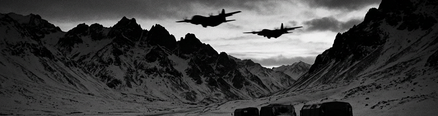

Chongchon River Offensive and Allied Retreat
A close review of operational logs indicates that roughly 230,000 soldiers of the Chinese People's Volunteer Army 13th Army Group occupied the ridgelines above the Chongchon River by late November 1950. They vastly outnumbered the 50,000 combat troops of the United States Eighth Army facing them. Operating under commander Peng Dehuai, the 13th Army Group deployed six full field armies across the Yalu River. These included the 38th, 39th, 40th, 42nd, 50th, and 66th armies. They evaded Allied air reconnaissance through strict movement discipline and blackout orders. Archival evidence shows that these infantry forces marched up to twenty miles each night through sub-zero conditions. They carried basic rations of parched flour alongside dry rice, Soviet-pattern PPSh-41 submachine guns, stick grenades, and light mortars. When General Douglas MacArthur launched his Home-by-Christmas assault on November 24, Allied commanders believed they were pursuing broken remnants of scattered units. Enemy forces had instead established deep, concealed staging sectors in the jagged terrain east and north of Kunu-ri. They waited for Allied columns to advance into narrow valleys where mechanized firepower was constrained by sheer rock walls and unfordable water crossings.
The Chinese encirclement began along the eastern ridgelines on November 25.
That night, the Chinese 38th and 42nd Armies engaged the Republic of Korea II Corps at Tokchon and Yongwon. They routed two full divisions within forty-eight hours. This completely exposed the eastern flank of the United States 2nd Infantry Division. With the front folding, Major General Laurence B. Keiser chose to execute a high-risk operational maneuver. Eighth Army headquarters ordered a retrograde movement. They presented Keiser with two distinct routes. One was a four-lane, circuitous western withdrawal through Anju guarded by British forces. The other was a direct, six-mile mountain pass down Route 33 from Kunu-ri to Sunchon. The western path added over forty road miles. It threatened to strand hundreds of vehicles due to critically depleted fuel supplies. Route 33 offered a direct escape corridor to southern assembly areas. Aerial reconnaissance confirmed that Chinese infantry had already entrenched themselves across the pass. Keiser weighed the fuel metrics against tactical warnings. He calculated that tactical air support and the division's 9th and 38th Infantry Regiments could penetrate the roadblocks. Colonel Paul L. Freeman of the 23rd Infantry Regiment contested the decision. He urged an exit through Anju to avoid an obvious bottleneck. Keiser overrode the objection and committed the entire division convoy to the narrow mountain road.
Route 33 became an inescapable kill zone.
Across a six-mile stretch known as the Gauntlet, the Chinese 113th Division occupied elevated positions on both sides of the roadway. They deployed 76mm pack howitzers, Maxim machine guns, and 60mm mortars directly onto the stalled Allied column. Severe cold plunged to twenty degrees below zero. This froze the oil in the recoil mechanisms of Allied M101A1 105mm howitzers and turned vehicle grease into solid paste. Heavy M26 Pershing tanks struggled for traction on ice-covered inclines. Lead transport trucks were knocked out by direct mortar impacts. This sealed the road ahead. Chinese teams fired downhill with small arms. They hurled satchel charges into open-topped trucks filled with wounded soldiers. Allied P-51 Mustangs and F4U Corsairs executed low-altitude napalm runs mere yards from American positions. The close air support failed to break the defensive perimeter before dusk. When the 2nd Infantry Division finally extracted its rearguard to Sunchon on December 1, casualty reports confirmed the loss of 4,997 officers and men. They also abandoned sixty-four artillery pieces and hundreds of trucks.
Atmospheric Icing and Radar Pod Failures
Archival evidence shows that during the final week of November 1950, polar air masses spilling out of Manchuria drove ambient air temperatures over the Chongchon River basin down to forty degrees below zero Fahrenheit. Operating out of Itazuke Air Base in southern Japan and forward airstrips at Kimpo, the F-82G Twin Mustangs of the 68th Fighter All-Weather Squadron flew four-hour night combat air patrols into blinding snow squalls between Sinanju and Kunu-ri. Each aircraft carried its primary night-fighting sensor, the SCR-720 airborne radar. This system was encased inside an eight-hundred-pound aerodynamic pod suspended beneath the center wing section between the twin engine nacelles. Heavy moisture rolling off the Korea Bay collided with frigid continental high-pressure systems. This generated supercooled water droplets across standard patrol altitudes of eight thousand to twelve thousand feet. As twin-engine fighters penetrated dense cloud banks along the river valley, laminar airflow across the center wing forced supercooled liquid droplets to freeze instantly upon impact. This coated the leading surfaces of the centerline radar pod in rough rime and dense glaze ice exceeding three inches in thickness.
This outer mass disrupted the designed aerodynamics of the external housing.
Cockpit instruments registered sudden airspeed drops as outer ice layers built across the fuselage centerlines. A close review of operational logs indicates that the internal electric defrosting blankets and hot-air ducting designed to clear the fiberglass nose radome failed under sustained sub-zero exposure. Ground crews discovered that the twenty-eight-volt electrical heating elements embedded in the dielectric nosecone lacked the thermal output required to overcome the windchill generated at two hundred knots in sub-zero blizzards. When ice formed over the radome exterior, it blocked and absorbed the three-centimeter high-frequency microwave emissions produced by the SCR-720 transmitter tube. The radar scanner inside rotated continuously in azimuth and tilted through elevation arcs. The thick crystalline coating warped the antenna beam pattern. It reflected transmission energy back into the receiver circuits. Inside the radar observer cockpit position, the Type B range-and-azimuth cathode-ray scope filled with diffuse backscatter. This blinded crew members to low-flying Chinese transport aircraft and terrain obstacles.
Mechanical drive linkages seized when meltwater leaked past external perimeter seals.
The water froze solid against the dish gimbal bearings. This locked the parabolic reflector at fixed tilt angles and terminated high-frequency horizontal sweeps altogether. Radar observers watched their indicator displays blank out under sheets of total electronic distortion. Fifth Air Force mission planners understood the exact failure rates of the SCR-720 assemblies. They calculated that grounding the night fighter fleet would leave Eighth Army retreat columns entirely unprotected from night strafing by Soviet-built Po-2 biplanes. Flight leaders received direct orders to press sweeps over the river corridor regardless of antenna seizure reports or dead-pod diagnostics. Pilots throttled up their Allison V-1710 engines to maintain level flight against increasing pod weight. They descended below three thousand feet into unmapped valleys to visually verify targets through iced cockpit windscreens. Maintenance rosters from K-14 air base documented that out of twenty-four scheduled night sorties dispatched to the Chongchon sector between November 27 and November 29, nineteen aircraft returned with totally inoperable radar scanners. Ground crews at Suwon spent up to eight hours with blowtorches attempting to strip frozen sheets from a single antenna housing before the next evening rotation.
Tactical Air Control Scopes and Mountain Clutter
Archival evidence shows that mobile radar detachments from the 606th Aircraft Control and Warning Squadron struggled to establish coherent search pictures along the Chongchon River axis throughout the final days of November 1950. Deployed on frozen hillsides outside Anju and Kunu-ri, operators manned AN/TPS-1B medium-range search radars and modified SCR-584 gun-laying sets housed in canvas-topped truck shelters. The five-hundred-kilowatt pulsed transmissions operating on L-band frequencies struck the razorback granitic ridges of the Nangnim Mountains. This created immediate electronic saturation. Sidelobe radiation and main-beam spillover bounced off vertical rock faces. This reflected massive pulses back into the receiver antennas. These ground clutter signatures overwhelmed Eighth Army Tactical Air Control Party ground scopes. They plastered the twelve-inch cathode-ray Plan Position Indicators with solid static glare that blinded radar operators to all airborne targets within twenty miles of the river bends.
Antenna sweep traces crossed the green phosphor screens.
They left broad swaths of persistent glare across the display tubes that obscured both incoming Chinese Po-2 harassers and Allied F-82 night fighters attempting low-altitude intercept runs. Cathode-ray screens went completely white with static ground bounce. A close review of operational logs indicates that technical teams attempted to suppress these terrain echoes by manually dialing back receiver gain controls and adjusting sensitivity-time-control circuits inside the radar vans. Lowering receiver sensitivity eliminated portions of the ridgeline backscatter. It simultaneously erased the faint radar cross-sections of friendly aircraft flying below three thousand feet. Tactical Air Control Party ground controllers were forced to choose between two catastrophic options. They could run maximum receiver gain and drown their scopes in unreadable mountain clutter. They could suppress receiver gain and lose radar track on the very aircraft they were vectoring into high-speed combat descents. Controller teams assigned to the 6132nd Tactical Air Control Group opted for the risky middle ground. They chose to manually track targets by cross-referencing faint, intermittent signal blips directly against topographical paper grid maps pinned to plywood charting boards.
Target tracking relied entirely on manual grid estimations.
When examining the historical record, the loss of low-altitude signal returns across steep river valley terrain exposed the physical limits of microwave line-of-sight radar physics in mountainous battle spaces. The Chongchon River carved steep, winding canyons through terrain rising sharply to elevations exceeding two thousand feet. This effectively shielded the deep valley floor from land-based radar antennas positioned on southern reverse slopes. Radar pulses traveled in straight lines and could not bend over jagged ridgelines into the river cuts below. Any aircraft descending beneath the visual crest of the peaks vanished instantly from the search scopes into wide radar shadow zones. Chinese infantry columns took advantage of these blind sectors. They moved unobserved along the icy riverbed gravel bars while Allied interceptors swept empty air miles above them. Mountain peaks blocked microwave beams from reaching the valley bottoms.
Faced with total radar blackouts in the valleys, Fifth Air Force controllers cleared night fighters down into the masked river cuts without radar vectoring.
Flight crews received compass headings, estimated descent rates, and fixed stopwatch intervals from ground stations before plunging into dark canyons. Radio contact severed the moment aircraft slipped below the mountain rims. Radar logs from the 502nd Tactical Control Group at Sinanju recorded thirty-seven separate instances between November 26 and November 29 where night fighters lost all electronic tracking. These intervals exceeded twelve minutes while maneuvering at altitudes under eight hundred feet above river ice.
The 68th Fighter All-Weather Squadron Directive
Archival evidence shows that at 2140 hours on November 28, 1950, teleprinter circuits inside the 68th Fighter All-Weather Squadron operations shack at Itazuke Air Base began printing immediate scramble orders directed by Fifth Air Force headquarters. Combat controllers ordered the squadron to bypass standard pre-flight intervals. They prepped twelve F-82G Twin Mustangs within thirty minutes and routed them across the Tsushima Strait directly into the Kunu-ri pocket. Maintenance teams sprinted across frozen tarmac. They dragged external auxiliary power carts to start twin liquid-cooled Allison V-1710-143/145 inline engines that had been cold-soaked by sleet blowing off the Sea of Japan. Mechanics cranked inertia starters by hand. Armorers hand-cranked four-hundred-round ammunition belts into the central battery of six .50-caliber M3 Browning machine guns mounted in the wing center section. Ground crews pumped high-octane avgas into four underwing drop tanks. This brought total fuel capacity to 1,008 gallons so the two-man crews could sustain up to ninety minutes of loiter time over the Chongchon valley after the five-hundred-mile transit from Kyushu.
Raw aviation fuel spilled across the frozen concrete during the manual engine starts.
A close review of operational logs indicates that flight leaders received verbal authorization from Fifth Air Force command to violate standard peacetime safety regulations governing night combat operations. Air force standing directives strictly prohibited night close air support passes below a cloud ceiling of three thousand feet or in flight visibility under five miles. These conditions were intended to prevent controlled flight into terrain when operating without radar ground-mapping aids. Fifth Air Force planners calculated that adhering to these altitude floors would render all Allied strike aircraft useless against the Chinese roadblock positions. Solid stratocumulus clouds blanketed the river basin from eight hundred feet up to eight thousand feet. Command staff authorized F-82G pilots to descend beneath the overcast down to five hundred feet above ground level. They risked flight crews against mountain peaks to save the collapsing 2nd Infantry Division column trapped along the Gauntlet. Pilots understood that the mountainous river pass rose steeply on both sides to elevations exceeding fifteen hundred feet. This turned any blind drop below cloud base into an uncontrolled dive between granite valley walls.
Flight crews had no margin for navigation error.
When examining the historical record, flight logs from the 8th Fighter-Bomber Wing reveal that flight leaders had to hand-fly their twin-fuselage interceptors through continuous turbulence while descending into total darkness. Radar observers in the right cockpit tracked altitude by barometric altimeters. These instruments swung erratically due to sudden pressure drops caused by mountain updrafts. Ground control intercept units stationed at Taegu lost radio contact with the flight elements the moment the aircraft descended past the 3,000-foot contour line. This left crews without altitude callouts or vector updates. Pilots pulled the throttles back to 2,400 RPM and armed five-inch High Velocity Aircraft Rockets on their outer wing pylons. They relied strictly on yellow muzzle flashes erupting from Chinese machine gun nests along the riverbed to orient their aircraft inside the snow-choked valley floor. By midnight, eight F-82Gs were circling at four hundred feet between the ridges. They skimmed tree lines and dropped white phosphorus markers directly onto enemy entrenchments fifty yards from the stalled American truck convoy. Six twin-fuselage fighters completed their firing runs using stopwatch timings clocked against the river bends.
Dead Reckoning and Communications Breakdown
Archival evidence shows that flight crews operating over the Chongchon River corridor carried outdated 1:250,000-scale Japanese aeronautical charts produced during the 1930s. These maps regularly misidentified ridgeline elevations across northern Pyongan Province by as much as twelve hundred feet. With airborne radar dishes blinded by icing and rock return, radar intercept officers sitting in the right cockpits of the F-82Gs had to secure their cathode-ray scopes and pull out mechanical E-6B circular flight computers. Operating under dim red instrument floodlights, these officers scribbled wind-drift vectors on paper knee-boards with grease pencils. They calculated groundspeed against estimated fifty-knot crosswinds blowing off the Manchurian plain. Unmapped granite needles rose past four thousand feet near the Huichon salient. These were completely obscured by driving blizzard bands and heavy cloud cover that hung at eight hundred feet above the valley floor. Navigators tracked elapsed flight seconds with mechanical A-11 stopwatches clamped to the instrument panel. They matched compass headings against the jagged turns of the frozen riverbed.
Flight calculations allowed zero seconds of drift error.
If an aircraft drifted two degrees off course during a three-minute blind penetration leg, the twin-fuselage fighter would impact the sheer face of an uncharted ridge before the pilot could register terrain warnings on his barometric instruments. When examining the historical record, flight commanders made the controversial decision to push low-altitude interception runs purely on dead-reckoning mathematics. They rejected Eighth Army guidelines that mandated immediate altitude aborts when visual ground markers vanished. Radar intercept officers calculated descent rates of two thousand feet per minute based strictly on time-to-station estimations clocked from the Sinanju rail junction. Pilots pushed forward on the control sticks. They plunged through cloud layers at two hundred twenty knots while their navigators counted down the remaining seconds before the aircraft would drop below the crest line of surrounding peaks. Aircrews knew that local atmospheric pressure was plunging rapidly across the front. This caused the Kollsman altimeter windows to read four hundred feet higher than the true altitude of the aircraft above the jagged ground. Flight leaders accepted this mathematical gamble. They reasoned that breaking off the attack runs would allow massed Chinese infantry columns to cross the frozen river ice and envelop the rearguard of the 2nd Infantry Division at Kunu-ri.
Barometric instrument pointers dropped below the calibrated safety margins.
A close review of operational logs indicates that communications between interceptor crews and ground-based forward air controllers fractured the moment the Twin Mustangs descended between the peaks. The aircraft utilized AN/ARC-3 VHF radio transceivers. These were eight-channel crystal-controlled sets transmitting across the 100-to-156-megahertz band. These high-frequency signals depended entirely on unobstructed line-of-sight propagation. When the twin-engine interceptors descended beneath the towering ridgelines of the Nangnim Mountains, vertical walls of crystalline granite cut the radio paths between the cockpits and Eighth Army Tactical Air Control Parties stationed in open jeeps south of Kunu-ri. Radio channels broke into sharp, static-filled bursts as frequency modulation failed across the rugged gaps. Forward controllers attempting to pass target updates on Chinese mortar batteries found their microphone transmissions blocked by terrain shadow. This left pilots completely without target corrections during their high-speed passes. Squelch circuits inside the cockpit control boxes fluttered erratically. They drowned incoming voice calls under screeching background interference caused by ground bounce and atmospheric friction.
Static blocked the radio frequencies.
Inside the right cockpit, radar intercept officers repeatedly cycled through preset crystal channels A through D on the radio control head. They attempted to reach airborne forward controllers flying North American T-6 Mosquito spotters over the river valley. The T-6 spotter aircraft were themselves pinned down by low ceilings. They circled through snow squalls at nine hundred feet while under heavy fire from Chinese 12.7mm DShK heavy machine guns positioned on the forward bluffs. Thermal inversions settling inside the Chongchon gorge bent the remaining VHF radio waves upward into the upper cloud deck. This generated skip zones that caused American controllers ten miles south at Sunchon to hear calls intended for ground parties stationed directly below the fighters at the river crossing. Left without radio corrections or radar vectoring, aircrews operated in total isolation. They aligned their strafing runs entirely on the trajectory of red tracer streams arcing upward from the snowdrifts below. Operational logs from the 68th Fighter All-Weather Squadron record that on the night of November 28, seventeen ground-directed close support sorties over Kunu-ri were executed without establishing a single two-way radio confirmation with forward air control parties.
Ordnance Risks and Target Misidentification
Archival evidence shows that during the night of November 29, 1950, Fifth Air Force strike aircraft conducted blind radar bombing runs directly over narrow mountain gaps where Chinese assault forces and retreating Eighth Army units were physically interlocked. Operating in pitch darkness between Kunu-ri and Sunchon, Douglas B-26 Invaders of the 3rd Bombardment Group joined F-82G night fighters to drop 500-pound AN-M64 general-purpose bombs and 110-gallon M47 napalm canisters along the frozen roadway. Ground controllers from the 6132nd Tactical Air Control Group used rudimentary radar triangulation to calculate drop coordinates over the winding valley floor. Chinese 113th Division infantrymen had swarmed into ditches less than thirty yards from stalled 2nd Infantry Division vehicles. Standard safety doctrines required a minimum 1,000-yard safety buffer between friendly defensive lines and radar-directed bomb release points. Fifth Air Force planners suspended that buffer entirely. Flight crews released explosive ordnance based on electronic pulses bouncing off jagged ridgelines. They knew that the lethal fragmentation radius of an AN-M64 bomb extended past four hundred feet in all directions across frozen rock.
Fragmentation blast envelopes completely overlapped friendly positions along the road cut.
When examining the historical record, flight logs from the 8th Fighter-Bomber Wing reveal that aircrews accepted extreme target misidentification hazards because stopping the aerial bombardment meant allowing Chinese forces to overrun the division rearguard. Inside the cockpits, radar observers tracked weak blips on cathode-ray tubes that offered zero distinction between military vehicles and clustered foot soldiers. The AN-APQ-13 and SCR-720 radar sets resolved targets purely as fuzzy glowing clusters on their amber phosphor screens. Resolution cells stretched over several hundred feet of ground. Chinese assault elements marched in tight, undulating columns alongside the road embankments. They matched the precise speed and orientation of retreating American infantry platoons from the 9th and 38th Infantry Regiments. Soldiers on the ground abandoned their deadlined transport trucks. They scrambled south on foot among Chinese squads that were actively maneuvering around the burning vehicles. Flight crews could not tell whether an electronic cluster on their radar scopes represented thirty Chinese soldiers carrying satchel charges or thirty wounded American soldiers clinging to the bed of a damaged trailer.
Cathode-ray screens displayed friendly and enemy units as identical phosphor returns.
A close review of operational logs indicates that visual identification failed just as completely whenever pilots descended beneath the cloud deck into the snow squalls. Chinese troops wore padded white cotton uniforms that vanished against roadside snowbanks. Many captured American M-1943 field jackets and pile caps from overrun forward depots, stripping Allied pilots of reliable visual uniforms. Below four hundred feet, burning gasoline from exploded M26 Pershing tanks and blazing 2.5-ton GMC trucks filled the canyon bottom with thick, oily soot. This coated cockpit windshields within seconds. Vehicle drivers from the 2nd Division motor pool had smashed out their truck headlamps to comply with blackout regulations. Chinese mortar crews lit small signal fires along the hillsides to deliberately draw Allied airstrikes onto stalled American convoys. Aircrews flying at two hundred knots through the narrow gorge had roughly two seconds to align their gun sights on dark shapes before pulling up to clear granitic bluffs.
Tracer rounds ripped indiscriminately into the burning column.
Ballistic incident reports from the 2nd Infantry Division documented multiple strafing strikes by Allied aircraft against friendly elements during the retreat down Route 33. Near the southern end of the Gauntlet at coordinate CT-4155, two low-flying twin-engine aircraft dropped napalm and fired five-inch High Velocity Aircraft Rockets into a congested cluster of stalled trucks belonging to the 503rd Field Artillery Battalion. Rocket warheads and .50-caliber armor-piercing incendiary rounds ignited four M2 ammunition carriers. This triggered secondary detonations that destroyed five trailing M101A1 105mm howitzers and killed twenty-two American artillerymen who were attempting to push damaged transport trucks off the single-lane road bed.
Joint Daily Situation Report Number 145
Archival evidence shows that when staff officers compiled Joint Daily Situation Report Number 145 at Eighth Army forward headquarters on December 1, 1950, they formally recorded an escalating pattern of fratricide across the retreat corridors of western Korea. Operating officers documented that twenty-eight percent of all close-support casualties reported by the United States 2nd Infantry Division over the prior forty-eight hours had been inflicted by friendly ordnance. The document detailed how the collapse of the bomb line erased the margin between enemy roadblocks and retreating Allied columns. The bomb line was the designated geographic boundary separating air strikes from friendly ground formations. Between coordinates CT-4552 and CT-4861 along Route 33, forward tactical air coordinators had lost contact with the 9th Infantry Regiment rearguard. This left flight leaders with no means to identify friendly vehicle hulks from Chinese defensive positions. Report Number 145 warned that ordnance drops inside the narrow mountain defiles were scattering fragmentation across friendly defensive perimeters. 260-pound fragmentation bombs and 500-pound general-purpose munitions detonated against vertical rock faces and ricocheted metal shards into stalled American ambulances.
Fragmentation patterns covered the entire width of the valley floor.
A close review of operational logs indicates that Fifth Air Force analysts conducted a formal technical assessment of blind radar-directed weapons release across the Kunu-ri gauntlet. They uncovered lethal mathematical discrepancies. Radar detachments from the 502nd Tactical Control Group attempted to guide Douglas B-26 Invaders and B-29 Superfortresses using AN/MPQ-2 ground-directed radar vans stationed near Anju. Operating at distances of twenty to thirty miles from the target zone, these microwave antennas produced an inherent circular error probable exceeding six hundred feet under heavy atmospheric snow squalls. Route 33 wound through a canyon barely eighty feet across at its widest points. It was flanked by near-vertical granite cliffs rising twelve hundred feet on both sides. Analysts calculated that a blind radar-guided release through cloud cover had less than an eight percent probability of impacting the actual Chinese positions on the ridgelines without spreading lethal blast effects across the stalled convoy below. High-velocity mountain updrafts deflected unguided 500-pound AN-M64 bombs as they fell from seven thousand feet. This pushed bomb impact points up to four hundred yards off their plotted ballistic paths and directly into the cab roofs of the 2nd Division motor pool.
The calculated spread of the ordnance exceeded the width of the canyon floor tenfold.
When examining the historical record, Fifth Air Force operations director Brigadier General Delmar T. Spivey and Eighth Army staff faced a ruthless mathematical gamble. Chinese 113th Division machine guns entrenched at the southern bottleneck of the Gauntlet were executing trapped Allied soldiers at point-blank range. They threatened the total capture of five thousand troops before daylight. Ground controllers could either halt all air support to eliminate friendly-fire casualties, or maintain continuous blind radar bombardments to suppress Chinese gun pits at the known cost of striking their own men. Commanders chose to accept the fratricide risks. They formally waived standard safety limits that mandated a three-thousand-yard stand-off distance for blind radar drops. Flight crews received instructions to align drops purely on radio triangulation bearings generated by AN/CPS-1 radar indicators at Kimpo. Radar operators tracked the aircraft blips across grid sector 5438. They transmitted tone signals that triggered mechanical bomb rack solenoids over the pass while ground troops huddled under truck chassis to survive both Chinese mortar volleys and descending American ordnance.
Allied command chose probable fratricide over certain annihilation.
Joint Daily Situation Report Number 145 concluded its technical annex by logging forty-one distinct blind radar bombing runs executed along the six-mile gauntlet between 2200 hours on November 30 and 0600 hours on December 1. Field medical stations at Sunchon treated ninety-four American soldiers suffering from white phosphorus burns and fragmentation wounds caused directly by these radar-directed drops. Recovery teams confirmed that twenty-six disabled Chinese heavy machine gun emplacements were destroyed in the exact same target boxes.
Doctrinal Reform in Joint Night Air Control
Archival evidence shows that the catastrophic friendly fire incidents documented during the retreat from the Chongchon River forced an immediate overhaul of Far East Air Forces operational doctrine. By mid-December 1950, General George E. Stratemeyer initiated a comprehensive review of all night close air support protocols governing the Korean theater. The findings confirmed that utilizing L-band and S-band radar systems to guide unguided munitions into narrow mountain defiles produced unacceptable fratricide rates. Command staff issued new standing orders that strictly prohibited blind radar drops within two thousand yards of any friendly ground formation unless the aircraft was under positive, continuous lock by a forward-deployed ground radar unit. The reliance on dead reckoning and stopwatch timing for ordnance release over unseen targets was formally banned in all sectors where Allied and enemy forces were engaged in close-quarters combat.
The technical limitations of early Cold War radar dictated the survival of the infantry.
A close review of operational logs indicates that the United States Air Force began rapidly deploying advanced MSQ-1 radar tracking systems to the Korean peninsula to replace the outdated AN/MPQ-2 vans. The MSQ-1 offered tighter beam widths and improved plotting board mechanics. This allowed ground controllers to track strike aircraft with a circular error probable of less than two hundred feet. Planners integrated these new ground stations with Short Range Navigation airborne transponders installed in B-26 Invaders. This created a closed-loop electronic bombing system that bypassed the need for visual ground identification. Forward air controllers on the ground were issued specialized VHF radio packs with directional antennas to punch through the mountain skip zones. This ensured that communication links between the valley floor and the strike aircraft remained intact during low-altitude passes.
The 68th Fighter All-Weather Squadron officially removed the SCR-720 radar pods from their remaining F-82G aircraft by the spring of 1951.