
Route 547 Logistics and the 1968 Monsoon
Archival evidence shows that Military Assistance Command Vietnam issued a strict seventy-two-hour deadline to the 101st Airborne Division. The objective involved establishing a ground supply axis along Route 547. Winter monsoon weather patterns threatened to shut down aerial corridors over western Thua Thien Province. Headquarters staff drafted this schedule based on map distances. They ignored terrain studies. The ticking clock exposed deep rivalries across the theater. The III Marine Amphibious Force held authority over regional heavy equipment. Marine commanders questioned Army territorial priorities west of Hue. Army staff pushed back. They pointed out that isolated fire bases could not survive on limited helicopter sorties once seasonal weather closed the mountain passes. Inter-service debates over vehicle allocations consumed the preparation phase. Regional cloud banks gathered over the Annamite Range.
Time expired before earthmoving equipment touched the road.
When examining the historical record of late 1968, the ground construction burden fell on the 326th Engineer Battalion. They worked alongside infantry elements from the 101st Airborne Division. Their objective was clearing a continuous supply artery from the coastal lowlands past Fire Support Base Birmingham toward Fire Support Base Bastogne. This route extended forty kilometers into rugged jungle hills. Airborne infantrymen swept ridgelines on foot to suppress sniper fire. The primary tactical enemy quickly became the environment itself. Friction between service components complicated every advance. Marine logistics officers at Da Nang declined to release rock-crushing units or dedicated gravel transports to Army engineers. They argued that naval construction battalions required those assets for coastal defense lines.
Left without crushed rock aggregate, the 326th attempted to cut a road out of raw wilderness using only organic divisional assets.
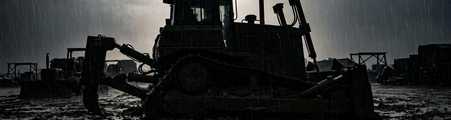
A close review of operational logs indicates that the geology of the road trace doomed this mechanical approach from the outset. The subsoil consisted of dense laterite clay. This material degraded into an unnavigable slurry under relentless downpours. Caterpillar D7 bulldozers (Military Standard 2901) deployed to cut hillside benches and clear jungle undergrowth. They sank past their drive sprockets within hours of entering the corridor. Engine blocks strained as operators tried to work through saturated mud. This resulted in blown hydraulic lines, stripped winch gears, and overheated transmissions. Recovery crews linked two bulldozers together with steel tow cables to pull out stuck vehicles. The sheer drag of the suctioning clay snapped half-inch wire rope like thread.
Maintenance crews spent nights scraping red laterite from jammed tracks.
Morning rains washed out whatever temporary road cuts had been carved the previous afternoon. Heavy iron machinery stalled out across the trace. Engineer companies responded by felling adjacent timber stands to build corduroy roadbeds across the worst sections of deep mud. Squads dropped ironwood trees with chainsaws. They placed trimmed logs side by side across the right-of-way. The timber bed was secured with steel spikes and wire rope. Torrential rain destabilized the construction instantly. Water ran beneath the subbase. The laterite liquefied until the entire timber mat floated and lost all friction with the underlying ground. Tactical transport vehicles attempted to traverse this foundation anyway. Convoys of M35 two-and-a-half-ton cargo trucks and heavier M54 five-ton haulers laden with artillery shells and jet fuel for Bastogne shattered the shifting logs. Radial tires slipped between loosened timbers. Drive shafts snapped. Suspension leaves bent.
The trucks wedged immovably into the broken wooden bed.
Tactical Signal Intercepts and Security Compartmentation
Archival evidence shows that inside the reinforced revetments at Camp Eagle, technicians from the 265th Radio Research Company tracked the electronic pulse of the Annamite mountains. Attached directly to the 101st Airborne Division but answering through an isolated chain of command to the Army Security Agency, these radio operators manned banks of R-390A high-frequency receivers twenty-four hours a day. Copper-wire antennas strung across bamboo poles and aluminum masts above the red dirt pulled Morse code transmissions out of the atmospheric static blanketing western Thua Thien. Intercept operators listened to the distinctive hand-keying rhythms of North Vietnamese telegraphers transmitting between three and twelve megahertz. Enemy signal teams used low-power Soviet-built portable transmitters. They shifted frequencies daily according to prearranged cryptologic schedules to mask movements along the Route 547 axis.
Direction-finding rigs coordinated with airborne tracking platforms over the canopy.
These systems calculated angular bearings across the jagged ridgelines. When these cross-bearings intersected on plotting charts, they revealed that senior North Vietnamese signal battalions were operating barely six kilometers from the advance elements of the 326th Engineers.
The electronic map showed a trap forming in real time.
A close review of operational logs indicates that the intercepted traffic belonged to the command element of the North Vietnamese Army 324B Division (NARA Record Group 338, Box 412). Ground-to-ground traffic analysis isolated callsigns tied directly to the 812th and 803rd Regiments. This traffic positioned heavy mortar platoons and mechanized anti-aircraft detachments along the narrow bluffs overlooking the Song Bo river crossing. North Vietnamese Army reconnaissance patrols transmitted coordinate blocks identifying prospective kill zones. American bulldozers and supply trucks would bottleneck between steep karst bluffs in these exact areas. Intercept logs recorded specific orders mandating that infantry units stockpile B-40 rocket-propelled grenades, 82mm mortar rounds, and command-detonated directional mines along high ridgelines dominating the road trace at coordinates YD612148 and YD635132. Enemy planners intended to let American lead vehicles pass into the valley before sealing the exit with interlocking crossfires from pre-registered machine-gun nests.
By early November, the 265th possessed a precise tactical overlay of every prepared firing trench and supply cache waiting ahead of the engineers.
That intelligence remained locked behind steel blast doors.
When examining the historical record, the barrier between this data and the infantry was created not by tactical failure but by institutional architecture. Special compartmented security procedures governed all communications intelligence originating from Army Security Agency facilities. Under directives managed by the National Security Agency, raw intercepts fell into restricted code-word categories. These files were accessible only to personnel with specialized clearances. They remained isolated within dedicated Special Security Officer communications channels. Division intelligence staffs were forbidden from transmitting raw coordinates, signal transcripts, or interception methods to battalion commanders working in the field. Field commanders could only receive heavily scrubbed, sanitized summaries. These summaries stripped away the origin and exact precision of the threat. The stated goal was preventing North Vietnamese radio operators from realizing their cryptographic systems had failed.
Delays in rewriting the data into vague terrain advisories meant days elapsed before warnings arrived at forward infantry command posts as generic notices of possible enemy presence.
Battalion commanders along Route 547 routinely discarded these ambiguous memos. They chose instead to rely on vulnerable visual scouting patrols to discover camouflaged bunkers. Calculated secrecy protected the agency at the expense of the frontline rifle company. Field operations along the road proceeded under this self-inflicted blindness. At forward positions near Bastogne, commanders moved men directly into zones where the 265th knew fortified regiments were waiting. Radio officers at Phu Bai maintained silent operational logs while forward engineers pushed tracked machinery into the preregistered mortar arcs of the 812th Regiment. Signals intelligence had successfully penetrated the mountain radio net. Organizational culture had not yet evolved to bridge the gap between discovery and protection.
On the morning of November 8, forward engineer elements triggered the initial ambush line precisely where the intercepted Morse traffic had predicted it three days earlier.
They took direct fire from 12.7mm heavy machine guns concealed on Hill 822.
Intelligence Dissemination Delays for Combat Engineers
Archival evidence shows that communications intelligence collected by the 265th Radio Research Company hit an administrative ceiling before it could reach route clearance teams. Inside the classified intercept vans at Camp Eagle, intercept officers transcribed high-frequency Morse code transmissions originating from the forward command posts of the North Vietnamese 324B Division. These intercepts pinpointed exact mining sectors and ambuscade positions along Route 547. Strict Department of Defense security directives classified raw direction-finding bearings and cryptographic decrypts as Top Secret Sensitive Compartmented Information. Access was restricted exclusively to personnel possessing Special Intelligence clearances. Division engineers clearing the roadway did not hold these clearances. Army Security Agency cryptanalysts had to hand-deliver carbon copies through armed couriers to the division tactical operations center. Staff intelligence officers were required to manually redact technical sources and rewrite the data into generic intelligence summaries.
This declassification workflow consumed sixteen to twenty-eight hours.
By the time rewritten bulletins were typed on standard mimeograph paper and cleared for distribution to the 326th Engineer Battalion, the enemy units referenced in the transcripts had already shifted positions. They altered radio call signs and completed mining preparations along the road corridor.
Clearance platoons moved out without reading the decrypts.
A close review of operational logs indicates that Company B of the 326th Engineer Battalion advanced westward from Fire Support Base Birmingham directly into pre-plotted kill zones. Sweeper teams walked three abreast down the washed-out centerline of Route 547 at two miles per hour. Lead engineers swept the mud with handheld AN/PRS-3 and AN/PSS-11 electromagnetic detectors (NSN 6665-00-856-9827). They carried twenty-pound battery packs on their web gear while wearing fragment jackets in ninety-degree heat. These soldiers possessed no access to perishable tactical intercepts that the 265th Radio Research Company had logged eighteen hours earlier at coordinates YD618134.
Radio interceptors at Phu Bai had documented North Vietnamese Army 803rd Regiment work parties burying explosive devices along a six-hundred-meter shelf above the Song Bo river.
Divisional headquarters did not pass these exact coordinate blocks down to the platoon level over unencrypted AN/PRC-25 field radios. They feared North Vietnamese radio monitors would detect an intelligence leak. Lead sweepers systematically entered the narrow defile between the cut bank and the river gorge. They worked within thirty yards of pre-registered enemy interlocking sectors. Security regulations kept the warning on an air-conditioned desk at divisional headquarters. When examining the historical record of mid-November 1968, the physical consequences of this informational disconnect materialized at kilometer marker 14. North Vietnamese combat sappers from the 812th Regiment had rigged unexploded American aerial ordnance inside drainage ditches cutting beneath the roadway.
This ordnance included salvaged two-hundred-and-fifty-pound Mark 81 low-drag bombs.
Instead of using standard pressure-plate fuses that electronic mine detectors could register through metallic casing signatures, the sappers ran insulated copper firing wire two hundred meters up the adjacent ridgeline to dry-cell battery detonators. A Caterpillar D7 bulldozer and an accompanying security squad from the 1st Battalion, 501st Infantry reached the culvert. The hidden observation post closed the circuit. The detonation blew the front blade and track assembly off the bulldozer. It threw sixty tons of earth across the cleared trace and killed the civilian contractor operator instantly. Simultaneous fire from pre-sighted Type 56 assault rifles, Soviet DShK 12.7mm machine guns, and B-40 rocket-propelled grenades poured down from concealed rock trenches directly into the open route clearance element.
The detachment was pinned inside the ditch without smoke cover or artillery registration data. They fought for ninety minutes to recover their wounded.
Company B abandoned two disabled dump trucks.
They fell back four kilometers to Birmingham before nightfall.
Ground Controllers and Tactical Air Clearance Friction
Archival evidence shows that by late November 1968, authority over the airspace above Route 547 fractured along entrenched institutional boundaries. Forward Air Controllers assigned to the 101st Airborne Division operated under the Military Assistance Command Vietnam chain of command. They answered directly to ground commanders fighting along the river valley. Tactical strike aircraft answered to Seventh Air Force air directors seated inside the Tactical Air Control Center at Tan Son Nhut Air Base. This facility sat four hundred miles south in Saigon. Ground commanders submitted urgent strike requests through the Direct Air Support Center at Camp Eagle. They demanded ordnance on active North Vietnamese mortar pits. Air Force directors systematically rerouted those requested flights to secondary targets in Laos or held F-4 Phantom II packages on alert pads at Da Nang Air Base. Centralized theater management governed all Air Force flight scheduling. This system subordinated immediate infantry defense to preplanned air interdiction campaigns.
Ground liaison teams argued that frontline troops engaged in close combat required immediate command over tactical air wings.
Headquarters staff in Saigon managed air sorties as strict tonnage quotas.
When examining the historical record of the monsoon push toward Bastogne, the weather turned this jurisdictional standoff into a complete tactical freeze. Seventh Air Force rules of engagement explicitly mandated visual target acquisition before any tactical pilot could release general-purpose ordnance. Strike leads flying F-4C Phantoms from the 366th Tactical Fighter Wing had to establish uninterrupted visual contact with both the strike mark and adjacent friendly tree lines. Low stratus clouds pushed ceilings down to three hundred feet above the jagged canopy of the Song Bo canyon. This weather buried ridgeline bunkers in unbroken fog. Pilots flying Cessna O-1 Bird Dogs from the 20th Tactical Air Support Squadron repeatedly dipped beneath the cloud deck. They took small-arms fire from North Vietnamese Army 12.7mm anti-aircraft positions along Hill 822 without ever spotting the camouflaged mortar tubes below. Air directors at Tan Son Nhut refused to waive visual confirmation standards.
They cited the risk of friendly fire.
Flight formations orbited above the dense overcast until fuel reserves dropped to emergency levels. They jettisoned their Mark 82 five-hundred-pound bombs into unpopulated offshore water zones and returned to base. Unused bombs dropped into the ocean while frontline riflemen absorbed mortar fire. A close review of operational logs indicates that ground controllers attempted to bypass the overcast through electronic guidance systems. Pinned down at coordinate grid YD615138 by heavy machine guns of the North Vietnamese 812th Regiment, Army forward controllers demanded blind beacon-guided radar strikes against known ambush coordinates. Technicians set up portable transponder gear along forward perimeter lines. They intended to guide incoming fighter-bombers through the cloud layer using AN/TPQ-10 ground radar installations and AN/MSQ-77 Combat Skyspot tracking stations. Ground-based computers calculated bomb release points automatically based on transponder telemetry. This allowed aircraft to deliver high-explosive ordnance blind through heavy clouds without visual reference points.
Staff officers at Tan Son Nhut rejected the clearance requests.
Seventh Air Force regulations strictly prohibited radar-directed blind drops within one thousand meters of allied ground forces. They declared automated radar tracking too inaccurate for mountain operations. Infantry commanders watched the radar tracks disappear from coordination maps while 82mm mortar rounds landed directly within their defensive trenches along Route 547. Radio channels carried angry arguments between ground captains along the road and air staff officers in Saigon. Operational records from November 17 document this breakdown near the Rao Trang river crossing. Platoon elements from the 2nd Battalion, 501st Infantry took heavy machine-gun fire at coordinate YD621142. They were pinned inside a raw road cut by three covered North Vietnamese Army machine-gun bunkers seventy meters to their west.
Division air liaison officers transmitted coordinate data to the Direct Air Support Center.
They requested immediate delivery of cluster ordnance via AN/MSQ-77 radar guidance. Tan Son Nhut denied clearance four times in two hours. They waited for cloud cover to lift from five hundred feet to the mandatory fifteen-hundred-foot visual clearance window. Flight crews in two A-37 Dragonfly aircraft (tail numbers 67-14522 and 67-14524) circled at ten thousand feet. They burned sixty gallons of JP-4 fuel per minute until their tanks ran dry. The forward air controller on the ground smashed his radio antenna with an entrenching tool.
Air directors ordered the flight to return to base with full bomb racks.
Institutional Fragmentation and Convoy Defense Deficits
Archival evidence shows that operational paralysis along Route 547 developed directly from conflicting service doctrines between the United States Army and the Marine Corps. The campaign tested whether separate military branches could synchronize land power without a singular tactical commander. This exposed structural divisions that theater doctrine had failed to reconcile. The 101st Airborne Division operated under airmobile concepts that prioritized deep inland penetration. III Marine Amphibious Force commanders adhered to coastal enclave defense and centralized theater asset management. Marine supply officers at Da Nang refused to release tracked M548 cargo carriers or specialized recovery vehicles to XXIV Corps engineers. They argued that naval port operations held administrative priority over highland road projects. Army planners pushed forward regardless. They attempted to force standard two-and-a-half-ton trucks through saturated red clay without the tracked support vehicles required to pull immobilized axles from the mud.
Operational movement halted entirely for six days at Checkpoint Alpha near coordinate YD604128.
Staff officers exchanged formal memoranda over boundary limits, road maintenance responsibilities, and equipment allocation quotas. Engineering units spent those six days idling in staging areas near the Song Bo river. They burned diesel fuel while North Vietnamese reconnaissance patrols mapped the stalled column.
Bureaucratic protocol froze the advance in place.
A close review of operational logs indicates that this doctrinal friction left unescorted supply convoys running directly into ambushes along the eight-kilometer corridor toward Fire Support Base Bastogne. Seventh Air Force strike scheduling excluded dedicated visual escort for division supply runs. They prioritized high-altitude interdiction sorties along the Ho Chi Minh Trail over localized route protection. On November 22, a relief detachment of twelve M54 five-ton cargo trucks from the 426th Supply and Services Battalion attempted to transport 105mm artillery shells and bladders of JP-4 aviation fuel from Birmingham to Bastogne.
They moved with only two M55 quad-.50 gun trucks for perimeter defense.
North Vietnamese gunners from the 812th Regiment waited until the convoy negotiated a narrow, single-lane road cut below Hill 822 at coordinate YD628136. An opening salvo of B-40 rockets and 75mm recoilless rifle rounds struck the lead five-ton hauler. The impact sheared the front axle and blocked the roadway against the cut-bank. Secondary explosions ignited forty barrels of aviation fuel on the second truck. This trapped the remaining ten vehicles within a three-hundred-meter kill zone. Pinned drivers crawled into drainage ditches under sustained DShK 12.7mm machine-gun fire. Air liaison officers in Saigon denied emergency strike clearances because low cloud ceilings obscured visual target marks. Four truck drivers died behind their steering wheels. Defensive artillery batteries at Bastogne fired white phosphorus smoke shells to cover the recovery of the survivors.
The supply line stopped four miles short of the firebase perimeter.
When examining the historical record of I Corps operations, this physical vulnerability was compounded by systematic barriers separating field commands from civilian intelligence collection. Case officers at the Central Intelligence Agency station in Hue (Station Chief File 44-A) had developed informant networks among local woodcutters and defectors from the North Vietnamese 324B Division. These sources identified major supply caches and rocket staging areas within Base Area 114. This location sat barely two kilometers south of Route 547 at coordinate YD642119. Strict compartmentalization rules prevented the agency from transmitting raw field reports across military radio networks. Military Assistance Command Vietnam intelligence officers and division planners dismissed civilian agency reports as unverified rumors. They refused to integrate non-military data into daily target plots distributed to the 101st Airborne Division. Detailed dossiers documenting forty tons of buried ammunition and two hundred Chinese-manufactured 107mm rockets remained locked inside an agency safe in Hue for nine consecutive days.
North Vietnamese gunners from the 803rd Regiment excavated those exact rocket caches during that administrative delay.
They mounted an eight-tube barrage against the Bastogne landing zone.
The attack destroyed two UH-1H medical evacuation helicopters on the pad.
Shrapnel from the impacts ruptured four thousand gallons of stored aviation kerosene and severed ground landlines running to the forward tactical operations center.