
Charting an Economic Frontier
In the decades following the War of 1812, the United States turned its gaze westward, not just across the continent, but over the immense expanse of the Pacific Ocean. This oceanic frontier, a vast and largely unmapped territory, offered both immense opportunity and commensurate peril. The burgeoning American whaling industry, with fleets from New Bedford and Nantucket pushing ever deeper into remote waters, required new hunting grounds and safe passage. A single successful whaling voyage could bring back thousands of barrels of whale oil, a commodity essential for lighting and lubrication, representing a fortune for ship owners and a livelihood for entire towns. Simultaneously, the lucrative China trade beckoned, promising wealth from commodities like tea, silk, and porcelain, but at the cost of navigating treacherous, reef-strewn sea lanes. The loss of a single merchantman to a navigational error was a catastrophic drain on this nascent global commerce, erasing capital and lives in an instant. American merchants, no longer under British colonial restriction, were eager to secure these profits for themselves and saw the Pacific as a vital artery for the young nation’s economic development.
The federal government recognized the strategic imperative. To protect and enable this explosion of maritime enterprise, the US Navy was tasked with a new, non-combat mission of immense scale: charting the Pacific. This was not a war of cannon and sail, but a campaign of measurement and observation. On December 6, 1830, the Secretary of the Navy established the Depot of Charts and Instruments, a modest office tasked with the care of the Navy’s navigational equipment. This small organization, the forerunner to the Naval Observatory and the Hydrographic Office, represented the first institutional commitment to systematic hydrography. Its initial mandate was simple maintenance, but it quickly evolved. Under the leadership of ambitious officers like Lieutenant Charles Wilkes, the Depot began its first original production of nautical charts, marking a pivotal shift from reliance on questionable foreign maps to the creation of reliable American navigational intelligence. This demand for accurate charts was a direct response to the material risks faced by American mariners, a government investment in national economic security. The charts produced by these early naval expeditions would become the essential infrastructure enabling the westward push across the water, providing the invisible pathways for commerce and, eventually, for military power.
The Perils of Primitive Surveying
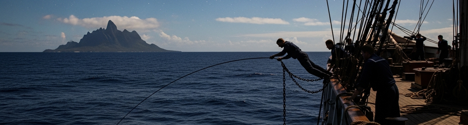
The work of a 19th-century naval surveyor was a grueling and hazardous occupation, blending intense manual labor with precise scientific observation. The technological toolkit was rudimentary, demanding immense physical effort and methodical patience from the crews. At the heart of their hydrographic work was the simple but effective lead line. This was a length of hemp rope, often over 100 fathoms long, marked at intervals with strips of leather, calico, or serge, with a heavy lead weight at its end. For coastal surveys, a sailor known as the leadsman would stand balanced precariously on a small platform in the ship’s chains, exposed to the elements. He would heave the lead forward, letting the line run through his hands as the ship moved. The moment he felt the weight strike the seabed, he would call out the depth based on the markings, his voice carrying in a rhythmic chant known to all sailors. To gain information about the seabed's composition, the lead was often “armed” by filling a cavity in its base with tallow. This sticky substance would pick up samples of sand, mud, or gravel, giving the navigator vital clues about the holding ground for anchoring. This repetitive, physically demanding process was the only way to map the ocean floor, one sounding at a time.
Determining a ship’s position on this vast ocean was a feat of astronomical calculation. Navigators used the sextant to measure the angle of the sun, moon, or specific stars above the horizon. This data, when combined with complex mathematical tables in the Nautical Almanac, yielded the ship’s latitude. Finding longitude, the east-west position, was a far more difficult problem. It depended on knowing the precise time at a reference point, such as Greenwich, England, and comparing it to the local time. The solution was the marine chronometer, a highly accurate and rugged clock designed to withstand the violent motion of a ship at sea. Housed in a gimbaled wooden box to keep it level with the horizon, the chronometer was the single most important piece of high technology aboard. The ship’s navigating officer guarded it obsessively, winding it at the exact same moment each day. An accurate chart was therefore the product of thousands of individual data points: a sounding from a lead line, a position fixed by a sextant and chronometer, and a compass bearing to a distant landmark, all painstakingly recorded and plotted.
The environment itself was a constant adversary. Uncharted reefs lay like traps just beneath the waves, capable of tearing the hull out of a wooden ship in minutes. The Pacific was prone to violent, unpredictable storms that could overwhelm the most capable sailing vessel. Beyond the physical dangers of the sea, the crews faced severe health threats. Long voyages with limited fresh provisions made scurvy, a debilitating vitamin C deficiency that caused lethargy, bleeding gums, and eventually death, a constant risk. Crowded and often damp living quarters were breeding grounds for diseases like dysentery and typhus. Medical care was primitive; surgeons operated without anesthetics or a modern understanding of germs, and many sailors succumbed to infections and illnesses that are treatable today.
One of the most significant undertakings of this era was the United States Exploring Expedition of 1838-1842. Commanded by the notoriously difficult Lieutenant Charles Wilkes, the squadron of six vessels, including the sloops-of-war USS Vincennes and USS Peacock, was tasked with a monumental mission: to survey and explore the Pacific and the Antarctic. The expedition charted hundreds of islands, mapped a significant portion of the Oregon coast, and confirmed the existence of the Antarctic continent by sailing along its coast. The human cost was high. The expedition lost two ships, the schooner USS Sea Gull with all fifteen hands in a storm off Cape Horn, and the USS Peacock, which was wrecked while attempting to cross the treacherous bar of the Columbia River. Wilkes’s abrasive leadership style led to frequent conflicts with his officers, resulting in courts-martial after their return. Despite the internal turmoil and material losses, the sheer volume of scientific and hydrographic data collected by the “Ex. Ex.” was immense. It formed the basis for collections at the new Smithsonian Institution and provided the US Navy with an invaluable repository of strategic knowledge about the Pacific.
Laying the Maritime Foundation
The raw data collected through immense sacrifice by Wilkes and other naval surveyors did not sit idle. It flowed back to Washington, specifically to the Depot of Charts and Instruments, which was evolving into a center for oceanographic analysis. In 1842, Lieutenant Matthew Fontaine Maury was appointed superintendent. A visionary officer who had been lamed in a stagecoach accident and removed from sea duty, Maury dedicated his career to the systematic study of the oceans. He initiated a project of immense scope, sifting through dusty ship logbooks stored at the Depot, which he called the “Dead Letter Office of the Sea.” He then created a system, providing blank, standardized logbooks to Navy and merchant captains who, in exchange for their completed logs, would receive copies of his new charts for free.
By collating thousands of observations, Maury and his small team created the “Wind and Current Charts,” a series of publications that transformed maritime navigation. For the first time, captains had access to charts that showed not just static hazards, but the dynamic patterns of the ocean itself. These charts detailed seasonal wind patterns, prevailing currents, and even the distribution of whales, dramatically shortening voyage times and increasing safety. The route from New York to San Francisco around Cape Horn, critical during the California Gold Rush, was shortened by over a month. Maury’s work represented a paradigm shift, turning ocean navigation from an art based on individual experience into a science based on collective data. It was a powerful example of data aggregation, and it was built directly upon the hydrographic information gathered by naval expeditions.
The practical application of this foundational hydrographic work was powerfully demonstrated by Commodore Matthew C. Perry’s expedition to Japan. When Perry sailed his squadron of “Black Ships” into Edo Bay in 1853 and again in 1854, he did not proceed blindly. He was armed with the best available charts and a clear understanding of the region’s waters. A key part of Perry’s gunboat diplomacy was the assertive act of surveying. He dispatched his ships’ launches, small boats filled with officers and sailors, to methodically take soundings and map the approaches to the Japanese capital. This technical demonstration of naval capability, conducted under the watch of alarmed Japanese officials in their own harbor, was as intimidating as the firepower of his Paixhans guns. This act underscored a critical reality: control of the sea was predicated on knowledge of the sea. The ability to chart the bay was a projection of power, signaling that the waters were no longer Japan’s exclusive domain. Perry’s success in forcing the opening of Japan was a direct consequence of decades of prior naval surveying work that enabled his fleet to operate with confidence so far from home. The arduous surveys conducted in the first half of the 19th century laid the strategic and logistical groundwork for the US Navy’s ascent as a global maritime power. The painstaking work of heaving a lead line and taking a celestial observation in the remote Pacific directly contributed to the projection of American influence. The hard-won knowledge of depths, reefs, and currents was the true foundation of American sea power in the Pacific.