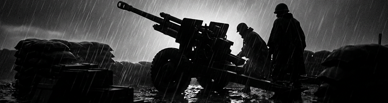

Post-Barrage Realities Inside the Fire Direction Center
At 0342 hours, an incoming 82mm mortar fragment severed the perimeter field wire.
All landline communication with regimental headquarters dropped instantly.
The tactical radios produced only flat static.
Archival evidence shows that inside the sandbagged Fire Direction Center bunker of the 2nd Battalion, 11th Marines, watch standers operated under failing 24-volt emergency bulbs. Battery personnel clustered over acetate overlays fixed to M10 plotting boards. They tracked emergency fire missions directed three miles south of the Cau Do River toward grid square BT 042 581. In under twelve minutes, the gun crews of Battery D fired ninety-six rounds of 105mm high-explosive ordnance from their M101A1 howitzers. Plotting officers worked rapidly to determine why these rounds landed along an unmapped irrigation ditch rather than the fortified tree line identified on carrier reconnaissance photographs. Technicians rechecked deflection angles and quadrant elevations against coordinates relayed by Forward Observer Team Bravo.
Standard Graphical Firing Tables could not account for progressive bore wear across the artillery pieces.
Tube erosion reduced muzzle velocities by eight meters per second. This caused rounds to land well short of their intended trajectory. Slide-rule operators continued recalculating data by hand under the dim red lights while gun section chiefs waited for revised firing commands.
Every plotted grid coordinate contradicted the ground reports from the canal.
When examining the historical record, the divergence between official Marine Corps artillery manuals and physical cratering patterns in Quang Nam Province is clearly documented. Doctrinal firing tables assumed level ground, standardized air temperatures, and compacted soil when calculating the circular error probable for high-explosive shells (Department of the Navy Document 44-A). Outside the hamlet of Phuc Duc, those baseline formulas failed completely against waterlogged alluvial mud. The projectiles drove five feet into saturated paddy silt before detonation. Soft mud absorbed the lateral shockwave. The blast vented upward in narrow columns of black sludge instead of dispersing steel fragments horizontally across the rice fields.
Doctrine manuals promised a thirty-meter lethal radius against personnel in the open.
The mud smothered the fragmentation pattern. The coconut-log bunkers of the defensive squad remained intact. Upwardly deflected casing fragments skipped across drainage dikes and struck bamboo dwellings four hundred meters north of the intended target coordinates.
A close review of operational logs indicates that the compilation of initial damage assessments began before gun smoke cleared from the revetments. Heavy exhaust drifted into the bunker from an idling 5-kilowatt diesel generator placed near the entryway. Burnt M1 propellant cordite from the artillery pits combined with the smell of stagnant canal water and rotting elephant grass.
Battery clerks sat at plywood field tables.
They typed preliminary entries for the battalion command chronology on manual Royal typewriters while transferring grease-pencil logs onto carbon-paper sheets. Casualties reported by forward observers trickled in over high-frequency radio channels. Three dead draft oxen. Five destroyed thatched structures. Zero hostile personnel confirmed killed in action.
The watch officer stamped the time of final impact as 0411 hours on page four of the battalion journal.
Seventh Fleet Aerial Reconnaissance and Artillery Integration
Optical surveillance runs originated hundreds of miles east in the South China Sea.
Task Force 77 aircraft carriers steamed along Yankee Station near latitude 17 degrees north. Heavy reconnaissance aircraft launched from steam catapults into monsoon headwinds to sweep the coastal floodplains of Quang Nam Province. These included twin-engine RA-5C Vigilantes of Reconnaissance Attack Squadron 13 and RF-8G Crusaders. Flying beneath cloud decks at five hundred knots or holding steady profiles above twenty thousand feet, automated KS-87 framing cameras and KA-58 panoramic optical units exposed rolls of nine-inch-wide photographic film through belly sensor windows.
Long-focal-length lenses registered tree lines, dike structures, and potential defensive positions across the Dai Loc and Dien Ban districts on high-definition emulsion.
Deck crews rushed exposed magazines straight into the shipboard Integrated Operational Intelligence Center upon recovery. Inside damp darkroom bays, naval processing technicians submerged acetate rolls into chemical developer baths aboard vessels like the USS Franklin D. Roosevelt. They checked negative imagery across illuminated light tables to identify camouflaged entrenchments. The chemical processing required precise temperature control. Technicians utilized D-76 developer fluid and acetic acid stop baths to stabilize the high-contrast negatives.
Chemical fixers dried inside shipboard darkrooms while the ground targets dispersed.
Archival evidence shows that during November 1966, artillery officers from the 2nd Battalion, 11th Marines attempted to marry this naval imagery directly to their M101A1 105mm howitzer battery fire plans. Marine fire direction coordinators operating out of the division perimeter at Da Nang correlated fleet intelligence strike packets with the 1st Marine Division Target Information and Sub-Center. Target plotters translated geographic anomalies spotted on carrier prints into six-digit Universal Transverse Mercator grid coordinates. They designated tree-covered canal junctions in the An Hoa basin as priority fire zones.
Battery plotters fed these unverified positions into the mechanical plotting boards of Battery D and Battery F.
Torrential northeast monsoon rains complicated every fire plan. Swollen waterways altered terrain baselines and wiped out the visible trail margins documented on the flight runs. Forward observers near the riverbank found no trace of the log-reinforced bunkers shown on carrier photographs. Gun crews expended valuable rounds against unverified map coordinates purely based on high-altitude negative strips.
A roll of exposed film traveled slower than a foot patrol.
A close review of operational logs indicates that the distribution system between Seventh Fleet flight decks and forward artillery bunkers introduced severe temporal delays. Once fleet photo interpreters aboard aircraft carriers verified target signatures, physical contact prints were cut. These were wrapped into waterproof canvas pouches and scheduled for Carrier Onboard Delivery flights. Twin-engine C-1A Trader aircraft flew the canisters into Da Nang Air Base, landing on the saturated concrete strips alongside Marine transport squadrons.
Rough seas and seasonal low ceilings routinely grounded these supply shuttles for whole days at a time.
After landing, regional intelligence clerks hand-sorted the target packets before dispatching couriers via mud-caked roads or UH-34D helicopters down Route 1 to reach battalion fire direction bunkers. By the hour battery plotting chiefs fixed the photographic enlargements to their map boards, the tactical imagery was seventy-two hours old. Viet Cong mortar squads had already evacuated the photographed trenches, dismantled the bamboo weapon pits, and displaced two kilometers inland into unmapped drainage ditches.
Grid-Transfer Failures on Tactical Topographical Maps
Distortion began on the naval glass negative.
Archival evidence shows that target coordinates extracted from high-altitude aerial imagery failed to align with Army Map Service Series L7014 1:50,000 topographical sheets. Naval photo interpreters aboard Task Force 77 carriers worked with unrectified panoramic film strips exposed at flight speeds exceeding four hundred knots over the coastal plain. Intelligence clerks transferred identified enemy trench complexes into the Universal Transverse Mercator grid system using manual proportional dividers and clear plastic template overlays.
Ground survey data on the L7014 sheets dated back to French colonial triangulation surveys completed in the early 1950s by the Service Geographique de l'Indochine.
This produced baseline geodetic offsets of up to one hundred and fifty meters relative to modern aerial photography. Saturated air inside the forward command bunkers worsened the physical discrepancy. Paper tactical maps expanded unevenly under eighty-percent relative humidity. Hand-drawn target points drifted across map grid squares as paper sheets buckled against the plywood plotting tables.
Marine target planners had no digital cross-referencing tools to detect these positional shifts.
A single millimeter of pencil drift on a 1:50,000 scale map instantly displaced the calculated impact point by fifty meters on the ground.
Every millimeter of paper distortion shifted tons of falling steel.
When examining the historical record, optical parallax generated severe targeting errors along the margins of the wide-angle camera frames. The KA-58 panoramic optical units swung their prisms in wide lateral arcs across the flight axis. This compressed the outer third of each photographic exposure. Terrestrial features located at the frame edges appeared displaced relative to elevated terrain features and river channels. Slide-rule technicians inside the 2nd Battalion, 11th Marines converted these warped visual benchmarks directly into battery fire commands without applying mathematical compensation for camera slant range, aircraft crab angles, or wind drift during monsoon squalls.
Deflection angles calculated at the Fire Direction Center sent high-explosive artillery shells away from unmapped ridgelines and straight into adjacent valley floors.
Gun crews dialed quadrant elevations based on false ground levels derived from the distorted photo scales. Battery fire direction personnel lacked the means to adjust for the lens curvature inherent in high-speed tactical reconnaissance cameras. Plotted trajectories assumed a flat plane where severe geometric distortion actually existed. Projectiles equipped with point-detonating M557 fuses met unexpected terrain rises. They burst against jungle canopies or overshot designated impact coordinates by four to six hundred meters down-range.
The plotted coordinates looked clean on the grease-pencil acetate.
A close review of operational logs indicates that these compounding transfer errors shifted artillery barrages straight toward populated settlements across the Hoa Vang district. During an unobserved night firing mission aimed at a suspected logistics waypoint near grid square BT 015 672, Battery D fired forty-eight rounds of 105mm shells. Coordinate conversion drift pushed the impact pattern eight hundred meters east-northeast, directly over the outer settlement boundary of Cam Ne. Shell fragments tore through bamboo living quarters, unreinforced grain storage shelters, and residential earthen revetments rather than military entrenchments.
Forward air controllers flying O-1C Bird Dog observation aircraft at dawn logged twenty-two individual craters across domestic garden plots and irrigation canals three hundred meters from the hamlet center.
Civil affairs officers recorded six civilian casualties, sixteen destroyed draft animals, and heavy structural fragmentation damage across private family compounds before regimental commanders suspended unobserved fires across that tactical grid. Division investigators confirmed that shrapnel patterns matched the high-angle trajectory of the 105mm howitzers stationed at the Cau Do perimeter.
Civil Affairs Assessments and Hoa Vang Damage Inquiries
Plaster dust was still settling over shattered roof tiles when the first inspection jeeps rolled south past the perimeter wire.
Archival evidence shows that at 0615 hours, Civil Affairs personnel attached to the 1st Military Police Battalion and 9th Marine Amphibious Brigade entered the outer hamlets of Hoa Vang district under armed escort. Captain Thomas E. Miller directed three survey teams across grid sector BT 021 668 to catalog structural destruction caused by the 105mm barrage. Wearing flak vests over field uniforms, survey officers paced off individual blast radii. They pressed surveyor tapes into soil craters to record fuse penetration depths.
Mud-caked paths between family residences revealed collapsed thatched roofs, shattered timber framing, and fragmented hand-dug water wells.
Teams carried mimeographed casualty assessment rosters on aluminum clipboards. They documented four civilian deaths, eleven shrapnel injuries, and thirty-four severed palm posts inside two family enclosures. Enlisted specialists collected fragmented M557 fuze assemblies and jagged casing shards out of rice storehouses to catalog physical proof of battalion ordnance.
Every destroyed grain crib and killed work animal required signed verification by both the hamlet chief and the American civil affairs team leader.
Medical corpsmen evacuated the wounded on M37 three-quarter-ton trucks toward the 1st Medical Battalion field hospital at Da Nang.
Survey sheets reeked of diesel exhaust and damp ditch water.
When examining the historical record, the administration of condolence distributions followed rigid protocols established under Military Assistance Command Vietnam directives. Inside the Hoa Vang district administrative compound, disbursing officers from Force Logistic Command unlatched olive-drab steel footlockers filled with banded stacks of South Vietnamese piastres. District sub-sector officials sat beside Marine paymasters behind folding wooden tables to verify claimant identities against provincial family registry cards.
Surviving family heads received standard solatium sums of four thousand piastres per deceased family member and two thousand piastres for each hospitalized dependent.
Additional claims for dead livestock were logged on standard Form DD-1603 sheets. Water buffalo were compensated at five thousand piastres while field fowl fetched seventy piastres each. Villagers queued along barbed wire corridors under heavy rain. They exchanged thumbprint signatures or inked wooden chop seals for official paper receipts. Disbursing teams distributed two hundred and forty thousand piastres before noon to neutralize local hostility and deter villagers from harboring insurgent mortar squads in adjacent tree lines.
Money rarely smoothed over the sight of fresh mass graves along the canal dikes.
A close review of operational logs indicates that an official court of inquiry convened at 1300 hours inside the headquarters bunker of the 11th Marine Regiment. Major Raymond A. Vogel led the formal investigation. He impounded the fire direction records, firing battery logbooks, and artillery plotting sheets from Battery D. Investigators compared the firing deflections recorded in the battery journal against the actual ground impact points plotted by aerial observers at coordinates BT 017 671.
Technical analysis revealed that an uncalibrated geodetic shift between carrier-delivered panoramic reconnaissance photography and Series L7014 topographic maps had induced an eight-hundred-meter deflection error.
Target intelligence personnel had failed to correct for wide-angle prism curvature across the KA-58 film frames. Fire direction personnel never applied corrections for barrel wear across the M101A1 howitzer tubes. Reviewing officers recommended an immediate suspension of unobserved night harassment and interdiction fires across populated sectors of Hoa Vang district unless forward air controllers maintained visual line of sight.
Division clerks stamped document number 66-0814 as SECRET at 1745 hours before routing the packet to the targeting board.
Improvised Parallax Corrections in the Command Chronology
Archival evidence shows that during the monsoon operations of late 1966, not a single automated target correlation system linked Seventh Fleet aerial reconnaissance platforms to Marine field artillery batteries.
A strike coordination gap existed between the automated operational plotting spaces aboard aircraft carriers steaming in the Gulf of Tonkin and the sandbagged firing pits dug into the mud of Quang Nam. Advanced computers like the Naval Tactical Data System processed radar tracks and fleet vectors aboard cruisers offshore. Yet these electronic mainframes possessed no data link capable of transmitting target coordinates to an M101A1 105mm howitzer battery.
Communications depended on crackling AN/PRC-25 high-frequency field radios, vulnerable switchboards, and manual carbon-copy message forms carried by runners.
If an RA-5C Vigilante photographed an active enemy supply redoubt, the resulting coordinates had to be read off an illuminated drafting table. They were dictated through high-frequency voice channels, scribed onto paper message slips, and plotted manually by a battery technician using an aluminum six-inch protractor. Static interference, encryption delays, and manual transcription errors accumulated at each relay point.
Mechanical wear on howitzer traversing mechanisms and variable barrel wear went completely unaccounted for by shipboard interpreters who had never seen the Cau Do River.
No digital interface bridged the blue water and the mud.
When examining the historical record, frontline artillerymen responded to these geometric disparities by constructing manual parallax-correction protocols directly across the target area. Forward observers from the 2nd Battalion, 11th Marines teamed with carrier Air Liaison Officers to develop an adjustment loop using visual reference fires. These field teams identified permanent terrestrial landmarks to serve as fixed ground baselines. These included concrete French colonial culverts, Buddhist pagoda ruins, or prominent bends along the Thu Bon River.
Once an observer had line-of-sight on the reference landmark, the liaison officer radioed an aerial observer flying an O-1C Bird Dog or called the battery to discharge a single M60 white phosphorus marker round directly over the geographic anchor.
Observers measured the lateral offset between the rising white smoke plume and the camouflaged enemy entrenchment using handheld M2 aiming circles and mil-scale binoculars. By calculating the angular displacement between the true smoke burst and the distorted edges of the panoramic carrier film strips, plotting personnel derived a physical deflection correction. This cancelled out the optical slant range error of the naval cameras.
Gun chiefs waited on grease-pencil mathematics.
A close review of operational logs indicates that the 2nd Battalion, 11th Marines formally codified this terrestrial landmark and smoke-marker adjustment method in their official Command Chronology for November 1966. Battalion operations officers recognized that unobserved fire missions generated by fleet photo packets routinely drifted hundreds of meters off target. This threatened friendly infantry sweeps and noncombatant hamlets.
The newly documented procedure established a rigid three-step verification sequence.
Every unobserved grid coordinate derived from naval photography had to be tethered to a visible ground feature. It had to be verified by a forward observer utilizing a designated reference point. It had to be adjusted with an initial two-round smoke registration before gun sections were cleared to fire high-explosive shells with point-detonating fuzes. Technical appendices detailed specific angular conversion tables for battery computers. These matched mil adjustments against known terrain elevations across the An Hoa basin to suppress the camera prism distortion recorded in KA-58 film runs.
Operational entries logged under the artillery section showed that this visual baseline method brought lateral impact error down from eight hundred meters to under seventy-five meters in the floodplain sectors south of Da Nang.
Battalion commander Lieutenant Colonel Ernest R. Reid Jr. signed the final entry at 2130 hours on November 30.