
Reconnaissance Telemetry and Intelligence Failures
Tropical heat radiating off the Gulf of Thailand hit ninety-five degrees Fahrenheit by dawn on May 15, 1975. Ninety percent humidity soaked canvas webbing and utility uniforms completely within minutes. Corrosive salt spray coated camera optics. It stripped exposed aluminum fittings on ship decks. Torrential rain dumped over the jungle canopy in squalls. The ridgelines locked beneath thick, stagnant cloud decks.
No breeze penetrated the limestone cliffs.
Archival evidence shows that optical reconnaissance across Koh Tang depended entirely on mechanical collection pipelines with built-in time lag. Ryan AQM-34 Buffalo Hunter unmanned drones flew low across the tree line at five hundred knots. These drones launched from underwing pylons of modified DC-130 Hercules aircraft staging out of Thailand. They triggered high-speed wet-film cameras. Telemetry links severed repeatedly whenever the craft banked below the five-hundred-foot bluffs flanking the island's eastern ridgeline. Ground recovery crews waited for the airframes to parachute toward designated open-water coordinates. Sometimes they snagged them midair using CH-3E helicopters equipped with recovery winches. The physical film cassettes traveled by courier flight from staging strips to darkrooms at U-Tapao Royal Thai Navy Airfield (NARA Record Group 338). Technicians spent hours running physical film through chemical developer baths. Photo interpreters then viewed five-inch negative strips through optical magnification lenses. By the time photo intelligence packets reached Seventh Air Force planners at Nakhon Phanom, the recorded visual data was eighteen to twenty-four hours behind the actual movements on the island.
The command staff acted on pictures taken during low tide the previous day.
A close review of operational logs indicates that the United States Strategic Air Command categorized the island as an unguarded waypoint. Joint intelligence task forces estimated the presence of twenty to thirty irregular militia members. Briefers in Okinawa and Thailand assured officers of 2nd Battalion, 9th Marines that any armed Khmer Rouge presence would flee into the jungle after an initial aerial demonstration of force. That assessment flatly ignored civilian vessel logs from captured Thai fishermen. These civilian logs reported fortified troop rotations throughout the preceding month. Major Em Son commanded the Khmer Rouge naval border defense units on the island. He had spent months turning Koh Tang into a fortified perimeter. His force comprised over two hundred combat-hardened troops belonging to an integrated heavy weapons detachment. Digging into the tree lines along the narrow northern peninsula, the Khmer Rouge soldiers constructed log-reinforced bunkers. Covered trench lines connected these positions alongside both beaches.
Two heavy machine guns sat concealed behind the treeline at coordinate 10 degrees 18 minutes North, 103 degrees 08 minutes East.
Defenders held thirty B-40 rocket-propelled grenade launchers. They possessed four 82mm mortars and two 75mm recoilless rifles. Multiple 12.7mm DShK heavy anti-aircraft machine guns sighted across the open approaches. Sand ramparts masked their direct lines of sight toward incoming air routes. This protected the gunners from offshore naval gunfire. The assault force of two hundred and thirty Marines assigned to the first wave boarded CH-53 and HH-53 helicopters without accurate target maps for these heavy emplacements. Planners designated narrow landing zones on Eastern and Western Beach based on aerial prints. These prints labeled the defensive fighting positions as empty tree stumps.
American planners ordered an unescorted helicopter landing directly into the kill zone of an entrenched battalion.
The Headquarters Bubble and Rear Echelon Isolation
Archival evidence shows that tactical authority over the amphibious assault sat one hundred and ninety miles northwest of Koh Tang at U-Tapao Royal Thai Navy Airfield. Inside an air-conditioned joint operations trailer, Air Force Brigadier General Walter H. Baxter III and Marine Colonel John M. Johnson Jr. directed the assault. They lacked any direct line of sight to the objective. Voice communications between the staging base and the combat perimeter relied entirely on an Airborne Battlefield Command and Control Center. This was an EC-130E Hercules orbiting at twenty thousand feet under the callsign Cricket. Backpack AN/PRC-77 ground radios emitted barely two watts of power from the surfline. These transmitters failed repeatedly to push signals past the island's steep limestone ridges to the circling aircraft. Ky-28 secure voice encryption equipment systematically clipped weak signals. Urgent battlefield calls degraded into bursts of unintelligible static. Every combat report underwent an excruciating relay sequence. Pinned platoon leaders shouted coordinates to airborne forward air controllers. The controllers radioed the orbiting Hercules. Staff aboard the aircraft typed compressed message summaries. They sent these summaries via high-frequency teletype and UHF radio to consoles at U-Tapao. General Baxter and Colonel Johnson received these fragmented assessments minutes after the events occurred. They issued movement orders and ordnance clearances based on secondhand radio transcriptions.
Atmospheric noise blanked out entire transmissions.
When examining the historical record, the gap between rear echelon tracking boards and dynamic combat conditions along the surf widened with every helicopter wave. Operations officers at U-Tapao tracked the battle by sliding red and blue magnetic counters across a flat 1:50,000 scale paper topographic map. The map was mounted on plywood. Grease-pencil arrows depicted an orderly two-pronged assault across Eastern Beach and Western Beach. This rested on the assumption that landing teams from 2nd Battalion, 9th Marines had linked up across the narrow three-hundred-meter neck of the island. The physical situation on the ground was catastrophic. Heavy automatic weapons fire had already destroyed CH-53 Knife 21 on the shoreline. The same fire forced Knife 23 into the water. Isolated fireteams of Golf Company were trapped under crossfire from log bunkers forty yards away. Survivors crouched neck-deep in the waves behind granite rocks. They took direct hits from 12.7mm machine guns and 82mm mortar shrapnel. Rear command displays logged those bloodstained coral shelves as secure staging areas.
Plotting boards showed stabilized perimeters while burning titanium helicopter hulls sank into the tidal flats.
A close review of operational logs indicates that this cartographic delusion generated lethal tactical commands throughout the morning. Rear staff officers at U-Tapao were convinced that the eastern tree line was secure. They ordered incoming HH-53 Super Jolly Green extraction helicopters to land directly into fortified sectors zeroed by Khmer Rouge gunners. Forward air controllers piloting OV-10 Bronco aircraft spent forty minutes trying to cancel incorrect target markers. These markers were transmitted by rear planners who did not know where their own men were pinned. Command personnel at the staging runway repeatedly withheld clearances for A-7D Corsair II strafing runs against visible enemy heavy weapons pits. Outdated acetate overlays placed American Marines eighty yards closer to the targets than their true positions. The telemetry delay inside the rear trailer meant combat decisions lagged dynamic events by forty-five minutes. Second-wave reinforcements boarded transport helicopters at U-Tapao to land on coordinates that regional maps still recorded as captured territory. Defenders reloaded machine guns along the treeline.
Signal Latency Across Orbiting Airborne Relay Nodes
Archival evidence shows that every outbound radio transmission from Koh Tang had to climb twenty thousand feet into the holding pattern of an Air Force EC-130E Airborne Battlefield Command and Control Center. Flying under the tactical callsign Cricket, the modified four-engine turboprop belonged to the 7th Airborne Command and Control Squadron. The unit staged out of Korat Royal Thai Air Force Base. Inside its twenty-thousand-pound, pressurized USC-15 command capsule, twelve battle staff operators sat along a central electronics console. They monitored thirty-eight UHF and VHF radios connected to external trailing-wire antennas. Four Allison T56-A-15 turboprops burned twenty-four hundred pounds of JP-4 fuel per hour. Pilots flew a continuous twenty-mile racetrack pattern west of the island. The mission crew held no direct visual contact with the shoreline. Staff officers logged incoming combat reports onto paper slips and magnetic audio tape decks. They manually validated map coordinates before relaying strike approvals to offshore strike packages. Electrical power spikes inside the capsule repeatedly threw the internal audio amplifiers off frequency. Communications technicians had to reset individual analog circuit breakers. Priority distress traffic jammed the primary receiver nets.
The sky above the island carried twenty-two separate military radio frequencies simultaneously.
A close review of operational logs indicates that this aerial relay structure generated lethal voice and telemetry latencies for ground units pinned under automatic weapons fire. Forward air controllers on the beaches operated twenty-six-pound AN/PRC-77 backpack radios. These radios were coupled to KY-28 Nestor secure voice encryption canisters. Heavy surf soaked the equipment during the initial debarkation. This degraded the rubberized moisture seals and flooded the internal cryptological key circuits with conductive salt deposits. Transmissions failed whenever the two-watt transmitters lost line-of-sight behind the sixty-foot limestone bluffs flanking Eastern Beach. A radioman squeezing the handset trigger initiated an eight-hundred-millisecond digital synchronization delay before passing audio power to the whip antenna. The receiving terminal aboard the orbiting EC-130 required a matched cryptographic unit to synchronize the incoming carrier wave. It needed to parse the encryption sequence and open the audio channel. Corroded battery terminals and low-voltage output from water-soaked BA-4386/U dry batteries routinely corrupted that synchronization tone. Operators inside Cricket heard loud mechanical squeals instead of coordinates. This triggered mandatory re-authentication exchanges that wasted four to eight minutes per call.
Static blanked out emergency casualty evacuation coordinates across three designated UHF frequencies.
When examining the historical record, this multi-tiered relay bottleneck crippled urgent close air support during critical phases of the landing. First Lieutenant Terry Tonkin was the Marine forward air controller directing fires from behind a fallen tree trunk on Eastern Beach. He spotted twin 12.7mm machine-gun nests firing from concealed positions at coordinate 10 degrees 18 minutes 05 seconds North, 103 degrees 08 minutes 22 seconds East. Tonkin radioed Nail 68, an orbiting OV-10A Bronco from the 23rd Tactical Air Support Squadron. He called for twenty-millimeter cannon strafing runs from circling A-7D Corsair II jets. Nail 68 was barred by standing rules of engagement from clearing tactical strikes independently. The Bronco pilot was forced to relay the target coordinates up to Cricket. Air Force staff officers pulled grease-pencil tactical charts to confirm the clearance parameters. Transcribing the coordinates, matching them against outdated map overlays, and securing verbal authorization through the relay chain took twenty-six minutes. The Khmer Rouge gunners had already shifted their fire eighty yards south. They shot out the tail rotor of an incoming HH-53 Super Jolly Green extraction helicopter.
Friendly Fire Along the Eastern Tree Line
Archival evidence shows that twenty survivors from the crash of Knife 23 lay pinned along the eastern shoreline beneath forty-foot limestone ridges. They were trapped within a fifty-meter pocket between the surf and log-reinforced Khmer Rouge bunkers. Outdated 1:50,000 scale topographic charts failed to account for tidal variations. Ground observers estimated their position relative to mangrove clusters that did not match aerial photography. Second Lieutenant John Lucas was the co-pilot of Knife 23. He used an emergency URC-64 survival transceiver to transmit six-digit Universal Transverse Mercator coordinates to the circling forward air controller in an OV-10A Bronco. Weak radio batteries and heavy background surf degraded the transmission. The final two digits of the easting coordinate were garbled. The airborne controller passed the grid up to the EC-130 command capsule orbiting at twenty thousand feet. Flight technicians misread the handwritten message log. They shifted the reported Marine frontline two hundred meters north. Operations staff at the U-Tapao Joint Operations Center plotted those altered coordinates on their central grease-pencil tracking boards. They concluded that the target area contained only hostile heavy machine-gun emplacements.
Twenty yards of churned sand separated the opposing foxholes.
A close review of operational logs indicates that this transcription error propagated through three airborne command links before weapon clearances reached the strike flights. Backpack AN/PRC-77 transceivers on the beach lacked the power to broadcast directly to the strike aircraft. Ground Marines remained unaware of the attack profiles being coordinated directly above them. Tactical controllers aboard the EC-130 Hercules cross-referenced the corrupted coordinates against twelve-hour-old reconnaissance photographs. They erroneously validated the position as an unoccupied brush line flanking enemy mortar pits. Message clearance forms moved manually from radio operators to battle staff evaluators. This consumed twelve minutes between the initial request and the transmission of strike coordinates to inbound fighter-bombers. Flight leads received clearance to release weapons. The ground situation had shifted. Khmer Rouge machine-gun squads advanced to within thirty yards of the American perimeter. Headquarters personnel had effectively authorized airstrikes directly onto their own trapped troops.
Static blanked out the final warning call.
Two A-7D Corsair II attack aircraft belonging to the 3rd Tactical Fighter Squadron rolled into steep thirty-degree dives out of four thousand feet. Lining up on the misidentified tree line, the lead pilot triggered the M61A1 twenty-millimeter Vulcan rotary cannon. The weapon cycled high-explosive incendiary ammunition at four thousand rounds per minute. Armor-piercing incendiary shells impacted along the sand berms sheltering the Knife 23 survivors. The rounds chewed through brush and struck the titanium rotor hub of the crashed helicopter. The impacts severed emergency field wiring and shattered the remaining water containers. Shrapnel drove into the shallow depressions where wounded infantrymen lay flat. Concussive pressure waves collapsed sand parapets. Two Marines were buried up to their shoulders. Hot tungsten fragments ignited vegetation within fifteen feet of the defensive perimeter. The pilot of the orbiting OV-10A Bronco saw muzzle flashes exploding across the Marine defensive scrapes. He shouted emergency abort calls into the UHF net. The trailing jet was already committed to its firing dive.
High-explosive projectiles severed palm trunks at ground level.
When examining the historical record, the second Corsair discharged eighty-four rounds of twenty-millimeter cannon fire along the identical trajectory before clearing the tree line. Searing fragments shredded the web gear and ammunition pouches of the defenders. The sole remaining PRC-77 radio antenna coupler was disabled. Dense smoke and pulverized coral obscured visibility for the survivors. They were prevented from deploying fluorescent orange identification panels to signal the orbiting aircraft. The friendly strafing fire tore away natural cover. The platoon's southern flank was exposed to point-blank bursts from concealed Khmer Rouge RPD light machine guns dug in thirty-five meters away.
Beachhead Chaos and Unresolved Casualty Evacuations
Archival evidence shows that by 1530 hours, the casualty collection point established behind a low sand berm on Western Beach had collapsed under targeted 82mm mortar barrages. Navy hospital corpsmen assigned to Golf Company, 2nd Battalion, 9th Marines worked with their bodies pressed flat against saturated sand at coordinate 10 degrees 18 minutes 14 seconds North, 103 degrees 08 minutes 10 seconds East. Pinned down forty yards from the jungle perimeter, the medical team treated sixty-three wounded men using field dressings stripped from the dead. Shrapnel from airburst mortar shells punctured rubber blood albumin bags. High-velocity 12.7mm rounds cracked through aluminum litter frames stacked near the water's edge. Corpsmen injected morphine directly through torn jungle utilities. They labeled casualty foreheads with red wax grease pencils to track doses. Every attempt to drag litter cases across the open twenty-yard shelf to the surfline drew direct fire from three fortified Khmer Rouge log bunkers situated along the tree line. The open sand became an impassable fire zone. Severely wounded Marines suffered systemic hypovolemic shock in thirty-two-degree Celsius heat. Their open chest and abdominal wounds were exposed to blowing grit and salt water.
Mortar concussions ruptured saline bags and buried chest tubes under loose sand.
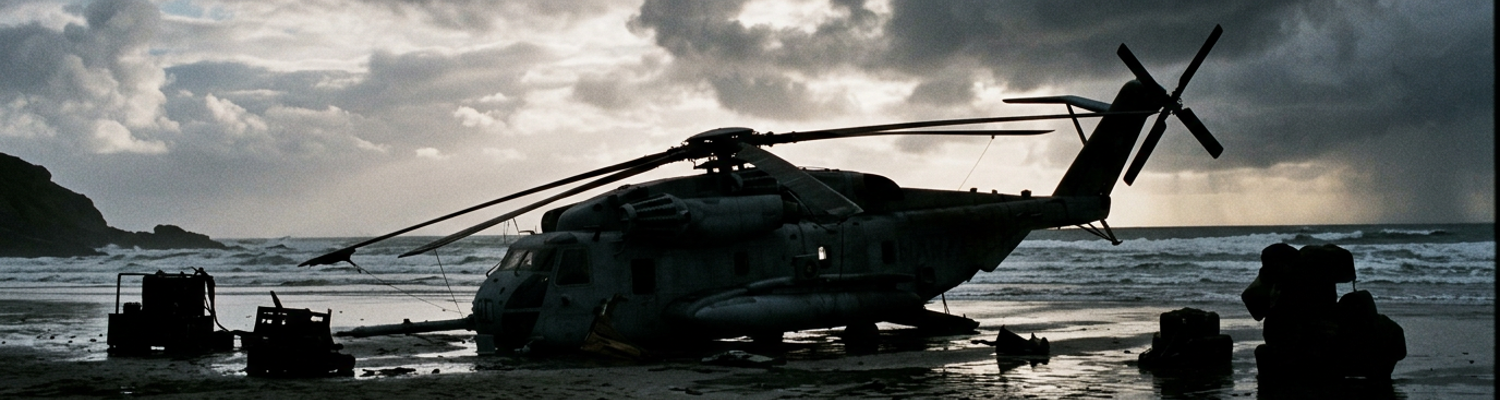
A close review of operational logs indicates that the decision to collapse the perimeter came from Seventh Air Force evaluators through the EC-130 relay net as dusk settled over the Gulf of Thailand. Air Force HH-53 Super Jolly Green helicopters, designated Jolly 41, 42, and 43, entered the landing zone beneath suppressive fires from the guided missile destroyer USS Henry B. Wilson. Rotor wash from the sixty-seven-foot rotor discs kicked up blinding clouds of coral sand. This stripped away pilot visibility and smothered the airframe intakes with abrasive debris. Pilots wrestled dual General Electric T64 turboshaft engines against fluctuating oil temperatures. Automatic rifle rounds punched through the aft titanium fuel sponsons. Ground controllers on the beach used emergency strobe lights and red pen flares to guide the tail ramps toward the surf. They shouted loading numbers into failing radios. Flight mechanics dragged wounded men by their flak jacket collars up the shuddering metal ramps under direct mortar fire. They packed fifty-four men into airframes rated for forty. Helicopters lifted off with tails grazing the ocean swell. They vented hydraulic fluid and JP-4 jet fuel directly into the water.
The surfline turned black under spreading aviation fuel.
When examining the historical record, the final collapse of the defensive line left an isolated three-man M60 machine gun team cut off on the southern flank of Western Beach. Lance Corporal Joseph N. Hargrove, Private First Class Gary L. Hall, and Private Danny G. Marshall had been ordered to establish an interlocking field of fire sixty meters south of the primary extraction zone. This was to suppress Khmer Rouge counter-attacks against the retreating perimeter. Darkness enveloped the island after 1900 hours. Intense small-arms fire and mortar explosions severed the squad's physical contact with the main body. Platoon leaders were under intense pressure to clear the beachhead before incoming enemy squads overran the extraction site. They conducted hurried headcounts inside the vibrating, unlit cargo compartments of the departing HH-53s. Radiomen failed to reach the southern position using AN/PRC-77 transceivers because salt water had ruined the dry-battery assemblies. The transport ramp of the final aircraft slammed shut. Hargrove, Hall, and Marshall were left behind in their fighting position with one machine gun and several hundred rounds of ammunition.
No radio confirmed the abandonment before the last flight cleared the coast.
Operational manifests aboard the amphibious assault ship USS Okinawa uncovered the accounting discrepancy two hours later. Naval task force commanders had permanently secured all flight operations by that point.
Post-Action Audits and Command Structure Critiques
Archival evidence shows that by December 1975, Headquarters Marine Corps and the III Marine Amphibious Force finalized exhaustive technical debriefs evaluating the communications breakdown at Koh Tang. Investigators documented the comprehensive hardware failure of the standard AN/PRC-77 tactical transceiver when coupled with the KY-28 Nestor secure-voice canister. Marine landing teams hitting the eastern beach had plunged into chest-deep surf. This swamped rubber seal gaskets that were rated only for surface splashing. Saltwater deposits formed direct electrical shorts across internal circuit cards. Transmitter output dropped from two watts to less than zero point four watts. Transceivers on the beach could not drive radio waves past the sixty-foot limestone bluffs flanking the tree line without tall whip antennas. These antennas drew lethal sniper fire the instant Marines raised them. Official December 1975 damage reports recorded that over fifty percent of all tactical combat calls broadcast on the primary 46.50 megahertz Marine net failed to exit the beachhead. Platoon commanders shouted urgent calls for suppressive fires into dead handsets. Khmer Rouge 82mm mortar crews adjusted target coordinates from thirty yards away.
Saltwater ruined sensitive cryptographic keys within seconds of the initial ramp drop.
A close review of operational logs indicates that the orbiting EC-130E command capsule transformed from an airborne relay into a severe mechanical bottleneck. Marine after-action boards noted that the USC-15 command capsule aboard the aircraft lacked automated data-switching capabilities. Twelve Air Force controllers had to transcribe incoming voice traffic by hand onto paper index cards. Encryption mismatches between Air Force aircraft, Marine radios, and Navy vessels forced battle staff to drop secure links. They broadcast tactical targets in the clear or spent ten minutes resetting cryptological synchronization pulses. Marine forward air controllers tried calling in gun runs against 12.7mm machine-gun nests along coordinate 10 degrees 18 minutes 05 seconds North, 103 degrees 08 minutes 22 seconds East. Their distress traffic queued behind routine flight-status reports filed by peripheral tanker units. Transcripts filed with the 9th Marine Amphibious Brigade confirmed that priority casualty evacuation requests sat on radio consoles inside the EC-130 for up to twenty-eight minutes before flight crews pushed the coordinates to rescue aircraft.
Twelve operators manually sorted combat messages with grease pencils while helicopters burned below.
When examining the historical record, formal military critiques focused directly on the illusion of real-time control maintained by rear-echelon commands. Strategic centers operated on the assumption that automated high-frequency teletypes provided an unclouded picture of the shoreline. This included the Joint Operations Center at U-Tapao, Commander in Chief Pacific in Honolulu, and the National Military Command Center inside the Pentagon. The National Military Command System funneled synthetic situation maps to Washington. Strategic planners held the false impression that they possessed the clarity to direct company-level movements from twelve thousand miles away. Defense Department audits uncovered that this centralized hierarchy introduced fatal delays into the combat cycle. White House monitors and regional admirals demanded constant operational confirmations before approving basic changes in helicopter routing.
Static lines and slow teletypes turned routine approvals into forty-minute dead zones.
Audits confirmed that senior staff at U-Tapao consistently overruled warning calls from airborne forward air controllers who held direct visual contact with enemy positions. Operations controllers in Thailand trusted delayed grease-pencil plots over voice reports from pilots flying through heavy flak over the beaches. Rear planners repeatedly rejected direct close air support requests on active enemy trench lines. Outdated plotting boards placed Marine assault squads two hundred yards north of their true defensive scrape holes. On December 18, 1975, military evaluators concluded that centralized electronic command structures stripped ground commanders of tactical initiative without delivering timely intelligence or fire support. The final report documented forty-one separate command-link failures. These failures directly delayed the final evacuation of Western Beach until after dark.