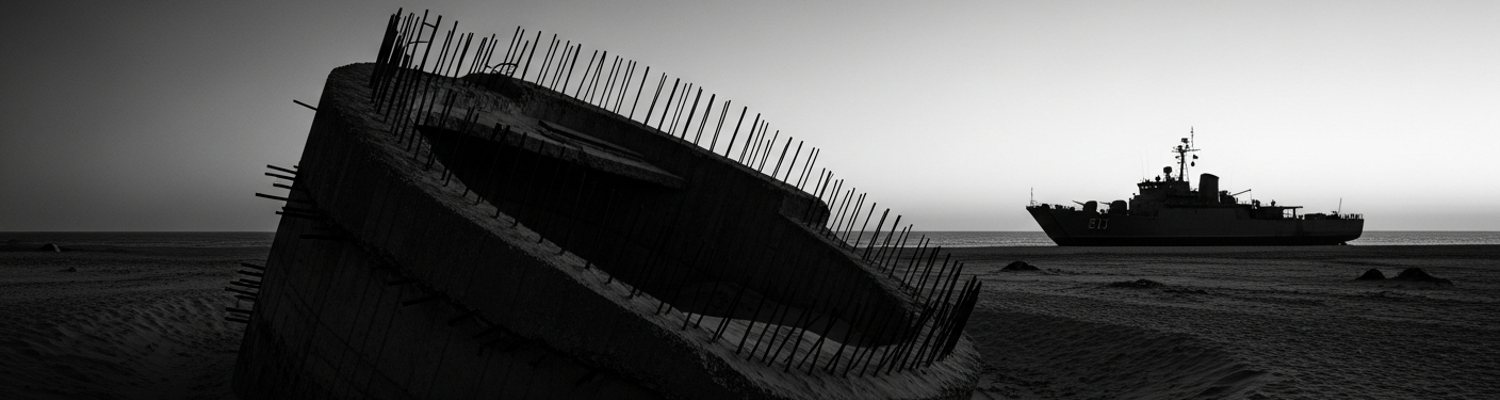

The affair began without warning. A close review of declassified records points to the issuance of Joint Chiefs of Staff Directive 77-B in early February 1961. The document, born from escalating Cold War anxieties surrounding potential Soviet submarine operations in the Gulf of Mexico, ordered the immediate establishment of a fortified defensive barrier along the Mississippi Sound. It focused explicitly on the uninhabited barrier islands of Horn and Petit Bois. The directive was hasty. It allocated no new funding for the enormous undertaking. Service branches were ordered to execute the mission using existing operational budgets, a decision that immediately forced commanders to cannibalize funds and resources from already planned training and maintenance schedules. The U.S. Army’s 117th Engineer Battalion and the Navy’s Mobile Construction Battalion 4 (NMCB 4) were abruptly reassigned from other projects. They were given an impossible 90-day timeline to construct hardened observation posts, anti-invasion gun emplacements, and radar facilities on islands that lacked any infrastructure.
The initial landings on Horn Island in April 1961 were a near-disaster. The Navy’s LCM-6 landing craft, designed for firm Pacific atolls, struggled against the Gulf’s notoriously shifting sandbars. Several boats ran aground, their propellers fouled by sand and seagrass. This forced troops to wade through chest-deep, murky water with their gear. The Army’s heavy M59 bulldozers, intended to clear sites for the concrete bunkers, proved mechanically unsuitable for the environment. Their air intakes, not designed for the fine, aerosolized sand, clogged within hours of operation and led to a cascade of engine failures. Archival evidence shows that the Seabees of NMCB 4, possessing more direct experience with amphibious construction, proposed using pontoon causeways and lighter, specialized equipment. Their suggestions were flatly denied by the regional Army Corps of Engineers command. That command held ultimate jurisdictional authority over all domestic fortification projects and insisted on adherence to standard Army construction doctrine, a doctrine utterly incompatible with the sandy, unstable terrain.
Bureaucracy became the primary obstacle. Plans mandated by Directive 77-B, drawn by architects in a Washington D.C. office, specified the use of a high-strength concrete mixture. Yet the only aggregate available on-site was sand with high salt and shell content. The only available water was brackish. Using these materials directly contradicted Army engineering manuals (TM 5-330), as the salt would corrode the steel rebar and cause the concrete to fail within a few years. Official requests from the 117th’s commanding officer for shipments of appropriate aggregate and fresh water were rejected by the Tri-Service Fortification Materiel Review Board. The board cited the unfunded nature of the directive and the prohibitive cost of barging materials from the mainland. Its response, a five-page memorandum, suggested the on-site commanders experiment with local material compositions. This bureaucratic sidestep placed all liability for the inevitable structural failures directly on the units in the field. Consequently, the first bunker foundations poured on Petit Bois Island began to show signs of spalling and cracking before the wooden forms were even removed.
The fortification designs were fundamentally flawed. Army doctrine called for deep, vertical-walled revetments for the 90mm anti-invasion gun batteries, a design proven in the firm soil of Europe. On the shifting sands of Horn and Petit Bois Islands, this was a physical impossibility. A review of the 117th Engineer Battalion’s operational logs for May 1961 details the repeated attempts to follow these blueprints. Engineers using M59 bulldozers and backhoes would excavate a pit to the specified 12-foot depth, only to watch as groundwater instantly flooded the bottom and the saturated, cohesionless sand of the walls slumped inward. The soil’s angle of repose was simply too low to support a near-vertical cut. Attempts to use standard wooden shoring failed as the pressure of the waterlogged sand crushed the timbers.
After a week of failed attempts, the on-site commander made a field decision to abandon the official design. The engineers were forced to excavate wide, shallow, bowl-shaped depressions instead. This expediency created new tactical vulnerabilities. The guns sat lower, restricting their fields of fire and creating a significant dead space at close range. The shallow design also offered far less protection for the gun crews and their ready ammunition. A test-firing of a single gun in a newly excavated emplacement on Horn Island resulted in a partial collapse of the sandbagged parapet from the weapon's own recoil. The position was inherently unstable before ever seeing a theoretical enemy.
The Army’s ignorance of the terrain was willful. It was a direct result of inter-service arrogance. Archival evidence shows that the U.S. Navy possessed exhaustive hydrographic surveys of the Mississippi Sound, compiled over decades by the Naval Oceanographic Office. These charts, specifically the Mississippi Sound and Barrier Islands Littoral Drift Survey of 1958, detailed the precise rates of erosion, the shifting nature of offshore sandbars, and the impact of storms on the islands' coastlines. The commander of Navy Mobile Construction Battalion 4 formally transmitted this data to the Army Corps of Engineers liaison officer on April 28th, 1961. The accompanying memo strongly recommended against placing any permanent structures within 200 yards of the shoreline, as the Navy’s data projected a high probability of foundation undermining within a single storm season.
The warning was ignored.
The Army command structure, holding jurisdictional authority, dismissed the Navy’s detailed oceanographic data. The official reply stated a preference for the Army’s own topographical land surveys. These Army surveys, conducted hastily over two days, treated the islands as static landmasses. They failed to incorporate any analysis of the powerful coastal dynamics that defined the environment. The decision to place the primary gun batteries for Battery A on a low-lying sandspit on the eastern tip of Horn Island directly contradicted the Navy’s explicit recommendations. Doctrinal authority was prioritized over ground truth.
The Marine platoons dispatched to the barrier islands were fundamentally unprepared for the environment. A review of unit manifests from the 2nd Marine Division elements reveals a standard temperate-climate loadout. Marines arrived clad in the M-1951 field jacket and wool service sweaters, items wholly unsuitable for the oppressive humidity and heat. The burden of carrying useless cold-weather gear, combined with a lack of sufficient warm-weather uniforms, added a needless layer of physical misery. The core of their individual equipment, the M-1956 Load-Carrying Equipment, was a canvas and steel system prone to mildew and rust in the perpetually damp, salt-laden air.
Their weapons were a source of constant failure. The newly issued M14 rifle proved disastrously susceptible to the fine, abrasive sand and corrosive salt spray. A close examination of after-action maintenance reports shows a cascade of malfunctions directly attributable to the environment. The rifle’s roller-delayed blowback action, while robust in normal conditions, became a trap for sand, leading to failures to feed and eject. The wooden stocks of these early-production rifles swelled and warped in the constant dampness, affecting accuracy and making a mockery of marksmanship training. Marines, doctrinally trained to keep their weapons meticulously oiled, discovered that lubricant in this environment became a gritty paste that accelerated wear on moving parts. This forced a shift to running the weapons nearly dry, which only increased the likelihood of rust.
A glaring absence of specialized hardware defined the Marine deployment. Doctrine for the defense of advanced naval bases, a core Marine Corps mission, called for specific equipment to counter coastal threats. None of it was provided for Directive 77-B. There were no beach mines, no anti-swimmer nets for the shallow approaches, and no dedicated systems for underwater obstacle removal. Most critically, the units lacked any man-portable surveillance radar. Systems like the AN/TPS-21, a lightweight ground surveillance radar designed to detect moving targets, were available within the wider military inventory but were not allocated to the mission. Instead, observation was entirely dependent on the human eye, aided by standard-issue binoculars. This method was completely inadequate for the vast stretches of water and the frequent curtains of rain and fog that shrouded the islands. The platoons were forced into a reactive posture, capable only of responding to a threat once it was practically ashore.
The entire defensive scheme was built on a foundation of incompatible technologies. A close review of after-action reports highlights a communications architecture fractured from the start. The Army signalmen of the 117th Engineer Battalion were equipped with the standard AN/PRC-10 infantry radio. This was a robust, tube-based VHF FM transceiver operating in the 38.0 to 54.9 MHz band. The Navy patrol craft assigned to picket duty in the Mississippi Sound, however, operated on entirely different frequencies and modulation types. Their ship-to-shore communications relied on HF and AM systems, making direct contact with the Army’s FM radios a physical impossibility. A frantic attempt during a May 1961 exercise to report a simulated contact illustrates the failure. The Army radioman in the bunker at 30.22°N, 88.67°W repeatedly broadcast on his PRC-10. His signal was meaningless hiss to the Navy patrol boat less than two miles away, which was monitoring a completely different part of the radio spectrum.
This disconnect extended vertically. Marine forward observers from the 2nd Marine Division, deployed to the eastern tip of Petit Bois Island, carried the AN/PRC-6, a short-range, low-power VHF FM radio designed for platoon-level communication. These radios, operating in the 47 to 55.4 MHz band, were intended to connect a squad leader to his platoon commander over a distance of perhaps one mile. They were utterly incapable of communicating with the Navy A-4 Skyhawk attack jets flying out of Pensacola, which constituted the operation’s primary air support. The Skyhawks’ radios were built for UHF AM frequencies used in air traffic control and tactical air direction. The proper equipment, a dedicated Tactical Air Control Party with its own vehicle-mounted UHF and HF radios, was never requested, as Directive 77-B provided no budget for such specialized units. A training log from June 3rd, 1961, details the convoluted path of a single request for air support. The Marine forward observer used his PRC-6 to call his platoon sergeant. The sergeant ran to the command post to have the request relayed by a slightly more powerful radio to the joint command center on the mainland. There, it was transcribed and handed to a Navy liaison officer who finally radioed the airbase. By the time the simulated A-4s were given a target, twenty-five minutes had elapsed.
This technical dysfunction fed a procedural paralysis at the Joint Operations Center (JOC) at Keesler Air Force Base. Redundant and conflicting reporting chains guaranteed inaction. A sighting from a Navy patrol craft would travel up the naval chain of command, from the boat to the squadron commander at Gulfport, before being sent by teletype to the JOC. A sighting of the exact same event by a Marine observation post on Petit Bois would travel via its own Marine Corps radio net to its battalion liaison, who would then report it to the Army task force commander, who held operational authority and would in turn pass the information to his representative at the JOC. An incident on May 28th, 1961, became the exemplar of this failure. The Navy reported a surface contact at one set of coordinates. Twenty minutes later the Army passed on a Marine report of a similar vessel at coordinates nearly a half-mile different. Faced with two conflicting reports arriving from two different services through two different channels, the JOC commander was paralyzed. He demanded verification. This request had to travel back down both separate, incompatible command chains, initiating a cycle of delay and confusion that ensured no decision could be made in a timely manner.
The exercise planners initiated the mass casualty event at 0930 on June 5th, 1961, with a single coded message: Condition Red. On Horn and Petit Bois Islands, exercise controllers handed sealed envelopes to the platoon leaders and the senior non-commissioned officer of the Army engineer detachment. The scenario was a simulated surprise air and sea attack. The main observation post on Horn Island was ruled destroyed. One of the 90mm gun emplacements on Petit Bois was designated as having suffered a direct hit on its ready ammunition. Controllers began walking through the positions, tapping soldiers on the shoulder and handing them carmine-red casualty tags. Each tag detailed a specific notional injury: sucking chest wounds, compound fractures, third-degree burns. Within thirty minutes, forty-seven soldiers across both islands were classified as casualties. Nearly a third were designated as immediate, requiring urgent surgical intervention.
An examination of the operational plan for Directive 77-B reveals a complete absence of a coordinated medical evacuation framework. There was no integrated inter-service document outlining procedures, responsibilities, or communication channels. The Army’s medical plan was entirely self-contained, assuming casualties would be moved by Army ground ambulances to an Army aid station and then transported by Army helicopters to a mainland hospital. This was a fantasy on a roadless barrier island surrounded by saltwater. The Navy, in turn, possessed no specific directive to provide medical transport. Its role was supporting the construction project, not assuming responsibility for Army personnel. Any request for naval assets, like a landing craft, had to be submitted through formal channels. No pre-arranged agreement for emergency medical transport existed.
Army medics on Horn Island found themselves presiding over a triage area in a stiflingly hot GP-Medium tent. They had morphine syrettes, battle dressings, and limited supplies of whole blood. They did not have any way to move the twenty immediate casualties lying on litters in the sand. The medics, belonging to the 117th’s organic medical platoon, had no vehicles and no watercraft. Their own higher command simply assumed the Navy would provide transport in an emergency, a catastrophic failure of inter-service planning. At 1045, a Navy LCU-1466 class landing craft grounded itself on the beach to offload pallets of cement. The Army medical platoon sergeant directed his litter teams to carry two immediate casualties toward the ramp. The Navy coxswain, a Chief Petty Officer, physically blocked them. A review of his after-action statement reveals his orders were to transport construction materiel only. He possessed no authority to take on personnel, let alone casualties from another service branch. He demanded a formal, written transfer order approved by the JOC before he would allow a single Army soldier onto his vessel.
The refusal was not born of malice. It was born of a bureaucracy that made no provision for common sense. The request for formal transfer orders had to be relayed by the medic’s PRC-10 radio from the island aid station, up the Army battalion chain, across to the Navy liaison desk at the JOC at Keesler, and then back down the entire naval command chain to the boat sitting on the beach. While the request crawled through the administrative labyrinth, the exercise controllers began their grim work. They moved from litter to litter, observing the designated bleed-out times printed on the casualty tags. At 1130, the first soldier with a notional arterial bleed was declared dead. By 1300, eighteen of the simulated immediate casualties on Horn Island were ruled to have died from their wounds due to a lack of evacuation. Their red tags were updated in the official exercise log.