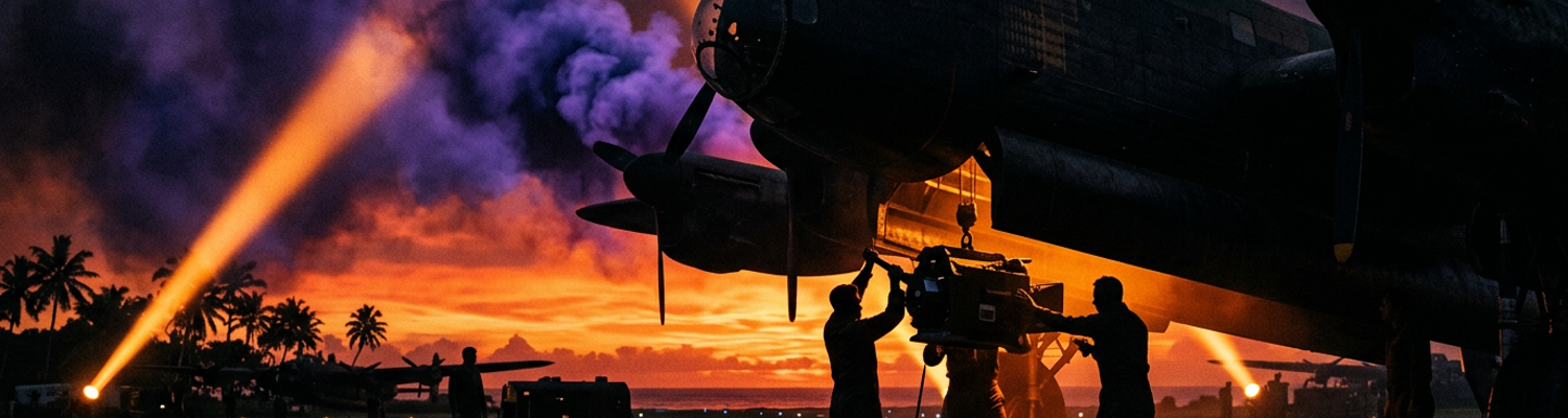

Superfortress Preparations at Isley Field
Camera heating jackets and specialized optical glass windows created an immediate mechanical bottleneck for high-altitude reconnaissance flights over the Japanese home islands. Ground crews of the 3rd Photographic Reconnaissance Squadron rushed dawn camera configurations under strict operational timetables at Isley Field on Saipan, working against compounding delays that threatened early morning launch windows. Mechanics labored in heavy tropical humidity beneath open corrugated metal hangar bays, racing to install heavy lenses before rising ambient heat warped the delicate chemical emulsions on exposed film rolls. Technical modifications to standard B-29 airframes retained defensive armor plate, remote-controlled gun turrets, and central fire-control computers while accommodating K-17, K-18, and K-22 aerial reconnaissance cameras inside the rear fuselage. Installing auxiliary fuel tanks inside the bomb bays expanded fuel capacity, giving the converted F-13 Superfortresses enough range to complete three-thousand-mile round trips to Tokyo and back. Ground technicians secured the bulky reconnaissance gear inside custom shock-absorbing metal frames, tightening threaded steel mounting bolts with calibrated handheld wrenches to prevent engine vibration from blurring reconnaissance exposures.
Wrenches clattered against structural aluminum ribs as technicians completed the structural checks and began inspecting the pressurized photographic compartments. Rapid turnaround maintenance protocols required the ground crews to service delicate optics and pressurized bulkheads between long-range Honshu sorties with almost no downtime. Salt spray carried by trade winds across Saipan combined with crushed coral dust from the runways to coat exterior optical glass with an abrasive film, forcing maintenance specialists to wipe down lens ports with pure alcohol and lint-free cotton. Pressurization seals surrounding the optical glass ports degraded under constant expansion and contraction during twenty-hour flights through temperatures of minus fifty degrees, requiring immediate replacement before another high-altitude climb. Maintenance crews tested rubber gasket linings, scraped away cracked synthetic sealant around the viewing glass, and pumped compressed air into the aft compartment to ensure the sealed space would hold life-supporting pressure at thirty thousand feet.
Hoses hissed as technicians disconnected ground pressure lines after verifying that the sealed compartment held steady at seven pounds per square inch. Photographic specialists immediately climbed inside the aft compartment carrying sealed metal containers loaded with nine-inch by eighteen-inch aerial roll film. Crews threaded the acetate film strips through the twin motorized feed rollers of the vertical K-18 cameras, aligning vacuum pressure plates that held the film perfectly flat against the lens focal plane during high-speed runs. Technicians mounted split-vertical K-17 cameras alongside long-focal-length K-22 units in forward-facing and oblique positions, running heavy copper wiring harnesses to electrical intervalometers that automatically timed every shutter actuation over target zones. Ground officers signaled the ready status to the cockpit, ordering the flight crew to start their four radial engines and meet the strict dawn departure window.
Engines coughed and backfired across the coral parking revetments as flight crews energized the ignition circuits and ground crews hauled away aluminum maintenance ladders. Ground crewmen pulled heavy wooden chocks from beneath the main landing tires while thick exhaust plumes erupted from the four Wright R-3350 engines turning large four-bladed propellers. Pilots released the mechanical toe brakes, allowing the fully armed F-13 Superfortress to roll onto the perimeter taxiway toward Runway Able under the command of XXI Bomber Command. Flight officers guided the aircraft into takeoff position at the runway threshold, throttling the engines to full military power to launch the day's first damage assessment sortie over the industrial cities of Honshu.
F-13 Flights Across Tokyo and Nagoya
Propellers bit into the humid morning air as the stripped F-13 lifted off the runway and climbed steadily toward thirty-two thousand feet on a direct northerly heading for Honshu. Crews flew without fighter escorts for five straight hours over open ocean before reaching the jagged coastline of the Kanto Plain. Japanese air defense units immediately tracked the lone reconnaissance aircraft on coastal radar stations, coordinating interlocking lattices of high-intensity searchlight beams and dense curtains of heavy anti-aircraft flak bursts. Pilots held the heavy bomber on a rigid level heading straight through the bursting black flak clouds, refusing to turn or take evasive action that would tilt the camera mounts and ruin the survey run. Blinding soot decks from recent night incendiary attacks hung across the lower atmosphere between ten and twenty thousand feet, obscuring landmarks and forcing navigators to sight their run through narrow breaks in the rising carbon smoke. Photographic technicians energized the central control switches as the aircraft leveled out directly over the burning heart of Tokyo.
Intervalometers fired every six seconds inside the rear camera bay, triggering overlapping shutters on twin vertical K-18 cameras to capture continuous stereoscopic strip imagery of the devastated urban expanse. High-resolution optical lenses documented square miles of leveled city blocks where incendiary firestorms had consumed wood-and-paper residential districts and feeder workshops along the shores of Tokyo Bay. Pilots banked the aircraft southwest after clearing the Kanto skies, stabilizing their heading over the industrial basin of Nagoya to begin a second photographic run along major rail corridors and factory districts. Stereoscopic film rolls recorded pairs of offset exposures that allowed photo-interpreters back on Saipan to view the ground in three dimensions, measuring crater depths, blown factory walls, and collapsed structural ironwork across the Mitsubishi aircraft engine works. Motorized film spools hummed steadily inside the aft fuselage while the compartment thermometer dropped to forty degrees below zero, freezing condensate along the metal skin and stiffening rubber seals around the optical window ports.
Rubber oxygen masks stiffened against crew faces as exhaled moisture froze into solid ice crystals inside the delivery valves during the ten-hour unescorted flight. Severe physiological strain took a heavy toll on the men throughout the mission, as extreme cold seeped through electric flying suits, causing muscle cramps, sluggish reflexes, and blinding headaches in the thin air of the unheated compartments. Japanese army fighter bases scrambled Nakajima Ki-44 and Kawasaki Ki-45 interceptors near Nagoya, but the enemy pilots struggled to reach the thirty-thousand-foot operating ceiling where the stripped Superfortress cruised. Pilots pushed their four Wright radial engines to maximum continuous power, outdistancing the climbing fighters whose carburetors and superchargers lost efficiency in the upper atmosphere. Accumulating frostbite, hypoxia, and severe mental fatigue generated steady crew attrition after every flight, forcing squadron flight surgeons to ground experienced personnel for medical rest and leaving fewer operational crews to fly subsequent damage assessment sorties. Co-pilots eased back the throttle levers as the Japanese coast faded behind them, starting the five-hour return flight south toward the coral runways of the Marianas.
Photographs Trigger Intelligence Conflicts at CinCPAC
Couriers unloaded aluminum film magazines from the landed reconnaissance aircraft and rushed the damp negatives directly into the photo laboratories at Harmon Field on Guam. Technicians dried the long acetate strips under electric blowers, producing glossy contact prints that Major General Curtis LeMay and his XXI Bomber Command staff gathered to inspect around wooden plotting tables. LeMay used these high-altitude photographs of blackened ruins across Tokyo and Nagoya to argue that independent strategic air power was dismantling the Japanese war economy on its own. Doctrinal clashes erupted almost immediately between the air staff at Harmon Field and Admiral Chester Nimitz, whose headquarters at CinCPAC stood only a short drive away on the same island. Nimitz and his naval commanders rejected the USAAF doctrine that firebombing cities alone could compel a Japanese surrender without an amphibious invasion. LeMay maintained that every heavy bomber diverted from Honshu delayed the destruction of Japan, and he dispatched couriers with duplicate photograph sets across the island to prove his claims to the naval high command.
Analysts grabbed the glossy print duplicates at the Joint Intelligence Center Pacific Ocean Areas and slid them beneath magnifying stereoscopes to verify the army air force claims. Photo-interpreters inside the naval intelligence center expressed sharp skepticism regarding the damage assessments published by XXI Bomber Command. JICPOA officers discovered that army air force interpreters repeatedly classified partially burned workshops as fully destroyed targets, counting scorched roofs and charred ground as neutralized industrial capacity. Naval intelligence specialists argued that machinery inside reinforced concrete structures often survived intense fires, and that Japanese war workers quickly cleared burned timbers to resume assembly inside surviving factory shells. Navy officers pointed out that small feeder plants dispersed throughout residential neighborhoods could not be confirmed as eliminated simply because surrounding wooden homes had burned down. JICPOA analysts compiled their own skeptical target reports, challenging LeMay to provide physical proof of factory neutralization rather than relying on wide-angle aerial photographs of smoke and ash.
Nimitz cited these skeptical intelligence reports to demand that XXI Bomber Command halt its independent campaign against Honshu and divert massive air resources to support Operation Iceberg at Okinawa. Japanese kamikaze attacks were sinking naval transports and damaging radar picket destroyers off the beaches of Okinawa, prompting CinCPAC to demand immediate B-29 strikes and photo runs against staging airfields on Kyushu. LeMay protested this operational diversion, arguing that using high-altitude strategic bombers against dispersed grass airstrips was an ineffective waste of air power that prolonged the war. CinCPAC exercised its theater command authority, ordering LeMay to reassign hundreds of B-29 strikes and critical F-13 photo-reconnaissance missions to locate and suppress suicide air units. Navy commanders accused the USAAF staff of hoarding scarce photographic assets to build an institutional case for strategic bombing while the fleet burned off the Ryukyu Islands.
LeMay reluctantly approved new flight schedules drafted by his operations staff, rerouting dozens of Superfortresses away from industrial centers on Honshu toward the airfields of southern Kyushu. Reconnaissance crews swapped out their high-altitude urban map sheets for coastal charts of the Ryukyu chain and the staging bases around Kanoya. Technicians installed fresh film rolls into vertical camera bays to document the craters blasted into enemy taxiways and revetments across Kyushu. Ground crews loaded five-hundred-pound general-purpose demolition bombs into the forward bays of the diverted Superfortresses, preparing the aircraft to strike the Japanese airstrips at dawn.
Planimeters and Joint Target Group Reports
Bomb bay doors snapped shut under the loaded airframes while intelligence officers at Harmon Field turned their full attention to the heavy volume of unprocessed photographic plates arriving from Honshu. Target analysts worked under a standardized methodology established by the Joint Target Group, a combined military agency in Washington that evaluated aerial bombing results. Interpreters received duplicate film rolls flown by courier from Guam, mounting the acetate negatives on illuminated glass light tables to perform systematic frame-by-frame evaluations. Analysts compiled these technical findings into Damage Assessment Report 3-a(20) to record the consequences of the incendiary sweeps across Tokyo, alongside Damage Assessment Report 3-a(22) covering the devastated industrial basin of Nagoya. Both publications circulated directly to the Joint Chiefs of Staff and theater commanders, establishing official military baselines for the destruction of Japanese war potential.
Draftsmen traced planimeter wheels across the photographic plates to calculate exact square-mile burnout figures across the Kanto and Tokai manufacturing corridors. Interpreters peered through twin-lens stereoscopes, matching overlapping aerial exposures to create three-dimensional views of the targeted urban basins. Stereoscopic plate analysis revealed that massive firestorms had consumed more than fifty square miles of densely populated terrain across the Kanto Plain around Tokyo Bay, while companion raids in the Tokai industrial belt burned out more than twelve square miles of Nagoya. Detailed measurements showed that the vast majority of the leveled acreage consisted of timber dwellings and small neighborhood feeder workshops rather than heavy structural factories. Steel and reinforced concrete skeletons of primary war plants remained standing amid the ashes, proving that wide-area fire had incinerated living quarters while leaving heavy industrial equipment partially intact under collapsed corrugated roofs.
Railroad tracks cut cleanly through the leveled landscape alongside these surviving factory structures, giving intelligence specialists photographic verification that core transportation corridors had survived the flames. High-magnification lenses revealed intact steel rails, clear classification yards, and functioning signal gantries running directly through thousands of acres of incinerated residential buffer zones. Canals and coastal shipping slips throughout the Kanto and Tokai districts showed little structural disruption, allowing barges and tugs to navigate urban waterways between scorched factory docks. Interpreters spotted moving freight trains and road convoys navigating the perimeter routes within forty-eight hours of major firebombing missions, demonstrating that the logistical circulation of the cities remained unbroken despite the near-total loss of surrounding worker housing.
Officers at CinCPAC seized on these transport findings to challenge XXI Bomber Command claims that urban firebombing was paralyzing the Japanese empire. Naval planners argued that burning residential buffer zones created catastrophic civilian homelessness without halting the flow of raw materials, weapons, and troops along the vital rail arteries. Target specialists in the Joint Target Group urged an immediate shift from general area burning to precision interdiction strikes against key railroad bottlenecks, marshalling yards, and coastal coal colliers. Major General Curtis LeMay reviewed the photographic evidence at Harmon Field and ordered his operations staff to draft targeting directives for focused daylight demolitions against railway bridges and repair shops on Honshu. Planners pulled detailed blueprints of the Tokaido rail line from their target folders, assigning wings of B-29 bombers to strike critical railway choke points across central Japan.
Factories and Strategic Verification Limits
Photographs of these targeted rail choke points revealed an unexpected dispersal of Japanese industry across the countryside. Surveillance evidence mounted by the 3rd Photographic Reconnaissance Squadron documented the relocation of Japanese aircraft subassembly production into concealed shadow factories and rural workshops. Low-altitude oblique exposures captured workers hauling stamping machines and drill presses out of bombed metropolitan centers into mountain ravines, disused railway tunnels, and village schoolhouses. Japanese army and navy authorities had camouflaged these decentralized assembly sites beneath thatched roofs, dirt berms, and fresh pine boughs to blend them into surrounding farmland. Heavy aerial cameras documented newly worn dirt tracks linking rural rail sidings to hidden forest sheds where laborers assembled fighter fuselages and radial engines piece by piece. Flight technicians cataloged hundreds of these dispersed workshops across central Honshu, demonstrating to Allied officers that the destruction of main manufacturing plants had triggered an immediate underground dispersal rather than a total collapse of Japanese aircraft construction.
Machine tools transferred into these rural workshops created a stark divergence between total urban acreage burned and the actual persistence of decentralized munitions manufacturing capabilities. Planimeters rolled over reconnaissance film recorded more than one hundred square miles of urban ash across major cities, but intelligence analysts discovered that physical burnout statistics failed to reflect remaining enemy industrial capacity. Japanese munitions output persisted because managers had moved essential lathes, hand tools, and small metal stamping equipment out of urban neighborhoods weeks before the incendiary clusters fell. Stereoscopic plate analysis confirmed that while residential zones and small wooden feeder shops burned completely, decentralized munitions fabrication continued inside concrete basements, caves, and rustic farm outbuildings. Ground intelligence and aerial observation revealed that completed subassemblies flowed steadily along secondary gravel roads to concealed flight strips, allowing military units to assemble and field combat aircraft despite the loss of entire urban districts. Analysts at Harmon Field confronted growing evidence that burned acreage was an inadequate yardstick for economic destruction, leaving air force planners without reliable proof that the burning of Japanese cities had halted weapons production.
Commanders met at joint intelligence headquarters to resolve this verification breakdown during the final weeks of the strategic bombing campaign. Pacific command echelons negotiated formal post-strike reconnaissance intelligence compromises to bridge the bitter divide between naval planners and XXI Bomber Command. Both headquarters agreed to abandon raw square-mile burnout claims as the sole standard of bombing success, establishing a unified damage assessment board that combined aerial photographic proof with radio intelligence, captured documents, and shipping traffic data. Intelligence specialists created new targeting criteria that required photo-interpreters to confirm the destruction of specific transport choke points, tunnel entrances, and rural assembly nodes before listing a target complex as neutralized. USAAF command redirected tactical reconnaissance sorties to track secondary supply roads and dispersed machine shops, while CinCPAC agreed to validate strike results based on documented industrial paralysis rather than visible surface fire damage. Aircrews at Harmon Field received updated target packets specifying these hidden rural workshops, loading their bomb bays with precision high explosives to eliminate the decentralized production network that urban firestorms had failed to destroy.