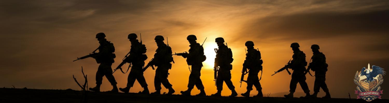

Silence was the first enemy. In the pre-dawn chill of the Arkansas Ouachitas, it was a physical pressure. The weight of a million unmapped acres pressed in on the small camp. For the men of the 3rd U.S. Infantry detachment, this was not peace. It was the held breath before the day’s engagement. A battle not against men with muskets, but against the terrain itself. A twig snap under a sentry’s boot sounded like a gunshot. Soon, the light would come. The orders would follow.
The purpose of the 1858 Arkansas expedition was, on paper, a bureaucratic function. The primary objective was the extension of the Public Land Survey System. Following a geometric logic conceived decades earlier, the mandate was to impose a grid of six-by-six mile townships onto a landscape that rejected straight lines. Each township was to be subdivided into 36 individual sections, and each section into quarter-sections for sale and settlement. This was not exploration. It was the conversion of wilderness into a national asset, a commodity to be sold. The War Department directive, issued through the General Land Office (GLO Directive 58-11A), carried federal authority. It was an order to erase the existing map of creeks and ridges, replacing it with a rational, saleable grid. Failure to execute meant a delay in the machinery of westward expansion.
This use of military personnel for a civil engineering task was an inheritance from the post-War of 1812 era. That conflict had exposed weaknesses within the republic. The army’s inability to move men and materiel through the western territories had been a source of near-total failure. A generation of officers, shaped by those logistical debacles, came to power convinced that the army's peacetime role was to build the nation’s infrastructure. They would lay down roads, canals, port fortifications, and survey lines. The United States Military Academy at West Point was transformed into the nation’s premier engineering school to serve this purpose. The Army Corps of Topographical Engineers became the lead element, tasked with mapping the path of progress. Using enlisted infantrymen as the labor force was a pragmatic solution. It kept soldiers occupied, hardened them to frontier conditions, and accomplished a national objective without the cost of hiring civilian contractors.
Archival evidence shows the role of the common soldier in these expeditions was arduous and repetitive. For the men assigned to the Arkansas survey, there was no glory. They were not scouts or explorers. They were human machinery. The primary group, the chainmen, carried the Gunter’s chain, a 66-foot length of iron links weighing nearly thirty pounds with its tally pins. They walked a straight line, hacking through dense canebrakes, wading through frigid streams, and scrambling over rockfalls, planting a pin every 66 feet. An axeman followed, clearing a line of sight for the officer’s instruments. Behind them, moundmen built cairns of earth and stone or blazed witness trees to mark section corners. The work was governed by the sun and the officer’s solar compass. The enlisted men’s job was to obey the compass, to force the idealized line of the survey grid onto the chaotic land, one 66-foot segment at a time. Each day's progress was measured in chains.
The entire survey enterprise rested upon the integrity of brass and glass components manufactured 4,000 miles away in London by Troughton & Simms. A review of operational logs from similar period surveys indicates a standard expedition would carry a primary traversing theodolite and a Burt-pattern solar compass. The solar compass was a complex assembly of interlocking arcs and balanced needles, designed to find true north by tracking the sun. This bypassed the unreliable magnetic readings common in the iron-rich Ouachita rock. Its operation was a constant procedure for the lead surveyor. Any slight jarring could de-index the vernier scale, a delicate measurement overlay requiring painstaking realignment. The cold was an enemy to its function; dropping temperatures caused the brass to contract and the whale-oil lubricant on the adjustment screws to gum up, turning smooth movements into jerky, inaccurate jumps. A sudden downpour was a mission threat. Water penetrating the housing could fog the main lens. Moisture on the silvered reflector of the solar apparatus would disperse the pinpoint of light needed for a fix.
Early route planning was an exercise in theoretical geometry imposed upon a hostile geology. The survey’s mandate from the General Land Office demanded a grid of north-south and east-west lines, a system conceived for the flat lands of Ohio, not the topography of the Ouachitas. Field officers were given maps with pre-drawn section lines, plotted in a distant office by draftsmen who had never seen the territory. The officer’s job was to force that paper grid onto a landscape of knife-edge ridges running east-to-west, perpendicular to the main survey direction. A projected section line did not curve around an obstacle. It went through it. This created difficult decisions. A line might run directly up the face of a 200-foot novaculite bluff or into a half-mile-wide canebrake swamp. The officer had to choose between ordering his men into a dangerous, time-consuming ascent or deliberately initiating an offset. This offset, a traverse, required multiple instrument readings and introduced a high probability of error. The lack of any reliable prior maps meant there was no way to plan for these obstacles. The expedition was walking blind, with each day’s route revealed one 66-foot chain length at a time.
The logistical preparations for the men and pack animals were based on standard frontier infantry doctrine, with little adaptation for a winter survey. A detachment from the 3rd U.S. Infantry, a unit hardened by service in the arid Southwest, provided the labor. Their quartermaster issue was not designed for a cold, wet environment. Each man carried a single wool blanket and wore a standard-issue dark blue wool uniform. Once saturated by rain and creek crossings, it would not dry for days in the sunless hollows. Their ankle-high Jefferson brogans were shredded by sharp rock, their stitching rotting in the damp. The bulk of the supplies, crates of hardtack, barrels of salted pork, and sacks of green coffee beans, were transported by a mule train. These animals were essential for carrying the heavy chains, axes, tripods, and instrument boxes. They were also a liability on the treacherous ground, prone to slipping on wet rock and breaking legs in unseen depressions. Forage was scarce, forcing the expedition to carry its own grain and dictating the effective range of any foray.
The operational breaking point occurred on September 14, 1858. Survey field notes from similar expeditions show that river crossings were a common point of equipment loss. For the 3rd U.S. Infantry detachment, the chosen ford of the Fourche La Fave River was a scene of controlled chaos. Cold rain continued, turning the riverbanks into a slick morass of mud. Mules struggled for footing in the swift, frigid current. The crossing proceeded with grim efficiency until a single pack mule lost its footing on a submerged, moss-covered boulder. The animal panicked and lunged. The heavy mahogany box containing the primary traversing theodolite slipped from its harness. It struck the rocks with a sharp crack of splintering wood, audible over the rush of the water.
The men stopped. The only sound was the river. The officer in charge, a lieutenant from the Corps of Topographical Engineers, ordered the box retrieved. When it was brought to the bank, dripping river water, the extent of the disaster was clear. The mahogany case was fractured. Inside, the Troughton & Simms theodolite was fatally damaged. The firm had been established in 1826, producing some of the most precise surveying instruments in the world. This specific instrument, with its calibrated vernier scales and rack-and-pinion focusing, was the heart of the operation. Now, its main objective lens was a spiderweb of cracks. The impact had rendered it useless. It could no longer form an image. The expedition possessed a Burt-pattern solar compass for determining true north, but the theodolite was irreplaceable for the high-precision angular measurements needed for triangulation. There was no spare.
This single event created a cascading delay. The detachment was in the process of establishing the principal meridian for the new survey block. This true north-south line was the foundational axis from which all subsequent township, range, and section lines would be measured. Any error in its initial alignment would be magnified across hundreds of square miles, rendering the season’s work invalid and legally contestable. Period survey instructions from the General Land Office demanded an accuracy that the Burt solar compass could not guarantee on its own over long distances. The theodolite was essential for turning the precise angles required for traverses that carried the meridian across impassable obstacles. The officer had to choose: halt the expedition for months to request a replacement that likely did not exist west of the Mississippi, or proceed with the solar compass alone and knowingly introduce error into the public land record. The daily work of the chainmen, axemen, and moundmen ceased, yet the consumption of rations continued.
The lieutenant’s decision was immediate. The expedition would proceed. This order forced a doctrinal regression, pushing the team back to secondary instruments. The primary tool for orienting the survey line became the Burt solar compass. For the moment-to-moment work of keeping the chainmen on a straight path, the party had to rely on simpler, less trustworthy magnetic compasses. Geological surveys of the Ouachita Mountains reveal the core of this problem. The region is riddled with massive deposits of iron-rich rock, primarily magnetite and hematite. These subterranean mineral concentrations created powerful, localized magnetic fields. A standard compass needle was easily deflected by a few degrees by an unseen iron deposit. A deviation of one degree would result in an error of 92 feet over a mile, throwing off the boundary of a 640-acre section. The surveyors were forced into a time-consuming ritual of taking multiple bearings, moving the compass, and taking another, attempting to find a statistical average that approximated true north.
The burden of verifying the survey’s direction now fell to astronomical observation. This was a task of exceptional difficulty under field conditions. Without the theodolite’s precise vertical arcs, the officer had to rely on his sextant for latitude determinations and the solar compass for azimuth. The Burt solar compass demanded a clear view of the sun. The expedition’s own logs noted weeks of persistent cold rain and heavy cloud cover, rendering the instrument useless for days at a time. The survey party was paralyzed, waiting for a break in the weather. When the sun did appear, the process was a race against time. The surveyor had to level the instrument, align the solar apparatus, and factor in the declination of the sun for that specific day and time using pre-computed ephemeris tables. A slight miscalculation could ruin the reading. To verify latitude at night, the officer would have to perform a Polaris observation, lying on the frozen, wet ground for extended periods, sighting the North Star through the sextant’s eyepiece and making adjustments with numb fingers. The spherical trigonometry required to convert these celestial sightings into usable coordinates had to be done by the weak light of a tallow lamp inside a damp tent.
The expedition’s forward progress collapsed. Archival evidence from similar Army Topographical Engineer surveys of the period shows a daily progress rate of several miles in open terrain. In the Ouachitas, even before the instrument loss, the pace was a fraction of that. Now, work slowed to a crawl. A single cloudy day could halt the detachment. The hours spent waiting for a sun-shot or a clear night for a Polaris fix were hours where two dozen men sat idle, consuming finite barrels of salted pork and hardtack. A traverse around a ravine, a task that might have taken an hour with the theodolite, now could consume an entire day of setting up the solar compass, taking a sight, moving, and repeating the process, all while hoping the sun stayed out.
Subsequent survey reviews conducted years later reveal the physical scars of this improvised navigation. Township lines mandated to be perfectly straight show slight bends when plotted with modern equipment. Section corners, intended to be at precise 90-degree angles, are often off by fractions of a degree. These are not random mistakes. They are the cumulative product of magnetic deviation, hurried astronomical calculations, and the inherent instability of the solar compass as a primary angle-turning device. The errors were small enough to be invisible to the 1858 team but large enough to create decades of legal challenges over property boundaries, water rights, and timber claims as the area was settled. The perfect grid demanded by the General Land Office had been forced onto the land, but it arrived warped and flawed.
The errors in navigation had a physical consequence. By the third week of October 1858, the cumulative effect of magnetic deviation and flawed solar readings had pushed the survey line miles west of its intended course. The officer’s field journal, cross-referenced with later corrective surveys, shows the detachment was attempting to run a range line due south, parallel to the established Arkansas state border. Their flawed calculations were causing the line to drift westward with every mile marker. They were operating under the assumption they were still within the public domain lands east of the Poteau River. In reality, they had crossed it.
They were in the Cherokee Nation.
The ground itself was a clear indicator. The party had moved from logged-over terrain into a mature hardwood forest managed for hunting. Cherokee Nation records of the period describe these specific grounds as autumn hunting territory, reserved for harvesting deer and black bear for winter provisions. The survey party, hacking a straight line through the undergrowth, was a violent disruption. The confrontation occurred around October 22nd. The survey’s axemen, clearing a sightline, broke through a canebrake and stopped. Not thirty yards away stood a party of five Cherokee hunters, armed with percussion rifles and bows. The silence was absolute. The infantrymen escorting the survey crew moved to form a skirmish line, bringing their Springfield rifled muskets to a ready position. The officer’s mission was to protect his equipment and enforce the federal mandate. The infantry’s training was to respond to a perceived threat with organized force.
The crisis hinged on a failure of communication, rooted in a misinterpretation of the boundary treaty and the inadequacy of the expedition’s interpreter. The 1828 treaty that established the western border of Arkansas contained geographically ambiguous language. The line was described in part by natural features, including the Poteau River, but the text lacked the geodetic precision the survey was meant to impose. It failed to specify which bank of the river constituted the border, leaving the exact line open to interpretation. This ambiguity was now being arbitrated by a civilian hire, a local fur trader who served as the detachment’s translator. This individual possessed a limited vocabulary of a regional trade jargon, a pidgin mix of English, Choctaw, and Muscogee words sufficient for bartering but insufficient for conveying abstract legal or technical concepts.
The communication that followed was a failure. The survey lieutenant, through the translator, attempted to explain the federal mandate of the General Land Office, using terms like “principal meridian” and “section corner.” The translator likely reduced this to the simple, aggressive-sounding statement that they were drawing a line for the government. The Cherokee hunters, in turn, were trying to explain a concept of territorial use rights, describing the area as an ancestral hunting ground essential for their community’s winter survival. This concept had no direct equivalent in the translator’s vocabulary or the officer’s legal framework. To the lieutenant, the Cherokee position, as filtered through the trader, sounded like a simple refusal to allow passage. To the Cherokee, the army’s insistence on running a line through their reserved lands sounded like a deliberate, armed invasion. The intricate justifications for the survey were lost, replaced by a tense standoff between two groups with leveled rifles.
The standoff solidified around a source of fresh water. Following the initial confrontation, the survey officer ordered his men to fall back 50 yards and establish a defensive perimeter around a small, clear-running spring. To the officer, this was standard field procedure: secure a water source, establish a defensible camp. He was operating under the belief he was on public land and dealing with hostile trespassers.
An examination of Cherokee settlement patterns shows that such springs were often the nucleus of seasonal communities. This specific spring was the primary water source for a small Cherokee settlement of three families located less than a half-mile downstream. The survey party’s camp, with its mules, latrine pits, and armed perimeter, was now sitting directly on their lifeline.
The dispute was unbridgeable. The Cherokee hunters, soon joined by elders from the downstream settlement, were not contesting a theoretical boundary line. They were witnessing the armed seizure of their drinking water. Their protests, filtered through the incompetent translator, were not abstract claims of sovereignty. They were direct demands: the soldiers must leave the spring. The presence of the mule train fouled the water. The armed camp prevented women and children from approaching. The survey officer, consulting his flawed maps and faulty intelligence, saw the situation through a different lens. His orders were to protect federal property and execute the survey mandate. He saw the Cherokee as obstructing a federal project. His field journal entries, later submitted to the War Department (NARA Record Group 94), frame the incident as an insurrection. He believed he was exercising restraint by not opening fire. Harrison tried to explain the concept of the Gunter’s chain; the Cherokee tried to explain that their children needed water. Neither message was received.
The standoff lasted for three days.
For the enlisted men of the 3rd Infantry, it was a period of high tension and misery. They were ordered to dig shallow rifle pits in the cold, wet soil. Sentries were posted in two-hour shifts, day and night, scanning the silent woods. The rest of the detachment sat huddled by sputtering fires, their wool uniforms perpetually damp, cleaning their weapons and waiting. The work of the survey had stopped, but the clock on their dwindling rations had not. The Cherokee did not mount an attack. They simply watched, their numbers growing as more members of the community came to bear witness. Their presence was a constant, unnerving pressure.
On the morning of the fourth day, the officer made a decision. The expedition was accomplishing nothing. Rations for both men and mules were low. The morale of the enlisted men was collapsing. There was no possibility of continuing the survey southward. To remain would be to risk starvation or provoke a battle he had no authority to start. He gave the order to break camp. The detachment packed their equipment, abandoned their position at the spring, and began a retreat back the way they came. The withdrawal confirmed the complete failure of the season’s objective. They left behind a series of incorrectly blazed trees and wrongly placed corner mounds, a flawed line on the earth that represented weeks of wasted labor and a significant diplomatic breach.
By early December 1858, the remnants of the 3rd U.S. Infantry detachment had established a winter encampment on the north bank of the Canadian River in Indian Territory. Their survey was not just halted; it was routed. The chosen location was tactically sound but environmentally punishing. It sat on a defensible bluff overlooking a wide bend in the river, offering a clear field of fire, but it was completely exposed to the north wind. The men, already demoralized, now had to construct a camp for the winter. They were not building a base for future operations. They were building a shelter in which to endure a defeat. Using axes and bare hands, they erected crude huts of timber and mud, with scavenged canvas tent fragments stretched across the roofs.
The weather was the primary antagonist. The typical hardships of a frontier winter were replaced by sustained freezing rain. For weeks, the temperature hovered at the freezing point. Precipitation did not fall as snow, but as a supercooled liquid that coated every surface in a growing sheath of clear, heavy ice. The constant ticking of the frozen drizzle on the canvas roofs was a persistent sound. The ice accumulated on tree branches until they cracked and fell, a constant danger. The wool uniforms of the infantrymen, once saturated, froze solid. This offered no insulation. Keeping fires lit was a near-impossible task; the little dry wood available inside the huts was quickly consumed, and all outside wood was soaked and ice-encrusted. Medical records from 19th-century military encampments reveal that such conditions were a perfect storm for frostbite, hypothermia, and trench foot.
Their survival depended on a single promised supply barge. Army quartermaster doctrine on the frontier relied on a network of riverine supply lines. This specific barge, dispatched from the depot at Fort Smith, was loaded with supplies: barrels of flour and cured bacon, medical chests with quinine and laudanum, and crates of new Jefferson brogans and winter clothing. Its arrival was predicated on a fragile signaling system. A small, advance detachment was supposed to have placed signal flags at two designated upstream locations to confirm the river was navigable. The barge captain had explicit orders not to proceed past the confluence with the Arkansas River until both signals were sighted.
The system failed. The signal detachment, facing the same ice storm, had been unable to reach the second location. Their mules lost footing on the iced-over terrain, and the men were forced to turn back from exhaustion and exposure. Downstream, the barge captain followed his orders precisely. Seeing only the first signal, he held his position, assuming the route ahead was blocked or compromised. For two weeks, the supplies sat docked just a few days’ journey away, paralyzed by a missing yard of colored cloth. In the encampment, the men stared at the empty, ice-choked river, their hope dwindling with each passing day. The officer cut rations in half, then in half again. The mules, their forage gone, began to starve.
The systematic breakdown of the expedition began with a slow attrition of the enlisted men’s bodies. By Christmas of 1858, the persistent freezing rain and the failure to establish dry quarters had created a widespread health crisis. The primary affliction was frostbite, or more accurately, the condition later defined as trench foot. The standard-issue Jefferson brogans offered no protection against the constant dampness. Once saturated, they never dried. The men’s feet were perpetually cold and wet, leading to tissue damage. The initial stage was a painful tingling, which soon gave way to numbness as circulation was compromised. The flesh would become pale and swollen. For at least a dozen men, this progressed to the gangrenous stage. The skin turned black and began to die. The expedition's medical supplies were wholly inadequate. Treatment consisted of rubbing the affected areas with turpentine and lanolin, methods which did little to halt the underlying tissue death. The only effective field treatment, keeping the feet dry and warm, was impossible.
Starvation drove the next phase of the crisis. With the supply barge stalled and rations cut to near-zero, the officer authorized hunting parties to forage. A successful hunt in early January brought down a large black bear. This should have been a reprieve. It was a disaster. Desperate for a meal and hampered by a lack of dry firewood, the men improperly cooked the meat over smoky, sputtering fires. Within a week, a severe gastrointestinal illness swept through the camp. The described symptoms, intense abdominal pain, fever, nausea, and bloody diarrhea, are consistent with either a severe bacterial infection like shigellosis or, more likely, trichinosis from undercooked bear meat. This parasite-borne disease would have first caused digestive distress before the larvae migrated into the muscle tissue, causing debilitating pain. The camp became a makeshift infirmary. Over half the detachment was incapacitated. The men, already weakened by exposure and frostbite, had no resistance. The available laudanum was used to manage pain until it ran out.
The animals died next. The expedition’s pack mules had been slowly starving for weeks. Their forage was gone. The ice storm had coated every patch of grass or cane. On January 19, 1859, a work detail attempted to lead a group of the weakest animals down an icy slope to the riverbank. Three of the mules, identified in the lieutenant’s log as #4, #7, and #9, lost their footing on the slick rock and fell. The sound of their leg bones snapping was sharp and final. A mule with a broken leg on the frontier was a fatal injury. The officer ordered the animals shot. This was more than a loss of transport. Each mule was capable of carrying over two hundred pounds of equipment. Without them, the detachment lacked the power to move the heavy survey chains, tripods, and instrument boxes.