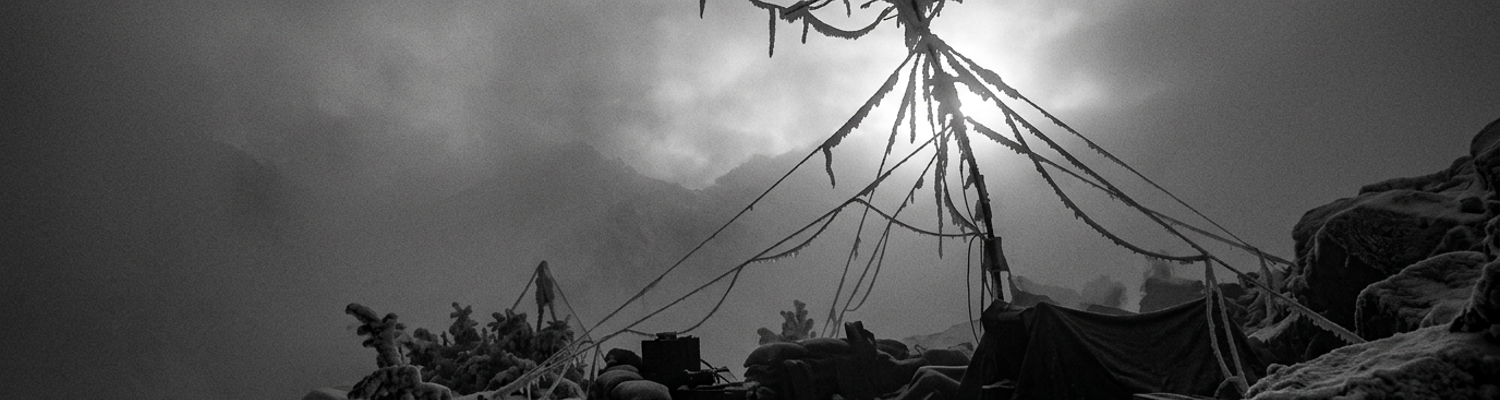

Operation Mountain Resolve Deployment in Nuristan
At 0430 hours on a sub-zero ridgeline in eastern Nuristan, the mountain air was dead still. Men from the 1st Battalion, 87th Infantry Regiment lay prone in freezing talus. They listened to their own shallow breathing through thermal balaclavas. Unkeyed radio receivers emitted a faint electronic hum. No wind stirred the scrub oak. Every rifle safety was clicked to semi-automatic. Fingers rested off the triggers. Eyes scanned the pitch-black contour lines below. Operational logs recorded an ambient temperature of eight degrees Fahrenheit. Intercept specialists had tracked enemy frequency hopping five minutes earlier. Everyone waited for the first muzzle flash.
The silence broke with an incoming mortar burst against the granite ledge.
When examining the historical record of November 2003, the deployment parameters revealed an immediate breakdown between field doctrine and physical conditions. Elements of the 102nd Military Intelligence Battalion sent four-man Low-Level Voice Intercept teams directly into the assault platoons of the 1-87th Infantry. Task Force Spartan initiated Operation Mountain Resolve. Doctrinal field manuals published at Fort Huachuca specified that these voice collection assets should operate from stable rear-echelon observation posts. These posts required mast-mounted directional antennas and reliable vehicle generators (Standard Operating Procedure 34-2). Instead, commanders assigned small intelligence teams to scale vertical ridgelines on foot. They carried AN/PRD-13 direction-finding sets, spare lithium batteries, and standard-issue assault gear.
An average collection specialist hauled ninety pounds of gear up seventy-degree inclines.
Sub-zero temperatures drained the BA-5590 lithium sulfur dioxide battery blocks within two hours. This cut operational listening spans by sixty percent before operators could establish a baseline signal log. Command decisions at the battalion level prioritized rapid infantry movement over signal dwell time. Intercept operators packed sensitive dipole receivers into rucksacks. They moved across active ambush corridors.
Signal theory assumed flat terrain.
A close review of operational logs indicates that the physical environment of eastern Nuristan shattered radio wave propagation. During Operation Mountain Resolve, the 1-87th Infantry pushed into the Hindu Kush highlands near the Waygal Valley. Knife-edge ridges exceeded 9,500 feet. Glaciated vertical rock walls trapped the assault force inside narrow chasms. Intercept teams attempted to monitor high-frequency and very-high-frequency radio transmissions used by Hezb-e-Islami Gulbuddin fighters. The massive granite faces blocked line-of-sight electronic paths. Radio signals from valley floors reflected erratically off the sheer basalt and gneiss formations. This produced severe multipath interference. The interference scrambled azimuth readouts on the AN/PRD-13 direction-finding systems. Directional bearings showed target transmitters originating from solid stone cliffs.
Tactical maps failed to show the true angles of the ravines.
Archival evidence shows that local insurgent spotters deliberately exploited these dead zones. They operated low-wattage hand-held transceivers within deep ravines. United States sensors picked up only static in these areas. Intercept operators from the 102nd Military Intelligence Battalion spent hours attempting to rig expedient long-wire antennas across frozen talus slopes. They used parachute cord and steel climbing pitons. These improvised field expedients increased reception across civilian shortwave bands. They completely failed to register tactical chatter on insurgent push-to-talk tactical networks. Infantry commanders lacked functional real-time electronic warnings. They cleared blind terrain features purely through rifle-squad bounding movements under direct fire. On 11 November 2003, intercept operators attached to Company A watched their primary receiver battery power drop to zero during an active firefight near coordinates 35 18 N 70 54 E.
Cold-War Intelligence Doctrine and Mountain Topography
When examining the historical record of United States Army signal intelligence, the doctrine guiding intercept operations in 2003 originated decades earlier. Field Manual 34-10 and associated divisional intelligence publications were drafted during the Cold War. They were designed to counter Warsaw Pact armored formations across the North German Plain and the Fulda Gap. Standard Army SIGINT doctrine assumed flat European plains with direct radio line-of-sight propagation. Vehicle-mounted AN/TRQ-32 Teammate systems and heavy mast-mounted receiving arrays were engineered under specific presumptions. Planners believed very-high-frequency and ultra-high-frequency transmissions would travel along direct paths across open terrain. Signal officers calculated wave loss through basic free-space attenuation models. They expected ground waves to propagate across rolling farmland with minimal physical obstruction.
The manual assumed flat horizons.
Planning templates instructed intelligence companies to deploy in echelon ten to fifteen kilometers behind forward armored battalions. This projected wide listening arcs over dozens of kilometers of unobstructed terrain. Archival evidence shows that the Hindu Kush made this tactical framework completely unusable. Along the gorges of the Pech and Waygal drainages, sheer granite canyon walls exceeding eight thousand feet severely disrupted doctrine-specified tactical placement. Tactical manuals instructed collection teams to position intercept receivers in triangular baselines three to five kilometers apart. This enabled three separate stations to compute intersecting lines of bearing and triangulate a transmitter.
In eastern Nuristan, establishing that geometry was impossible.
Moving a four-man team carrying an AN/PRD-13 direction-finding set two kilometers across a ravine required eight hours of technical climbing over loose shale. This left the team isolated from company fire support. Command staffs could not place receiver sites along open ridgelines without exposing operators to direct machine-gun fire from higher peaks. Dropping into valley floors cut off line-of-sight reception entirely.
Solid rock broke the mathematical formulas.
A close review of operational logs indicates that battalion commanders attempted to fix the issue by keeping intercept assets within company perimeters along narrow gorge floors. Near the village of Aranas (Grid coordinate 42S TE 9640 2480), vertical stone faces towered over the riverbed. They blocked off the horizon. Insurgent fighters communicated using commercial VHF transceivers operating between 136 and 174 megahertz. Their low-wattage signals struck the sheer canyon walls and bounced erratically off the rock faces. These fragmented radio waves hit the dipole antenna arrays of the AN/PRD-13. The severe multipath propagation distorted the phase measurements. Azimuth displays jumped by ninety degrees in fractions of a second. The automated direction-finding processor plotted enemy transmitters inside solid rock or thousands of feet up in empty airspace. Radio receivers registered signal drops of up to forty decibels whenever transmitters moved behind intervening spurs.
At 1620 hours on 12 November, interception logs recorded zero decibels of target signal across all tactical frequencies.
Atmospheric Blinding of AN/PRD-13 Direction Finders
Azimuth readouts on the AN/PRD-13 displays fluctuated continuously across three hundred and sixty degrees. They never locked onto a single target emitter.
When examining the historical record of Task Force Spartan, the doctrine-mandated AN/PRD-13 direction-finding system failed to generate accurate lines of bearing on enemy signals across eastern Nuristan. Technical documentation specified that the AN/PRD-13 system calculated lines of bearing by measuring relative phase differences across its five-element antenna array. It compared arrival times of incoming radio frequency energy between 20 and 500 megahertz to determine transmitter direction. Field manuals trained low-level voice intercept operators from the 102nd Military Intelligence Battalion to expect bearing accuracy within three to five degrees of root-mean-square error under standard ground conditions. On the mountain approaches northeast of the Waygal Valley, this calculated baseline collapsed.
Hezb-e-Islami Gulbuddin combatants transmitted over handheld Icom IC-V8 VHF radios.
Their two-watt signals reached the receiver array via dozens of indirect reflections off adjacent granite walls rather than through an unobstructed direct path. Algorithms inside the direction-finding processor attempted to calculate phase differences from these scattered wave fronts. The processor registered wildly conflicting data. It output erratic bearing lines that placed insurgent transmitters deep inside solid cliff faces. Other bearings pointed behind mountain massifs or miles away from confirmed hostile fighting positions. Forward intercept operators attached to Company C, 1-87th Infantry could not provide their company commander with actionable fire-direction data. The bearings shifted by eighty degrees between successive word transmissions.
The radio direction processor could not distinguish between a real emitter and an echo off granite.
Archival evidence shows that rime-ice accumulation and freezing fog overloaded sensitive mastheads. This degraded receiver sensitivity across every high-altitude collection site. Temperatures above 8,500 feet regularly dropped below ten degrees Fahrenheit. Supercooled moisture drifted off the river gorges. It enveloped the observation posts in dense freezing fog. Supercooled water droplets immediately froze upon contact with the exposed metal components of the AN/PRD-13 masthead assembly. Thick layers of heavy rime ice formed over the delicate dipole whips and masthead preamplifiers. This ice coating altered the physical capacitance and dielectric properties of the antenna array. Voltage standing wave ratios spiked immediately. This severely misaligned the tuned impedance match between the collector heads and the down-conversion circuitry.
Receiver sensitivity degraded by eighteen to twenty-four decibels within thirty minutes of exposure.
This pushed low-power enemy push-to-talk transmissions down below the internal noise floor of the receiver. The sheer physical weight of the rime-ice deposits bent the flexible whip elements down toward the support collar. This caused mechanical strain that snapped the mast attachment lugs on two separate teams deployed above the Darah-ye Pech. Operators attempted to scrape the crystalline crust off the dipole elements using combat knives. The brittle antenna joints fractured under field maintenance in sub-zero air.
A close review of operational logs indicates that this electronic blind-spot directly disrupted tactical operations on the morning of 13 November 2003. Near coordinate grid 42S TE 9812 2104, an intercept team from the 102nd Military Intelligence Battalion sat pinned down on a wind-sheared ridgeline with 2nd Platoon, Company B. They attempted to track a local insurgent commander coordinating mortar fire from an opposing slope. Freezing fog had encrusted the directional masthead in two inches of solid white ice. This completely cut signal reception across the 136 to 174 megahertz spectrum. The intercept team switched to a secondary handheld whip antenna. The processor failed to generate a single valid line of bearing due to continuous phase error over the reflective talus slope. Ground commanders received no early warning coordinates for the incoming 82mm mortar rounds. The rounds hit the platoon perimeter at 0915 hours. Collection specialists burned through three consecutive BA-5590 lithium battery sets in under four hours just trying to maintain baseline internal receiver heating circuits against the sub-freezing moisture.
At 1140 hours, the tactical operations center logged total electronic failure across all forward-deployed AN/PRD-13 systems in the sector.
Antenna Structural Failure and Multipath RF Refraction
Archival evidence shows that standard OE-254 biconical antenna groups suffered structural collapses when deployed on ridgelines above 8,000 feet. Engineered for open European terrain, the thirty-foot OE-254 antenna relied on segmented tubular aluminum mast sections held upright by three-point guy lines. A feed-cone assembly topped the mast. It supported upward and downward biconical radiating elements. During the freeze events between 13 and 15 November 2003, supercooled cloud moisture swept up through the Waygal Valley. It deposited sheets of clear glaze ice across every exposed surface. Within four hours of erection on observation post positions, the biconical whip elements accumulated over two inches of radial ice thickness.
This added seventy pounds of dead weight directly onto the cast-aluminum mast collar.
The weight far exceeded the tensile tolerances specified in technical manuals. Signals personnel from Company B, 102nd Military Intelligence Battalion observed the upper radiating elements bowing downward into acute angles. The threaded structural joints sheared clean off. The hollow tubular sections folded inward near the upper guy ring. The radiating cone dropped directly onto the snowpack. This severed the fifty-ohm coaxial transmission cables at the base connector.
Ice had flattened the primary broadband antennas within twelve hours of deployment.
When examining the historical record of Task Force Spartan, the physical geometry of eastern Nuristan corrupted tactical radio direction finding through severe multipath RF refraction. Insurgent combatants in the ravines used handheld VHF transceivers operating between 140 and 160 megahertz. They emitted short bursts of frequency-modulated voice traffic. In flat training environments, these radio waves moved along direct line-of-sight paths. Automated direction-finding algorithms calculated a precise emitter azimuth based on wave front arrival times. Along the vertical granite walls of the Pech River corridor, the direct path to the listening posts was physically blocked by knife-edge gneiss ridges rising over two thousand feet above the canyon floor.
Radio signals struck these towering rock faces.
The waves bounced at sharp angles across the ravines before reaching receiver antennas. This surface reflection delayed signal phase arrivals by fractions of a microsecond while inverting wave polarizations. Receiver processors inside the AN/PRD-13 direction-finding sets registered the delayed reflections as primary wave fronts. They computed inverted bearings that pointed exactly 180 degrees away from actual transmitter positions. Bearing calculations repeatedly plotted hostile weapons teams inside uninhabited cliff faces or on empty ridgelines three kilometers behind friendly assault platoons.
The automated direction finders were tracking electronic echoes off stone walls.
A close review of operational logs indicates that these refracted signals disrupted fire-support coordination during the clearing of objectives near coordinate grid 42S TE 9640 2480. Tactical air controllers with 1st Battalion, 87th Infantry Regiment received direction-finding fixes. These fixes placed an active mortar crew on an unoccupied spur at elevation 2,740 meters. Based on these azimuth readings, fire support officers cleared two 120mm high-explosive mortar rounds into the empty scree slope at 1410 hours on 14 November. The actual insurgent mortar tube was concealed four hundred meters below in a ravine draw. It was masked behind an intermediate granite wall that bounced its radio control traffic straight up to the peak. Forward observers spotted no enemy activity at the target impact zone. Mortar fire continued hitting 3rd Platoon perimeter from the unmapped ravine below. Field commanders responded by ordering signals personnel to disregard automated bearing solutions entirely. Collection operators disconnected their phase-matched antenna arrays. They ran manual wire dipoles along snowbanks to confirm raw signal strength with handheld field meters.
Tactical Modifications to Standard Signal Hardware
Field manuals disintegrated above eight thousand feet.
When examining the historical record of Task Force Spartan, forward intercept specialists systematically stripped their equipment of factory-issued components to make mountain ascents physically survivable. United States Army technical manuals mandated that direction-finding baseplates and tactical receivers be coupled directly to three-section bronze grounding spikes. These spikes had to be driven at least six feet into the earth. These bronze assemblies shipped under standard military supply stock numbers alongside heavy steel slide-hammers and braided copper ground straps. They added upwards of twenty-five pounds of dead metal to an individual soldier pack. Along the seventy-degree vertical scree fields outside the Waygal Valley, carrying that iron and brass ballast forced intercept operators from the 102nd Military Intelligence Battalion to drop essential survival gear. They abandoned cold-weather clothing and ammunition.
Platoon commanders authorized collection operators to ditch the bronze grounding spikes entirely before leaving staging bases.
Soldiers dumped the rods into supply storage crates at Camp Wright. Deprived of a physical earth ground, the receivers floated electrically on dry snow and unyielding bedrock. Static electricity built up inside the chassis during dry mountain windstorms. This delivered continuous electrical shocks to operators through their headsets. It burned out sensitive front-end diodes inside the signal decoders. Unshielded receiver noise floors rose by fifteen decibels. Distant insurgent radio clicks were swamped in an inescapable wash of internal electronic hum.
Bronze rods remained stacked in base camp crates.
Archival evidence shows that intercept teams turned to raw battlefield salvage when ice and high winds snapped standard tactical antenna arrays. Wind shear collapsed the factory-issued biconical whips and directional dipoles of the AN/PRD-13 and OE-254 systems. Replacement parts were nonexistent in forward company patrol bases. Collection operators raided company command posts and infantry mortar sections for discarded spools of standard WD-1/TT twin-lead field communications wire. Operators peeled open the heavy black and olive-drab plastic insulation using bayonets and multi-tools. They teased apart the inner weave of four copper and three galvanized steel strands. Technicians measured exact wire lengths against field tables to match quarter-wavelength resonance for the 136 to 174 megahertz frequency band favored by Hezb-e-Islami Gulbuddin commanders. They hacked the wire with wire-cutters and hand-twisted the bare ends into fractured coaxial base-fittings.
These expedient wires were weighted with rocks.
Soldiers flung them into dwarf juniper branches or anchored them across open ravines using 550 parachute cord and aluminum mountaineering carabiners. These jagged wire webs lacked the directional phase-balance necessary for automated direction-finding. They restored raw analog audio reception. Low-level voice intercept operators could hear insurgent mortar spotters transmitting on opposing ridge flanks.
Copper and steel wire lines crisscrossed the cliffs.
A close review of operational logs indicates that these expedient modifications altered tactical collection across the Pech corridor between 16 and 18 November 2003. Intercept specialists attached to 1st Platoon, Company A, 1-87th Infantry positioned near coordinate grid 42S TE 9934 2315 rigged thirty meters of salvaged WD-1 wire between two vertical granite boulders. A morning gale had fractured their primary directional masthead. The improvised long-wire array pulled in clear frequency-modulated audio from an insurgent command cell four kilometers away. This alerted the platoon to an active three-tube rocket ambush prepared on an adjacent crest. The ungrounded receiver chassis sparked repeatedly against the rocky shale. This shorted out the battery retention springs. Operators held the lithium battery packs flush against the terminal leads using OD-green duct tape. Signal operators could no longer extract target coordinates. They could not calculate lines of bearing or direct close air support with the damaged hardware. Rifle squads depended on hand-aimed 60mm white-phosphorus marking rounds to locate hostile mortar pits. Radio log entries for Company A logged thirty-seven tactical voice intercepts between dawn and dusk. All were recorded through bare field wire wrapped directly around stripped coaxial pins.
Improvised Beverage Antennas in the Mountain Boughs
Archival evidence shows that intercept specialists from the 102nd Military Intelligence Battalion turned to early twentieth-century wave theory to solve the structural failure of their equipment. Factory-built mastheads broke under rime ice. Collection operators attached to the 1-87th Infantry scavenged three-hundred-meter spools of standard WD-1/TT field telephone wire from forward battalion distribution points. Technicians stripped away the black and olive-drab plastic coatings with combat knives. They spliced the internal bundles of four tinned-copper and three galvanized-steel strands into continuous single-conductor runs.
Discarded telephone line became a wave collector.
Soldiers worked in freezing conditions at elevations above 8,200 feet near coordinates 35 16 18 N 70 56 40 E. They laid out field-expedient Beverage antennas. These antennas measured between one and two wavelengths of the targeted VHF spectrum. Infantrymen climbed the steep slopes above company hide sites. They threaded the insulated wire directly through the lower branches of Himalayan blue pines. These thick boughs acted as natural dielectric standoffs. They kept the unshielded wire elevated two to three meters above the snowpack without needing standard ceramic insulators. At the distant end of the wire, operators installed improvised terminating resistors. These were assembled from four-hundred-ohm carbon resistors pulled from fried vehicle intercom boxes. Operators grounded the circuit into wet scree using driven steel pitons.
When examining the historical record of Task Force Spartan, this improvised directional array bypassed the severe radio-frequency refraction bouncing off Nuristan rock faces. Standard omnidirectional whips and damaged AN/PRD-13 direction finders failed. Multi-watt signals from insurgent handheld transceivers ricocheted between vertical gneiss walls. This swamped front-end receiver mixers with delayed out-of-phase echoes. The horizontal Beverage antenna functioned as a directional traveling-wave collector. It generated a narrow reception lobe aligned precisely along the physical wire path.
Intercept teams aimed the wire down the axis of the Pech River gorge toward suspected staging areas.
They achieved high front-to-back signal attenuation. Off-axis reflections striking the cliffs at thirty-degree and sixty-degree angles fell into deep nulls along the antenna pattern. This dropped multipath noise by up to twenty decibels. Direct low-level VHF energy traveling up the canyon floor induced radio-frequency currents along the wire. This fed coherent signals directly into surviving receiver chassis. Phase distortion cleared immediately. Low-level voice intercept operators restored real-time electronic monitoring across the 136 to 174 megahertz spectrum. They isolated short frequency-modulated voice bursts that had previously registered as unusable static.
The mountain echoes stopped blinding the receivers.
A close review of operational logs indicates that this expedient antenna configuration reversed electronic collection failures during the clearing of the Waygal corridor on 19 November 2003. At 0745 hours, collection operators from Team 2, Company B, 102nd Military Intelligence Battalion deployed a 140-meter WD-1 wire array through a pine grove at coordinate grid 42S TE 9720 2280. They connected the stripped feed line directly to a handheld scanner input port. Within twelve minutes of grounding the far terminal, the receiver locked onto push-to-talk voice transmissions. These originated from a Hezb-e-Islami Gulbuddin observation post positioned four kilometers to the southwest. Intercepted traffic revealed enemy spotters. The spotters were adjusting 82mm mortar fire onto the exposed flank of Company C, 1-87th Infantry. Platoon leaders received immediate verbal warnings five minutes prior to the first mortar impacts. They directed their rifle squads into protective dead-space along an adjacent rock shelf. By 1330 hours, Company B intercept logs recorded seventeen intercepted tactical transmissions over the wire array. The logs detailed enemy withdrawal routes down the valley floor.