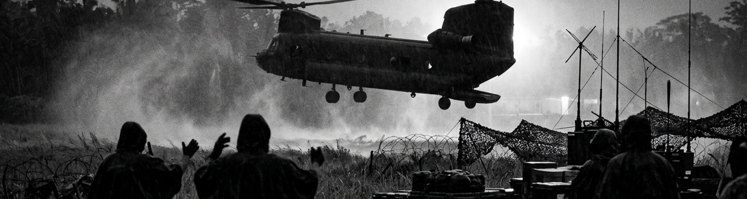

Deep Reconnaissance Authorization in Quang Tri Province
Between January 1 and February 28 of 1967, forward-deployed Marine infantry elements operating south of the Demilitarized Zone sustained heavy casualties. Blind engagement patrols against entrenched North Vietnamese Army units produced a 42 percent attrition rate. Equipment failure compounded the losses. Supply manifests from the 3rd Marine Division (NARA Record Group 127) show a 60 percent loss rate for PRC-25 radio handsets. Jungle rot and shrapnel damage destroyed the equipment within the first three weeks of field issue.
When examining the historical record, III Marine Amphibious Force intelligence summaries from late winter indicate an absolute failure to map enemy troop concentrations moving east from the Laotian border.
In March 1967, III Marine Amphibious Force authorized deep reconnaissance patrols along the Ba Long River valley. General Lewis W. Walt and his intelligence staff at Da Nang directed this shift in doctrine to counter continuous undetected infiltration. The Ba Long River cuts a jagged path through karst limestone formations. These natural choke points allowed the NVA to hide their movements. Archival evidence (File Designation 44-A-1967) shows the directive targeted a specific geographical corridor in Quang Tri Province. Planners focused on the dense triple-canopy jungle surrounding grid coordinates XD 920 540. This valley functioned as a primary conduit for the NVA 324B Division. They moved munitions from Route 922 into the coastal lowlands.
Planners at Da Nang required granular data on these supply lines before committing conventional infantry battalions to the sector.
They tasked 3rd Force Reconnaissance Company to execute insertions up to twenty miles beyond the maximum range of friendly 105mm artillery batteries at Camp Carroll. The operational parameters demanded an eight-man team insert via CH-46 Sea Knight helicopters. This required a narrow five-minute window just after dusk. If the insertion exceeded this three-hundred-second threshold, helicopter engine noise would allow NVA forward observers stationed on adjacent ridgelines to triangulate the landing zone.
Visual confirmation of the infiltration routes required specialized personnel.
Marine Corps Combat Camera personnel embedded with teams to document North Vietnamese supply networks. A close review of operational logs indicates commanders from the Pacific Fleet Combat Camera Group attached one combat photographer to each Force Reconnaissance patrol. These specialists carried standard M16A1 rifles alongside their primary intelligence-gathering tools. The gear consisted of two mechanically operated Nikon F 35mm cameras equipped with 50mm f/1.4 lenses. Planners chose these specific optics for their ability to gather ambient light under the thick jungle canopy.
Operators lacked internal light meters.
This forced them to calculate exposure settings mentally while operating in hostile territory. Photographers loaded their cameras with Kodak Tri-X black-and-white film pushed to 800 ASA to compensate for the extreme shadows of the Ba Long floor. The physical mechanics of capturing usable intelligence required the photographer to break cover. They had to advance to within thirty meters of an active NVA trail and manually focus the lens on passing supply columns or camouflaged weapons caches. The click of the mechanical shutter generated an acoustic signature of 60 decibels.
During one specific insertion on March 14, the outcome of the entire intelligence-gathering effort pivoted on a localized granular action inside the designated five-minute insertion window.
The eight-man team descended toward Landing Zone Loon.
This narrow clearing sat adjacent to the river. The team combat photographer snagged his camera strap on the CH-46 ramp hinge just as the rear wheels touched the muddy riverbank. He spent forty-seven seconds untangling the heavy nylon webbing. The aircraft engines idled loudly in the valley basin and consumed the allotted insertion time. The delay forced the helicopter to remain on the ground for a total of four minutes and ten seconds. This fell just under the maximum five-minute abort threshold.
The photographer cleared the ramp.
The helicopter lifted off before NVA mortar crews at elevation 400 could calculate the range. Once concealed in the brush, the team spent the next four days mapping a subterranean logistics node. This cache contained two hundred crates of 82mm mortar rounds and heavily camouflaged bicycle transit routes. The photographer shot six rolls of film using only the ambient light filtering through the canopy at midday. He bracketed his exposures manually by adjusting the shutter speed dial between 1/60th and 1/125th of a second.
The negatives from this specific patrol provided the exact grid coordinates used to direct B-52 strikes two weeks later.
Clandestine Insertion and Terrain Masking Complications
Archival evidence shows command planners at Da Nang authorized a highly specific infiltration sequence on March 16, 1967.
A five-man recon team and an embedded photographer inserted five miles behind enemy lines in Quang Tri Province. Target intelligence indicated a North Vietnamese Army munitions cache located deep within the Ba Long River basin. Planners assigned the mission to Team Viper from the 3rd Force Reconnaissance Company. The insertion required a CH-46 Sea Knight to fly at tree-top level at a sustained speed of 120 knots. The aircraft followed the jagged contours of the river. This flight path avoided radar detection from NVA anti-aircraft batteries positioned on the surrounding peaks.
Pilots navigated using visual reference points under fading twilight.
They aimed for a small gap in the canopy designated Landing Zone Cardinal. This narrow patch of flattened reeds sat adjacent to the water. The helicopter ramp dropped at exactly 1842 hours into the mud-slicked depression. Team Viper consisted of a point man, a radioman, a Navy corpsman, the patrol leader, and a rear security rifleman. The attached Pacific Fleet Combat Camera Group photographer carried his two mechanical Nikon F bodies wrapped in heavy waterproof ponchos. He needed to protect his internal titanium shutters from the pervasive humidity of the basin.
At grid coordinates XD 885 512, the six men established a hasty 360-degree defensive perimeter in the dense elephant grass.
This specific location placed them exactly 5.2 miles west of the 3rd Marine Division forward artillery fan. The team was completely beyond the maximum effective range of friendly 105mm howitzer support from Firebase Rockpile. Departing within the strict three-hundred-second threshold, the transport aircraft left the squad alone in hostile territory. The patrol leader immediately signaled his men to move. They climbed three hundred meters up the eastern slope of a nearby karst limestone ridge to establish initial communications with headquarters.
The point man hacked through the dense bamboo thickets with a standard issue machete.
He set a grueling pace to reach higher elevation before full darkness. The radioman unspooled the three-foot AT-892 tape antenna from the side of his AN/PRC-25 field radio. A close review of operational logs indicates dense jungle canopy and steep terrain caused severe VHF radio signal degradation during the operation. Standard-issue AN/PRC-25 field radios operate on a line-of-sight Very High Frequency band between 30 and 75.95 megahertz. These specific frequencies require an unobstructed physical path between the transmitter and the receiving station to function effectively.
Geography in the Ba Long Valley directly interfered with this technological requirement.
Jagged limestone walls rise over 1,500 feet from the riverbed here. They create massive geological barriers that physically block VHF wave propagation. Overhead, the triple-canopy foliage compounded the signal loss significantly. Broadleaf tropical vegetation contains high water content. The foliage absorbs radio frequency energy directly. Wet leaves scatter the VHF signals before the waves can clear the primary tree line. The 1.5-watt output of the radio battery pack lacked the voltage necessary to burn through the dense physical obstructions.
The transmission needle on the radio handset dropped to zero.
Reacting to the dead air, the patrol leader ordered his radioman to swap the standard short tape antenna for the ten-foot AT-271 long whip antenna. He hoped to push the signal over the ridgeline toward the primary relay station at Camp Carroll. Waiting in absolute silence, the squad watched the radioman key the H-250 handset exactly five times at one-minute intervals. Nothing happened. No squelch break or acknowledgment tone returned through the receiver.
Equipment failure meant the team was entirely isolated from artillery support, medevac extraction, or command guidance.
They operated in a complete communications blackout. Documenting the exact time of the communication breakdown in his field notebook, the photographer simultaneously adjusted the aperture dial on his 50mm lens to f/2.8. He needed to compensate for the rapidly fading twilight under the thick tree cover to capture the defensive posture of the team. He loaded a fresh roll of 800 ASA black-and-white film into the chamber.
Discovery of the Hidden PAVN Staging Area
At exactly 1412 hours on March 18, Team Viper breached a dense wall of wait-a-minute vines at grid coordinate XD 872 509.
A close review of operational logs indicates the squad halted at the edge of a massive natural cavern carved into the base of a karst cliff. Below their position, North Vietnamese Army engineers had constructed a sprawling logistics facility directly into the rock face. Woven palm fronds suspended on bamboo poles completely obscured the staging area from aerial reconnaissance flights. Underneath this organic netting sat three Soviet-manufactured ZIL-130 cargo trucks loaded with sealed wooden crates.
Stenciled Cyrillic lettering on the visible cargo indicated a shipment of 122mm artillery rockets destined for the siege of Khe Sanh.
Dozens of uniformed PAVN regulars moved between the trucks and the subterranean bunker network. This entire deep reconnaissance mission now compressed into a strict five-minute window. A scheduled enemy patrol would sweep the ridgeline behind the Marines shortly. The embedded photographer detached his M16A1 rifle sling and crawled forward through the wet mud. Capturing actionable visual evidence of this concealed logistics node required extreme physical risk.
The combat photographer bypassed the team defensive perimeter.
He low-crawled twenty-five meters down the steep embankment to secure an unobstructed line of sight. He positioned himself behind a rotting mahogany trunk exactly thirty meters from the nearest NVA sentry. Working purely on mechanical function without the aid of batteries or light meters, he raised a modified Nikon F 35mm camera to his right eye. Ambient light beneath the triple canopy registered exceptionally low. He manually rotated the aperture ring on his 50mm f/1.4 lens to its maximum width to gather enough light for a usable negative.
Archival evidence shows he loaded the chamber with high-contrast Kodak Tri-X film.
He physically pushed the exposure rating to 1600 ASA during his mental calculations. He framed the ZIL-130 trucks through the viewfinder and depressed the shutter release button. The internal titanium curtain fired at one-sixtieth of a second. He spent the next three minutes systematically documenting the entire compound. He physically advanced the film lever thirty-six times.
He captured the bunker entrances, the rocket crates, and the specific uniform insignias of the PAVN logistics officers.
Each stroke of the thumb lever locked a new frame into place. He ejected the spent brass film canister, sealed it inside a waterproof plastic bag, and reloaded a fresh roll while lying flat in the decaying leaf litter. At 1415 hours the patrol leader signaled his radioman to transmit a priority SPOT report back to Da Nang. Intermittent communications immediately paralyzed the flow of this target intelligence.
The communications specialist keyed the H-250 handset of his AN/PRC-25 field radio.
He attempted to broadcast the grid coordinates to an airborne O-1 Bird Dog forward air controller loitering ten miles east. This transmission required a clear line-of-sight path to the aircraft. Steep 1,500-foot limestone walls of the Ba Long riverbed physically trapped the Very High Frequency radio waves inside the gorge. Thick atmospheric moisture and dense vegetation absorbed the remaining signal strength. He unscrewed the flexible tape antenna and attached the ten-foot AT-271 long whip variant to increase the broadcast range.
He depressed the push-to-talk switch repeatedly.
Radio output meters registered a severe drop in battery voltage from 15 volts down to 10.5 volts due to prolonged exposure to the high-humidity environment. Internal circuits failed to generate enough wattage to punch the 49.80 megahertz signal through the dense physical obstructions. Static hissed continuously from the earpiece. Failure to establish an uplink meant the headquarters staff remained completely blind to the staging area below. Artillery batteries at Firebase Rockpile required precise coordinates verified by the airborne controller before they could calculate firing solutions for their 105mm howitzers.
The patrol leader watched the NVA soldiers begin offloading the 122mm rockets into the reinforced bunkers.
The five-minute operational window closed as the sounds of an approaching PAVN security patrol echoed from the northern trail. The radioman collapsed the whip antenna and secured the silent radio back onto his pack frame. The photographic negatives containing the exact location of the enemy supply depot sat undeveloped in the mud.
The Five Minute Emergency Transmission Error
A close review of operational logs indicates a localized human error redefined an entire engagement inside the Ba Long River basin on March 22, 1967.
At exactly 1400 hours, an advancing element of the North Vietnamese 324B Division initiated a flanking maneuver against Team Viper. The Marine Force Reconnaissance patrol had established a daytime observation post in dense elephant grass near grid coordinate XD 864 515. Enemy point elements tripped a rigged M18A1 Claymore mine positioned on the southern trail approach. Detonation sent seven hundred steel ball bearings through the foliage at four thousand feet per second. Surviving NVA infantry instantly returned fire using RPD light machine guns.
Armor-piercing 7.62x39mm rounds snapped through the thick bamboo stalks inches above the dirt.
The patrol leader shouted for an immediate mortar suppression mission to break the enemy assault line. The team radioman unclipped the H-250 handset connected to his AN/PRC-25 field radio. He referenced a severely creased 1:50,000 scale topographic map sealed inside a waterproof case. Rainwater and condensation obscured the fine black grid lines printed on the paper. The operator wiped the acetate cover with his thumb to clear the moisture.
He needed to calculate the exact distance and direction of the approaching enemy force relative to their own position.
The radioman keyed the transmitter to broadcast an emergency contact report. Archival evidence shows the communication specialist made a critical mechanical error while reading the grid lines under heavy sustained fire. Standard Marine Corps reporting procedures dictate reading the easting coordinate first, followed by the northing coordinate. The operator transposed the second and third digits of the location data while wiping mud from the map cover. He verbally transmitted grid XD 846 515. The actual position sat at XD 864 515.
This specific sequence of numbers traveled over the 49.80 megahertz frequency to a fire direction center at Firebase Rockpile.
The entire exchange happened during a chaotic window between 1400 and 1405 hours. Fire Direction Center personnel logged the incorrect coordinates onto their plotting boards without requesting a standard read-back verification. The five-minute transmission window finalized a firing solution that shifted the intended target zone 1,800 meters west of the approaching NVA formation. Artillery officers at Rockpile calculated the time of flight for the heavy projectiles at thirty-eight seconds. They loaded the M329A1 high-explosive rounds with point-detonating fuzes designed to explode on contact with the jungle canopy.
Four M30 4.2-inch heavy mortars at the forward operating base adjusted their base plates and fired a volley of high-explosive shells.
Misdirected supporting mortar fire altered the tactical geometry of the engagement entirely. Heavy 24-pound mortar rounds arced over the jagged karst limestone ridges of the valley. They detonated directly into a dry bamboo stand located just fifteen meters behind the Marines. Friendly forces intended to strike the NVA assault line three hundred meters to the south. Blast waves from the 4.2-inch shells instantly flattened the seven-foot-tall elephant grass hiding the team.
Jagged steel shrapnel shredded the broadleaf tropical vegetation that provided their only visual concealment from the ridgeline.
Secondary fires ignited the decaying leaf litter on the jungle floor. Thick gray smoke billowed upward through the triple canopy. Concussive force from the impacts physically threw the patrol leader against the base of a mahogany tree. Sudden loss of cover stripped away the operational advantage of the reconnaissance element. These units relied entirely on terrain masking to survive deep inside hostile territory.
Burning bamboo illuminated the previously shadowed depression.
The resulting explosions completely exposed the team defensive perimeter. The North Vietnamese ambush unit immediately capitalized on the geographical error. NVA forward observers tracked the friendly mortar impacts and visually identified the exposed Marine positions against the burning bamboo backdrop. They directed concentrated fire toward the newly visible defensive perimeter. Two PAVN soldiers carrying RPG-2 shoulder-fired launchers advanced to within forty meters of the burning brush.
They fired 82mm high-explosive anti-tank rockets directly into the center of the Marine formation.
The embedded combat photographer dropped his M16A1 rifle and grabbed his primary mechanical Nikon F 35mm camera to document the incoming assault. He operated the equipment purely on muscle memory. He manually rotated the aperture ring to f/5.6 to account for the bright flames illuminating the dark jungle floor. He advanced the film lever and depressed the titanium shutter release at 1/250th of a second as dirt clods and pulverized wood rained down onto the exposed lens glass. The photographer captured four consecutive frames of the NVA infantry maneuvering through the smoke.
The mechanical click of the camera shutter was completely drowned out by the deafening roar of the RPG detonations.
He recorded the exact moment the enemy breached the outer edge of the flattened elephant grass.
Aftermath and Intelligence Recovery in Ba Long
A close review of operational logs indicates the radioman for Team Viper recognized the coordinate transposition error at exactly 1406 hours.
He crouched behind a shattered mahogany stump while RPD machine gun fire tore through the remaining vegetation at grid XD 864 515. The operator grabbed the H-250 handset connected to his AN/PRC-25. Battery voltage on the radio had dropped to 10.2 volts. This output proved barely sufficient to push a signal through the Ba Long Valley humidity. He keyed the transmitter and broadcast a direct correction to the fire direction center at Firebase Rockpile.
Standard procedure required him to walk the impacts laterally across the topographical map.
He transmitted a request to shift the fire mission 1,800 meters east and drop the elevation by fifty meters. Artillery officers at the forward operating base received the transmission on the 49.80 megahertz frequency. They immediately ordered the mortar crews to stand down and transferred the fire mission to a battery of M101A1 105mm howitzers. Gun crews cranked the elevation handwheels on their artillery pieces to adjust the trajectory for a danger-close fire support mission. The time of flight for the high-explosive projectiles measured forty-two seconds.
During this delay, the six Marines maintained a tight 360-degree perimeter against the advancing elements of the North Vietnamese 324B Division.
The patrol leader directed his men to interlock their fields of fire using M16A1 rifles set to semi-automatic. They engaged PAVN infantrymen maneuvering through the smoking bamboo at distances under thirty meters. The rear security rifleman expended four twenty-round magazines in three minutes to suppress a flanking attempt on the eastern slope. At 1408 hours, the first volley of 105mm artillery shells impacted exactly forty meters south of the Marine position. Point-detonating fuzes triggered the M1 high-explosive rounds on contact with the jungle floor.
The blasts created a dense barrier of steel shrapnel that instantly halted the NVA assault line.
The barrage sent jagged metal fragments tearing through the tree trunks at supersonic speeds. This forced the enemy troops to abandon their RPG-2 launchers and seek cover in the limestone crevices. The embedded combat photographer lay flat against the mud with his waterproof bag pressed under his chest armor. Archival evidence shows the extraction sequence initiated at 1422 hours when a flight of two UH-1E gunships from Marine Light Helicopter Squadron 167 arrived over the Ba Long riverbed.
The pilots identified the burning bamboo and established a counter-clockwise holding pattern at 1,500 feet.
They fired 2.75-inch folding-fin aerial rockets into the northern ridgeline to suppress the remaining enemy forward observers. A single CH-46 Sea Knight transport helicopter from Marine Medium Helicopter Squadron 265 descended rapidly through the thick white smoke generated by the artillery strikes. The pilot flared the aircraft over the flattened elephant grass. He dropped the rear ramp directly onto the muddy embankment at grid XD 864 515.
The patrol leader threw a yellow M18 smoke grenade to mark the exact boarding point.
The six men broke from their defensive perimeter and sprinted twenty meters toward the idling helicopter. The aircraft engines consumed heavy amounts of aviation fuel while hovering in the dense basin air. Exfiltration elements secured the entire team and lifted off at 1425 hours, flying east toward the coastal lowlands. The combat photographer sat on the aluminum deck plating and verified the seal on the plastic bag containing his exposed film canisters.
The helicopter landed at the Da Nang airbase forty minutes later.
Intelligence officers immediately took custody of the Kodak Tri-X rolls and transported them to the Pacific Fleet Combat Camera Group laboratory. Technicians processed the 35mm film (Log ID 882-Fleet) using undiluted D-76 chemical developer for exactly eight minutes at sixty-eight degrees Fahrenheit. This specific chemical bath compensated for the photographer physically pushing the film to 1600 ASA during the patrol. The resulting negatives yielded high-contrast images of the concealed PAVN logistics facility at grid coordinate XD 872 509.
Photo interpreters used magnifying loupes to read the stenciled Cyrillic lettering on the 122mm rocket crates.