Frontier Surveying Operations and Riverine Equipment Failures
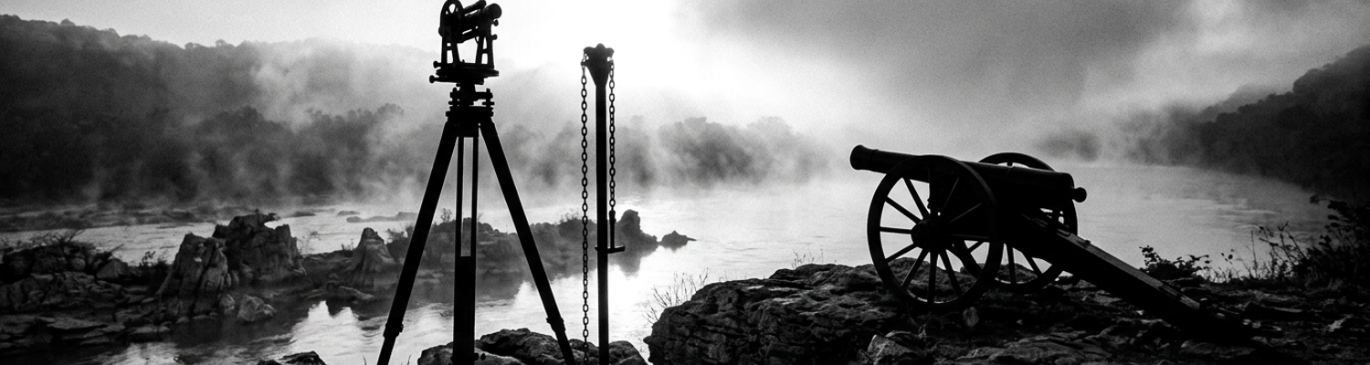
Ice water slammed over the gunwales of the splintering wooden pirogue as it wedged sideways across the jagged limestone shelf of the lower Muscle Shoals. Below the freezing spray, the brass azimuth ring of the surveyor's transit sheared three teeth against its worm gear. The leveling head froze in place instantly. Silt from the churning Tennessee River penetrated the exposed gear housing within seconds of submersion. When an escort private from the 8th U.S. Infantry cocked his Model 1795 musket to signal the secondary boat pinned upstream, the flint struck a waterlogged frizzen. The action threw a weak amber spark that failed to ignite the frozen slurry inside the flash pan. The firing mechanism sat dead.
River water neutralized both the mapping instruments and the defensive weapons.
Archival evidence shows that these mapping detachments operated under general orders from Andrew Jackson's Southern Division headquarters. The crews carried fragile English-pattern brass transits and standard circumferentors unsuited for sustained exposure to sub-freezing river rapids. Sand and limestone sediment ground between the brass leveling screws. This friction destroyed the micro-threading required to calculate accurate magnetic bearings. Surveyor field books were saturated. Ink notes became illegible while surveyors attempted to plot Cherokee territorial limits south of the river. Weapons suffered an identical breakdown. The detachment's Springfield flintlocks depended on dry, fine-grain priming powder held in shallow iron pans. Cold river spray continuously seeped past the pan covers. The moisture transformed the potassium nitrate and charcoal mixture into an inert black paste. Water oxidized the strike plate of the frizzen. This reduced the friction necessary to shave off hot iron particles when struck by the cock's flint. Detachments found themselves completely incapable of defensive fire against regional hostiles while stranded on mid-river rocks.
The line between an active military survey and a stranded survival party ceased to exist.
A close review of operational logs documents rapid structural decay across every riverine transport craft assigned to the mapping detachments during the winter of 1815. Heavy drift ice moving out of the upper Tennessee tributaries repeatedly struck flat-bottomed supply bateaux. The impacts punctured half-inch white pine hulls. Crews were forced to jettison survey chains, iron boundary pins, and salt pork rations to maintain buoyancy. River hazards along the thirty-mile stretch of shoals forced soldiers to drag keeled transport craft through waist-deep, forty-degree water over razor-sharp chert formations. Men suffered systemic frostbite, trench foot, and respiratory collapse. Medical supply chests containing sulfur and bark extract were swept downstream when tow ropes parted under the tension of the river current. At Colbert's Shoals, the survey party under civilian contractors and federal escorts documented water depths dropping from eight feet to six inches over a span of thirty yards. Three heavily laden supply boats were pinned against submerged limestone bluffs. Ice sheets wedged against the hulls. The structural oak ribs bent until the gunwales buckled inward.
Command continuity fractured as physical mobility fell to zero.
War Department surveyors lost over sixty percent of their field gear between the Elk River confluence and the shoals rapids before ever laying down a single permanent boundary stone. Detachments had been instructed by civilian administrators in Washington to follow strict geodetic protocol. These orders required astronomical observations and double-chained baseline measurements along the contested riverbanks. Freezing temperatures distorted the brass vernier scales. The thermal contraction caused errors exceeding forty links per mile. Unable to keep their instruments dry or their perimeter guards armed with operational powder, detachment leaders abandoned the prescribed federal survey methods entirely. Crews resorted to rough compass traverses and crude pacing along the southern shoreline. The resulting erratic maps placed Cherokee villages directly inside contested Chickasaw hunting tracts. Field surveyors delivered these corrupted boundary plots directly to Jackson's headquarters at Nashville in early 1816.
Defiance of War Department Treaty Directives
Jackson discarded civilian War Department instructions the moment dispatch couriers reached his encampment.
Archival evidence shows that Secretary of War William H. Crawford issued rigid written directives to federal commissioners in May and June of 1816. Crawford strictly forbade any coercive land acquisitions that violated the diplomatic settlement signed in Washington that March. He instructed the commission, nominally headed by Jackson alongside Jesse Franklin and David Meriwether, to respect Cherokee territorial integrity south of the Tennessee River. The orders mandated strict expenditure ceilings. Jackson viewed these cabinet orders as dangerous civilian interference. He believed the policies threatened southern coastal defense and interior military supply lines. Moving his field headquarters into the Chickasaw Council House along the Natchez Trace in September 1816, Jackson abandoned Crawford's diplomatic protocols. He gathered Cherokee, Chickasaw, and Choctaw delegations in a single clearing. He then exploited the overlapping boundary claims generated by the defective winter surveys. Departmental dispatches confirm that Jackson discarded Crawford's instructions to treat the Cherokee as rightful landholders. Addressing Cherokee leaders Pathkiller and Charles Hicks, Jackson warned that the War Department lacked the authority to maintain their boundaries against regional settlers. He stated that refusal to yield would result in total federal recognition of rival Chickasaw deeds.
Civilian authority collapsed five hundred miles north of the negotiating table.
A close review of treaty expense vouchers indicates that Jackson broke every fiscal constraint imposed by the War Department to secure tribal signatures. Crawford explicitly limited federal compensation to modest one-time payments drawn from existing departmental reserves. Jackson disregarded these caps. He unilaterally committed the federal government to an unauthorized ten-year annuity of five thousand dollars. This was accompanied by an immediate cash payment of five thousand dollars for tribal redistribution upon ratification. To dismantle the internal cohesion of the Cherokee delegation, Jackson deployed private indemnities to individual chiefs. Secret property allocations and direct monetary payments were negotiated outside formal council proceedings. Ledger sheets confirm personal payouts of hundreds of dollars delivered to influential regional headmen. Jackson guaranteed land reservations covering private plantations, river ferries, and cotton gins owned by mixed-blood Cherokee leaders. Drafted treaty articles incorporated private indemnity clauses promising federal reimbursement for improvements and personal cattle claims. Crawford's original instructions strictly barred these exact financial maneuvers.
The financial leverage broke collective tribal resistance.
During the final council sessions, Jackson forced Pathkiller and Hicks into operational isolation. He threatened to deploy 8th U.S. Infantry detachments to clear Cherokee families from the contested boundary lines along the Tennessee River. Cherokee delegates had traveled across seventy miles of rough river bottom without logistical support. They survived on depleted federal rations issued directly from Jackson's quartermaster wagons. This physical vulnerability left them exposed when Jackson presented the unauthorized annuity documents as a non-negotiable settlement. If Cherokee headmen refused to sign the instrument surrendering over two million acres south of the river, Jackson vowed to withdraw federal peacekeeping pickets. This action would leave Cherokee settlements exposed to immediate encroachment by Tennessee militia companies and rival claimants. Hicks broke under the combined threat of physical eviction and personal ruin. Jackson executed the final convention on October 4, 1816. He forwarded the signed boundary cessions to Washington alongside demand drafts for tens of thousands of dollars in treasury funds that Crawford had neither vetted nor authorized.
Treaty 83 Negotiations at Chickasaw Council House
Federal commissioners Andrew Jackson, Jesse Franklin, and David Meriwether formally executed the articles of Treaty 83 on September 14, 1816. The signing occurred inside the wooden assembly hall of the Chickasaw Council House. The commission operated under Jackson's direct tactical control. Franklin, a North Carolina veteran politician, and Meriwether, a former Georgia congressman, handled civilian correspondence. Jackson dictated the pace and terms of the council sessions along the Natchez Trace. Weather records from the Mississippi Territory show unseasonable heat and dust blanketing the council grounds throughout early September. This caused physical exhaustion among tribal delegations bivouacked in the timberline. Jackson leveraged these conditions to push daily administrative sessions into long daylight negotiations without recess. Treasury warrants confirm that the three commissioners drew federal cash vouchers to underwrite rations of dried beef and flour. This allowed them to control the supply lines that fed the attending native delegates. Jackson sat at the center of the pine table with drafting clerks beside him. He used the compiled survey sketches to point out conflicting boundary lines and drive federal acquisition objectives. Franklin and Meriwether affixed their signatures immediately beneath Jackson's. This completed the official War Department instrument recognizing federal dominion over the disputed interior.
The pen moved across the parchment under armed guard.
A close review of operational logs indicates that Jackson applied systematic coercive pressure directly against Principal Chief Pathkiller and Cherokee council secretary Charles Hicks. He used direct threats of regular army occupation. Jackson made it clear that if tribal leadership refused the treaty articles, the War Department would order infantry garrisons to secure the disputed riverbanks by force. He stated that the federal government would classify Cherokee towns along the upper Tennessee and Coosa river basins as hostile squatters on federal domain. This classification would revoke military protections against encroaching white squatters and state militia units. Stationed detachments of the 8th U.S. Infantry lay garrisoned within marching distance at regional outposts. They were ready to establish permanent stockades along the river crossings. Hicks suffered from chronic leg inflammation and was physically weakened by the overland journey. He recognized the immediate hazard facing unfortified Cherokee settlements. Jackson informed Pathkiller that federal bayonets would not intervene if regional settlers seized family farmsteads and agricultural improvements throughout the valley. The commissioners isolated the two Cherokee leaders from external legal counsel. They surrounded the negotiating cabin with armed federal escorts. This removed any defensive leverage the tribal council possessed.
Pathkiller and Hicks conceded to preserve their core river towns from military clearance.
Treaty 83 formally executed the extinguishment of Cherokee land claims across more than 1.3 million acres south of the Tennessee River in northern Alabama. The plotted boundary commenced at the camp near the mouth of Duck River. It struck straight south across the highland watershed before slicing east through the fertile Tennessee valley limestone soils. This boundary cut off Cherokee hunters and farmers from the rich alluvial bottomlands between the southern bank of the Tennessee River and the highland ridge separating the Tennessee waters from the Tombigbee drainage basin. It opened a broad, contiguous military and commercial corridor. This corridor connected federal supply stations in Tennessee to the newly developing cotton districts around Huntsville. Surviving survey plots show that the tract encompassed critical shoals, transport portages, and prime agricultural acreage south of the river bend. The treaty transferred full territorial control to the General Land Office. Cherokee title across this vast limestone plateau dissolved on the morning of September 14. Surveyors prepared chain-and-compass parties to subdivide the territory into township ranges immediately.
The surveyors commenced staking boundary markers before the treaty ink dried.
Survey Operations Directed by General John Coffee
General John Coffee assumed field command over federal cartographers and civilian survey crews across northern Alabama in early 1817. He established his primary operations camp at Melton's Bluff along the south bank of the Tennessee River. Coffee organized the surveying detachments into disciplined tactical units. He divided the contested indigenous riverine territory into strictly monitored quadrants. Field crews carried Rittenhouse surveying compasses with six-inch magnetic needles. They used two-pole Gunter chains of sixty-six feet, checked against standard iron yardsticks every dawn. Sealed tin map cases protected field notes from river damp. Axemen hacked continuous sight corridors through six-foot-tall cane breaks and dense greenbrier along the southern river terraces. Spring floodwaters backed up the Elk River and Town Creek. The flooding submerged bottomlands in three feet of freezing mud. Coffee maintained rigid production quotas of five to eight linear miles per day per detachment. Cartographers sighted lines on true north, correcting for magnetic dip. They marked boundary lines by hacking three distinct blazes into sweetgum, post oak, and hickory trees to separate federal domain from native territory.
Coffee drove his survey detachments through swamps without providing replacement boots or dry bedding.
A close review of operational logs indicates that Coffee's technical lines were engineered to bisect Cherokee tactical defensive positions along the rocky shelves of the Muscle Shoals. Rather than running boundaries along natural elevation divides, Coffee ran transit lines straight across the steep limestone bluffs overlooking Colbert's Shoals and Bainbridge. These bluffs historically served Cherokee riflemen as commanding defensive positions. The heights controlled the narrow, shallow water passages where federal river transport craft were forced to slow their speed to half a knot. By driving the survey line directly through these high ridges, federal cartographers severed Cherokee settlements from their elevated observation posts, natural rock breastworks, and canoe landings. The plotted lines sliced through seasonal encampments, fish weirs, and river fords at Marathon. This denied Cherokee defenders continuous frontage along the southern bank. Chainmen drove iron-shod red cedar posts every eighty chains through tribal paths. This cut the physical connection between Cherokee interior settlements and the fortified river shoals where federal supply boats had previously faced native interdiction.
The plotted line stripped Cherokee settlements of their natural river barriers.
Coffee anchored his baseline coordinates directly to the newly established Huntsville Meridian. He projected township grids across Cherokee lands south of the river bend. Cartographers including James Weakley logged daily magnetic variations to counteract the deflection caused by exposed iron ore deposits in the surrounding limestone bluffs. Survey escorts drawn from regional militia companies patrolled the compass lines with loaded muskets. They kept displaced Cherokee scouts at a distance while surveyors cleared sightlines through indigenous corn fields. Coffee set up forward supply dumps along the Natchez Trace to deliver flour, salt pork, and lead shot to surveying crews working isolated sections of the southern watershed. Field cartographers plotted every section line onto standard parchment grids. They assigned range numbers that systematically replaced indigenous Cherokee names for shoals, bends, and creek mouths with federal parcel identifiers. Coffee submitted these finished township plats directly to Jackson's headquarters at Nashville in July 1817.
Federal surveyors marked thirty-four miles of disputed riverfront into taxable townships by the end of that summer.
8th US Infantry Road Construction Operations
General Andrew Jackson directed combat elements of the 8th U.S. Infantry into the northern Alabama backcountry in 1817. Their orders were to hack out the northern division of the Jackson Military Road. Armed working parties abandoned standard garrison routines. They traded their Model 1795 muskets for six-pound broadaxes, two-man crosscut saws, and heavy iron pickaxes. Captain Hugh Young of the Topographical Engineers ran transit baselines across 483 miles of dense pine wilderness and indigenous hunting territories. He charted a direct overland bearing toward the Gulf Coast. Company officers organized the infantrymen into disciplined labor gangs comprising sawyers, carpenters, and blacksmiths. These gangs were tasked with clearing a twenty-foot-wide corridor through old-growth timber. Sledgehammers fractured limestone outcrops. Teams of draft oxen hauled away severed sweetgum and chestnut stumps using cast-iron chains. Axle trees on quartermaster supply wagons repeatedly snapped under the weight of wet red clay. Soldiers repaired forge hardware directly on the forward line of march. Field officers rotated armed perimeter sentries through the dense cane thickets. They maintained live cartridge boxes on standby to deter hostile regional scouts.
Axes replaced bayonets along the trail.
A close review of operational logs indicates that the 8th U.S. Infantry expended thousands of workdays bridging swamp bottoms and highland drainages across the interior. Rations spoiled inside waterlogged timber barrels as supply details struggled through endless autumn deluges. In the black-mud bottoms of Noxubee and along the tributaries of the Buttahatchee, infantry squads laid down more than twenty thousand feet of corduroy causeways. Soldiers felled straight-trunked cypress and pine. They notched horizontal retaining logs and pinned split puncheons together with wooden dowels. This prevented heavy artillery wagons from sinking into the subsoil. Malaria, dysentery, and severe cut wounds incapacitated entire platoons. Active labor rolls dropped below fifty able-bodied men during seasonal disease outbreaks. Quartermasters continuously requisitioned replacement draft animals from Nashville depots to replace oxen killed by exhaustion and rattlesnake bites. Major Perrin Willis drove working detachments forward under rigid construction schedules. He threatened insubordinate privates with extra ditch-digging details and docked pay.
Mud settled over thirty-five finished timber bridges.
Jackson planned this terrestrial corridor specifically to neutralize indigenous tactical control over Southern river networks. Prior to 1816, Cherokee and Chickasaw riflemen effectively controlled the movement of federal troops by commanding the shallows, bends, and portage sites of the upper Tennessee River. Shifting federal transit onto a direct overland line running from Columbia, Tennessee, down through York Bluff and Russellville eliminated the reliance on fragile pirogues traversing the lethal limestone reefs of the Muscle Shoals. The new road converted the Tennessee River crossing at Florence into a fortified military choke point under continuous federal supervision. Large timber ferry flats were constructed under the protection of 8th Infantry weapons. These flats moved six-mule supply wagons and mobile field guns across deep water without exposing crews to indigenous fire from the bluffs. Native boatmen who had levied river transit fees or disrupted unauthorized federal waterborne transports found their positions completely outflanked.
The river defense network broke.
Archival records from division headquarters at Nashville confirm that the overland highway compressed the travel time between the Tennessee frontier and the southern Gulf territories by more than two hundred miles compared to the historic Natchez Trace. Running straight across the Tennessee-Tombigbee drainage divide, the engineered corridor severed the physical communication channels Cherokee war parties maintained with southern Gulf tribes. Permanent federal supply depots established at Columbus on the Tombigbee converted indigenous riverfronts into fortified staging posts for regular troops. Colonel Zachary Taylor assumed field command of the southern construction sector in March 1820. The 8th Infantry joined the final road links through the Pearl River bottomlands under his direction. By May 17, 1820, federal couriers delivered official confirmation to the Secretary of War that heavy freight wagons could transit continuously from Duck River to the Gulf Coast without setting a single keel into the contested waters of the Muscle Shoals.