
Da Nang Photo Processing Laboratories and Film Analysis
High-frequency radio communications failed at 1422 hours. The tactical air direction center lost all contact with the forward outposts outside Muang Soui. Frontline troops on the ridgeline were isolated without air cover. Three hundred miles to the east, technicians waited inside the reinforced concrete bunker of the Marine Composite Reconnaissance Squadron 1 processing facility at Da Nang Air Base. They had already begun receiving the take from returning aircraft. A close review of operational logs indicates that detachment personnel locked the heavy steel blast doors immediately. This action fell under strict Operation Yankee Team operational security protocols. Armed Marine sentries stood at the entrance. They physically blocked unauthorized Seventh Air Force or South Vietnamese personnel from entering the facility.
The ambient temperature outside exceeded ninety-five degrees Fahrenheit.
Inside the processing bunker, a veteran maintenance technician shivered in soaked flight fatigues. The darkroom air conditioning ran at maximum capacity to keep the chemical baths stable. Technicians unspooled reels of exposed five-inch and nine-inch aerial reconnaissance film. These magazines had been pulled straight from the forward and oblique camera bays of an RF-8A Crusader assigned to Yankee Team missions. Chemical baths of liquid developer, stop bath, and fixer sloshed in stainless-steel continuous processing sinks. Photographic specialists worked under low-intensity amber safelights. They guided the acetate rolls through mechanical rollers. They checked emulsion density by touch. Running these rolls through chemical processors demanded exact timing down to the second. Any slight variation in bath temperature stripped the emulsion from the backing. This ruined hundreds of feet of high-altitude imagery.
Darkroom air reeked of acetic acid and damp combat uniforms.
Archival evidence shows that security rules for these specific rolls superseded standard Pacific Fleet intelligence handling directives. The film cassettes came from Fairchild CA-980 and Chicago Aerial KS-67 cameras. These units were mounted in station one and station two of the Crusader. Ground crews extracted them within seven minutes of engine shutdown on the Da Nang tarmac. Operation Yankee Team reconnaissance over northern Laos violated the technical terms of the 1962 Geneva Accords. Every negative strip carried a top-secret classification. Strict compartmentalization markings covered the metal canisters. Photographic interpretation technicians washed the long rolls in running water troughs. They hand-fed the dripping film into heated forced-air drying cabinets. This stabilized the silver gelatin layers before inspection. Water pooled across the floorboards. Developers used razor knives to splice frame segments directly onto back-lit light tables.
The technician in dripping flight gear examined the long rolls through an eight-power stereomicroscope. He checked each frame against navigational logs provided by the Crusader pilot. Tracking the flight line meant cross-referencing camera exposure counters with dead-reckoning cockpit plots. These plots were recorded during high-speed runs over the Xiangkhoang Plateau.
The light tables revealed severe tactical failure.
When examining the historical record of this sortie, the newly dried film strips revealed the origin of the failed engagement over the Plain of Jars. Black-and-white oblique negatives captured the distinct limestone karst geography surrounding Ban Ban. Clear bomb craters scarred an entrenched position designated by coordinate grid WG-2844. That coordinate did not correspond to Pathet Lao anti-aircraft batteries. It did not match North Vietnamese supply caches identified on pre-strike target folders. The imagery showed multiple five-hundred-pound bomb impacts centered squarely across defensive trenchworks. These trenches belonged to an allied Royal Lao Army post and adjacent Hmong irregular compounds. Flight plot errors had originated during the planning phase. Targeters converted legacy French 1:100,000 scale topographic maps to standard American Universal Transverse Mercator grids. This introduced a four-kilometer cartographic displacement to the northwest.
The RF-8A cameras recorded splintered bunkers and burning thatch barracks.
Overturned defensive artillery pieces littered the compound where allied troops had maintained an active observation outpost during the morning hours. Technicians inked the misidentified coordinates in red grease pencil directly across the film margin. They marked this alongside frame numbers 0042 through 0048. The log recorded eight destroyed structures and four crater fields. This documented the friendly-fire strike in permanent silver halide.
VMCJ-1 Detachment Platforms and Yankee Team Integration
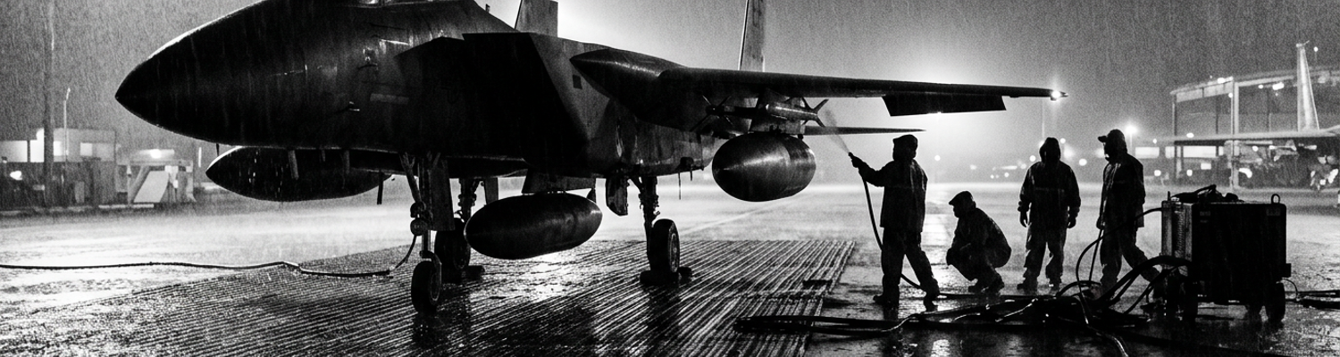
Archival evidence shows that Marine Composite Reconnaissance Squadron 1 deployed detachment aircraft to Da Nang Air Base between December 1964 and March 1965. They moved six RF-8A Crusaders and four EF-10B Skyknights onto bare steel matting under Detachment 1. Marine maintenance crews struggled against monsoon downpours. They serviced Pratt and Whitney J57-P-20A turbojets and twin Westinghouse J34-WE-36 engines. These aircraft were parked within unroofed corrugated blast revetments. The Crusaders operated as dedicated photographic reconnaissance airframes. Armorers stripped them of 20mm Colt Mk 12 cannons. This accommodated ventral and cheek blisters packed with forward-facing and split-vertical cameras.
Aged EF-10B twin-engine jets provided active jamming support to counter enemy radar networks. They used AN/ALQ-31 jamming pods and AN/APR-9 tactical receivers. Pulse analyzers detected hostile tracking emissions. Mechanics worked twenty-hour shifts wiping fungus off magnesium airframe skins. They rebuilt shorted cannon-bay junction boxes continuously.
Avionics specialists repeatedly cannibalized radio cables to maintain the older Skyknights.
Supply depots in Okinawa lacked replacement vacuum tubes for early-generation countermeasure consoles. Flight line chiefs logged daily avionics ground aborts. High ambient moisture penetrated forward radomes. Salt air corroded internal wiring harnesses inside open revetments. A close review of operational logs indicates that the physical performance disparity between both airframes created severe tactical coordination friction during flight ingress. The RF-8A dashed over target zones at transonic velocities above 550 knots. The straight-wing EF-10B struggled to sustain 380 knots at full throttle. This forced Marine flight coordinators to stage electronic warfare orbits far to the rear over Savannakhet or the Gulf of Tonkin.
That speed differential stripped high-speed photo runs of direct escort jamming.
Pilots flying the single-seat RF-8A managed trim controls and cockpit altimeters manually. They adjusted manual camera cycle intervals without back-seat navigators. They tracked dead-reckoning lines over featureless jungle canopies using hand-annotated 1:250,000 aeronautical charts. These charts were clipped to their knee boards. If an internal hydraulic line failed, the lone aviator had no onboard assistance. If an engine compressor stalled from debris ingestion on Da Nang muddy runway, the pilot handled the emergency alone.
Flight crews ran blind without airborne radar coverage.
When examining the historical record of these sorties, Yankee Team operational directives tasked Marine crews with charting Pathet Lao headquarters. They mapped logistical networks across northern Laos. Target coordinates focused heavily on command encampments concealed in limestone caverns around Sam Neua. Primary supply arteries feeding Route 6 and Route 7 toward the Xiangkhoang Plateau received heavy coverage. Tasking orders routed Marine reconnaissance flights along narrow river gorges between Ban Ban and the edge of the Plain of Jars. They hunted for vehicle staging areas, fuel dumps, and camouflaged culverts. Pathet Lao ground units protected these choke points with dug-in 37mm M1939 and 57mm S-60 antiaircraft batteries. They positioned automatic weapons on ridge crests above standard flight paths.
Low-altitude passes between 3,000 and 5,000 feet were required under these directives. This secured sharp shutter resolution. It placed the unarmed jets directly within effective envelope range of visual-optical gun directors. Pilots turned camera selectors to continuous cycling while clearing ridgelines. They burned hundreds of feet of high-speed acetate to register tire ruts and fresh timber bridges along unpaved mountain roads. Flight intelligence officers at Da Nang processed incoming Yankee Team target annexes every midnight. They translated military assistance command requirements into specific flight tracks over Houaphanh and Xiangkhoang provinces.
Planners plotted narrow flight corridors directly over suspected communist assembly areas near Muang Peun.
They cross-referenced radio intercept coordinates gathered by the detachment Skyknights during standoff electronic support sweeps. Operational directives instructed pilots to expose complete film runs over suspected cave entrances near Viengxay. Pathet Lao central committee cadres directed battalion-sized infantry operations against Royal Lao outposts from these locations. Film magazines from these runs documented camouflaged truck parks containing Soviet-built GAZ-51 cargo vehicles. They revealed concealed weapons pits and supply caches tucked under double-canopy jungle along the Nam Neun river basin. Interpreters annotated negative strips frame by frame. They compiled comprehensive route surveys that pinpointed thirty-four distinct antiaircraft positions. They located nine command bunkers between Nong Het and the Vietnamese border crossing at Ban Namkan.
Aerial Refueling Tracks Over the Karst Ridges
A close review of operational logs indicates that keeping unarmed RF-8A photo jets airborne over the Route 7 corridor required constant replenishment. Marine KC-130F Hercules tankers of VMGR-152 provided this fuel alongside Task Force 77 carrier-based KA-3B Skywarriors. Tanker crews established designated rendezvous orbits over northern Laos. They anchored tracks above the jagged limestone formations that rose over six thousand feet between Muang Soui and the border of North Vietnam. Marine turboprops staged out of Da Nang or Futema. They trailed dual Sargent Fletcher high-speed refueling drogues at seventeen thousand feet while holding racetrack patterns through narrow mountain gaps.
Navy strike carriers rotated through Yankee Station in the Gulf of Tonkin. They launched their own heavy tanker assets to cover the eastern ingress routes across the Annamite Range. Without these coordinated offshore and land-based fuel tracks, the Crusader had less than twenty minutes of target time before internal fuel reserves plummeted below the safety threshold.
Limestone thermal currents threw thirty-ton tankers into sudden five-hundred-foot drops.
When examining the historical record of these rendezvous, pilots entering the Route 7 track fought violent updrafts. These updrafts were generated by the sheer karst walls of the Xiangkhoang Plateau. An RF-8A coming off a high-speed photographic run over Ban Ban burned JP-5 at excessive rates. The pilot engaged the afterburner to clear antiaircraft envelopes. Rejoining the tanker required the pilot to drop airspeed down to two hundred and fifty knots. They deployed the retractable refueling probe from the port fuselage. They plugged into a basket churning wildly inside the propeller slipstream.
Archival evidence shows that mechanical failures struck these linkups on a weekly basis. High-pressure hydraulic hoses kinked inside the tanker reel pods. This cut off fuel transfer instantly. Snapped probe tips regularly sprayed pressurized fuel across windshields. This blinded jet pilots while they hung suspended thousands of feet above enemy-held gorges. Marine crews logged four separate instances in early 1965 where severed drogue baskets jammed tightly onto Crusader probes. Pilots nursed starved engines back toward the coast with metal collars choking the intake ducts.
No fuel reserve survived for a second approach.
Relying entirely on aerial tankers expanded the combat radius of VMCJ-1 detachments past five hundred nautical miles. This introduced extreme recovery vulnerabilities during the southwest monsoon. Massive convective storms formed along the Annamite ridgelines every afternoon between May and October. Anvil-headed cumulonimbus clouds stacked up to fifty thousand feet. Reconnaissance pilots attempting to break away from Route 7 targets found their standard return corridors completely blocked by squall lines. Marine tactical air coordinators routinely updated bingo fuel figures mid-flight to reflect these weather detours.
Circling around severe weather cells consumed the fuel margins intended for emergency holding patterns. Jet engines ingested torrential rainwater that threatened to wash out combustion cans. Pilots dropped throttle settings and lost precious altitude over uncharted ridgelines. A close review of operational logs indicates that recovery windows collapsed completely when coastal weather closed Da Nang Air Base. Carrier flight decks in the Gulf of Tonkin suspended flight operations due to thirty-knot surface swells.
Detachment aircraft hitting minimum fuel states could not divert to Thai airfields at Nakhon Phanom or Udorn. They lacked classified diplomatic clearances through embassy channels in Vientiane. Marine controllers at Da Nang recorded multiple sorties where Crusaders arrived overhead with less than four hundred pounds of fuel in the feeder tanks. They slid onto steel-mat runways blanketed by standing water and zero-zero visibility. Maintenance records document recurring fuel-pump cavitation caused by negative g-forces. Pilots fought crosswinds across the threshold. This starved the Pratt and Whitney J57 engines moments before the arrestor gear engaged. Flight records from July 1965 confirm that three RF-8A aircraft diverted into Royal Thai Air Force Base Ubon on emergency fuel fumes. Their tanks contained less than five minutes of flight time upon touchdown.
Those aircraft landed dry on foreign concrete.
Target Misidentification and Royal Lao Outpost Bombing
A close review of operational logs indicates that the dense triple-canopy jungle flanking Route 7 completely swallowed ground landmarks. This turned high-speed visual identification into guesswork. Tactical cartography used by Yankee Team escorts relied on aging French Service Géographique de l'Indochine charts. These were printed in 1954 at 1:100,000 scale. American cartographers transferred these coordinates into the standard 1927 North American Datum and Universal Transverse Mercator projections. They introduced horizontal offset errors exceeding three thousand meters across the Xiangkhoang province.
Heavy monsoon vegetation sealed the valley floors beneath three layers of interlocking bamboo, teak, and broadleaf branches. These trees rose over one hundred feet. Ridge features plotted on flight kneeboards failed to match the actual jagged karst contours below. Pilots flew at four hundred knots beneath a solid overcast. They could not spot the subtle physical distinctions between communist logistics encampments and allied outposts manned by the Royal Lao Army.
Friendly forces stationed along the ridgelines east of Muang Soui maintained defensive positions without radio beacons. They lacked standard ground identification panels. This compounded the spatial confusion. Pilots cross-referenced barometric altimeters that drifted by hundreds of feet in the tropical heat. This rendered contour lines useless.
Maps printed a decade earlier misplaced entire ridgelines by miles.
Archival evidence shows that carrier-based strike escorts from Task Force 77 repeatedly misidentified these concealed outpost structures near the Plain of Jars. They logged them as active Pathet Lao fortified redoubts. Armed F-8E Crusaders and Air Force F-100D Super Sabres swept ahead of the VMCJ-1 photo runs. Pilots searched for telltale signs of dug-in 37mm antiaircraft positions. Outpost compounds constructed by the Royal Lao Army used native timber log bunkers. They built earthen revetments and stepped trench networks. These mirrored the field fortifications constructed by North Vietnamese and Pathet Lao battalions.
Escort aviators flew through narrow mountain saddles at five hundred feet above the canopy. They caught brief glimpses of thatched barracks, trenches, and weapon pits carved directly into limestone shoulders. Shadows cast by vertical karst pinnacles concealed warning flags. Allied aerial identification panels spread on the ground remained hidden in the low light. No airborne forward air controller was on station to authenticate the site. Flight leads designated the clearings as active hostile gun sites threatening the reconnaissance tracks.
Pilots saw reinforced trench lines and immediately rolled in hot.
When examining the historical record of these strikes, ordnance deliveries caused catastrophic destruction across allied outposts defending coordinate sector UG-4128. Strike escorts dropped five-hundred-pound Mk 82 low-drag bombs fitted with mechanical delay fuzes. The steel casings penetrated thick teak overhead cover before detonating inside underground shelters. Blast waves shattered timber revetments. This collapsed communication bunkers and buried Royal Lao Army radio operators under collapsed trench parapets. Twenty-millimeter cannon fire raked the inner perimeter. This ignited fuel barrels and tore apart ammunition storage pits holding 81mm mortar rounds.
Ground observers reported that the allied garrison lacked operational PRC-10 radio sets compatible with Navy tactical frequencies. This prevented besieged Lao officers from calling off incoming attack flights. The strike package completely pulverized four command bunkers and three mortar pits. Forty-two allied soldiers were dead or incapacitated before the Crusaders pulled up into cloud cover to rejoin the VMCJ-1 photographic jet. Shrapnel from Mk 82 bomb fragments pierced the battalion command post. This destroyed local map boards and killed the company commander instantly.
Classified Bomb Damage Assessment and Targeting Reforms
A close review of operational logs indicates that within six hours of the strike on sector UG-4128, high-level intelligence officers initiated classified bomb damage assessment audits. Personnel from the Military Assistance Command, Vietnam J-2 directorate and the 2nd Air Division documented structural damage at mistakenly bombed garrisons. Specialists at Tan Son Nhut Air Base impounded every wet frame of five-inch aerial film. This film was exposed by the VMCJ-1 RF-8A during its high-speed recovery over the Plain of Jars.
Analysts clamped the negatives onto Richards backlit light tables. They measured blast craters with Bausch and Lomb zoom stereomicroscopes and micrometer reticles. Measurements recorded twelve distinct forty-foot impact depressions. These were gouged into the limestone soil by delayed-action Mark 82 five-hundred-pound bombs. Every log-reinforced timber revetment across the garrison southern perimeter had collapsed inward. This crushed underground sleeping trenches under three feet of limestone debris.
The analysts documented six pulverized thatched barracks and two burned-out 81mm mortar pits. They mapped ninety meters of collapsed communication trenches that had buried Lao defenders alive. Grease-pencil circles marked where allied garrison flags had been torn apart by supersonic blast overpressure.
Allied bomb fragments had gutted an allied position.
When examining the historical record, discrepancy reports drafted inside the Da Nang photo laboratory exposed glaring contradictions between carrier strike reports and raw film evidence. Strike pilots from Task Force 77 had logged an active Pathet Lao 37mm anti-aircraft strongpoint neutralized by visual dive-bombing runs. Film negatives unspooled on Da Nang light tables told a completely different story. They revealed non-combatant supply shelters, unfortified indigenous livestock pens, and three discarded allied signal panels spread across dirt paths. Physical analysis revealed that Seventh Air Force target planners had relied on outdated coordinate ledgers without verifying current aerial surveillance.
A technical conversion error between 1954 French Service Géographique 1:100,000 topography sheets and 1965 American Transverse Mercator grids shifted the assigned strike coordinates. The target moved three point eight kilometers north of the intended enemy depot. That transposition error directed two flights of Navy attack jets straight onto coordinate UG-4128. Photographic interpretation officers documented thirty-two casualties visible in ground litter. They compiled an eighty-page secret dossier that detailed every mechanical and cartographic breakdown.
Targeting folders had replaced actual terrain with mathematical errors.
Archival evidence shows that these discrepancy reports led to revised strike validation protocols. They tightened visual verification rules for Marine reconnaissance runs across northern Laos. United States Ambassador William H. Sullivan in Vientiane coordinated with Admiral Ulysses S. Grant Sharp at Pacific Command. They stripped Yankee Team armed escorts of immediate strike authority over suspected karst gun positions. Flight clearances were rewritten to ban ordnance release based solely on pilot visual acquisition. Unverified smoke plumes rising from jungle canopies no longer authorized a strike.
Under the revised rules of engagement, all kinetic strikes along Route 7 required direct visual validation from an airborne forward air controller. These controllers flew O-1F Bird Dog or civilian-registered Pilatus Porter aircraft under Project 404. These light spotter aircraft had to establish positive two-way radio communications with local Royal Lao commanders. They used 121.5 megahertz guard or 46.5 megahertz FM tactical frequencies before escort fighters could trip their ordnance arming switches. VMCJ-1 flight routing orders were overhauled to require Crusader photo runs to conduct high-altitude cartographic validation passes seventy-two hours prior to any planned strike package ingress.
Target intelligence cells at Tan Son Nhut had to cross-reference stereoscopic film against five independent ground intelligence plots to confirm garrison identities. Ground validation was mandatory. Marine escorts operating without forward air controller visual marks had to divert to secondary water targets. They returned to carrier decks with full weapon loads. The ordnance remained pinned to the wing pylons.