
Charting the Line of Departure
For the planners of Operation Husky, the Allied invasion of Sicily, the island was a puzzle with missing pieces. The maps available in early 1943 were a dangerous patchwork of hope and fiction. Lieutenant General George S. Patton’s Seventh Army, tasked with the western landings, possessed little more than outdated British military surveys and a sparse collection of captured Italian tourist maps. This was the geographical intelligence upon which the success of the first major American amphibious assault in the European theater would depend. The paper charts spread across planning tables in North Africa showed roads that were actually mule tracks, bridges that existed only in a cartographer's memory, and contours that failed to convey the brutal, unforgiving nature of Sicily’s mountainous interior. The maps were a lie, and every officer from General Dwight D. Eisenhower down to the platoon leaders knew it.
This knowledge presented a severe ethical problem for the Allied command. Launching an invasion is an act of calculated violence, but sending men into that violence with deliberately inaccurate information borders on dereliction. Commanders weighed the strategic imperative, the absolute need to strike at Europe's 'soft underbelly' and force Italy from the war, against the tangible cost of bad data. An inaccurate map could send an armored column into a box canyon, guide a supply convoy to a non-existent bridge, or mask an enemy strongpoint until it was too late. Every misplaced contour line was a potential ambush. Every mislabeled road was a logistical failure waiting to happen. The decision to proceed was a grim calculation, an acceptance that the initial waves of soldiers would be navigating not just by map and compass, but by direct, lethal contact with the enemy and the terrain. They would pay in blood for the intelligence gaps, becoming the unwilling surveyors of their own battlefield.
The Map Makers Under Fire
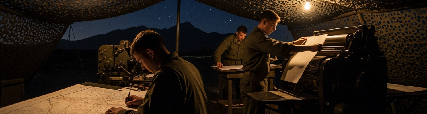
The responsibility for correcting this critical failure fell to a new type of military formation, the U.S. Army’s topographic units. Specifically, the burden landed on the shoulders of the 649th Engineer Topographic Battalion. Activated in the wake of Pearl Harbor, this unit was conceived as a self-contained, mobile map factory. Its soldiers were not infantrymen. They were draftsmen, photographers, lithographers, and press operators plucked from civilian life and trained to apply their trade under combat conditions. Their mission for Husky was to land with or immediately after the assault troops, deploy their heavy equipment, and begin printing accurate maps on the hostile shores of Sicily. It was a logistical and operational nightmare. Their equipment list read like an inventory of a commercial print shop, not a combat unit. It included massive, multi-ton lithographic printing presses, bulky photographic process cameras, power generators, and hundreds of crates of specialized paper and toxic printing chemicals. This delicate, cumbersome cargo had to be loaded onto landing craft and brought ashore under the constant threat of Axis air and naval interdiction. A single well-placed shell or bomb could decapitate the entire cartographic effort of the Seventh Army before it even began.
Deploying these specialists so close to the front was a tactical gamble. The engineers of the 649th were not trained for sustained combat, yet their function was inseparable from the fighting. Commanders had to balance the need for their product against the risk of losing the men and machines that created it. Upon landing near Gela on July 10, 1943, elements of the 649th worked with frantic urgency, often within range of German artillery. They dug in their presses and generators, camouflaging their positions and establishing a production line in the dust and chaos of the beachhead. Their primary inputs were fresh aerial reconnaissance photographs, often flown by F-5 photo-reconnaissance aircraft, and captured German and Italian maps which, while often tactically valuable, had to be rapidly cross-referenced, redrawn, and standardized to American military specifications. The engineers worked in shifts around the clock, the roar of their presses adding to the din of war as they churned out thousands of map sheets per day. The work was grueling, hot, and perilous. They were creating clarity from chaos, imposing a grid of order on a landscape of violence, all while the battle for Sicily raged around them.
The Tangible Impact of Ink and Paper
The output from the 649th's field presses had an immediate and profound effect on the Seventh Army’s operations. As Patton began his controversial, high-speed flanking maneuver toward Palermo, his armored and mechanized columns relied heavily on the newly printed maps. In the rugged interior, where General Omar Bradley’s II Corps faced stiff German resistance, these maps were a lifeline. They allowed company and battalion commanders to navigate the confusing maze of secondary roads and mountain tracks, identifying bypasses to avoid German strongpoints and maintaining the momentum of the advance. A column that might have been stalled for hours by a demolished bridge could now, with a reliable map, find a fordable river crossing a few kilometers away. This ability to maintain mobility was a direct result of the engineers' work.
For the artillery, the impact was even more significant. Accurate indirect fire is impossible without accurate maps. The new topographical charts, with their reliable grid coordinates and elevation data, allowed American artillery batteries to mass their fire with devastating precision. Gunners supporting the 1st and 45th Infantry Divisions during the brutal fighting for the high ground around Troina could bring down storms of steel on German positions that were invisible to them, breaking up counterattacks and suppressing machine gun nests. This capability saved countless American lives by allowing steel, not flesh, to do the heaviest work. The improved cartography also drastically reduced the frequency of friendly fire incidents. In the fast-moving, often confusing battles across the island, a common and reliable map ensured that all units were operating from the same geographical reality. It prevented tragic errors where one American unit might call for fire on what they believed was an enemy position, only to find it occupied by another American force.
The ethical equation of cartography was written on the ground in Sicily. A bad map led men to their deaths. It sent patrols into ambushes and caused artillery to kill its own. A good map, produced under fire by the 649th Engineer Topographic Battalion, did the opposite. It provided commanders with the clarity to make sound tactical decisions. It gave a lost truck driver a route to deliver ammunition. It gave a forward observer the confidence to call for fire just meters from his own position. The Sicily campaign proved that in modern warfare, the printing press was a weapon system as vital as the tank or the howitzer. The quiet, technical work of the cartographer was indispensable to victory, turning paper and ink into a decisive battlefield advantage.