
VMCJ-1 Reconnaissance Overview
Marine Composite Reconnaissance Squadron 1 (VMCJ-1) received its orders. The mission was to be the primary aerial intelligence asset for Military Assistance Command, Vietnam (MACV), and the U.S. Navy’s Task Force 77. In the context of the Cold War, this required constant collection of signals and imagery intelligence on Viet Cong and North Vietnamese Army (NVA) units. It also meant monitoring for any signs of intervention by Soviet or Chinese forces. VMCJ-1 was a composite squadron, a hybrid force with two distinct intelligence functions. One was photographic reconnaissance for mapping, targeting, and post-strike analysis. The other was electronic warfare, designed to detect, identify, and counter the enemy’s growing network of radar installations guiding anti-aircraft artillery (AAA) and Soviet-supplied SA-2 surface-to-air missile (SAM) systems.
Operational logs show the squadron operated two radically different airframes. For electronic warfare, VMCJ-1 initially relied on the EF-10B Skynight, a machine from another era. It was a twin-engine, propeller-driven aircraft developed from the Korean War-era F3D night fighter. By its arrival at Da Nang Air Base in April 1965, the Skynight was an anachronism in a war of supersonic jets. Slow and vulnerable, its strength lay in its specialized electronic suite. Packed with receivers and jamming pods, the EF-10B’s job was to loiter near strike routes, listening for the electronic emissions of enemy Fan Song guidance radars. Once detected, its Electronic Warfare Officer would jam the signal, blinding the SAM battery as American strike aircraft approached their targets. Four EF-10Bs supported a massive USAF strike against a SAM site near Hanoi as early as July 1965. The aircraft’s slow speed made it a target. The squadron would lose five Skynights during its service in Vietnam.
Its counterpart was built for pure speed.
For photographic intelligence, VMCJ-1 flew the RF-8A Crusader, the unarmed reconnaissance variant of the Navy’s F-8 fighter. Where the Skynight was slow, the Crusader was a high-performance jet capable of exceeding Mach 1. Starting in 1964, detachments of VMCJ-1’s Crusaders flew from carriers at Yankee Station, augmenting Navy reconnaissance squadrons for missions over Laos and North Vietnam. The RF-8A’s fuselage was modified to house multiple camera stations, providing forward, oblique, and vertical imagery on a single pass. Its missions were some of the most hazardous of the air war. To defeat the AAA and SAM threat, pilots flew at extremely low altitudes and high speeds, often descending to just a few hundred feet above the ground. On August 13, 1965, an RF-8A from a VMCJ-1 detachment was hit by anti-aircraft fire while photographing a radar site. It became the squadron’s first combat loss of the war. The pilot ejected over the sea and was recovered, but the event was an indicator of the risks involved in getting the pictures commanders demanded.
By the early 1970s, the war had shifted. The policy of Vietnamization meant a steady withdrawal of American ground forces, placing a heavier burden on air power and the intelligence that guided it. Reconnaissance became more important. U.S. flights showed the North stockpiling weapons and massing troops for a major offensive. When the NVA launched the Easter Offensive in the spring of 1972, VMCJ-1, which had withdrawn from Vietnam in 1970, was urgently redeployed. Now flying the more advanced EA-6A Intruder for electronic warfare, the squadron was based at Cubi Point in the Philippines and staged through Da Nang. Its mission was to provide ECM support for Operations Freedom Train and Linebacker I, designed to blunt the offensive. From April to December 1972, augmented by a detachment from VMCJ-2, the squadron flew nearly 2,500 combat sorties, jamming enemy radars to protect B-52 and Task Force 77 carrier strikes against targets around Hanoi and Haiphong. The intelligence gathered and the protection provided by VMCJ-1 were direct factors in the effort to halt the invasion.
High-Altitude Sensor Inadequacies
Operational logs reveal a fundamental mismatch between strategic reconnaissance platforms and the tactical intelligence demanded. The high-altitude photographic systems on aircraft like the RF-8A Crusader and later the RF-4B Phantom II were designed to capture vast swaths of territory from altitudes offering safety from conventional anti-aircraft artillery. This standoff capability came at a cost in granular detail. The primary antagonist was the environment. Vietnam’s persistent tropical haze, a thick blanket of moisture and atmospheric particulates, scattered light and degraded image contrast. During monsoon seasons, cloud cover was a near-constant impediment. Even in clear weather, the physics of optics imposed hard limits. The concept of Ground Sample Distance (GSD), which defines the ground area represented by a single pixel or film grain cluster, became a critical constraint. From 30,000 feet, even with powerful telephoto lenses, the GSD was often measured in feet, not inches. A camera system could easily resolve a truck or a building, but it was physically incapable of distinguishing a camouflaged individual from the surrounding jungle floor. The film might show a path, but it could not reveal the tripwire of a mine stretched across it. The result was a collection of expansive and often tactically inadequate photographs.
The challenges facing electronic intelligence (ELINT) gathering were just as profound. VMCJ-1’s EA-6A Intruders, which entered service with the squadron in October 1966, were among the most advanced electronic warfare aircraft of the era. They were designed to detect and jam the sophisticated Soviet-supplied radar systems guiding North Vietnamese SAMs. Flying high-altitude orbits gave the EA-6A’s powerful receivers, like those in the AN/ALQ-76 jamming pod, a commanding line-of-sight over wide areas. The same terrain that made ground warfare so difficult also created radar shadows. The karstic, mountainous topography of North Vietnam and the Laotian border regions blocked the low-power emissions from mobile enemy radar and communications posts, hiding them from the high-flying Intruders. NVA and Viet Cong forces practiced exceptional signal discipline, often turning on their guidance and acquisition radars only for the final phase of an attack. This gave the ELINT crews a brief window to detect, identify, and jam the threat. It was an electronic duel where the enemy on the ground dictated the terms of the engagement.
This disconnect between high-altitude collection and ground-level threats culminated in the failure to resolve the most immediate dangers to infantry. The intelligence gathered from 30,000 feet could identify supply depots and truck parks, but it could not find the sniper in a tree line or the camouflaged bunker housing a heavy machine gun. North Vietnamese and Viet Cong forces were masters of concealment, using natural vegetation, extensive tunnel systems, and purpose-built camouflage to defeat aerial observation. A high-altitude photograph did not possess the resolution to pierce this veil. A single camouflaged soldier, remaining motionless, would be an insignificant part of the jungle’s texture. The strategic view provided by VMCJ-1’s sensors offered a false sense of clarity, identifying the shape of the war but remaining blind to its deadliest details. Imagery could confirm the destruction of a bridge but could not provide the actionable intelligence needed to prevent an ambush a mile down the road.
Jungle Terrain Obscurity
The laws of physics were a formidable adversary. After-action reports from VMCJ-1 photo-reconnaissance pilots reveal a consistent pattern: the Vietnamese landscape rendered their advanced sensor suites inert. The primary antagonist was the triple-canopy jungle, a fortification with three distinct layers of vegetation so dense that it blocked nearly all direct sunlight from reaching the forest floor. For the RF-4B Phantom’s primary camera systems, such as the KS-87, this created an insoluble problem of light and shadow. Flying at high speed, the camera’s shutter was open for a fraction of a second; the jungle floor, shrouded in perpetual twilight, did not reflect enough light to properly expose the film. The resulting imagery was a collection of dark, grainy blurs. Even when infrared film was employed, the results were disappointing. While this technology was designed to detect variations in heat and chlorophyll, the jungle presented a monolithic, uniform green signature from above. The canopy acted as a thermal blanket, trapping heat and humidity below and masking the thermal signatures of truck engines, cooking fires, or human bodies. To an aerial sensor, a camouflaged NVA battalion headquarters and an empty patch of jungle looked exactly the same.
This sensory blindness was compounded by the specific environmental conditions of the April-June 1971 operational period. Archival weather data indicates this timeframe marks the onset of the southwest monsoon season in southern Vietnam. Daily schedules became dictated by the weather, with torrential afternoon downpours and low, dense cloud cover frequently grounding flights. For VMCJ-1, this atmospheric interference was catastrophic. The persistent cloud layers and thick, moisture-laden haze scattered light, degrading image contrast and making high-altitude photography a waste of fuel and film. Even when pilots found a break in the clouds, the terrain below presented its own reconnaissance challenges. The heavy rains transformed vast areas, particularly in regions like the Mekong Delta and the Plain of Reeds, into inundated swamp and marshland.
This waterlogged landscape actively defeated intelligence collection. From the air, the surface of the inundated terrain created massive patches of specular reflection, or sun glint, that would white-out sections of photographic film. The water itself, turned murky and brown with sediment, was an opaque shield. It concealed submerged sampans, underwater supply caches, and the movement of troops who could wade through flooded mangrove forests with near-total impunity. The daily rains also systematically erased evidence. A Viet Cong unit could move supplies or reposition overnight, and the subsequent downpour would wash away every track of their passage, making post-mission bomb damage assessment an exercise in guesswork. An operational summary from the period (NARA Record Group 472) notes that NVA and Viet Cong forces deliberately timed logistical movements and offensives to coincide with the monsoon, using the atmospheric blindness as a strategic asset. For the crews of VMCJ-1, the jungle and the weather conspired to create an impenetrable fortress, swallowing intelligence targets and leaving their high-tech sensors to photograph nothing but clouds and trees.
Air-Ground Communication Breakdown
Sophisticated intelligence gathered by VMCJ-1 aircraft often evaporated within a clogged and fragile communication chain. The system’s critical human component, the Radio Telephone Operator (RTO), was frequently its most strained. A Marine RTO at the company or platoon level was the nexus for the company command net, the battalion command net, artillery fire request nets, and the tactical air request net. Archival records show these operators, often young Marines with minimal specialized training, were tasked with monitoring this cacophony of traffic simultaneously. The North Vietnamese Army made destroying these communication nodes a priority, specifically targeting men carrying the tall, conspicuous whip antennas of the AN/PRC-25 man-pack radio. The loss of a single RTO could sever a platoon’s link to air support or medevac.
Into this already saturated and high-risk environment, VMCJ-1 attempted to inject highly technical, time-sensitive intelligence. An EA-6A Intruder crew might detect the brief signal of a previously unknown anti-aircraft artillery radar, but relaying that threat information required navigating a bureaucratic system from the sky, through a Direct Air Support Center (DASC), and down multiple echelons to a ground unit that might be only a few kilometers away but an hour or more away in communication-time.
The very physics of the environment conspired to sever communication links. The standard-issue AN/PRC-25 radio, the 25-pound workhorse of the infantry, was an FM line-of-sight system. Its effective range, advertised as 5 to 8 kilometers, shrank catastrophically in the Vietnamese jungle. The triple-canopy foliage, thick with moisture, absorbed and scattered VHF radio waves in a phenomenon known as attenuation. Field reports consistently describe a unit’s effective communication range being reduced to mere hundreds of meters. This isolated squads and platoons from each other even when they were in close proximity. The problem was magnified by the terrain. In the steep, karstic mountains of the Central Highlands, units in deep valleys were completely cut off, their signals blocked by the sheer mass of rock. Rotting vegetation and thick mud further degraded signal quality. To compensate, RTOs used long, 10-foot whip antennas to try and push a signal through the canopy, but these snagged on vegetation and made the operators a more prominent target. This signal degradation meant that a clear report from a VMCJ-1 pilot often became a garbled, untrustworthy message by the time it reached the intended ground commander, if it reached him at all.
This created a fatal disconnect. The process for translating VMCJ-1’s aerial reconnaissance into actionable ground intelligence was labyrinthine. A typical scenario involved an RF-4B Phantom on a photo run identifying a new, camouflaged NVA bunker complex. The pilot would radio the sighting to a controlling agency, likely the DASC, which was responsible for coordinating immediate air support. The DASC, however, was a step removed from the ground unit in contact. Its operators had to receive the request, vet it, process it, and then attempt to relay the information down the chain of command to the relevant battalion’s Fire Support Coordination Center (FSCC). From there, another radio operator had to contact the company commander, who would finally task a platoon. Each of these hand-offs introduced a delay and a potential for error, all conducted over radio nets being absorbed by the jungle and targeted by the enemy. A detailed report from the pilot, containing the precise location and nature of the fortification, would be truncated and distorted with each transmission. Nuanced intelligence became “enemy bunkers at these coordinates.” By the time a Marine rifle squad was directed to the location, the information was often minutes or hours old, allowing a mobile enemy to have already relocated or set an ambush.
Ground Unit Tactical Adaptations
The high-altitude perspective from VMCJ-1’s reconnaissance flights bore little resemblance to the violence of the ground war. For Marine infantry and their support units in the mud of I Corps, aerial intelligence was a luxury, often outdated or irrelevant. Survival depended not on maps but on immediate adaptations to a landscape that defied analysis. Ground units were forced to develop their own intelligence, reading the terrain with their feet and developing tactical responses that often ran in opposition to the strategic picture. This was a war of improvisation, where the official doctrine of air-land battle was severed by the physical obstacles of the environment.
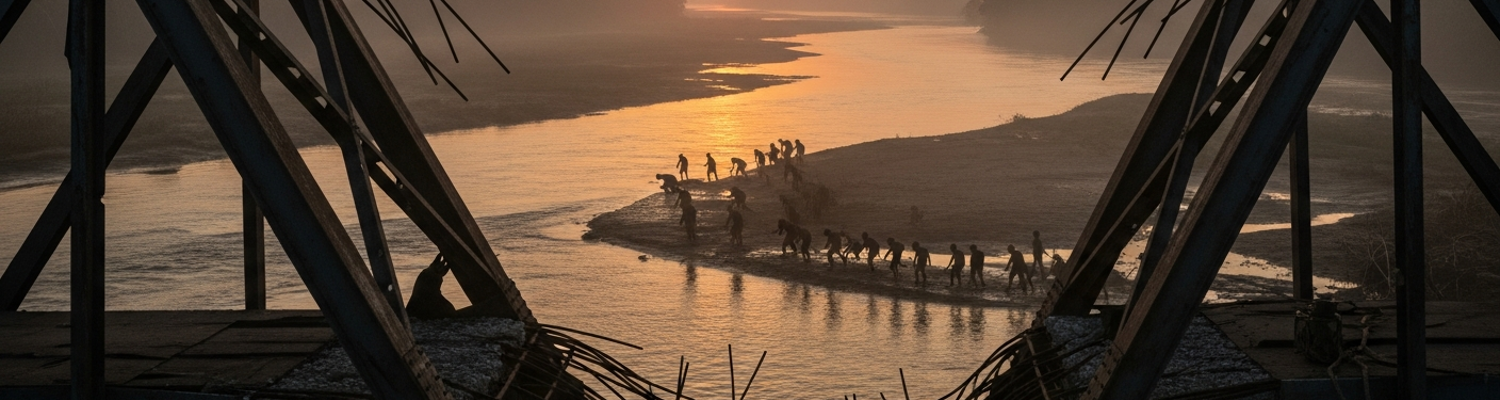
Nowhere was this improvisation more critical than in the work of Marine combat engineers. A review of logs from units like the 9th Engineer Battalion shows a constant struggle against an enemy who weaponized infrastructure collapse. An RF-4B photograph might identify a bridge on Highway 1 south of Da Nang as destroyed. For a platoon from the 9th Engineers, that single data point translated into a complex engineering problem to be solved under enemy observation. A bridge was a mess of shattered concrete abutments and twisted steel I-beams dropped into a muddy, often mined, river. The engineers’ task was to make it passable. They did not have pre-fabricated replacement sections. After-action reports detail how they became masters of battlefield salvage, cannibalizing the frames of destroyed enemy trucks for structural steel, using timber felled from the surrounding jungle, and laying down sections of M8A1 pierced steel planking originally intended for expeditionary airfields. This was heavy work done with hand tools and light equipment, often while submerged in waist-deep water. Command chronologies repeatedly note that these repair sites acted as magnets for NVA mortar teams and snipers who understood their operational value. An engineer team wrestling a steel beam into place was completely exposed. The tactical adaptation was a direct response to the inadequacy of the aerial view; while the photo identified a problem, the engineers had to physically engage with its dangerous, three-dimensional reality.
For a Marine rifle platoon on patrol, the disparity between the aerial photograph and the ground was a constant danger. A trail visible on imagery as a thin line became a chest-deep channel of boot-sucking mud and tangled roots. A seemingly open patch of grassland marked as a potential helicopter landing zone was, in person, covered in razor-sharp elephant grass hiding punji pits and command-detonated mines. The most persistent threat was the one aerial sensors could never detect: the lone sniper. After-action reports from dozens of patrols undertaken by the 1st and 3rd Marine Divisions describe a consistent pattern. A platoon, moving along a route planned from aerial photos, would be paralyzed by the single crack of a rifle. The shot often came from a direction impossible to pinpoint, fired by a single NVA soldier concealed in a spider hole or lashed to the upper branches of a tree. The patrol would halt, take cover, and spend hours trying to locate a shooter who had likely already slipped away. An entire platoon of heavily armed Marines could be pinned and tactically neutralized by a single, invisible enemy. The tactical response was to abandon the map. Experienced platoon leaders learned to distrust the clear paths suggested by photographs, opting instead to “bust jungle,” a brutally exhausting but less predictable method of movement. They learned to read the terrain for what it was, not what it appeared to be from above, identifying potential ambush sites based on instinct and experience.
This led to direct contradictions with high-level intelligence. A VMCJ-1 aircraft might flag a village as a suspected Viet Cong supply depot based on indicators like new construction or heavy foot traffic. The directive passed down the chain of command would be to conduct a sweep. A company commander on the ground, approaching the village, often developed a completely different assessment. He could see things the camera could not: the presence of women, children, and the elderly; the absence of military-age males; the routine of farming. Critically, he might have a Kit Carson Scout, a former Viet Cong or NVA soldier who had defected, providing a nuanced interpretation of the scene. The scout could identify villagers by dialect, recognize signs of coercion versus willing support, and explain that the new construction was a rice shed, not an arms cache. The ground commander then faced a difficult decision: follow the order based on impersonal aerial data or trust the human intelligence gathered on the spot. Operational records show numerous instances where Marine leaders chose the latter, adopting a less aggressive posture and avoiding an escalation that would have alienated the local population, even if it meant disputing the intelligence provided by a high-tech reconnaissance squadron.
Doctrine Reality Discrepancy
American military doctrine from the mid-1960s was built to fight a different war. The theoretical framework for reconnaissance, taught at staff colleges, was predicated on a conventional conflict against a Soviet-style adversary. It assumed large, mechanized formations moving across open terrain, clear lines of battle, and an enemy who relied on a high-power electronic infrastructure that could be detected and destroyed. Training manuals outlined a linear process: aerial reconnaissance, using platforms like VMCJ-1’s RF-4B Phantoms, would identify enemy divisions. Electronic warfare aircraft, like the EA-6A Intruder, would map and jam their air defense radars. This intelligence would then guide massive airstrikes to annihilate the threat before it engaged friendly ground forces. This was a doctrine of industrial-scale attrition, perfected for a hypothetical World War III on the plains of Germany. Vietnam presented a contradiction to every one of its base assumptions. There were no fronts, only a 360-degree battlefield. The enemy was not a division but a squad, not a tank but a man with a rifle.
Not by choice. By design.
The intelligence provided by VMCJ-1, while technologically sophisticated, was often functionally useless when applied to the tactical ground situation. An RF-4B flying a high-speed, low-altitude photo run over the A Shau Valley might produce thousands of feet of high-resolution film. To the photo-interpreter back at Da Nang, a faint line on the imagery might be dismissed as a game trail. An analysis passed down the chain of command would mark the area as clear of significant activity. For a Marine platoon ordered to patrol that same area, the “game trail” was the primary infiltration route for an NVA sapper unit, its lack of visibility from the air a deliberate feature of its design. The trail was almost certainly seeded with pressure-plate mines and watched by a sniper. In the electronic sphere, the disconnect was just as pronounced. An EA-6A Intruder crew, orbiting at 20,000 feet, was hunting for the powerful electronic emissions of Soviet-made Fan Song guidance radars for SA-2 missile batteries. Their equipment was not designed to detect the low-power, short-range field radios used by Viet Cong platoons. A squadron report could declare an entire operational area electronically silent, creating a false sense of security for commanders. That same area could be a hive of enemy activity, with units coordinating an ambush using simple hand signals and runners, entirely invisible to the multi-million-dollar sensor suite flying miles above.
This chasm between what was seen from the air and what was happening on the ground crystallized the concept of the Doctrine Disconnect. Archival evidence shows that VMCJ-1 was, by the metrics of its own service, performing its mission with proficiency. Its aircraft flew the sorties, its cameras captured the imagery, and its electronic warfare officers detected the specified threats. The failure was not in the execution but in the doctrine itself. The entire system was geared to produce a specific type of intelligence that the war in Vietnam did not value. A classic example from operational logs is the process of Bomb Damage Assessment (BDA). A VMCJ-1 photo-reconnaissance mission after a major airstrike might return with definitive proof that a key bridge on a North Vietnamese supply route was completely destroyed. For the Seventh Air Force and Task Force 77, this was a quantifiable victory. The data point went into a report, and the air campaign was judged a success. For the Marine infantry company operating ten kilometers from that bridge, the intelligence was meaningless. They knew the NVA would have a submerged pontoon bridge erected overnight or would be moving supplies on sampans under the cover of the jungle canopy, all methods invisible to aerial photography. The success celebrated at headquarters did not stop a single enemy soldier or piece of equipment from reaching the front line. The information was factually correct but tactically irrelevant.