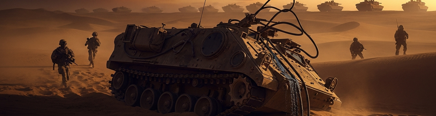

The Geopolitical Context of Desert Sentinel
The year 1984 was one of exceptional global tension. Just a year prior, NATO's Able Archer 83 command post exercise had simulated a nuclear escalation so realistically that Soviet intelligence services went to high alert, believing it could mask a genuine first strike. The downing of Korean Air Lines Flight 007 by a Soviet Su-15 interceptor in September 1983 had erased any remaining diplomatic goodwill. Washington's rhetoric framed the Soviet Union as an "evil empire," while the infirm Konstantin Chernenko’s ascension in Moscow created a power vacuum and policy paralysis. The United States was pouring funds into its military, developing the Strategic Defense Initiative and deploying Pershing II missiles across Western Europe. The Soviets were mired in a draining war in Afghanistan, a conflict consuming men and materiel without a clear end. In this environment, every large-scale military maneuver was scrutinized by opposing intelligence agencies as a potential prelude to war.
This was the world that birthed Exercise Desert Sentinel.
Desert Sentinel was a full-scale evaluation of the Rapid Deployment Joint Task Force's ability to project power into a desert theater, a direct reflection of Cold War anxieties about a Soviet-backed invasion of a neutral oil-producing nation. Conducted in the blistering expanse of the Mojave Desert’s Fort Irwin National Training Center, it mobilized over 40,000 personnel. The exercise’s core involved the 1st Cavalry Division, equipped with the new M1 Abrams tank and M2 Bradley fighting vehicle, conducting a corps-level attack against the resident Opposing Force (OPFOR). The OPFOR was trained and equipped to mimic a Soviet motor-rifle regiment in doctrine and hardware. Air support flew from Nellis Air Force Base to simulate interdiction strikes. Logistics channels strained to supply the massive quantities of fuel, water, and ammunition demanded by mechanized warfare in an unforgiving environment. The exercise was designed to stress every system, from strategic airlift to the cooling systems on individual vehicles.
Success for the entire operation depended on the engineers.
The operational logs for the US Army's 17th Engineer Battalion detail a mission of extraordinary difficulty. Their tasks were foundational to the battle plan. The battalion's primary mobility mission was ensuring the 1st Cavalry Division’s armored spearheads could maintain tempo through a series of narrow, pre-designated corridors. This required Company A's M728 Combat Engineer Vehicles to breach simulated minefields and anti-tank ditches under direct fire. Simultaneously, Company B was tasked with rapidly constructing forward arming and refueling points (FARPs) for helicopter squadrons, using M9 Armored Combat Earthmovers to level ground and build protective berms in rock-hard caliche. The most pressing sustainment task fell to the battalion’s support elements: providing potable water. Using truck-mounted Reverse Osmosis Water Purification Units (ROWPUs), they had to produce thousands of gallons of drinkable water per day from brackish desert wells. Any failure by the 17th to clear a path, build a position, or supply water would create a failure cascade across the entire operational front.
The Sandhill Sector Gauntlet
The 17th Engineer Battalion's assignment was designated "rapid route clearance," a deceptively simple term for a complex mission. They were ordered to force a usable path through the designated "Sandhill Sector" for the lead elements of the 1st Cavalry Division. The engineers of Company A, mounted in their M728 Combat Engineer Vehicles, would be the first heavy armor to enter the pass. Their 165mm demolition guns were expected to reduce OPFOR-constructed rockfalls, while their heavy dozer blades were meant to carve through earthen berms and fill anti-tank ditches. Supporting them were the M9 Armored Combat Earthmovers, faster machines tasked with grading the route and clearing debris. The entire concept rested on speed. The plan demanded the engineers open a two-lane route, designated "Route Bluebird," through the 12-kilometer pass in under four hours.
Any deviation would halt a force of forty thousand.
Archival topographical maps show a high-altitude mountain pass that was less a road and more a scar of rock and sand. The route twisted through tight, ascending switchbacks, with sheer rock walls on one side and precipitous drops on the other. The roadbed itself was a mixture of compacted dirt and loose, abrasive scree, known to foul engine air intakes and wear down vehicle track pads at an accelerated rate. At an average elevation of over 6,000 feet, the thin air reduced the power output of the diesel engines powering the M728s and M9s by a documented 15 percent. This power degradation was a known factor, but its effect on vehicles already pushing tons of earth was difficult to model accurately. The sector was a natural fortress, offering the defending OPFOR dozens of ideal, hull-down positions for their T-72 surrogate tanks and anti-tank guided missile teams. For the engineers, it represented a gauntlet of interlocking kill zones.
The Sandhill Sector was the operation’s single point of failure.
The entire multi-billion-dollar weight of a US Army corps was intended to flow through this one narrow artery. A review of the exercise’s master plan shows no viable alternative routes. To the south lay an impassable salt marsh. The northern route required a diversion of over 150 kilometers, consuming fuel and time the offensive did not have. Halting the advance inside the pass would create a target of unprecedented scale: a multi-kilometer traffic jam of stationary armored vehicles, packed bumper-to-bumper and vulnerable to OPFOR artillery. The mission's importance meant the 17th Engineer Battalion was not just clearing a path; it was holding the integrity of the entire corps-level maneuver in its hands. The OPFOR, understanding this geography, had concentrated its best-trained units to hold the pass, mining the likely approaches and pre-sighting artillery on every straight section of the road.
The mission began at 05:30.
The lead M9 Armored Combat Earthmover, callsign "A-1," lumbered forward to begin scraping a shallow anti-tank ditch. Ten minutes into the operation, a high-pressure hydraulic line connected to the vehicle’s main blade assembly failed. The failure was not a dramatic explosion but a silent, steady bleed, spraying atomized fluid over the hot engine block. The blade, its power source gone, slammed down into the dirt, digging itself in and bringing the 24-ton vehicle to an abrupt halt. The operator’s report noted a loss of all pressure on his main controls. The M9 was now an immovable obstacle blocking the narrowest point of the pass’s entrance. A-1’s sudden stop forced the following M728 to halt, which in turn stopped the column of Bradleys and Abrams tanks stretching back for miles. The four-hour clock was ticking, and the vanguard of the operation was paralyzed by the failure of a single hose.
A Cartographic Error Cascade
The genesis of the Sandhill Sector failure was a fundamental cartographic mistake. The planning staff in the 17th Engineer Battalion’s S-3 (Operations) section, working under intense pressure, utilized a standard 1:50,000 scale topographic map designated "Fort Irwin Proving Ground, Sheet #78-4." Over this paper map, they laid a mylar sheet to pencil in operational graphics. The error occurred when a junior officer, tasked with annotating known soil composition data, misaligned the overlay by a single grid square identifier along the north-south axis. This small shift, a displacement of 1,000 meters on the ground, transposed the geological characteristics of two vastly different terrain blocks. The intended route, a hard-packed desert floor of alluvial fan deposits, was now shown on the operations map as passing through a zone marked for "loose sand and unconsolidated scree." The treacherous, soft basin the engineers were now directed toward was incorrectly labeled as stable ground. The MGRS coordinates for the planned breach point should have been 11S_PU_238_875, but the grease pencil mark on the overlay mistakenly designated it as 11S_PU_238_865.
This flawed route was then cross-referenced against available supplementary data. The S-2 (Intelligence) section, seeking more granular detail on soil density, located what they believed was a relevant study: a 1981 Department of Agriculture civilian environmental survey titled "Soil and Water Resources Conservation Act: Program Report and Environmental Impact Statement." This document contained thousands of pages on soil types nationwide. Buried within its appendices was detailed analysis of soil porosity and load-bearing strength. The planning staff, searching for information related to "sandhill" topography, found a section detailing a region of fine, quartz-based sand overlaying a saturated, high-moisture substratum. This data perfectly matched the (erroneous) description of the terrain on their operational overlay. The engineers used this civilian data to calculate the expected performance of the M9’s dozer blade and the vehicle’s ability to maintain traction. The problem was that the survey data they were using did not describe the Mojave Desert. It was an environmental assessment of Jackson County, Mississippi.
The final layer of the error came from the digital realm. In the early 1980s, the US Army Engineer School was beginning to compile computerized databases to assist with planning. The 17th Engineer Battalion’s planners queried an early version of this system, hosted on a mainframe at Fort Belvoir, for training scenarios involving "sandhill route clearance." The system, using keyword-based logic, returned a data file that had been mislabeled. A previous exercise, designed for units training for the marshy coastal plains of the Gulf Coast, had involved creating a mock causeway through a wetland. The training data for this scenario was tagged with the location of the nearby Mississippi Sandhill Crane National Wildlife Refuge. This tag, 'Mississippi Sandhill Crane NWR', became linked in the database with technical data for operating heavy equipment in saturated, bog-like soil. When the Desert Sentinel planners searched for "sandhill," the system incorrectly provided this file. The result was that the engineers set the hydraulic pressure on the M9’s blade and the expected engine torque based on moving wet, heavy clay. This was a completely different physical challenge from the dry, abrasive sand they were actually facing. The M9’s hydraulic lines were therefore primed for a level of strain that the actual environment made impossible, setting the stage for the hose failure.
Doctrinal Paralysis and Explosive Limits
With the M9 earthmover disabled, the mission to clear Route Bluebird fell to the M728 Combat Engineer Vehicles. The OPFOR had created a significant rockslide blocking the pass, an obstacle requiring explosive demolition. Standard engineer doctrine, specifically Field Manual FM 5-250, authorized the use of M112 C4 demolition blocks for this task. The on-scene platoon leader from Company A determined that reducing the rockslide to rubble would require at least forty pounds of C4, equivalent to thirty-two M112 blocks. A request for this charge was sent to the battalion command post. The problem arose from a conflicting directive buried within the exercise’s safety regulations. To prevent unintentional damage to the Fort Irwin training area, the corps-level Exercise Control (EXCON) group had imposed a strict ten-pound net explosive weight limit for any single detonation within 500 meters of a designated roadway.
The engineers were trapped by their own rulebook.
This discrepancy forced the 17th Engineer Battalion’s commander to halt all forward progress. He could not authorize a charge that violated the EXCON directive, but the ten-pound limit was insufficient to clear the obstacle. At 07:15, his formal request for an emergency waiver began its slow journey up the chain of command. Transmitted via a SINCGARS radio net already crowded with traffic from thousands of users, the request first had to reach the 1st Cavalry Division’s brigade headquarters. Unwilling to make the call, brigade staff forwarded the query to the division’s main command post. From there, it was elevated to the highest authority: the EXCON group. This process consumed hours. The EXCON staff, a composite of officers from different commands, had to be physically assembled to review the request against the master scenario and safety charters. All the while, the 1st Cavalry Division’s lead elements remained stationary, a miles-long column of armor packed into the narrow desert valley.
The twelve-hour operational pause that resulted proved catastrophic. As officers debated explosive limits in a distant command tent, the weather in the Mojave Desert began to turn. The clear, cold morning gave way to a rising wind from the east. By noon, the wind was strong enough to lift the fine desert sand. By 15:00, the situation had deteriorated into a full-blown haboob, a massive, rolling wall of dust that engulfed the entire sector. Visibility dropped to near zero. The static vehicle column was blasted by abrasive, wind-driven sand traveling at over 50 miles per hour. This dust infiltrated everything, clogging engine air filters, scouring the sensitive optics on tanks, and creating a respiratory hazard for every soldier. Then, as the front passed, the temperature plunged and a cold, driving rain began to fall. The rain mixed with the loose soil and dust, turning the previously dry ground at the sides of the road into a thick, impassable slurry of mud. The delay had allowed the environment itself to create an entirely new set of obstacles.
A Desperate and Flawed Warning
This developing threat was invisible to the 1st Cavalry Division command, but not to everyone. A two-man Long Range Surveillance Unit, callsign "Dakota-3," was positioned in a concealed observation post on Hill 754, a windswept ridge overlooking the entire sector. For six hours, the team watched the OPFOR maneuvers with growing alarm. Their AN/GRC-109 radio, their primary means of communication, was unable to penetrate the thick, static-filled air of the dust storm. The team’s logbook notes multiple failed attempts to contact their parent unit. Frustration mounted. Seeing the T-72s settle into ambush positions and BMPs beginning their flanking march, the team leader made a decision that violated every established protocol. Believing the threat of the column's imminent destruction outweighed the risk of electronic detection, he ordered his radioman to abandon their assigned, encrypted frequency. They switched to the unsecured, division-level administrative SINCGARS channel, a frequency cluttered with logistics and personnel chatter, in a desperate attempt to broadcast a warning.
The transmission was a frantic, partial burst of information.
Dakota-3’s message, which stated that OPFOR regimental-strength armor was maneuvering on the south flank and that Objective Vulture was active, was transmitted without proper callsigns and was trampled by other radio traffic. It was picked up not by division command, but by a confused logistics officer in a supply convoy miles to the rear. The partial mention of a regiment maneuvering south and the lack of clear identifiers led the officer to misinterpret the call as a possible friendly fire incident involving a US Army armored cavalry regiment. This garbled report, when relayed up the chain, sent a shockwave of confusion through brigade headquarters. Instead of alerting them to the OPFOR threat, it triggered a frantic effort to account for all friendly armored units, diverting command attention at the most critical moment. The communication breakdown meant that while Dakota-3 had seen the truth, their violation of protocol had rendered that truth useless, planting a seed of lethal misinformation that left the 1st Cavalry Division’s command entirely blind to the closing jaws of the OPFOR trap.
The OPFOR's Decisive Repositioning
After-action reports from the 32nd Guards Motor Rifle Regiment, the designated Opposing Force, show its commander reacted to the prolonged American delay with rapid, doctrinal precision. The twelve-hour operational pause was not a simple delay, but a decisive opportunity. Soviet offensive doctrine stressed the necessity of maintaining constant pressure and exploiting any break in enemy tempo. A stalled armored column, packed into a restrictive valley, was the ideal target.
Under the concealing blanket of the afternoon haboob, the OPFOR commander initiated a complete tactical realignment. Exercise logs (NARA Record Group 338) show that starting at approximately 15:40, the T-72 tank surrogates, which had been in static forward positions, displaced to pre-surveyed, reverse-slope ambush sites. This maneuver rendered them invisible to American ground observation and protected them from direct fire. It positioned them to engage the 1st Cavalry Division’s armor as it crested the hills within the Sandhill Sector. Concurrently, a full battery of 2S1 Gvozdika self-propelled howitzers was moved to new firing points on a high plateau designated Objective Vulture. This location gave them a commanding field of plunging fire into the valley where the American column was paralyzed.
This time was used to fundamentally transform the battlefield.
The initial American problem, a single disabled vehicle and a rockslide, was a localized tactical challenge for engineers. The OPFOR’s reaction escalated it into a strategic crisis for the entire corps spearhead. As the T-72s and artillery established their trap, OPFOR reconnaissance elements mounted in BMP-2 fighting vehicles initiated a wide flanking maneuver. The operational map shows they used secondary washes and arroyos, terrain previously deemed impassable but now softened by the unexpected rain, to swing south and east, completely bypassing the front of the American column. Their objective, according to captured OPFOR orders from the exercise, was the rear of the formation: the thin-skinned fuel tankers, ammunition carriers, and command-and-control vehicles. This was a classic execution of Soviet doctrine, which emphasized attacking an enemy force throughout its entire depth to induce catastrophic collapse rather than simply winning a frontal engagement.
From Tactical Bottleneck to Strategic Encirclement
By the time the 1st Cavalry Division received clearance to deal with the original rockslide, its lead brigade was unknowingly sitting inside a prepared kill zone. The OPFOR had transitioned from a static defense designed to slow an advance into an active, multi-axis ambush designed to dismantle it. The combination of reverse-slope tank positions, elevated artillery, and a deep flanking attack against the vulnerable logistics tail meant the American force faced destruction from three directions. The tactical route-clearance mission had morphed into a strategic imperative to extricate an encircled force, a challenge for which the US command was completely unprepared.
The problem was no longer clearing a route. It was now survival.
The unassailable defensive position was not just a line of tanks; it was a fully integrated system of interlocking fire, made possible only by the twelve hours of inactivity forced upon the 1st Cavalry Division. The cascade of failures, starting with a pencil line shifted by a finger's width on a map in a command tent, had culminated in this moment.
The combined failures of data integrity, from the initial map overlay to the final, garbled radio transmission, ensured the collapse of the Desert Sentinel main effort was not a matter of combat power, but of information. The exercise was officially reset by EXCON at 21:00, with the lead brigade of the 1st Cavalry Division declared combat-ineffective, its logistics chain notionally shattered, and its command structure in disarray.