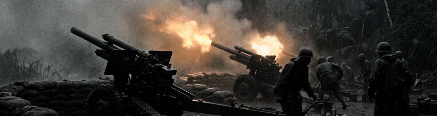

Empress Augusta Bay Perimeter Relief Operation
Archival evidence shows Corporal John Vargo scraping green copper oxidation off the binding posts of an EE-8-A field telephone with the edge of an M1 bayonet. Rain ran in sheets down his canvas leggings. He sat inside a dugout carved out of volcanic ash on the military crest of Hill 700. Blackened fingers wrapped bare W-110 communication wire around the terminal post. He wrenched the knurled brass nut down. It bit cleanly into the steel-and-copper core. That single telephone line snaked two thousand yards down through the rotting rainforest. It terminated at the fire direction center of the 140th Field Artillery Battalion. If that circuit broke during an infantry rush, every defensive barrage plotted along the northern ridgeline would instantly fall silent.
The entire Allied position on Bougainville rested on six miles of dirt fortifications.
When examining the historical record, this perimeter defense was governed by Joint Board 350 doctrine. This inter-service protocol defined command transitions between navy and army forces during landing operations. Amphibious assault forces retained command only until the beachhead secured sufficient depth for defensive and logistical buildup. On December 15, 1943, Major General Roy S. Geiger formally relinquished command of the Empress Augusta Bay sector. His I Marine Amphibious Corps transferred authority to Major General Oscar Griswold and the XIV Corps. Griswold assumed operational responsibility for all ground forces. He took control of naval base facilities and airfield development within the enclave. The administrative changeover was marked by severe friction. Griswold inherited an incomplete perimeter cut through thick mangrove swamp and volcanic ridges. Army engineers immediately replaced fragile Marine field communication links with buried multi-pair trunklines. They transformed unstable mud tracks into heavy-duty corduroy supply roads. Griswold reallocated shipping priorities to bring in thousands of tons of timber. Supply ships unloaded barbed wire and concrete. The posture shifted from an offensive landing expedition to a fortified redoubt.
Imperial Japanese Army commanders planned to wipe out this pocket entirely.
A close review of operational logs indicates that Griswold anchored the defense by dividing the fifteen-mile perimeter between two veteran infantry divisions. Major General Robert S. Beightler positioned the 37th Infantry Division across the rugged northern and inland sectors. Dense jungle met steep volcanic elevations in this zone. Beightler ordered the 145th and 148th Infantry Regiments to take up positions across Hill 700, Cannon Hill, and Hill 260. Infantrymen converted the terrain into interlocking strongpoints. Major General John R. Hodge deployed the Americal Division across the flatter eastern and southern sectors along the Torokina River. These troops protected the coastal swamps, the Piva bomber strip, and fighter strips. Across both divisional fronts, soldiers cleared undergrowth to create three-hundred-yard fields of fire. Combat engineers laced ravines with double-apron barbed wire. They buried tripwire-activated antipersonnel mines. Combat teams built hundreds of mutually supporting pillboxes roofed with three layers of coconut logs. Gun crews sited 37mm antitank guns loaded with canister ammunition beside water-cooled M1917 Browning heavy machine guns.
Radio intelligence units in the South Pacific intercepted encrypted messages sent by Lieutenant General Harukichi Hyakutake and the 17th Army. Naval codebreakers coordinated this effort through the Central Bureau in Brisbane. These intelligence decrypts confirmed that Japanese commanders were massing the 6th Division under Lieutenant General Tsutomu Kanda. Kanda planned an all-out effort to retake the airfields. Signal analysis revealed that the 13th, 23rd, and 45th Infantry Regiments had departed their base areas around Buin in the south. Japanese soldiers carried disassembled Type 94 75mm mountain guns on their backs. They hauled mortar tubes and rice rations across the narrow ridgelines of the Crown Prince Range. Intercepted logistics orders demonstrated that Kanda planned to concentrate over twelve thousand combat troops opposite the American perimeter by early March. Forward reconnaissance patrols from the Americal and 37th Divisions verified the radio intercepts. Scouts located widened jungle paths and telephone wire runs. They found freshly cleared artillery pits directed squarely at the Hill 700 promontory.
Fortification Geometry of Hill 700
Archival evidence shows that Hill 700 dominated the northern approaches to the Empress Augusta Bay perimeter from a narrow volcanic ridge. Rising 689 feet above the coastal lowlands, this steep crest sat four thousand yards north of the Piva Uncle fighter strip. If Japanese spotters hauled optical equipment onto that summit, they held direct visual line of sight over every revetment across the Torokina plain. Concentrated shell fire from Imperial Japanese Army Type 92 105mm artillery positioned in the Crown Prince Range could destroy parked aircraft. Spotter-corrected salvos would neutralize the airfields. Major General Robert S. Beightler recognized that control of this high ground determined control of the airspace across the northern Solomons. The northern slope dropped at an angle exceeding seventy degrees into the rocky gorge of the Laruma River. The eastern slope descended into impassable swamp terrain. Any infantry assault attempting to reach the summit had to advance through narrow gullies directly into pre-sighted small-arms kill zones.
Japanese observers on the crest could adjust shell fire directly onto Allied flight lines.
When examining the historical record, the 145th Infantry Regiment transformed this natural cliff into an interlocking defensive fortress between late January and early March 1944. Colonel William E. Cecil assigned his Second Battalion to hold the apex. He stationed Company G on the highest knob and Company F along the western saddle. Working six-hour shifts in heavy tropical rain, Ohio guardsmen felled mahogany and coconut trees eighteen inches thick. They constructed forty-two separate log pillboxes. These bunkers were excavated three to four feet into the volcanic soil. Engineers roofed them with three courses of crisscrossed timber. Work details packed the roofs beneath five feet of clay to withstand direct hits from 70mm battalion guns. Slit embrasures measuring eight inches in height were leveled flush with the ground. This design delivered grazing fire instead of plunging fire. Out in front, combat engineers set double-apron barbed wire belts thirty yards deep along the slope contours. Trip flares were wired to steel pickets. Salvaged five-gallon ration cans filled with scrap iron and half-pound TNT charges were anchored among the barbs.
Overlapping machine gun cones left zero dead ground along the wire.
A close review of operational logs indicates that the physical fortifications were only one half of the defensive system. Colonel David A. Craig mapped a coordinate grid that turned every yard of the approach into a pre-registered impact zone. He commanded XIV Corps Artillery. Forward observers from the 140th Field Artillery Battalion manned observation posts on Hill 700 using BC scopes and heavy-gauge wire connections. Craig directed his gunners to plot thirty-six defensive concentrations across the ravines facing the 145th Infantry positions. Eight separate artillery battalions stood on standby. This included 105mm howitzers from the 37th Division and 155mm Long Toms belonging to the 223rd Field Artillery Group. Plotting boards in division fire direction centers had firing data prepared on cards. Fire direction officers could drop eight hundred high-explosive rounds within four minutes of a single radio call. Gun crews kept shells fuzed for mechanical time airbursts matched to the jungle canopy clearance over the Laruma gorge.
Batteries kept twenty-four rounds per gun uncrated and stacked in ready racks beside the spades.
Japanese Sixth Division Offensive Preparations
Archival evidence shows Lieutenant General Masatane Kanda planned to break the Allied perimeter through an aggressive concentration of veteran shock troops. Kanda stripped his southern staging bases around Buin to assemble five reinforced infantry battalions from the 13th and 23rd Infantry Regiments. Colonel Toyohiko Muda assumed direct tactical control over the assault element formed around the 13th Infantry. He designated it as the primary force assigned to crush the Hill 700 promontory. Men from Colonel Yunosuke Hamada and his 23rd Infantry Regiment formed supporting assault columns. These units were tasked with pinning American forces further south and east. Foot soldiers were stripped of personal knapsacks. They carried only woven grass pouches, Type 99 rifles, sharpened bamboo stakes, and canvas bags packed with Type 99 magnetic armor-piercing charges. Tactical commanders organized specialized infiltration squads armed with Bangalore-style pipe charges. These squads carried heavy wire-cutting shears to breach the defensive wire apron before dawn. Japanese staff officers assigned over three thousand seasoned combatants to the assault detachment commanded by Muda. They banked on aggressive nighttime infiltration tactics developed during prior campaigns in China.
Movement toward the perimeter required traversing broken volcanic terrain that maps could not register.
When examining the historical record, assault columns moved along separate river corridors through the trackless rain forest. Advance scout echelons pushed north along the upper forks of the Torokina River. They cut west across razorback ridges to reach the Laruma River basin. Monsoon downpours turned the Laruma gorge into a churning cataract of mud and volcanic slate. Japanese infantrymen waded through waist-deep rapids against four-knot currents. Marching columns followed narrow paths carved beneath primary canopy growth. They avoided established native trails where American perimeter patrols set trip mines. Japanese combat engineers tied thick liana vines across vertical canyon walls. Heavily burdened troops hauled themselves up eighty-degree inclines in total darkness. Wet clay caused foot soldiers to slip off narrow ledges into ravines. Command orders strictly forbade flashlights or verbal communication during the approach. By early March, lead companies had bypassed XIV Corps reconnaissance outposts. They established concealed forward assembly areas five hundred yards north of the American log bunkers.
Artillery support depended entirely on manpower and strict conservation of high-explosive shells.
A close review of operational logs indicates Japanese ordnance crews dragged disassembled Type 94 75mm mountain guns up the reverse slopes of the Crown Prince Range on rope-and-pulley rigs. Each six-piece gun crew hauled steel trail legs and recoil cylinders. Gun tubes weighing over two hundred pounds per segment were dragged up the muddy saddles. Weapons specialists excavated firing pits beneath living bamboo root systems on reverse mountain slopes north of Hill 700. They shielded the muzzles behind woven foliage screens to defeat aerial spotters. Rigid ammunition rationing restricted every mountain gun battery to a total allowance of fewer than forty rounds per tube for the initial preparatory bombardment. Supply interdiction by American torpedo boats and carrier aircraft had choked off resupply convoys from Rabaul. Gunners had zero replacement shells once battle commenced. Battery commanders calculated firing tables using mechanical slide rules and manual aiming stakes. They zeroed their tubes on coordinates mapped directly onto the crest of Hill 700. Guns remained silent to prevent Allied counter-battery detection.
Saturation Bombardment and Communication Collapse
At 2345 hours on March 10, 1944, the northern slope detonated into fire.
Archival evidence shows Japanese artillery batteries dug into the Crown Prince Range initiated a synchronized saturation bombardment. This barrage was designed to erase the crest of Hill 700. Gun crews from the 6th Division artillery regiments shoved rounds into the breeches of Type 94 75mm mountain guns and Type 92 105mm howitzers. They fired on pre-calculated deflection angles registered days earlier. High-explosive shells hammered the outer defense belts held by Company G of the 145th Infantry Regiment. Detonations sheared through two-foot-thick mahogany roof beams on forward log bunkers. Explosions collapsed firing slits and buried automatic rifle teams under tons of displaced volcanic clay. Shrapnel ignited trip flares strung along the double-apron concertina wire. The flares lit the ravines while explosive blast waves tore the protective barbed barriers out of the mud. Japanese mortar detachments positioned along the Laruma River gorge lobbed ninety-millimeter projectiles into the saddle between Company G and Company F. They maintained a sustained cyclic rate of six rounds per minute to pin the garrison inside their remaining bunkers.
Every telephone line connecting the forward outposts died within three minutes.
When examining the historical record, the concentrated impact pattern completely severed the tactical communication network established by the 37th Division Signal Company. Jagged steel casing fragments sliced through exposed spans of W-110 twisted-pair field wire. The wire dangled from stripped tree trunks along the southern supply trail. Corporal John Vargo sat inside the Company G command dugout. His EE-8-A field telephone went dead. It emitted only a flat electrical hum through the handset receiver. Forward switchboards at Lieutenant Colonel William E. Cecil and his Second Battalion command post lost continuity lights for every pillbox facing north. Linemen attempting to re-establish the connection had to crawl through open trenches swept by shrapnel. They carried spools of assault wire on their backs under relentless explosive fire. Signal corps repairmen spliced broken copper strands using friction tape in the dark. Successive shell bursts tore out twenty-yard sections of cable faster than teams could identify breaks. Battery-powered SCR-536 portable radios failed to transmit through the mineralized volcanic ash. The isolated company commander had no operational relay to battalion headquarters.
A close review of operational logs indicates that burning cordite totally blinded forward artillery observers deployed along the razorback. Pulverized pumice and heavy white smoke from exploding powder charges filled the air. Forward observer teams from Battery C of the 140th Field Artillery Battalion manned an observation post dug into the narrow rock spine at coordinate grid 34.2-68.1. Spotters looked through optical battery commander scopes. They faced a dense cloud of sulfurous smoke that eliminated all visual reference markers across the Laruma River basin. Zero visibility extended across the pre-registered impact areas. Thirty-six separate defensive concentrations had been calculated on firing tables for these zones. American spotters could not identify muzzle flashes from incoming mountain guns. They could not track massing assault waves cutting through the perimeter wire fifteen yards away. Fire direction centers down on the coastal flats held eight hundred rounds of 105mm high-explosive ordnance in ready racks. They waited for coordinate adjustments that never arrived over the dead air.
At 0005 hours, the first Japanese infiltration squads reached the wire undetected.
Breach of the Infantry Parapets
Archival evidence shows that between 0008 and 0013 hours on March 11, 1944, the structural integrity of Hill 700 unraveled across a forty-yard razorback saddle. This narrow defile linked Company F on the western knoll to Company G on the high apex. Infiltrators from Major Masaru Tomita and his 2nd Battalion of the Japanese 13th Infantry Regiment bypassed the artillery-blasted crater fields. They crept along a blind drainage seam where the steep Laruma gorge met the ridge crest. Thick monsoonal drizzle masked the metallic click of heavy wire-cutting shears severing the lower strands of the concertina aprons. Zero illumination concealed Japanese sappers slipping through an eight-foot gap left between overlapping machine gun cones of fire. Squad leaders carried split bamboo markers tipped with phosphorescent rotting fungus. They guided two reinforced assault platoons up the slick clay slope without issuing verbal commands. Mud coated the uniforms of seventy Japanese foot soldiers. They crawled past the inter-company boundary stake at coordinate grid 33.8-67.9. By 0011 hours, this forward assault echelon had driven an undetected wedge thirty yards deep behind the forward combat outposts. They severed the physical link between the two defending companies.
The tactical boundary between two companies had become an open corridor.
When examining the historical record, fighting inside the primary trench line devolved into point-blank mechanical carnage. This occurred the moment trip flares ignited above the wooden revetments. Ohio National Guardsmen opened fire with M1 Garands and Browning Automatic Rifles into the sulfurous smoke. Japanese shock troops dropped straight into the parapets before empty eight-round clips ejected with their characteristic metallic chime. Assault squads hurled fused canvas satchel charges packed with five pounds of cast picric acid directly into the open communication ditches. Heavy detonations shattered timber breastworks. Explosions blew sandbag revetments inward and buried American riflemen beneath tons of volcanic muck. Defenders countered with cast-iron Mk II fragmentation grenades. They bounced explosives off trench angles. Japanese sappers threw Type 97 cylindrical grenades primed by striking firing pins against their steel helmets. Shrapnel sliced through hanging roots. Japanese infantrymen lunged forward with 19-inch Type 30 bayonets locked onto Type 99 rifles. Disoriented men grappled in knee-deep mud along the zigzag traverses. They swung heavy trench shovels and slashed with combat knives. Soldiers discharged M1911A1 .45-caliber pistols directly into torso contact.
Three forward log redoubts fell within two hundred seconds.
A close review of operational logs indicates that the fall of forward Pillboxes 2, 3, and 7 handed the assault force direct command over the southern reverse slope. Specialized Japanese assault teams shoved ten-foot bamboo pole charges through the rear eight-inch ventilation apertures. They triggered high-explosive concussions that killed the M1917 machine gun squads inside. Enemy gunners hauled Type 92 heavy machine guns into the captured coconut-log bunkers. They swiveled the barrels southward to sweep the exposed communication trenches of Company G with 7.7mm fire. This captured pocket established a bridgehead eighty yards wide and forty yards deep across the spine of the ridge. Mortar crews rapidly emplaced Type 89 knee mortars along the captured parapets. They lobbed 50mm projectiles onto the corduroy supply track. This track linked the ridge to XIV Corps artillery emplacements and the Piva airfields four thousand yards south. Exploitation patrols armed with magnetic mines and automatic weapons began filtering down the timberline toward the battalion ammunition dump at coordinate peg 33.5-67.2. Counterattack orders could not be telephoned from regimental headquarters.
The Five-Minute Fire Direction Crisis
At 0547 hours on March 11, the forward line ceased to exist as a defensible boundary.
Archival evidence shows that an emergency call reached the fire direction center from the Second Battalion, 145th Infantry command bunker. Japanese assault squads had completely overwhelmed Pillboxes 2 and 3. They swarmed across the open traverses. Enemy infantry lobbed satchel charges into the rear entrances of Company G log works. Lieutenant Colonel William E. Cecil demanded unobserved artillery fires. He ordered danger-close barrages brought down directly atop the American parapets. Surviving riflemen received orders to pull back inside remaining dirt-covered revetments. They dragged timber blast doors shut and pressed their bodies into the mud floors. The requested coordinates placed the impact center point precisely on grid coordinate 33.8-67.9. American infantrymen were fighting hand-to-hand with bayonets against troops from the Japanese 13th Infantry at that exact location. Cecil wanted high-explosive shells detonated along the exterior revetments. He accepted that fragmentation would shower friendly positions. This action would strip enemy shock troops off the bunker roofs.
No spotter on the mountain could confirm the target.
When examining the historical record, 37th Division Artillery battery commanders positioned three miles south on the coastal flat faced an agonizing dawn dilemma. Dense sulfurous smoke blanketed the northern face of Hill 700. Pulverized limestone and morning ground fog blinded every optical battery commander scope manned by Battery C of the 140th Field Artillery Battalion. Forward observers had been driven underground or killed by Japanese mortar fire. Phone lines were severed. Radio frequencies were jammed by volcanic ridges. Battery commanders had to decide whether to unlock their ready racks and pull lanyards on blind grid plots without visual correction or spotter verification. Firing blind salvos directly into a friendly regiment defensive redoubt violated standard safety directives issued by the Field Artillery School at Fort Sill. Battery officers understood that an errant salvo striking twenty yards short would shred the surviving elements of Company G. Refusing the mission meant Japanese forces would roll up the entire northern ridge within minutes.
Ballistic math left no margin for mechanical error.
A close review of operational logs indicates that fire direction officers worked with graphical firing tables to calculate minimum safe distances for both 105mm M2A1 and 155mm M1 howitzers. Peacetime field manuals established a strict safety buffer of two hundred yards for 105mm high-explosive rounds. These rounds generated a lethal burst radius of thirty-five yards and hurled shrapnel out to a hundred yards. Heavy 155mm howitzers required a five-hundred-yard exclusion zone to protect friendly troops from the blast concussion of ninety-five-pound projectiles. Firing at a range of forty-one hundred yards up a steep seventy-degree slope introduced vertical displacement factors. These factors warped the standard dispersion ellipse. Fire direction plotters determined that the probable error in range for 105mm tubes using Charge 5 was twenty-two yards. Lateral deflection error added another eight yards of dispersion. Dropping salvos onto an eighty-yard ridge saddle placed friendly parapets squarely within the 50 percent lethal dispersion pattern of incoming M48 point-detonating shells.
Battery commanders ordered Charge 5 loaded into every breech.
At 0551 hours, plotting officers locked the firing pins of twelve 105mm tubes to an elevation angle of 348 mils. They shifted deflection four degrees right to clear Company F western redoubt.
Danger-Close Howitzer Barrage at Dawn
At 0552 hours, thirty-six artillery tubes fired simultaneously into the fog.
Archival evidence shows that batteries of the 135th and 140th Field Artillery Battalions unleashed synchronized volleys of 105mm M48 high-explosive shells directly along the shattered apex of Hill 700. Working in thirty-second reload cycles, gun crews shoved five-pound propelling charges into sliding-wedge breeches. They adjusted mechanical time fuzes to detonate instantly on soil contact. Rounds hurtled over the four-thousand-yard transit line from the coastal flats. They descended through the canopy with deafening velocity. Explosions erupted twelve to fifteen yards from American foxholes along the boundary between Company F and Company G. Concussive pressure waves collapsed exterior parapet walls. Shallow slit trenches filled with burning cordite and pulverized volcanic silt. Serrated steel fragments from the split casings sheared clean through concertina wire pickets. Shrapnel stripped the remaining bark off felled mahogany trees. Forward observers who managed to maintain contact counted over four hundred high-explosive rounds slamming into an impact corridor eighty yards wide within six minutes.
Steel fragments scoured the open earth down to bedrock.
When examining the historical record, surviving infantrymen of the Second Battalion, 145th Infantry held their positions by burrowing beneath three tiers of interlocking coconut logs. Riflemen inside Pillboxes 4, 5, and 6 jammed their faces into damp clay. They wedged their helmets against timber footings while holding their mouths open to prevent blast overpressure from rupturing lung tissue. Overhead, roofs reinforced with five feet of tamped volcanic subsoil groaned under the concussive downpour. Fragments hammered the exterior log revetments. Soldiers gripped the iron handles of heavy timber blast hatches. They braced against shockwaves that threw dirt through the eight-inch vision slits. Japanese shock troops who had reached the pillbox roofs to emplace magnetic mines were atomized by direct hits. The American occupants remained shielded beneath the wooden bulkheads. Inside the suffocating bunkers, men checked M1 Garand clips by touch in absolute blackness. Lifting a hatch before the barrage lifted meant instantaneous dismemberment.
The mountain slope became an impassable zone of fragmentation.
A close review of operational logs indicates that follow-on assault echelons of the Japanese 13th Infantry Regiment were obliterated as they advanced up the razorback ridges from the Laruma River. Major Masaru Tomita and his reserve companies had stepped out of the lower jungle canopy onto the bald, seventy-degree northern incline. They were caught without revetments or natural dead space. Massed artillery fire from the 135th and 140th battalions walked down the slope in fifty-yard increments. The barrage sheared the open rock face with crosscutting kill zones. High-explosive detonations hurled ascending squads backward into ravines. Explosions severed communication lines to Colonel Muda and his command post. Artillery destroyed knee mortar crews along the trail. Type 99 rifles, canvas pouches, and severed limbs were scattered across the volcanic slate. The momentum of the follow-on attack broke completely within two hundred seconds. Forward movement along the primary assault axis ceased entirely by 0610 hours. The isolated infiltration squads were stranded inside the breached lines without reinforcement.
Counterattacks and Ridge Consolidation Operations
At 0715 hours on March 11, the counterattack ordered by Colonel William E. Cecil pushed straight into the smoking wreckage of the saddle.
Archival evidence shows that reserve elements of the 1st and 2nd Battalions, 145th Infantry, initiated immediate thrusts to retake the breached parapets before Japanese defenders could dig reverse-slope entrenchments. Captain John Higgins directed Company E, holding the Second Battalion reserve, to advance up the steep southern face through a rain-carved chute at coordinate grid 33.7-67.8. Mud along the eighty-degree incline forced men to haul themselves upward using exposed tree roots. They carried five-round clips for their M1 Garands in web bandoliers. Company C moved along the western draw to strike the enemy exposed eastern flank. Japanese soldiers manning captured Pillbox 3 fired bursts from captured Browning machine guns. This fire pinned the lead platoon of Company E behind volcanic boulders forty yards below the crest. Cecil radioed orders for 60mm mortar sections to drop white phosphorus rounds directly onto the open communication trenches. Small assault teams crawled within grenade range. Guardsmen scrambled upward under covering rifle fire. They lobbed Mk II fragmentation grenades into the log firing embrasures and retook two forward parapet positions by 1145 hours.
Bypassed rifle pits across the ridge still held dozens of entrenched Imperial Japanese Army soldiers.
When examining the historical record, clearing these fortified pockets required the direct intervention of armored vehicles and chemical weapons. Two M4A1 Sherman medium tanks from Company B of the 754th Tank Battalion crawled up the corduroy log track under constant sniper fire. Their tracks slipped repeatedly on the wet volcanic clay. One vehicle suffered a thrown steel track pin when traversing a three-foot crater near coordinate 33.6-67.4. The crew traversed the turret manually to cover the remaining tank. The operational Sherman advanced to within twenty yards of Pillbox 2. It fired point-blank 75mm M48 high-explosive shells that shattered the outer tier of coconut logs. Combat engineers from the 117th Engineer Battalion moved behind the tank steel hull carrying M1A1 portable flamethrowers pressurized to two thousand pounds per square inch. Operators squeezed the firing levers. They shot twenty-second streams of thickened diesel fuel through the shattered firing embrasures. The fire ignited the interior and consumed the air inside the underground chambers. Small-arms teams followed the fire bursts. They used trench knives and M1 carbines to clear out subterranean spider holes where surviving Japanese infantrymen attempted to detonate Type 99 magnetic charges.
Securing the ground meant rebuilding the defense from the earth up.
A close review of operational logs indicates that regimental engineers and signalmen began re-establishing the main defensive perimeter at 1420 hours under sporadic 90mm mortar fire from the Laruma gorge. Work crews from the 37th Division Signal Company laid fresh lines of W-110 twisted-pair assault wire from DR-8 spools. They stapled the cables to charred tree stumps to bypass the severed underground links. Combat engineers drove four-foot steel screw pickets into the pumice. They strung fresh spirals of double-apron concertina wire across the seventy-yard gap between Company F and Company G. Soldiers filled three hundred burlap sandbags with excavated clay to reconstruct collapsed parapet walls. They reset water-cooled M1917A1 machine guns on fixed tripod mounts zeroed along pre-designated interlocking fire lines. Forward observers from the 140th Field Artillery Battalion climbed into rebuilt observation pits with replacement EE-8 field phones. They completed wire checks to all eight firing batteries by 1730 hours. Artillery officers logged twenty-four updated defensive target coordinates on plotting boards before darkness fell across the mountain.