
Alamo Scout Covert Reconnaissance Insertions
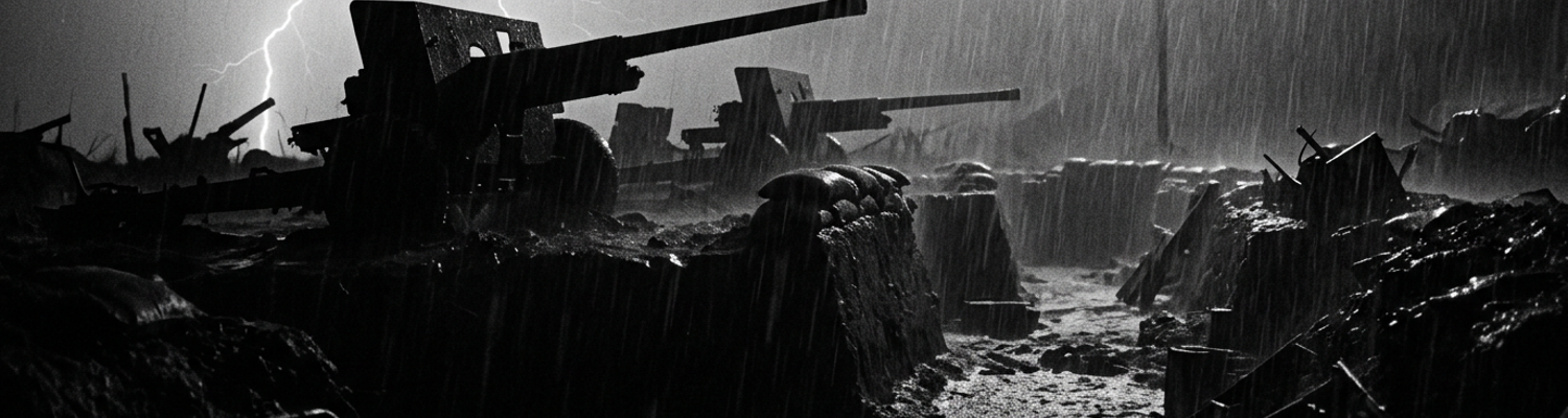
The invasion inventory for Operation Horlicks manifested 105mm howitzers, 155mm Long Tom artillery pieces, 500-pound general-purpose bombs, and 8-inch high-explosive naval shells. Planners stacked this payload aboard LSTs and LCTs alongside Sherman M4 tanks. Sixth Army commander Walter Krueger required exact terrain data before authorizing the bombardment. He deployed the Alamo Scouts to secure this intelligence.
Archival evidence shows the Thompson Team executing covert deep-jungle insertions onto Biak Island in mid-May 1944.
The operation began with a transit from Hollandia aboard two motorized Elco PT boats. Packard V-12 marine engines powered both vessels. A refueling stop at Wakde delayed the mission timeline. Sporadic rifle fire pinned the crews to the wooden decks during the fuel transfer. Final approach to the southern coast of Biak near coordinates 1 degree 10 minutes South 136 degrees 05 minutes East occurred in total darkness.
The scouts transferred from the PT boats into LCPR rafts three miles offshore.
Physical equipment failures immediately threatened the insertion. Brass inflation valves on the primary rafts seized solid from heavy saltwater corrosion. Operators had to manually pump the secondary air chambers while fighting the heavy offshore currents. Jagged subsurface coral formations punctured the outer rubber hull of the lead raft 400 yards from the beachhead.
A close review of operational logs indicates these reconnaissance patrols targeted enemy defensive positions prior to the main amphibious invasion scheduled for May 27.
The scouts waded ashore through chest-deep surf. Personnel immediately began measuring water depth, coral gradients, and slope angles for the incoming LVT amphibious tractors. Hand-drawn charts documented the exact locations of subsurface coral heads. These formations could rip the steel tracks off a landing vehicle. The team then pushed inland past the initial tree line to locate troop concentrations.
Local geography rejected standard-issue infantry gear.
Sharp limestone ridges shredded canvas leggings. The terrain destroyed the rubber soles of their jungle boots within hours. Strict noise discipline governed all movement through the dense undergrowth. Personnel carried SCR-300 portable radio sets through the heavy foliage to transmit coordinates back to the fleet. High atmospheric moisture continuously shorted the exposed battery terminals on these radios. The men resorted to cannibalizing copper wire from their spare headsets to bypass the damaged circuits.
The patrol tracked the movements of the Japanese 222nd Infantry Regiment under the command of Colonel Kuzume Naoyuki.
The scouts discovered that the Japanese had completely abandoned the immediate shoreline. Kuzume ordered his troops to fortify a vast network of subterranean coral caves overlooking the proposed landing beaches at Bosnek. This intelligence directly contradicted the theoretical training manuals issued to the invasion force. The manuals assumed enemy forces would construct traditional surface trench networks directly on the beach to repel an amphibious assault.
These reconnaissance units instead mapped heavy Type 92 machine gun emplacements recessed deep inside solid limestone caverns.
Elevation angles of the cave entrances were recorded relative to the southern coastal road. Deep secondary chambers held large stockpiles of mortar ammunition safely out of the blast radius of naval artillery. The limestone ceilings of these caverns measured up to forty feet thick. Thompson Team documented these subterranean anomalies while operating on strict field rations over a continuous 48-hour window. Personnel noted the complete absence of visible surface trenches along the primary invasion route. Hand-drawn maps detailed the interlocking fields of fire established by the hidden cave networks. The patrol withdrew to the offshore extraction point at 0300 hours on May 25. Final terrain coordinates reached Sixth Army headquarters via a hand-cranked generator. The insertion team boarded the extraction PT boat and left the operational grid.
Japanese Karst Fortifications and Subterranean Networks
Archival blueprints from the Japanese 222nd Infantry Regiment detail the complete abandonment of standard coastal defense doctrine in late April 1944.
Colonel Kuzume Naoyuki ordered his engineering battalions to exploit the natural karst limestone formations dominating the steep ridges directly above Mokmer airfield. This geological structure provided a ready-made subterranean bunker complex spanning several miles along the coast. Millennia of acidic rainwater dissolving soluble bedrock created these formations. U.S. War Department field manuals (FM 31-20) dictated that enemy forces would build sand and timber pillboxes directly on the flat invasion beaches. Kuzume discarded this expected approach entirely.
His command staff relocated over 10,000 personnel into two primary underground systems.
Tactical maps designated these as the East Caves and West Caves. Engineering units utilized specialized pneumatic rock drills imported from Manchuria to widen the natural geological fissures. Steel drill bits snapped against the dense calcium carbonate. Soldiers resorted to manual iron chisels and explosive blasting powder to carve out internal barracks and ammunition magazines. The resulting caverns featured ceilings up to sixty feet high. Natural vertical ventilation shafts successfully dispersed explosive concussion waves from incoming aerial bombs.
A close review of post-action engineering surveys reveals the specific armament hidden within these karst strongholds.
Japanese troops bolted Type 98 20mm anti-aircraft cannons and 75mm mountain guns directly into the solid limestone floors at the cave mouths. These heavy weapons pointed downward at a strict 45-degree angle toward the coastal highway and the adjacent airstrip. Infantry units carved surfaced trench networks that connected the deep underground caverns to forward revetted gun positions. Constructing these surface trenches required blasting directly through solid coral plate. Work details packed dynamite into shallow drilled holes to fracture the hardened crust. Troops cleared the jagged debris by hand using woven palm baskets.
They reinforced the trench walls with stacked coconut logs.
This prevented the loose coral gravel from collapsing inward during seismic shocks caused by naval artillery. This labor produced a zig-zagging corridor system measuring exactly three feet wide and five feet deep. The surfaced trench networks allowed Japanese riflemen to move undetected from the absolute safety of the subterranean caves directly to camouflaged spider holes and concrete pillboxes. Planners directed the placement of these forward positions to create overlapping fields of enfilading machine-gun fire across the flat coral terraces below.
U.S. 41st Infantry Division intelligence officers missed these connections entirely during initial aerial reconnaissance flights over Biak.
Japanese soldiers stretched camouflage netting woven from native jungle vegetation tightly over the open trench lines. They scattered crushed white coral dust over the netting to match the surrounding terrain. Elements of the 162nd Infantry Regiment advanced toward Mokmer Drome on May 28. They walked directly into this concealed kill zone. Japanese troops utilizing the communication trenches funneled 81mm mortar teams and Type 92 heavy machine gun squads to the forward revetted positions without exposing a single man to American observation.
The 162nd Infantry took severe casualties from 37mm anti-tank shells fired from low-profile bunkers they could not see.
Combat logs from the U.S. 146th Field Artillery Battalion note the extreme mechanical difficulty in neutralizing these interconnected defenses. High-explosive 105mm shells detonating against the limestone ridges caused zero structural damage to the primary subterranean bunker complexes. Shrapnel bounced off the thick karst outcroppings. Artillery barrages forced the Japanese gunners to retreat from their forward revetted positions. They fell back through the surfaced trench networks into the deep caverns. Once the shelling stopped, the gun crews moved back through the exact same trenches to re-man their weapons before American infantry could cross the open ground.
The U.S. advance stalled completely at the edge of the airfield. 75mm mountain guns fired continuously from the cave mouths.
Monsoon Runoff and Trench Drainage Failures
When examining the historical record of the 41st Infantry Division on Biak, post-action engineering surveys reveal a complete breakdown of U.S. War Department earthwork doctrines.
Field Manual 5-15 dictated standard trench construction protocols requiring a two-degree floor slope leading to localized soakaway pits. Army engineers designed these standard earthwork water diversion systems to handle maximum precipitation rates of one inch per hour based on temperate European weather data. The equatorial climate over the Schouten Islands delivered a vastly different weather pattern starting on June 2, 1944. Monsoon squalls moving across the Geelvink Bay dropped over eight inches of rain on the Bosnek beachhead in a single afternoon.
Unprecedented rainfall rates overwhelmed standard earthwork water diversion designs immediately.
The sheer volume of incoming precipitation filled the pre-dug soakaway pits in less than twenty minutes. Surface water backed up into the primary communication trenches connecting the 186th Infantry Regiment command post to forward rifle companies. The accumulated standing water exceeded three feet in depth.
A close review of operational logs from the 116th Engineer Combat Battalion details the rapid physical deterioration of the defensive perimeters.
Infantry squads spent three days digging fighting positions into the coastal topsoil. Engineers constructed standard soil stabilization layers along the trench walls using stacked burlap sandbags, woven coconut fronds, and crushed coral gravel pinned by wooden stakes. Torrential monsoon runoff washed away soil stabilization layers in drainage trenches within hours. The fast-moving surface water channeled directly into the open earthworks. This created high-velocity sub-surface rivers that undercut the trench floors. Heavy currents dissolved the loose coral gravel packed behind the burlap.
Without this structural backing, the wooden retaining stakes snapped under the lateral pressure of the saturated topsoil.
Thousands of pounds of wet earth collapsed inward. Entire platoon defensive positions vanished beneath rivers of brown sludge. The rapid destruction of these stabilization layers forced immediate tactical adjustments by Major General Horace H. Fuller. He ordered front-line units to abandon the collapsed deep-trench networks and relocate to higher ground along the coral terraces near coordinates 1 degree 11 minutes South 136 degrees 06 minutes East. This command decision exposed American infantrymen to direct line-of-sight fire from Japanese 75mm mountain guns positioned on the ridges above.
Soldiers attempting to salvage equipment from the ruined trenches encountered severe mechanical failures.
Portable Homelite gasoline generators brought ashore to power electrical sump pumps sank into the unstable mud. The intake valves on these pumps sucked in abrasive coral sediment. Internal impellers ground to a halt. Without mechanical pumping capacity, the remaining surface drainage channels overflowed their earthen berms and flooded the secondary ammunition dumps. Crates of .30 caliber ammunition submerged in the runoff required manual extraction by work details wading through chest-high water.
The acidic nature of the jungle runoff accelerated oxidation on exposed metal surfaces.
M1 Garand operating rods rusted tight. Canvas webbing rotted straight off the soldiers load-bearing equipment. The 162nd Infantry Regiment reported over three hundred cases of trench foot within a 48-hour window because personnel could not find dry ground to change their boots. Medical officers amputated gangrenous toes inside flooded hospital tents. Standard doctrine provided no solutions for terrain that actively dissolved engineered fortifications.
Infantrymen resorted to stacking empty brass artillery casings along the trench floors to create makeshift dry walkways.
The runoff washed these brass casings out toward the shoreline. Engineer units attempted to import pierced steel planking from the airfield construction zones to reinforce the collapsing trench walls. The heavy steel mats sank straight to the bottom of the flooded ditches. Water levels continued to rise across the entire sector.
Fungal Rot and Timber Structure Collapse
Archival evidence shows the 116th Engineer Combat Battalion initiating large-scale earthwork construction immediately following the May 27 amphibious landings.
Standard War Department training manuals dictated the use of imported Douglas fir for shoring up subterranean command posts and forward communication trenches. Supply shortages at the Hollandia staging areas forced engineers to harvest local timber directly from the Biak coastline near coordinates 1 degree 11 minutes South 136 degrees 05 minutes East. Work details felled hundreds of native coconut palms and ironwood trees to construct revetments along the primary defensive line at Bosnek. The raw timber went straight into the damp earth without any chemical curing process.
High humidity and rapid fungal decay degraded timber revetments and subterranean bracing within days of installation.
A close review of operational logs from the 41st Infantry Division details the rapid biological destruction of this defensive infrastructure. The atmospheric moisture on Biak hovered continuously above 90 percent. This specific equatorial climate accelerated the growth of endemic basidiomycete fungi across every U.S. defensive sector. Fungal spores permeated the exposed sapwood of the freshly cut coconut logs within forty-eight hours of placement in the soil. These aggressive organisms chemically dismantled the structural lignin holding the wood fibers together.
This severed the mechanical bonds required to bear heavy vertical loads.
Quartermasters had originally requisitioned copper naphthenate treatments to protect the wood from organic breakdown. Shipping manifests indicate those chemical supplies never left the cargo holds of the LSTs anchored offshore. Without chemical protection, the subterranean bracing supporting the 186th Infantry Regiment command bunkers turned into a soft, spongy pulp by the second week of June. Engineers could push a standard issue KA-BAR combat knife entirely through a ten-inch thick load-bearing post using only two fingers.
When examining the historical record of the 162nd Infantry Regiment engaged at the Ibdi Pocket, front-line reports document a catastrophic failure of earthwork engineering.
Structural timber failures caused widespread trench wall collapses across the island. U.S. infantrymen had excavated deep forward communication trenches through a volatile mixture of loose coral gravel and coastal topsoil. Troops reinforced these vertical trench walls using the degraded coconut logs and salvaged wooden ammunition crates. The fungal rot silently compromised the sheer strength of these retaining walls over a two-week period. Heavy nighttime precipitation saturated the surrounding topsoil. The water weight massively increased the lateral earth pressure against the weakened wood holding back the trench walls.
The subterranean bracing snapped under the weight of the wet earth.
Wood splintered apart along a two-mile stretch of the defensive line at 0400 hours on June 14. Thousands of cubic yards of saturated mud and sharp coral fragments poured directly into the primary fighting positions. The collapse buried heavy weapons emplacements before the gun crews could react. Recovery teams from Company C spent six hours digging through the heavy slurry to retrieve M1919A4 air-cooled machine guns and SCR-536 hand-held radios.
Abrasive coral dust mixed with the mud instantly jammed the internal operating groups of the recovered weapons.
Platoon commanders ordered immediate tactical withdrawals from the compromised trench networks to avoid further equipment losses. Retreating soldiers abandoned heavy crates of 60mm mortar shells buried under five feet of collapsed topsoil. Lieutenant General Robert L. Eichelberger assumed command of the Hurricane Task Force on June 15 and personally inspected the collapsed earthworks at the Ibdi Pocket. He ordered a complete halt to all subterranean bunker construction across the Biak theater.
Front-line troops abandoned the deep earthworks entirely.
Personnel resorted to fighting from shallow surface depressions covered by waterproof canvas ponchos. Engineering battalions left the ruined trench networks to fill with runoff water and rotting vegetation.
Prewar Military Engineering Formula Inaccuracies
When examining the historical record of the 116th Engineer Combat Battalion during the early June 1944 consolidation phase, operational blueprints reveal a strict adherence to War Department Field Manual 5-15.
This text governed all field fortification construction for the 41st Infantry Division. The manual provided specific mathematical formulas to calculate the active earth pressure, angle of internal friction, and shear resistance for excavated soil. Army engineers at Fort Belvoir developed these baseline metrics using dry clay and loamy topsoil found in temperate North American and European climates. Draftsmen calculated that a standard infantry communication trench required a steep four-to-one vertical-to-horizontal slope to maximize protection from shrapnel while minimizing excavation time.
Planners assumed the surrounding earth would maintain predictable structural cohesion under the shock of enemy artillery.
Staff officers applied these exact mathematical constants to the defensive grid mapped out along the Biak southern coast. Calculations based on temperate zone soil mechanics proved inaccurate in saturated rainforest environments. The geological makeup of the Bosnek coastal shelf consisted of a loose mixture of degraded coral dust, volcanic ash, and decaying jungle biomass. Equatorial monsoon rains began saturating this specific soil profile on June 2. Water quickly filled the microscopic voids between the soil particles.
This hydrostatic pressure completely eliminated the internal friction holding the earth together.
The safe angle of repose for the trench walls dropped from the manual predicted 75 degrees down to less than 15 degrees. Wet coral slurry liquefied. Dense muck slid straight down into the forward fighting positions of the 186th Infantry Regiment. Platoon leaders watched the mandated four-to-one trench slopes dissolve into flat mud pits within hours of the initial rainfall. Heavy weapons squads found themselves trapped waist-deep in a highly abrasive liquid paste that destroyed the delicate trigger sears on their M1 Garand rifles.
Thousands of pounds of unsupported topsoil rushed into the primary drainage ditches.
Standard military engineering formulas for timber and earth fortification maintenance completely failed in tropical conditions. Field Manual 5-15 required engineers to install vertical timber revetments backed by horizontal lagging to hold back the earth in deep excavations. The mathematical load-bearing tables assumed the use of cured, straight-grained Douglas fir or yellow pine possessing a known modulus of elasticity. Supply officers failed to deliver these specific materials to the Biak theater.
Work details instead harvested raw coconut palm and native ironwood near coordinates 1 degree 10 minutes South 136 degrees 05 minutes East to build the subterranean retaining walls.
The prewar formulas provided no adjustment variables for the high moisture content of freshly cut tropical sapwood. Heavy lateral earth pressure from the saturated soil pushed aggressively against these uncured wooden supports. Engineers attempted to calculate the necessary thickness for the cross-bracing using the standard temperate-zone equations. The local biological environment rendered those calculations obsolete in a matter of days. Fungal rot and endemic termites compromised the cellular structure of the raw timber bracing before the end of the first week of deployment.
The standard maintenance schedules dictated by Army doctrine called for visual structural inspections every thirty days.
The equatorial climate destroyed the wooden cross-beams in less than ten days. Wood fibers softened by the continuous 90 percent ambient humidity could no longer bear the required 500 pounds per square inch of compressive stress required to hold the saturated earth in place. Vertical support posts buckled inward at the center point under the unexpected hydrostatic load. Retaining walls fractured along the primary defensive perimeter at the Mokmer airstrip. Mud and shattered coral gravel poured through the broken lagging directly into the subterranean command posts.
Recovery crews from Company A abandoned two D7 Caterpillar bulldozers buried under twelve feet of collapsed earthwork.
Physical Attrition During Saturated Assaults
A close review of operational logs from the 41st Infantry Division G-2 section reveals a complete breakdown in pre-invasion troop endurance calculations.
Planners operating out of the Hollandia staging area utilized standard temperate-zone caloric consumption charts to predict the physical requirements for the Biak assault. Staff officers assumed the infantry would conduct standard surface clearing operations against dry, above-ground timber pillboxes along the flat coastal road. They authorized a forty-pound loadout per soldier, ignoring the high friction coefficients of deep liquid mud. Baseline intelligence estimates projected an average daily energy expenditure of 3,000 calories per rifleman.
This mathematical model completely failed to account for the biological demands of moving through subterranean karst formations filled with equatorial monsoon runoff.
Officers mandated a standard issue of three K-ration meals per man for a planned 72-hour sustained combat window. Front-line troops burned through their entire caloric allocation in less than fourteen hours. Archival evidence shows medical detachments attached to the 162nd Infantry Regiment recording mass physiological casualties entirely unrelated to enemy shrapnel. Quartermasters issued each soldier a single M-1910 one-quart aluminum canteen based on the G-2 assumption of rapid, low-resistance advances across dry coral terraces.
The actual environment forced men to wade through chest-deep, stagnant water inside the East Caves complex near coordinates 1 degree 11 minutes South 136 degrees 06 minutes East.
Ambient temperatures inside these saturated subterranean structures exceeded 95 degrees Fahrenheit with a relative humidity trapped at 100 percent. The human body thermoregulatory system cannot evaporate sweat under these specific atmospheric conditions. Core body temperatures spiked rapidly as soldiers wearing heavy HBT cotton fatigues and M1 steel helmets strained against the thick slurry. Battalion surgeons established triage centers in shallow surface depressions because the primary medical tents sank into the unstable topsoil. Evacuation teams lacked the physical strength to carry canvas stretchers back to the beachhead.
Medics documented hundreds of severe heatstroke cases before the first week of June ended.
Assault troops experienced extreme physical exhaustion attempting to clear these waterlogged, caved-in defensive networks under continuous small arms fire. Japanese engineers from the 222nd Infantry Regiment had deliberately collapsed the primary limestone ceilings over the lower access tunnels using explosive charges. Enemy gunners positioned Type 92 heavy machine guns behind the resulting rubble piles. These overlapping fields of fire forced American infantrymen to crawl on their stomachs through the flooded subterranean galleries.
This tactic required advancing squads to drag themselves over jagged, unstable mounds of wet coral debris while carrying specialized heavy assault equipment.
Operators strapped into the M2-2 portable flamethrower carried seventy-two pounds of pressurized thickened gasoline and nitrogen propellant on their backs. Traversing the flooded trench lines required these men to physically rip their boots out of deep suction pockets created by the liquid clay. Snipers firing 6.5mm Arisaka rifles from elevated, dry ledges deep inside the caverns targeted the slow-moving flamethrower operators struggling through the waist-high sludge. The weight of the equipment drove the operators deeper into the submerged sediment.
When examining the historical record of Company E during the assault on the West Caves, combat reports detail the mechanical and biological friction of reducing these saturated strongholds.
Infantrymen had to physically excavate the collapsed tunnel entrances by hand to create firing ports for their heavy weapons. Work details lifted hundred-pound chunks of wet limestone out of the flooded access points while submerged up to their clavicles in brown runoff water. Demolition teams carried twenty-pound canvas satchel charges filled with Composition C-2 explosive through the flooded corridors. The canvas bags absorbed the stagnant water and doubled in weight.
Soldiers passed out from pure muscular failure while attempting to heave these waterlogged explosives up steep, slippery inclines toward the recessed Japanese machine gun nests.
Lactic acid buildup paralyzed the arms of the demolition men. The constant shivering from immersion in the subterranean pools accelerated their metabolic exhaustion. Riflemen abandoned their thirty-pound M1918A2 Browning Automatic Rifles in the mud simply to crawl back to the surface.
Captured Axis Field Manuals at Alexandria
Archival evidence shows thousands of captured Japanese military documents arriving at a former naval torpedo manufacturing plant in Alexandria, Virginia, starting in November 1945.
The War Department repurposed this industrial facility along the Potomac River into a centralized hub for processing seized enemy operational data. Cargo trucks delivered heavy wooden crates bearing stenciled G-2 intelligence markings directly from the Pacific Theater. These shipments originated from the Hollandia staging area before crossing the ocean aboard Victory ships. They contained water-damaged field fortification manuals recovered from the Biak Island cave complexes near coordinates 1 degree 11 minutes South 136 degrees 06 minutes East.
U.S. Army intelligence officers attached to the 41st Infantry Division pulled these specific booklets from the ruined subterranean command posts of the Japanese 222nd Infantry Regiment.
The native paper stock exhibited heavy structural degradation from equatorial humidity and active basidiomycete fungal growth. The pages crumbled easily. Chemical preservation units baked the fragile manuals inside specialized thermal vacuum chambers at 110 degrees Fahrenheit. The dry heat halted the organic rot before translators assigned to the Military Intelligence Service could touch the paper. Linguists systematically translated the complex kanji characters detailing Colonel Kuzume Naoyuki complete departure from standard coastal defense doctrine.
Technicians loaded 100-foot spools of unexposed 35mm cellulose acetate film into Recordak planetary cameras to preserve the decaying tactical blueprints.
A close review of these postwar records projects reveals the exacting mechanical effort required to archive the enemy combat engineering schematics. Operators positioned each recovered page flat on a glass-topped platen under four 500-watt tungsten floodlights. The intense heat from the lamps threatened to ignite the brittle paper during the three-second exposure windows. The heavy steel shutters of the Recordak cameras snapped open and closed thousands of times a shift.
Fine white coral dust fell from the bindings of the captured manuals and coated the camera lenses.
Technicians wiped the glass clean with specialized optical paper every fifteen minutes to maintain focus. The ink was fading. Analysts photographed detailed hand-drawn diagrams illustrating the specific pneumatic rock drill patterns used by Japanese troops to carve into the Mokmer ridge limestone. These captured manuals instructed engineering battalions to bore vertical ventilation shafts at exact 60-degree angles upward through the karst formations. This specific geometry allowed the explosive concussion waves from American 1,000-pound aerial bombs to vent safely out the top of the ridge rather than crushing the internal barracks.
The microfilmed records documented mathematical formulas for calculating the structural load-bearing capacity of unreinforced coral ceilings spanning up to forty feet thick.
Film processing crews developed the exposed acetate reels in darkrooms using high-contrast hydroquinone chemical baths. U.S. War Department engineers at Fort Belvoir requested copies of these specific microfilm reels in February 1946. Postwar analysis evaluated these Axis field engineering techniques to determine why American earthwork doctrines failed so completely during the Biak campaign. Draftsmen from the Army Corps of Engineers reviewed the translated Japanese manuals alongside U.S. Army Field Manual 5-15 to calculate the exact structural differences.
The Axis blueprints demonstrated a total reliance on natural geological voids rather than excavated surface trenches.
Japanese engineers calculated that heavy monsoon rains would instantly liquefy the coastal topsoil. The math was flawless. Their manuals mandated the placement of primary ammunition magazines at least fifty feet above the water table within the solid calcium carbonate bedrock. American analysts noted that these subterranean defense designs actively utilized the high compression strength of the native limestone to replace vulnerable timber shoring.
The captured documents provided exact schematics for mounting Type 98 20mm anti-aircraft cannons on recessed steel rails deep inside the cave mouths.
Gun crews simply rolled the heavy weapons back into the deep caverns before incoming naval artillery could strike the exposed firing ports. Review boards plotted the coordinates of the Japanese subterranean firing positions against the known casualty reports of the 162nd Infantry Regiment. The mapped vectors proved that Colonel Kuzume designed his cave networks to create interlocking fields of enfilading fire across the exact coral terraces where U.S. forces attempted to dig standard surface trenches. The postwar engineers realized the enemy had utilized the local hydrology.
By avoiding the low ground entirely, the Japanese ensured that the torrential equatorial runoff would drown the American infantry while leaving the Axis subterranean strongholds completely dry.
Doctrine Disconnect and Pacific Theater Adjustments
The invasion inventory for Operation Horlicks manifested 105mm howitzers, 155mm Long Tom artillery pieces, 500-pound general-purpose bombs, and 8-inch high-explosive naval shells stacked aboard LSTs and LCTs alongside Sherman M4 tanks.
Planners assembled this vast payload to obliterate coastal defenses prior to the main amphibious assault on Biak Island. Staff officers operating out of the Hollandia staging area relied entirely on prewar training texts to organize the ground campaign. Archival evidence shows the 116th Engineer Combat Battalion strictly adhering to U.S. War Department Field Manual 5-15 during the initial beachhead consolidation. Draftsmen at Fort Belvoir had originally developed these field fortification guidelines using dry clay and loamy topsoil found in temperate North American climates.
The manual prescribed standard communication trenches excavated to a depth of five feet with a strict four-to-one vertical-to-horizontal slope.
Military engineers calculated that this specific geometry would maximize protection from shrapnel while maintaining structural cohesion under heavy artillery fire. The geological makeup of the Bosnek coastal shelf near coordinates 1 degree 11 minutes South 136 degrees 05 minutes East consisted instead of a loose mixture of degraded coral dust, volcanic ash, and decaying jungle biomass. Equatorial monsoon rains began saturating this specific soil profile on June 2. Water quickly filled the microscopic voids between the loose coral particles.
The resulting hydrostatic pressure completely eliminated the internal friction holding the earth together.
Safe angles of repose for the trench walls dropped from the manual predicted 75 degrees down to less than 15 degrees. Dense muck slid straight down into the forward fighting positions of the 186th Infantry Regiment. Platoon leaders watched the mandated four-to-one trench slopes dissolve into flat mud pits within hours of the initial rainfall. Heavy weapons squads found themselves trapped waist-deep in a highly abrasive liquid paste. The abrasive coral sediment penetrated the exposed operating groups of their weapons.
Microscopic calcium carbonate shards destroyed the delicate trigger sears on M1 Garand rifles.
Support units attempted to pump the water out using portable Homelite gasoline generators. The heavy machines simply sank into the unstable topsoil. Intake valves sucked in the thick mud and immediately jammed the internal impellers. Thousands of pounds of unsupported topsoil rushed into the primary drainage ditches. Entire platoon defensive positions vanished beneath rivers of brown sludge.
When examining the historical record of the 41st Infantry Division G-2 section, post-action engineering surveys reveal a complete breakdown of U.S. War Department earthwork doctrines.
The rapid destruction of these stabilization layers forced immediate tactical adjustments by Major General Horace H. Fuller. He ordered front-line units to abandon the collapsed deep-trench networks and relocate to higher ground along the coral terraces. U.S. Army Corps of Engineers draftsmen reviewed the terrain data transmitted back to Sixth Army headquarters. Analysts realized that prewar military engineering formulas for timber and earth fortification maintenance completely failed in tropical conditions. The mathematical load-bearing tables assumed the use of cured, straight-grained Douglas fir possessing a known modulus of elasticity.
Supply officers failed to deliver these specific materials to the Biak theater.
Work details instead harvested raw coconut palm and native ironwood to build the subterranean retaining walls. Fungal rot and endemic termites compromised the cellular structure of the raw timber bracing before the end of the first week of deployment. The local biological environment rendered temperate-zone calculations obsolete in a matter of days. Wood fibers softened by the continuous 90 percent ambient humidity could no longer bear the compressive stress required to hold the saturated earth in place. Vertical support posts buckled inward at the center point under the unexpected hydrostatic load.
Lieutenant General Robert L. Eichelberger assumed command of the Hurricane Task Force on June 15 and personally inspected the collapsed earthworks.
He ordered a complete halt to all subterranean bunker construction across the Biak theater. Front-line troops abandoned the deep earthworks entirely and resorted to fighting from shallow surface depressions covered by waterproof canvas ponchos. The catastrophic equipment losses and high rates of trench foot forced the War Department to reevaluate combat engineering protocols for the Pacific theater. Draftsmen initiated a complete rewrite of Field Manual 5-15 to account for the high moisture content of tropical sapwood and the specific hydrostatic properties of degraded coral.
New operational guidelines mandated the placement of primary ammunition magazines above the water table and strictly prohibited deep trenching in monsoon-prone coastal shelves.
Engineers replaced the standard four-to-one slope requirement with shallow, heavily revetted surface breastworks constructed from imported pierced steel planking. Supply chains were adjusted to prioritize the delivery of copper naphthenate chemical treatments to protect raw timber from rapid fungal decay. File clerks cataloged the revised engineering analysis under War Department reference number PAC-892. The document mandated that all future Pacific theater fortification designs assume a 100 percent failure rate for untreated local timber within fourteen days of soil contact. Quartermaster General directives issued on August 12, 1944, required every engineering battalion bound for the Philippines to carry 500 gallons of copper naphthenate per company. The 116th Engineer Combat Battalion received their first shipment of this chemical preservative three months after the Biak campaign ended. The drums arrived stacked on the same LSTs that carried the remains of the 162nd Infantry Regiment back to Hollandia.