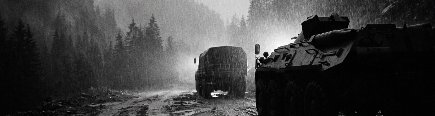

The Advance Along Highway 5
Over 150,000 troops of General Tomoyuki Yamashita's Shobu Group occupied the northern Luzon highlands. The Japanese 10th Division fortified the ridges above the approach route. They constructed mutually supporting bunker complexes and interlocking fields of Type 92 heavy machine-gun fire. Artillery coordinates were pre-registered. Archival evidence shows that the Japanese 39th Infantry Regiment possessed enough concentrated firepower to systematically dismantle the American vanguard.
The numerical superiority of the entrenched adversary generated a pervasive sense of inescapable dread.
In March 1945 the 25th Infantry Division advanced into the cloud-shrouded Caraballo Mountains along Highway 5. Major General Charles L. Mullins directed the 27th, 35th, and 161st Infantry Regiments northward from the secure lowland staging area at San Jose. Highway 5 was a single-lane dirt track winding through steep gorges toward Santa Fe and Balete Pass. Atmospheric conditions trapped dense stratus clouds at elevations below 2,000 feet. Visibility routinely dropped to less than thirty yards. This thick fog blanket neutralized American close air support. It blinded forward artillery observers. Back at division headquarters miles away from the front, staff officers plotted coordinates on two-dimensional topographic maps inside dry command tents. The physical distance created a severe information lag. Commanders relied on outdated field reports to draft their tactical plans. They ordered coordinated battalion-level sweeps without recognizing the steep terrain forced units into vulnerable single-file columns.
Radio signals from the SCR-300 backpack sets failed to penetrate the dense granite massifs.
Torrential rains transformed steep mountain inclines into knee-deep mud. Weather logs from the Army Air Forces meteorological detachments (NARA Record Group 18) recorded unseasonal downpours dropping several inches of precipitation per day throughout late March. The local volcanic soil and clay quickly liquefied into a thick paste. Heavy equipment failed immediately upon entering the ascent. The steel track pads on M4 Sherman tanks lost all traction on the 15-degree gradients. Driveshafts on 2.5-ton cargo trucks snapped under the extreme torque required to pull loads through the sludge. The 65th Engineer Combat Battalion attempted to stabilize the route by cutting timber for corduroy roads. Their unarmored bulldozers frequently slid off the unprotected sheer drop-offs into the ravines below. Artillery tractors bogged down completely. Supply lines permanently stalled as the mud swallowed the axles of transport vehicles. The physical environment defeated the internal combustion engine long before the vehicles reached the combat zone.
Frontline infantrymen hand-carried 81mm mortar shells up the final three miles to the line of contact.
Extreme environmental conditions left troops severely debilitated by trench foot and physical exhaustion. A close review of operational logs indicates that medical detachments began reporting mass casualties completely unrelated to enemy fire. Soldiers stood in waterlogged leather boots for up to seventy-two hours at a time. The constant exposure to cold water restricted blood flow to the extremities. Tissue necrosis and gangrene developed rapidly in the damp, unsanitary conditions. Quartermaster units failed to deliver dry socks or replacement footwear to the forward staging areas. Rations also stopped arriving at the front line. Infantrymen burned through thousands of calories climbing the vertical slopes while carrying sixty pounds of wet combat gear. They survived on a fraction of their daily required K-rations. Evacuation of the sick required four-man stretcher teams to navigate the same treacherous mud slides back down the mountain to the nearest battalion aid station. Battalion surgeons performed field amputations of necrotic toes inside unlit canvas tents. Rear echelon commanders continued transmitting orders over field telephones for aggressive frontal assaults against the ridgelines. Division headquarters received the casualty reports days after the infections had already incapacitated entire platoons.
Japanese Subterranean Fortifications on Kapintalan Ridge
Archival evidence shows that the Japanese 10th Division spent five months transforming the Kapintalan Ridge into an interlocking fortress system. General Yasuyuki Fujioka directed his combat engineering units to carve hundreds of subterranean fighting positions into the reverse slopes of the Caraballo Mountains. Troops excavated deep shafts. They drilled directly into the basalt and limestone bedrock. Construction battalions reinforced the ceilings with layers of thick mahogany trunks and packed earth. Camouflage netting woven from local vegetation covered the firing slits. A close review of operational logs indicates that the 39th Infantry Regiment positioned Type 92 heavy machine guns inside these fortified pillboxes. This created overlapping kill zones spanning every conceivable approach route up Highway 5. Each strongpoint contained enough ammunition and rations to sustain isolated garrisons for weeks. Communications trenches connected the primary bunkers to secondary spider holes. This subterranean network allowed defenders to shift positions seamlessly during artillery bombardments. The defensive belt spanned nearly three miles of jagged ridgeline.
The 25th Infantry Division headquarters operated completely unaware of this subterranean infrastructure.
High alpine ridges provided natural concealment against American ground reconnaissance detachments attempting to map the area. At elevations exceeding 3,000 feet, the terrain featured dense stands of eight-foot-tall cogon grass and impenetrable bamboo thickets. Japanese troops bent the surrounding vegetation over their firing ports. They tied living roots into the camouflage netting to ensure the foliage continued growing and matched the surrounding flora. Forward observers from the 27th Infantry Regiment stared through field glasses into unbroken green terrain. Foliage hid everything. Artillery spotter planes grounded by the perpetual fog could not provide aerial photographs of the defensive belt. Patrols sent forward to probe the lines frequently walked within ten yards of active bunkers without detecting the threat. Machine gunners held their fire until the American point elements moved entirely past the hidden embrasures. The muzzle blasts were entirely absorbed by the thick jungle canopy. Sound waves bounced off the steep ravine walls. This acoustic distortion made it physically impossible for surviving riflemen to triangulate the origin of the incoming fire.
Ground-level visibility rarely extended beyond fifteen feet in the dense alpine undergrowth.
Frontline infantry struggled to neutralize concealed positions without immediate direct fire support from heavy armor. The 161st Infantry Regiment launched a series of company-sized assaults up the 45-degree inclines of Kapintalan Ridge on April 6, 1945. Riflemen carried M1 Garands and fragmentation grenades. These weapons proved entirely ineffective against bunkers reinforced with five feet of packed earth and hardwood logs. The standard infantry tactic required M4 Sherman tanks to blast the firing slits with 75mm high-explosive shells while combat engineers maneuvered into range with M2 flamethrowers. Armor never arrived. The knee-deep mud on the lower trails had already stripped the assault companies of their armored support. Infantrymen attempted to suppress the bunkers using M1918 Browning Automatic Rifles. The .30 caliber rounds simply embedded into the timber ceilings. Bazooka teams fired 2.36-inch shaped charges at the camouflaged mounds. The wet clay absorbed the explosive jets. Pinned down in the open cogon grass, squad leaders frantically cranked the handles of their EE-8 field telephones to request 105mm artillery strikes.
The rear echelon command posts consistently denied these requests.
Battalion commanders located in the lowland staging areas five miles away ordered the pinned companies to continue the advance. Staff officers consulting two-dimensional map boards failed to grasp the physical impossibility of flanking the overlapping pillboxes on a narrow ridge. Platoon leaders on the ground watched their men get cut down by Nambu light machine guns while attempting to low-crawl through the mud. Combat engineers carrying seventy-pound flamethrower tanks slipped on the steep gradients. They became static targets for Japanese snipers strapped into the upper branches of towering banyan trees. Without direct fire from 37mm anti-tank guns to shatter the bunker embrasures, the American infantry could only advance by launching direct frontal assaults against the fortified slits. Ammunition bearers stripped belts of .30 caliber rounds from the bodies of fallen gunners to feed the few operational machine guns.
Command Isolation at the Lupao Headquarters
A close review of operational logs indicates that the 25th Infantry Division established its primary command post at the municipal center of Lupao. It was a lowland agricultural hub situated nearly twenty miles south of the active combat zone at Kapintalan Ridge. Signal Corps detachments erected heavy canvas command tents and strung miles of WD-1/TT field wire through the flooded rice paddies to connect the various staff sections. The physical separation between Major General Charles L. Mullins' staff and the forward rifle companies of the 161st Infantry Regiment generated a severe intelligence delay. Couriers driving Willys MB jeeps required up to six hours to navigate the rutted, mud-choked supply trails linking the rear staging areas to the forward battalion aid stations. Japanese artillery fire frequently severed the physical copper communication lines running alongside Highway 5. Wire repair teams from the 25th Signal Company suffered heavy casualties attempting to splice the cables in the open. By the time written situation reports reached the G-2 intelligence officers at Lupao, the tactical geometry on the ridge had completely changed.
Radio operators monitoring the SCR-299 mobile transmitters frequently recorded dead air.
Rear commanders relied on outdated topography maps that lacked accurate elevation data. Archival evidence shows these documents were printed from surveys conducted by the United States Coast and Geodetic Survey in 1922. Civilian surveyors originally drafted these sheets to facilitate agricultural tax assessments in the lowlands. The contour lines on the map boards featured intervals of one hundred feet. This broad scaling completely omitted massive terrain features. Deep ravines, eighty-foot limestone cliffs, and narrow ridgelines simply did not exist on the paper laid across the folding tables in the Lupao tents. Staff officers slid wooden markers across flat topographic sheets to represent battalion movements. They calculated march tables and approach routes based on a two-dimensional mathematical model that assumed a mostly flat incline. Artillery plotting centers attached to the command post used these same defective maps to calculate firing solutions for the 105mm and 155mm howitzer batteries. Fire direction officers factored in powder temperature, wind speed, and projectile weight. They based their baseline elevation metrics entirely on the flawed 1922 surveys.
The resulting coordinates directed high-explosive barrages into empty valleys.
Headquarters staff made strategic decisions in isolation from the frontline tactical environment. General Mullins and his operations officers issued daily field orders directing the 27th and 161st Infantry Regiments to conduct sweeping double-envelopment maneuvers. Written directives transmitted over the intermittent telephone lines instructed battalion commanders to flank the Japanese defensive line by marching through specific grid squares. Those designated grid squares contained vertical basalt walls and knee-deep mud slides. The officers at Lupao could not see the liquefied clay jamming the operating rods of M1 Garand rifles or the physical collapse of the infantrymen. They evaluated progress strictly through the lens of phase lines drawn in grease pencil on acetate overlays. When a rifle company failed to reach a designated map coordinate by nightfall, the rear echelon staff attributed the delay to a lack of aggression rather than the physical impossibility of ascending a forty-five-degree gradient under heavy machine-gun fire.
Platoon leaders receiving these orders via hand-cranked EE-8 field telephones were instructed to push forward regardless of casualties.
On April 14, 1945, the division operations center transmitted a direct order for Company G of the 161st Infantry to secure a specific high ground designated as Hill 1500. Operations officers at Lupao allocated a strict four-hour window for the assault. They calculated this timeline based on standard infantry marching speeds over flat terrain, expecting an advance rate of one mile per hour. The actual advance rate through the dense cogon grass and interlocking machine-gun fire was less than fifty yards per hour. Progressing toward Hill 1500 required troops to navigate a single-file goat path entirely exposed to Japanese Type 92 heavy machine guns. Forward observers attempted to relay the impossibility of the approach back to the headquarters. Signal degradation corrupted the transmissions into bursts of static. The division staff assumed the silence indicated compliance and ordered the 105mm batteries of the 8th Field Artillery Battalion to shift their protective barrages to the next phase line. The riflemen lost their covering fire just as they entered the primary Japanese kill zone.
Signal Attenuation and Fragile Landline Networks
Archival evidence shows that operators from the 25th Signal Company carried thirty-five-pound SCR-300 backpack transceivers up the steep approaches of the Caraballo Mountains in early April 1945. These frequency modulation units operated on a strict line-of-sight basis. The high alpine ridges blocking Highway 5 featured dense granite massifs rising over 4,000 feet into the cloud layer. Radio waves collided directly with the basalt walls and scattered into the surrounding ravines. Severe signal attenuation degraded the forty-megahertz carrier waves into unrecognizable static. Forward observers attached to the 161st Infantry Regiment attempted to transmit targeting coordinates to the 8th Field Artillery Battalion located in the lowlands. Topographic interference blocked the direct wireless transmissions entirely. Operators switched to the lower-frequency SCR-284 amplitude modulation sets in an attempt to bounce signals over the peaks. The heavy jungle canopy and atmospheric moisture absorbed the weaker radio frequency energy.
The alpine geography completely neutralized the primary wireless network of the American vanguard.
A close review of operational logs indicates that battalion commanders shifted entirely to hardwired communications by mid-April. Signalmen unspooled hundreds of miles of W-130 assault wire from hand-carried DR-8 reels. They laid the copper cables directly across the mud-choked trails leading toward Kapintalan Ridge. Units relied on these fragile landline wire chains to coordinate every tactical movement. The physical environment immediately degraded the exposed infrastructure. Unseasonal downpours triggered localized landslides that buried the wire splices under tons of liquefied clay. American M4 Sherman tanks slipping on the steep gradients frequently crushed the rubber insulation beneath their steel track pads. Japanese infantry patrols executed nightly raids specifically targeting the communication routes. Enemy soldiers used bayonets to sever the lines in multiple locations before retreating into the cogon grass. Frontline infantrymen depended on hand-cranked EE-8 field telephones to request emergency mortar support during these nighttime incursions. When a wire snapped, the connection died instantly. Two-man repair detachments had to physically trace the cables through the dark while under active sniper fire.
Linemen stripped the wet rubber insulation with their teeth to twist the copper threads back together.
This reliance on easily disrupted physical cables created severe information bottlenecks for the rear echelon staff stationed at Lupao. Headquarters personnel operated inside heavy canvas tents twenty miles south of the Kapintalan Ridge engagement zones. When the landlines failed, forward companies resorted to utilizing foot messengers. Couriers traversed the knee-deep mud and pre-registered Japanese artillery barrages for up to eight hours just to deliver a single handwritten situation report. The resulting communication delays completely masked real-time casualty figures from the division commanders. G-1 personnel updated their acetate status boards using data that was routinely forty-eight hours old. Major General Charles L. Mullins ordered coordinated battalion-level assaults based on these obsolete strength returns. On April 17, division headquarters directed Company E of the 161st Infantry to execute a direct frontal assault against a fortified pillbox network.
The rear command post did not know the company had already lost sixty percent of its riflemen.
Staff officers pushed the assault directive up the mountain over the few surviving intact wire lines. Platoon leaders received orders to advance with rifle squads that no longer physically existed. The delayed casualty reporting meant fire direction centers calculated rolling barrages for full-strength infantry screens that could not actually cover the assigned sector. Medical evacuation requests piled up at the forward battalion aid stations while the division operations center continued transmitting demands for aggressive forward movement. Company commanders on the ridge logged the incoming directives in their field books and stared at the decimated ranks of their units.
Artillery Miscalculations and Friendly Fire Incidents
A close review of operational logs indicates that the Fire Direction Center for the 8th Field Artillery Battalion operated completely blind on the morning of April 19, 1945. Staff officers situated at the Lupao headquarters twenty miles away relied on flawed 1922 civilian survey maps to plot heavy fire support missions. These topographic sheets featured one-hundred-foot contour intervals that failed to chart the jagged limestone drop-offs of the Caraballo Mountains. Forward observers attached to the 27th Infantry Regiment attempted to send corrected grid coordinates using SCR-300 backpack radios. Dense granite massifs and thick stratus clouds blocked the frequency modulation signals. The resulting static forced artillery spotters to rely on hand-carried written messages sent via foot couriers down the mud-slicked trails. This physical transit created a minimum four-hour delay between the time an infantry platoon requested heavy fire and the moment the howitzer crews received the target data. Officers inside the dry command tents slid wooden markers across two-dimensional map boards to track the assault. They calculated their firing solutions based on where the rifle companies had been positioned at dawn. Fire direction personnel factored in ambient air temperature, powder lot variations, and projectile weight using slide rules. They lacked any real-time tracking of the units advancing up the steep alpine incline.
The infantrymen had already advanced three hundred yards into the designated impact zone.
Archival evidence shows that the resulting miscalculation directed a concentrated barrage of high-explosive ordnance directly onto the forward elements of the 27th Infantry Regiment. Four batteries of M2A1 105mm howitzers elevated their barrels based on the uncorrected lowland map data. Gun crews loaded Zone 4 powder charges into the breeches to achieve the necessary range. The initial volley of M1 high-explosive shells was intended to strike a Japanese bunker complex on the reverse slope of a prominent terrain feature designated as Hill 1600. The flawed trajectory data caused the thirty-three-pound projectiles to fall entirely short of the ridgeline. They detonated directly within the perimeter of Company F. The riflemen were pinned down in the open cogon grass by Japanese Type 92 machine-gun fire and had no overhead cover. Point-detonating fuzes triggered the shells the instant they struck the wet clay. The blast overpressure flattened the eight-foot-tall vegetation in a fifty-yard radius around each impact crater.
Shrapnel ripped through the American lines at supersonic speeds.
The misdirected shelling shattered the American assault formation within seconds. Fragments of jagged steel casing tore through the unarmored infantrymen attempting to low-crawl up the forty-five-degree gradient. Platoon leaders frantically cranked the handles of their EE-8 field telephones to transmit an emergency cease-fire order. The first artillery salvo had already severed the W-130 copper communication wire laid across the ridge. Headquarters staff at Lupao continued to authorize sustained fire missions under the assumption that the barrage was successfully suppressing the Japanese defenders. Company F sustained severe casualties from their own supporting batteries. Medical personnel dragged wounded soldiers into shallow mud craters while 105mm shells continued raining down at a rate of four rounds per minute per gun. The concussive blasts liquefied the volcanic soil beneath the troops. The surviving rifle squads abandoned their weapons in the mud to dig frantic survival trenches with their bare hands. Battalion surgeons working in unlit canvas tents at the base of the mountain began receiving casualties suffering from massive blunt force trauma and traumatic amputations caused by American ordnance. Battalion commanders situated in the rear echelon staging areas interpreted the sudden halt in the advance as a failure of infantry aggression. They ordered subsequent waves of troops forward into the same active friendly fire zone.
The assault collapsed entirely.
Tactical Consequences of Blind Infantry Assaults
A close review of operational logs indicates that Major General Charles L. Mullins and his staff at the Lupao command post consistently issued directives for direct frontal ascents against heavily fortified Japanese positions. Throughout late April 1945, the 25th Infantry Division headquarters ordered the 161st Infantry Regiment to execute sweeping maneuvers up the 45-degree gradients of Kapintalan Ridge. Rear echelon officers drafted these attack vectors entirely without visual confirmation of the terrain. They directed rifle companies to advance in standard wedge formations through narrow defiles that physically restricted movement to a single-file column. Japanese combat engineering units from the 10th Division had previously excavated overlapping pillboxes into the basalt rock facing these exact approach routes. Defenders armed with Type 92 heavy machine guns waited behind five-foot-thick earth and mahogany barricades. American infantrymen stepped off the line of departure carrying sixty pounds of wet combat gear. Their M1 Garand operating rods immediately jammed with the liquefied volcanic clay. Without heavy armor support to shatter the bunker embrasures, the infantry had no tactical alternative but to climb directly toward the muzzle flashes. Battalion commanders situated five miles to the rear ignored the mounting casualty reports. They repeatedly ordered the pinned squads to stand up in the open cogon grass and charge the hidden firing slits.
The officers at Lupao plotted these daily ascents using grease pencils on flat acetate overlays.
Archival evidence shows that severe communication delays prevented forward platoon leaders from countermanding these fatal directives. The primary communication infrastructure relied entirely on fragile W-130 copper wire unspooled across the mud-choked trails. Japanese mortar shells and localized landslides routinely severed these landlines. When a company commander on the ridge identified an unmapped bunker complex blocking the designated path, he could not immediately reach the division operations center to abort the assault. Hand-cranking the generator on the EE-8 field telephone yielded only dead air. Officers were forced to dispatch foot couriers back down the mountain to the nearest intact relay station. These messengers required up to eight hours to navigate the steep, rain-slicked ravines while evading sniper fire. By the time a handwritten request to alter the tactical plan reached the G-3 staff twenty miles away in the lowlands, the mandated zero hour had already passed. Frontline lieutenants received explicit written orders to secure specific grid coordinates by a set time. They possessed no functional means to transmit the physical impossibility of the task back to their superiors. The rigid command structure demanded compliance with the last received instruction.
The isolated rifle companies executed the frontal assaults precisely on schedule.
When examining the historical record, the engagements along Highway 5 expose the severe operational hazards generated by headquarters isolation during high-altitude mountain warfare. The physical detachment of the Lupao command post created an impenetrable information bubble. Staff officers situated at zero elevation drafted combat orders for units operating above 3,000 feet in dense stratus clouds. They relied on 1922 civilian agricultural maps featuring one-hundred-foot contour intervals that completely omitted eighty-foot vertical limestone cliffs. A two-dimensional map board could not convey the topographic dimensions of a vertical granite massif or the impassable nature of the knee-deep mud. Because the G-2 intelligence officers never experienced the physical exhaustion of the ascent or the acoustic distortion of the jungle canopy, they attributed the stalled advances to poor unit leadership. They responded by transmitting increasingly aggressive demands for forward momentum. On April 24, the division headquarters ordered Company K of the 161st Infantry to bypass a supposed minor delay and secure a ridge crest by 1700 hours. The designated route required the men to scale a sheer rock face covered by three interlocking Nambu light machine guns.
Company K suffered forty-two casualties in the first fourteen minutes of the approach.