
Prewar Aerial Reconnaissance Equipment Deficits on Oahu
A frantic radio broadcast on the 2410 kilocycle band logged an urgent priority contact from a patrol aircraft reporting unidentified inbound targets at azimuth 357. The transmission demanded immediate vector instructions from a headquarters operating completely blind. Archival evidence shows the commanders inside the Pacific Fleet operations center at Pearl Harbor could not verify the threat parameters. Their situational awareness ended abruptly at the Hawaiian coastline. Staff officers sat in unventilated offices waiting for photographic intelligence that never arrived.
The intelligence failure stemmed directly from missing hardware.
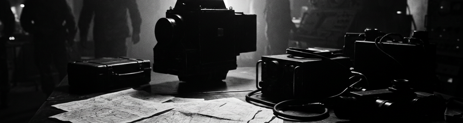
A close review of operational logs indicates Pacific Fleet aviation units lacked adequate standardized aerial cameras prior to the outbreak of hostilities. Requisitions sent to the Bureau of Aeronautics in Washington D.C. routinely expired without fulfillment. Patrol Wing Two operated a fleet of PBY Catalina flying boats equipped with empty camera bays. This unit held responsibility for scanning the vast expanses of the northern Pacific approaches from Oahu. Production bottlenecks on the East Coast severely delayed shipments of the standard Fairchild K-3B and K-17 aerial cameras required for high-altitude vertical mapping. These specific camera systems utilized heavy motorized film magazines and specialized 12-inch cones designed to capture wide swaths of the ocean surface from an altitude of ten thousand feet. Engineers designed the K-17 with an intervalometer. This mechanical timer automatically tripped the shutter to take overlapping photographs for continuous strip mapping. Without these units, squadrons possessed no mechanism to record clear images of surface vessels beyond the visual range of the pilots. Command decisions at the highest levels prioritized the shipment of torpedoes and .50 caliber ammunition over reconnaissance optics. Planners in the Hawaii headquarters drafted daily patrol sectors stretching hundreds of miles into the Pacific. Aircrews flying those sectors had no way to bring back visual proof of what they saw.
They flew blind.
When examining the historical record, it becomes clear that the men on the ground attempted to engineer their own solutions to this equipment deficit. Prior to December 1941, Ford Island naval air technicians improvised civilian camera mounts due to severe shortages of standardized reconnaissance equipment. Mechanics inside the Assembly and Repair shops at Naval Air Station Ford Island began purchasing commercial Graflex Speed Graphic cameras from local Honolulu photography stores on Hotel Street. The technicians hauled these civilian cameras back to the machine shops and began fabricating custom aluminum brackets. Using drill presses, lathes, and scrap metal salvaged from damaged aircraft cowlings, ground crews built crude wooden and metal frames to hold the cameras over the ventral hatch openings of the PBYs. Commercial Graflex units lacked the heavy-duty gyroscopic stabilization and vibration dampening required for aviation use. The rigid locally machined brackets transferred the continuous heavy vibration of the twin Pratt & Whitney R-1830 Twin Wasp engines directly into the camera bodies. Altitude presented another severe mechanical hurdle. Focal plane shutters on the civilian models jammed frequently due to the freezing temperatures in the unheated aircraft compartments.
The resulting photographs were often completely blurred by the mechanical shaking of the airframe.
Technicians tried inserting rubber gaskets cut from discarded tires between the aluminum mounts and the aircraft hull. These improvised rubber pads failed to absorb the low-frequency engine vibrations. Officers commanding the Pacific Fleet sat at their desks inside the reinforced concrete walls of the Makalapa crater headquarters reviewing these unreadable photographs. Delayed communications from the patrol planes forced the staff to make blind strategic decisions regarding fleet positioning based on verbal radio reports rather than hard photographic evidence. A report filed by the base photographic officer on November 28, 1941, detailed the total structural failure of three locally fabricated camera mounts during routine patrol flights (NARA Record Group 80). During one such failure, aluminum brackets sheared off entirely at the mounting bolts. Heavy civilian cameras dropped straight into the bilges of the aircraft.
Administrative Routing Channels and Delayed Intelligence Transit
A close review of congressional testimony from January 1946 reveals the exact bureaucratic mechanisms that delayed the flow of visual information at Pearl Harbor. During the Joint Committee on the Investigation of the Pearl Harbor Attack proceedings, senior intelligence officers detailed how delayed photographic reconnaissance reports were trapped in administrative routing channels for days. The committee examined the specific path a roll of aerial film took from the moment a Patrol Wing Two PBY Catalina touched down in the waters off Ford Island. Aircrews handed the exposed nine-inch film canisters to a ground crewman. This crewman drove the undeveloped negatives in a standard military jeep to the base photographic laboratory. Technicians processed the silver halide film in unventilated darkrooms using standard chemical baths, hanging the wet prints to dry on wire lines strung across the ceiling. Once the prints dried, the physical photographs entered a rigid chain of custody mandated by peacetime naval regulations. Couriers placed the images into heavy manila envelopes and walked them to the District Intelligence Office of the 14th Naval District. Clerks logged the arrival of the envelope into a thick canvas-bound ledger book using a fountain pen. They recorded the exact minute of transfer with a heavy mechanical timestamp machine that punched purple ink onto the paper.
The physical transit of these manila envelopes added hours to the intelligence cycle.
Administrative procedures required multiple layers of sign-offs before aerial photography reached fleet commanders inside the Makalapa headquarters. Archival evidence shows that a standard reconnaissance photograph of a suspected contact off the coast of Oahu required a minimum of four distinct physical signatures on Naval Form 314. A junior photographic interpretation officer first examined the eight-by-ten inch contact prints using a brass magnifying loupe to identify surface vessels or unusual wake patterns. This officer filled out the routing slip, attaching it to the photograph with a metal paperclip, and signed his name in the first designated box in blue ink. A runner then carried the file across the naval yard to the Combat Intelligence Unit. A senior analyst reviewed the initial assessment at this location. Peacetime protocols dictated that the senior analyst cross-reference the visual evidence with known civilian shipping registries and merchant marine schedules before signing the second box on the routing slip. The file then traveled by open motor launch across the main harbor channel from Ford Island to the submarine base docks. A staff car retrieved the courier at the pier and drove the documents up the steep hill to the Pacific Fleet operations center.
The chain of custody prioritized accountability over speed.
Inside the reinforced concrete walls of the headquarters, the isolation of the commanders deepened with every administrative delay. The Fleet Intelligence Officer received the packet next, requiring a third signature to authorize the distribution of the imagery to the war planners. Staff officers operating in the windowless rooms made blind strategic decisions about fleet dispositions based on outdated textual summaries while the actual photographs sat in wooden physical inboxes waiting for a signature. Commanders ordered destroyer patrols to guard empty stretches of water based on unverified radio chatter from two days prior. By the time the routing slip acquired the fourth and final sign-off from the Chief of Staff, twenty-four to forty-eight hours had elapsed since the camera shutter clicked over the ocean. A target vessel traveling at fifteen knots could cover three hundred and sixty nautical miles in that time frame. The ship captured in the photograph had long since departed the geographic coordinates listed on the report. A post-war audit of the 14th Naval District records introduced during the 1946 hearings identified one specific instance in late November 1941 where a photograph of an unidentified submarine contact at latitude 21 degrees 15 minutes north, longitude 158 degrees 20 minutes west took thirty-six hours to reach Admiral Husband E. Kimmel.
The final routing slip bore five separate date stamps from three different administrative offices.
Command Isolation Within Pacific Fleet Operations
The crisis opened with a fragmented high-frequency burst on the 500 kilohertz distress band. The operator transmitted a frantic contact report of multiple heavy surface wakes spotted near bearing 350, distance 150 miles, before the signal dissolved completely into atmospheric static. Archival evidence shows that inside the reinforced concrete walls of the Makalapa crater, Pacific Fleet operations officers received this garbled intercept and faced a total blackout of actionable intelligence. Senior naval leadership operated within a headquarters bubble making strategic decisions isolated from the actual conditions experienced by their scouting squadrons hundreds of miles offshore. Admiral Husband E. Kimmel and his immediate staff sat at large plotting tables covered in paper charts. They attempted to position a Pacific Fleet using outdated textual summaries and unverified radio chatter. The physical architecture of the headquarters itself contributed to this detachment. The facility featured thick blast doors, windowless rooms, and heavy ventilation systems that drowned out the ambient noise of the naval base outside. Heavy steel bulkheads encased the plotting rooms, severing all visual and auditory connection to the physical environment of the harbor. Commanders inside this bunker had absolutely no visual concept of the atmospheric conditions, cloud cover, or mechanical failures plaguing the PBY Catalinas flying the northern approach vectors. They drew grease pencil lines on acetate map overlays to dictate patrol sectors, assuming the aircrews possessed the optical equipment to execute these sweeps effectively. This severe disconnect meant that when a junior radioman handed a transcribed distress intercept to the duty officer, the command staff possessed no mechanism to corroborate the azimuth or the speed of the reported targets. They dispatched the heavy cruiser USS Indianapolis to intercept coordinates based entirely on unverified Morse code transcriptions.
The men drawing the defensive perimeters could not see the ocean.
A close review of operational logs indicates that delayed communications created severe intelligence lag between the airborne scouting squadrons and the Pacific Fleet command staff. The technical limitations of the Model TBK high-frequency radio transmitters installed in the patrol aircraft required pilots to manually tap out Morse code using heavy brass keys while wrestling with the flight controls in turbulent air. These bulky transmitters relied on trailing wire antennas that crews had to manually reel out from the fuselage. This system proved highly prone to snapping in high winds. Atmospheric interference and ionospheric skip frequently caused these fragile high-frequency signals to bounce completely over the receiving antenna arrays at Naval Air Station Kaneohe Bay. This forced aircrews to repeat their contact reports dozens of times before the base operators acknowledged receipt. Once a signal finally penetrated the static, radiomen at the Naval Communications Station in Wahiawa had to manually transcribe the dots and dashes onto paper forms. Cryptographers then fed these raw transcriptions through the ECM Mark II cipher machines to decrypt the operational codes. This mechanical process involved complex rotor settings that consumed up to forty-five minutes per message. This decrypted text traveled by physical teletype machine down a copper wire to the Makalapa headquarters. A messenger tore the paper strip from the receiver and walked it to the intelligence desk.
Time delays compounded at every physical transfer point.
By the time a senior intelligence officer read the decoded message, the tactical situation on the water had completely changed. A target vessel reported moving at twenty-two knots could easily traverse sixteen nautical miles between the moment a pilot depressed his transmission key and the moment a staff officer placed a wooden ship token on the plotting board. When examining the historical record, the severe consequences of this delay become apparent in the specific command decisions made during late November 1941. Task Force 8 sortied into heavy seas based on contact reports that were completely obsolete by the time the destroyers cleared the anti-torpedo nets guarding the Pearl Harbor entrance channel. The headquarters staff continuously issued course corrections to these warships using the same sluggish encrypted transmission chain. They effectively attempted to intercept fast-moving surface contacts using data that was chronically two to three hours old. Operations officers stood over the plotting tables pushing small wooden blocks representing destroyers and cruisers across the grid. They remained unaware that the physical locations of their actual ships differed wildly from the map due to dead reckoning errors and sea currents. Commanders debated the validity of submarine sightings reported off the coast of Kauai, waiting for confirmation from a second patrol plane that also suffered from the exact same radio transmission bottlenecks. The entire command structure functioned on a permanent time delay.
The plotting boards displayed ship positions that no longer existed.
Improvised Hangar Darkrooms and Emergency Chemical Processing
A close review of operational logs indicates that the Japanese attack systematically destroyed the primary photographic processing infrastructure at Naval Air Station Ford Island by 0945 on December 7, 1941. Armor-piercing bombs detonated adjacent to the seaplane ramps. High-velocity shrapnel tore directly through the unreinforced cinderblock walls of the base photographic laboratory. The concussions shattered every glass chemical tray and collapsed the ventilation shafts required to exhaust toxic developing fumes. Aerial reconnaissance crews from Patrol Wing Two returned from emergency search vectors in the early afternoon with exposed nine-inch film rolls containing visual data of the northern Pacific approaches. The staff officers trapped inside the Makalapa crater headquarters demanded immediate processing of these negatives to locate the retreating enemy carrier strike force. The physical facility required to develop this intelligence no longer functioned.
Photographers stood in a room filled with pulverized concrete and spilled acetic acid.
Archival evidence shows that enlisted combat photographers attached to Utility Squadron One immediately began constructing improvised temporary darkrooms inside the heavily damaged skeleton of Hangar 6. Chief petty officers directed ground crews to drag intact workbenches into the center of the concrete hangar deck, positioning them away from the gaping holes in the corrugated steel roof. Technicians salvaged heavy black canvas engine tarpaulins from wrecked PBY Catalinas and nailed them over the shattered window frames to block external light. The men built crude light-tight processing tents by draping surplus heavy wool blankets over wooden scaffolding originally used for engine maintenance. Inside these unventilated enclosures, mechanics replaced the destroyed stainless steel processing tanks with empty 55-gallon aviation lubricant drums that had been scrubbed with aviation fuel and rinsed. The K-17 camera film magazines held up to two hundred feet of continuous negative roll, requiring large-capacity vats for the chemical baths. The film base consisted of a highly flammable cellulose nitrate compound that degraded rapidly if exposed to the humid Hawaiian air. The photographers unspooled these massive rolls by hand. They relied entirely on physical touch to guide the film through the developer, stop bath, and fixer solutions while standing on concrete floors covered in standing water and aviation grease.
The temperature inside the tarpaulin enclosures routinely exceeded one hundred degrees.
The destruction of the island water mains presented a severe mechanical hurdle to the chemical processing of the search imagery. A standard roll of aerial reconnaissance film required hundreds of gallons of clean flowing water to wash away the residual sodium thiosulfate fixer and prevent the silver halide emulsion from rapidly degrading into a yellow unreadable state. The pressure drops in the municipal pipes forced command staff to redirect civilian fire trucks from Honolulu to pump brackish water directly from the harbor into the base reservoirs. When examining the historical record, base engineering reports detail how technicians developed reconnaissance film using emergency water supplies hauled by hand under strict blackout conditions following the air raid. Ground crews filled canvas buckets with untreated water drawn from the shattered municipal pipes pooling in the bomb craters along the seaplane apron. Other mechanics siphoned distilled water directly from the battery compartments of damaged diesel-electric submarines moored at the nearby submarine base. They transported the liquid in five-gallon glass carboys strapped to the back of military jeeps. The photographers poured this rationed water into the salvaged oil drums, manually agitating the wet negatives using wooden paddles cut from shattered desk drawers.
The water supply ran out every thirty minutes.
Military police enforced absolute blackout regulations across the entirety of Oahu as night fell on December 7, plunging the Ford Island hangars into total darkness. The enlisted men processing the film operated without the standard red safelights. They worked entirely blind while handling highly sensitive reconnaissance negatives that represented the only visual intelligence available to the Pacific Fleet. Chemical fumes from the developer solutions accumulated rapidly inside the unventilated tarpaulin structures, causing the technicians to suffer severe eye irritation and respiratory distress. Personnel rotated in and out of the canvas tents every fifteen minutes to avoid passing out from the concentrated ammonia vapors. Once the film finally passed through the washing stage, ground crews strung the wet negatives across the hangar rafters using safety wire salvaged from parachute rigging. Flashlights equipped with heavy blue filters provided the only illumination as junior intelligence officers examined the dripping film segments with brass magnifying loupes, searching for the wake patterns of Japanese aircraft carriers. A courier collected the damp contact prints, placed them in a leather satchel, and boarded a motorized whaleboat to cross the debris-filled harbor channel toward the Makalapa headquarters. The final processed image of a suspected enemy submarine contact at latitude 22 degrees 10 minutes north reached the Pacific Fleet operations center at 0415 on December 8.
Post Attack Search Imagery and Degraded Dispatch Systems
Archival evidence shows that by 1130 hours on December 7, surviving aircrews from Patrol Squadron 14 managed to launch three undamaged PBY Catalinas through the thick black smoke obscuring the Kaneohe Bay seaplane ramps. Ground crews cranked the inertia starters by hand, bypassing the damaged electrical grid to fire the twin Pratt & Whitney engines. Pilots shoved the throttles to emergency power, lifting the heavy flying boats off the water to execute desperate sector searches to the north. Enlisted radiomen operating in the rear blister compartments aimed heavy K-20 handheld aviation cameras through the plexiglass, capturing high-contrast black-and-white exposures of the ocean surface. They documented the lingering white foam of heavy surface wakes left by Vice Admiral Chuichi Nagumo's retreating carrier strike force. The film magazines contained hard verifiable coordinates of the Japanese withdrawal path near latitude 24 degrees 30 minutes north.
The physical film had to cross an active disaster zone to reach the war planners.
A close review of operational logs indicates that the transit of these exposed negatives from the aircraft to the Makalapa headquarters suffered severe mechanical and bureaucratic breakdowns. When the Catalinas landed back at the debris-choked Ford Island channel, the aircrews handed the metal film canisters to couriers who possessed no standardized transport. The primary naval motor pool lay in ruins from the dive-bomber attacks. Runners commandeered civilian bicycles or sprinted on foot across the tarmac while dodging unexploded ordnance. Once the improvised darkroom teams developed the negatives in their salvaged oil drums, the resulting damp contact prints entered a severely degraded dispatch system. Peacetime naval regulations still required physical signatures on dispatch slips, even as the base burned. Messengers carrying the leather satchels full of intelligence stood on the Ford Island ferry landing waving down any passing watercraft. The harbor waters were covered in a thick layer of burning bunker fuel leaking from the shattered hull of the USS Arizona. Motor whaleboats crossing this channel had to run their diesel engines at minimum idle to avoid sucking floating debris and heavy ash into their cooling intakes. This mechanical restriction reduced a standard ten-minute crossing to a grueling forty-five-minute crawl through toxic smoke.
Sentries enforcing martial law at the submarine base docks halted the couriers at bayonet point to verify identification badges.
By the time the messengers cleared the security checkpoints and ran up the hill to the Pacific Fleet operations center, the tactical value of the photographs had expired. Officers operating inside the reinforced concrete bunker tore open the manila envelopes under harsh electric lighting, examining the damp eight-by-ten prints with brass loupes. The imagery clearly displayed the distinct parallel wake signatures of heavy fleet carriers heading northwest at high speed. Analysts cross-referenced the wake dispersion patterns against known ship silhouettes to confirm the presence of Shokaku-class vessels. A heavy mechanical timestamp punched onto the back of the routing slip read 1315 hours. The wall clock inside the windowless plotting room showed 1940 hours.
The enemy fleet had been steaming away at twenty-six knots for over six hours.
When examining the historical record, this specific time lag directly crippled the American counter-strike efforts. Admiral Husband E. Kimmel and his staff desperately needed these precise coordinates to vector Vice Admiral William Halsey's Task Force 8, centered around the aircraft carrier USS Enterprise, into an interception angle. Halsey was operating entirely blind two hundred miles west of Oahu. He launched his own Douglas SBD Dauntless dive bombers on futile searches based on erroneous submarine sightings. The operations officers at Makalapa tried to transmit the newly acquired photographic coordinates to the Enterprise via high-frequency Model TBK radio transmitters. Ionospheric interference and the strict radio silence protocols maintained by the carrier task force delayed the transmission by another three hours. The plotted interception point required Halsey to reverse course and steam north through heavy Pacific swells. Nagumo's Kido Butai had already crossed the 26th parallel north, moving completely beyond the maximum operational combat radius of the American carrier aircraft. Operations staff slid the wooden blocks representing the Japanese carriers off the edge of the acetate map overlay entirely.
Congressional Testimony and Postwar Reconnaissance Doctrinal Shifts
A close review of congressional testimony from January 1946 reveals the exact administrative failures that caused the intelligence lag inside the Makalapa crater. During the Joint Committee on the Investigation of the Pearl Harbor Attack, lawmakers examined the specific physical pathways used to distribute visual data across the 14th Naval District prior to the Japanese strike. Senior officers testified under oath regarding major structural flaws in naval intelligence distribution, detailing a system entirely dependent on peacetime administrative routing. Prior to December 1941, the Pacific Fleet possessed no secure teletype networks or pneumatic tube systems capable of transmitting photographic intelligence directly from the Ford Island laboratories to the command bunker. Committee members analyzed the physical chain of custody for Naval Form 314, the standard routing slip attached to all aerial reconnaissance prints. The investigation found that standard operating procedures required enlisted personnel to hand-carry contact prints between five separate administrative buildings scattered across three miles of the Pearl Harbor naval yard.
Couriers transported these manila envelopes on foot through heavily trafficked motor pools.
Former staff officers explained to the congressional committee that this rigid courier system physically isolated the war planners from their own scouting squadrons. Once a PBY Catalina landed, ground crews drove the undeveloped film to the District Intelligence Office, where clerks logged the materials in canvas-bound ledgers using heavy mechanical timestamp machines. The film then traveled to the Combat Intelligence Unit for initial review before a messenger boarded a motor whaleboat to cross the main harbor channel. The committee audit of the December 1941 logs demonstrated that this specific sequence caused a minimum thirty-six-hour delay in delivering contact reports to Admiral Husband E. Kimmel. Commanders operating inside the windowless plotting rooms of the Pacific Fleet headquarters made strategic decisions based on outdated textual summaries because the actual photographic evidence sat trapped in transit. Lawmakers documented instances where operations officers dispatched heavy cruisers to intercept coordinates based on unverified radio chatter while clear photographs of empty ocean sectors sat in physical wooden inboxes awaiting a third administrative signature.
A single reconnaissance photograph required four separate ink signatures before reaching the plotting tables.
Archival evidence shows that the operational vulnerabilities exposed on December 7 forced an immediate and total overhaul of interwar reconnaissance doctrines. Throughout the 1920s and 1930s, naval aviation doctrine treated photographic reconnaissance as a secondary non-specialized function. Planners assigned these duties to standard patrol squadrons flying slow flying boats equipped with improvised civilian cameras and uncalibrated lenses. The prewar doctrine relied on pilots attempting to estimate target headings and speeds visually, transmitting these guesses via fragile high-frequency radio bursts. Following the total collapse of this system during the Pearl Harbor attack, the Bureau of Aeronautics issued emergency directives completely restructuring how the United States Navy gathered visual data. Planners established dedicated Photographic Squadrons, designating the first units as VD-1 and VD-2.
The Bureau of Aeronautics stripped the reconnaissance mission from the general patrol wings entirely.
Naval engineers equipped these new specialized squadrons with heavily modified PB4Y-1 Liberator bombers and F4U Corsair fighters featuring custom ventral camera bays. Technicians designed these bays specifically to house the Fairchild K-17 and K-18 high-altitude mapping cameras, utilizing specialized 24-inch focal length cones and heavy motorized film magazines. To process the massive volume of visual data generated by these new platforms, the Navy established the Joint Intelligence Center Pacific Ocean Areas, centralizing all photographic interpretation under one unified command structure. This doctrinal shift bypassed the old 14th Naval District routing channels completely. Specially trained photographic interpretation officers met the returning aircraft directly on the flight deck, retrieving the K-17 film magazines while the engine rotors still spun.
Technicians processed the cellulose nitrate negatives inside temperature-controlled shipboard darkrooms.
The physical architecture of fleet intelligence moved from static shore-based laboratories to specialized Amphibious Force Flagships designated as AGCs. These command vessels deployed directly into the combat zones, operating immediately behind the carrier strike groups. Engineers installed high-capacity radio-facsimile transmitters inside the communication compartments of these flagships. This allowed analysts to broadcast low-resolution target images directly to the fleet over encrypted high-frequency bands. The time delay from camera shutter to command plotting board dropped from forty-eight hours to less than three hours. Automated chemical agitation tanks replaced the salvaged aviation lubricant drums previously used for emergency film development on Ford Island. The centralized intelligence teams analyzed the wet negatives using specialized stereoscopic viewers to calculate the exact dimensions and armor thickness of Japanese surface vessels before the prints even dried. Standardized grid coordinates reached the carrier strike groups via direct teletype wire.