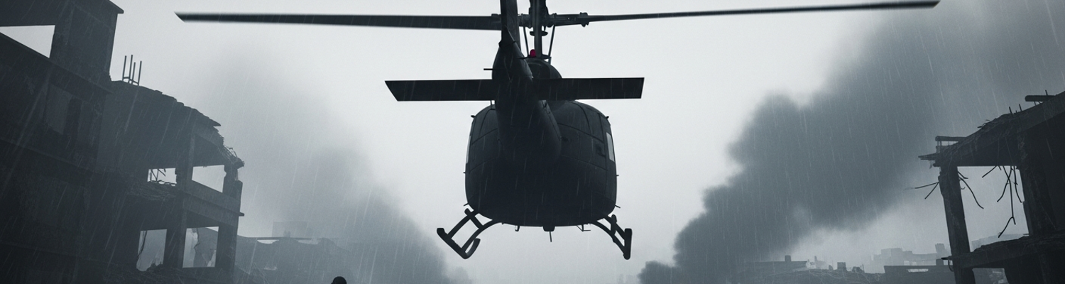

Hue City Urban Warfare Environment
The order was impossible from a military-technical standpoint. Retake Hue.
The Tet Offensive’s suddenness on January 31, 1968, turned the ancient city from a protected cultural center into the war’s most significant symbolic objective. Before Tet, Hue was a place of deep historical and religious importance, largely spared the violence that had engulfed much of the country. This status shattered when division-sized elements of the North Vietnamese Army (NVA) and Viet Cong (VC) forces, initially estimated at 8,000 but later revised to over 12,000, infiltrated and seized almost the entire city overnight. A close review of operational logs (MACV J-2) indicates Military Assistance Command, Vietnam was caught completely unprepared. Its intelligence apparatus was focused on the developing siege at Khe Sanh. The NVA’s objective was not just military but political. They intended to hold the city and establish a revolutionary government. This act of capturing the imperial capital was a profound psychological blow aimed at the heart of South Vietnam. Its recapture became an absolute political and military necessity for Washington and Saigon.
The city itself would become the primary weapon.
Archival evidence shows a battlespace defined by its intimacy. Hue was divided by the Perfume River. To the north lay the Citadel, a massive 19th-century fortress with stone walls several feet thick, surrounded by a moat. To the south was the modern city. NVA and VC forces had occupied both, turning the dense urban landscape into a fortress. The fighting that ensued was a grinding, house-to-house affair. Visibility was often reduced to meters by monsoon rains and the constant smoke from explosions and fires. Streets became perfect channels for machine-gun fire. Every window, sewer grate, and pile of rubble concealed a potential enemy. U.S. forces found their standard-issue M16 rifles were often incapable of penetrating the thick masonry walls of the older buildings. This forced a grim adaptation. Marines and soldiers had to rely on direct-fire support from M48 tanks, the multiple 106mm recoilless rifles of the M50 Ontos, and even anti-aircraft "Duster" vehicles used in a ground-support role. Progress was measured in individual buildings cleared, not kilometers gained. After-action reports from units like the 1st Battalion, 5th Marines, noted advances of only a few blocks over weeks of intense combat with casualty rates approaching 50 percent.
Command had a plan.
The initial U.S. operational objectives were, on paper, straightforward. Relieve the besieged ARVN 1st Division headquarters inside the Citadel and the MACV compound in the southern city, then methodically clear all enemy forces. The execution was divided. U.S. Marine Corps units, primarily from the 1st and 5th Marine Regiments, were tasked with clearing the modern city south of the river. U.S. Army elements, most notably the 1st Cavalry Division, were assigned to interdict NVA supply lines from the west and prevent reinforcements from reaching the city. This was a classic airmobile task that proved exceedingly difficult. A disconnect existed between the strategic goal of a swift victory and the tactical conditions on the ground. The initial deployment of forces was made with limited information. Reinforcements were committed piecemeal as the true scale of the NVA/VC presence became horrifyingly clear. Political reluctance to use heavy firepower to avoid destroying the historic city further hampered early efforts. This restriction was lifted only when the cost in American lives became undeniable. The block-by-block clearing operation was agonizingly slow and costly, with the battle for Hue lasting over a month and becoming one of the longest and bloodiest engagements of the war.
Distant Command Planning Imperatives
Operational logs show the commanders tasked with retaking Hue were insulated from the fight. Distance and doctrine were the walls. The senior U.S. Marine headquarters, Task Force X-Ray, operated from Phu Bai Combat Base, a major support facility located eight miles south of the city down Highway 1. Here, Brigadier General Foster LaHue and his staff attempted to orchestrate the battle from tactical operations centers, surrounded by maps that reduced the ancient capital to a grid of sterile squares. Communication with the front-line units fighting house-to-house was funneled through layers of command, primarily via AN/PRC-25 radios. These links were consistently hampered. The thick masonry of Hue’s buildings and the monsoon rains degraded radio signals. Platoon and company leaders were often isolated, forced to make decisions with intermittent guidance. Information flowing back to Phu Bai was consequently delayed and stripped of context. A request for fire support, a report of a machine gun nest, or an update on casualties had to travel up the chain, get plotted on a map, and then factored into a plan often obsolete by the time it was issued. The separation was both physical and electronic. It created a deep disconnect. At Phu Bai, commanders saw a two-dimensional map of symbols. Their Marines fought in a three-dimensional hell of street corners and windows.
The command bubble was a fragile construct.
This detachment was amplified by a failure of intelligence. Prior to the Tet Offensive, Hue was considered a safe, open city. As a result, MACV’s intelligence apparatus was almost entirely focused elsewhere, most notably on the developing siege at Khe Sanh, which was perceived as the primary enemy objective. The initial reports on January 31st were chaotic, fragmentary, and dangerously underestimated the enemy’s strength. Archival evidence from Task Force X-Ray’s G-2 section (Record Group 127) reveals an initial assessment that only a small enemy force had infiltrated the city, likely as a diversion. Based on this flawed picture, General LaHue dispatched a single company from the 1st Battalion, 1st Marines, to relieve the besieged MACV compound. The force was entirely inadequate for the task. Reconnaissance efforts to correct this picture were stymied by heavy monsoon weather, which grounded many aerial observation flights. The intelligence that was gathered, often from high-altitude photo-reconnaissance, was of limited use for identifying enemy forces dug into the dense urban terrain. Planners were forced to rely on the confused, desperate reports from the handful of American advisors in the MACV compound and the first Marine units that fought their way into the city’s southern sector. For the crucial first days of the battle, American command was effectively blind. Forces were committed piecemeal.
Planners, lacking reliable, real-time intelligence, fell back on established doctrine. They attempted to impose order on a fluid, chaotic urban battle by using the tools of conventional warfare. Airmobile assets from the 1st Cavalry Division were tasked with interdicting enemy supply lines west of the city, a classic mission for which the unit was designed. The NVA, however, had already established fortified positions and resupply routes that were difficult to pinpoint from the air, especially in poor weather that kept helicopters flying at treetop level. On the maps at Phu Bai, commanders drew phase lines for the Marines’ advance through southern Hue, designating objectives like the Thua Thien Provincial Headquarters with an authority that belied the conditions on the ground. These lines and objectives presumed a degree of control over the battlespace that did not exist. NVA and VC fighters used sewers, back alleys, and holes knocked through adjoining walls to maneuver, rendering American map coordinates almost meaningless. An area marked as “cleared” could have enemy fighters reappear within minutes. This created the conditions for catastrophe, where fire support like artillery or air strikes was requested on positions believed to be held by the enemy based on intelligence that was hours old. The approval of a fire mission on a specific grid coordinate became an act of faith in outdated information.
Helicopter Insertion Challenges
The sky above Hue offered no safe passage.
A review of operational logs from the 1st Cavalry Division shows that the doctrine of airmobility, so effective in open jungles, was nearly nullified by the city’s physical structure. Helicopter landing zones were not expansive, pre-cleared fields but improvised, constricted spaces. Pilots of UH-1 Huey transports were forced to identify and descend into small city parks, wide intersections, or the boat ramp area along the Perfume River. Each potential LZ was a study in geometric impossibility, flanked by multi-story buildings, dense trees, and a web of power lines. These obstacles forced pilots into steep, predictable, and highly vulnerable final approach paths. North Vietnamese Army and Viet Cong forces, equipped with heavy machine guns and RPGs, understood this. They did not need to see the helicopter. They only had to aim at the predictable entry points above the LZs. The tight confines created a 360-degree kill box, with enemy gunners able to engage the aircraft from surrounding rooftops, windows, and rubble piles during the most critical phases of flight: the final descent and the stationary hover.
The ground was disappearing.
This vertical battlespace was choked by an impenetrable mixture of weather and war. The northeast monsoon season shrouded the city in a perpetual low-hanging overcast, with fog and drizzling rain frequently reducing visibility to near zero. This natural phenomenon was compounded by the man-made environment of the battle. Thick, black smoke from burning buildings and vehicles mingled with the fine, gritty dust kicked up by artillery and tank rounds. The air was a disorienting soup of cordite, smoke, and mist. For Huey pilots attempting to fly at treetop level to avoid heavy anti-aircraft fire, this created an almost insurmountable challenge. They were too low for instrument flight, yet the visual cues needed to navigate the urban canyons and identify friendly positions were constantly obscured. Pilots often had to rely on desperate radio calls from troops on the ground to guide them into LZs they could not see until the final seconds.
Every second on the ground was a liability.
The insertion sequence itself, a maneuver honed to take mere seconds in training, became agonizingly protracted. A fully loaded UH-1 Huey was at its most vulnerable when stationary. The thin aluminum skin of the aircraft offered virtually no protection from rifle-caliber rounds, let alone the .51-caliber machine guns frequently used by the NVA. Soldiers, burdened by their gear, had to jump from the skids while the aircraft hovered several feet above ground made uneven by bomb craters and debris. This process was inherently slow. Once the infantry were out, equipment like M60 machine guns, boxes of ammunition, and heavy AN/PRC-25 radios had to be passed down or pushed out. This extended the helicopter’s time in the kill zone. This stationary target, rotors beating the smoke-filled air, drew a high volume of fire. Records indicate multiple instances of helicopters being hit hundreds of times, with some losing control and crashing. For the troops just disembarking, their first moments in the battle were spent in the open, completely exposed, as their aerial transport either struggled to escape or was shot down beside them.
Friendly Fire Incident Genesis
The conditions for fratricide were established long before the first shot was fired. After-action reports of both the 1st Marine Division and the 1st Cavalry Division reveal a battlespace where unit identification was a near impossibility. The urban terrain of Hue was a confusing maze of visually similar structures, made worse by the smoke and monsoon fog that reduced visibility to a few building lengths. In this environment, the standard visual markers used to delineate friendly positions became useless. VS-17 signal panels, brightly colored fabric sheets designed to be seen from the air, were either swallowed by the gray, rubble-strewn terrain or obscured by the low cloud ceiling. The mix of forces on the ground created further confusion. U.S. Marines, Army soldiers from the 1st Cavalry, and ARVN troops all wore different uniforms and helmets. Their silhouettes were often indistinguishable in the gloom of a shattered city block. Ground commanders repeatedly warned of the high potential for misidentification, as units advancing house-by-house could easily lose situational awareness of the units on their flanks or mistake a friendly element maneuvering in the smoke for an enemy force.
They were electronically isolated.
A deep examination of technical records shows the core of the problem lay in the incompatible radio nets used by the U.S. Army and the U.S. Marine Corps. While both services relied heavily on the AN/PRC-25 radio, they operated on different primary frequency bands and used different call signs and procedural vernacular. Army aviation assets, such as the Huey gunships of the 1st Cavalry Division, were tasked with supporting Marine ground units. The pilots and the infantry could not speak to one another directly. All communications had to be relayed through a series of command posts. From the Marine company headquarters back to the battalion, then to the regimental-level Task Force X-Ray, which would then contact its Army liaison, who would finally pass the message to the air mission commander. This chain was agonizingly slow and prone to error. A simple request for fire support or a warning about advancing troops could take many minutes to traverse the layers of command. By that time, the tactical situation on the ground had completely changed. The system was a product of doctrinal divides. It built an electronic wall between forces fighting feet from each other.
The tragic engagement was the logical outcome of these systemic failures. On February 2, as elements of H Company, 2nd Battalion, 5th Marines fought to relieve the besieged MACV compound in southern Hue, they were pinned down by intense NVA fire. Simultaneously, Army helicopter gunships from the 1st Cavalry Division were called in to suppress enemy positions in the same sector. Due to the broken communications chain, the pilots had an outdated picture of the Marines’ location, based on information that was no longer accurate. In the smoke and confusion, the helicopter crews misidentified the Marine position as an enemy strongpoint. The ensuing attack was swift. Rockets and minigun fire from the gunships tore into the Marine lines, inflicting immediate and severe casualties. The Marines on the ground, unable to contact the helicopters directly on their radios, were helpless to stop the assault. They were trapped between the fire from the NVA in front of them and the fire from their own air support above.
Immediate Post-Incident Chaos
The moments after the rockets and minigun fire tore through the position of H Company, 2nd Battalion, 5th Marines were defined by a total collapse of situational awareness. For the Marines on the ground, the source of the barrage was unknown. Pinned by NVA forces in their front, the sudden, violent attack from above was attributed to a new and overwhelming enemy weapon system. The air was instantly opaque, a churning mixture of concrete dust from shattered buildings, the acrid smoke of expended 2.75-inch rocket propellant, and the greasy black smoke of burning materials. Visibility dropped to zero. The sound of the departing gunships was lost in the cacophony of secondary explosions, new enemy fire, and the cries of the wounded. The immediate, instinctive reaction of the surviving Marines was to return fire, but there was no clear enemy to engage. The command structure of the platoon was itself a casualty, with leaders struggling to orient themselves in a landscape that had been violently and irrevocably altered in seconds.
The environment was a physical assault. The sensory details recorded in unit logs paint a picture of near-total environmental collapse. The cordite from the gunships’ ordnance was a sharp, acidic presence in the air, mixing with the thick, cloying smell of diesel fuel from a ruptured vehicle. Every surface was coated in a film of fine, gray dust from pulverized masonry and plaster, which turned to a gritty paste in the humid air and monsoon drizzle. This dust was filled with razor-sharp fragments of glass and microscopic splinters of wood. Breathing was a conscious and painful effort, as the dust and fumes clogged airways and induced violent coughing. For the wounded, this airborne debris was a secondary assault, contaminating open wounds and increasing the risk of infection. The physical space itself had become hostile.
Emergency medical response was an act of grim determination. The unit’s Navy corpsmen, operating with only the equipment they carried, began moving toward the sounds of the wounded before the dust had even begun to settle. A study of casualty rates from the battle shows the house-to-house fighting south of the river yielded a wounded rate of nearly 38 per 1,000 men per day. This incident created a sudden, massive spike in casualties in a single location. Triage had to be performed in near-total darkness, with corpsmen relying on touch to assess the catastrophic injuries caused by high-explosive rockets. There was no secure casualty collection point. The entire area was a kill zone, still under sporadic fire from NVA snipers who used the chaos to their advantage.
Evacuation was not an option.
The standard procedure of calling in a Dustoff helicopter for medical evacuation was out of the question. The airspace was not secure, and the landing zone itself was the point of impact. Surviving Marines had to physically carry their wounded comrades, using ponchos as makeshift stretchers. They moved through rubble-choked alleyways and the shells of buildings, a slow and exposed procession. Each trip was a monumental effort, covering hundreds of meters of broken ground while under threat, to reach a battalion aid station that was itself operating under extreme pressure.
Judge Advocate General Inquiry Findings
A forensic review of the Judge Advocate General’s investigation into the February 2nd friendly fire incident reveals an effort defined by its own logistical impossibilities. The investigators were not handed a clean narrative but a chaotic collage of conflicting data. After-action reports from H Company, 2nd Battalion, 5th Marines, were often drafted hours or days after the event by exhausted officers. Entries were based on the collective and confused memories of survivors. An examination of the submitted documents shows that key details, like unit locations, were recorded as approximations. Grid coordinates, when plotted, showed units occupying the same space as known NVA strongpoints. These Marine reports were then stacked against the flight logs from the 1st Cavalry Division gunship crews. The Army logs were technically precise, recording airspeed, altitude, and ordnance expenditure, but they lacked ground context. Pilots logged their attacks on coordinates passed to them by a distant radio operator, seeing only muzzle flashes in the gray-on-gray city below. The JAG investigators found themselves reconciling two incompatible languages of combat.
There was a near-complete absence of a single, verifiable timeline.
Radio logs, which should have provided a definitive sequence, were instead a major source of confusion. A close study of the inquiry’s technical analysis indicates that different command posts, from the 2/5 battalion headquarters to the Task Force X-Ray operations center at Phu Bai, were not synchronizing their clocks. A request for fire support logged at 14:05 by the Marines might not appear in the Task Force X-Ray log until 14:12. The order to the helicopter crews might be logged at 14:18. This temporal disconnect made it impossible to determine if the gunships were firing on the Marines’ old position or their current one. The very data meant to provide clarity instead painted a picture of a command system folding under its own weight, where information decayed with every passing minute and every link in the communication chain.
The inquiry’s findings point directly to a state of decision-making paralysis that gripped the command elements situated miles from the fighting. Archival evidence shows that the staff at the Task Force X-Ray Tactical Operations Center at Phu Bai were overwhelmed. They faced a deluge of information from dozens of units, much of it contradictory and degraded by poor radio reception. The doctrinal chasm between U.S. Marine Corps ground operations and U.S. Army aviation support created a procedural nightmare. There was no single officer in the operations center empowered to speak for both services and make an instantaneous, binding decision. A Marine lieutenant’s desperate call for an air strike on a machine gun nest had to be translated and relayed up a fragile, multi-layered chain of command. The inquiry identified that this process was not a fluid conversation but a series of disjointed transactions. The system was designed for a linear battlefield, not the three-dimensional, fluid chaos of urban warfare. As a result, when conflicting reports began to filter in, the system froze. Rather than issuing a definitive “cease fire” order that might allow an enemy position to survive, the default action was to wait for more information.
This paralysis led the investigation to confront profound challenges in assigning accountability. The Judge Advocate General’s report ultimately concluded that no single individual could be held criminally responsible. The Army gunship pilots had followed their orders, engaging a target designated by a higher authority. The Marine officers on the ground had correctly identified an enemy threat and requested support through the proper, albeit broken, channels. The various radio operators and staff officers had each performed their small part in the process according to established procedure. The inquiry determined that the fault was not with the men but with the system. The lack of compatible radio equipment, the absence of cross-service liaison officers at the company level with the authority to directly control air assets, and the failure of senior command to impose a unified communications protocol were the primary causes. Accountability became a question of recommending systemic changes. The investigation’s final report (JAGMAN Investigation File 68-02-04) led directly to the issuance of Joint Operations Directive 3-17, mandating the co-location of Army aviation liaison officers within Marine fire support coordination centers for all future combined operations.