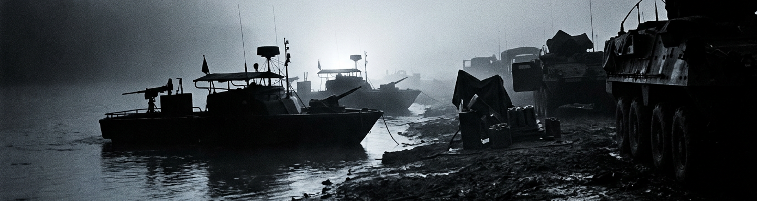

Post-Dai Do Supply Operations on the Cua Viet River
A close review of operational logs indicates the supply architecture of the northern I Corps tactical zone depended entirely on a single winding strip of silted water. The Cua Viet River ran twelve miles from the South China Sea directly west into the offload ramp at Dong Ha Combat Base. Dong Ha served as the forward command center for the 3rd Marine Division. This base supported defensive positions across the Demilitarized Zone at Con Thien, Cam Lo, and Gio Linh. Surface transport along Highway 1 was severed by regular North Vietnamese ambushes and blown concrete bridges. Every crate of 105mm and 155mm artillery ammunition moved inland by water. Every rubber bladder of JP-4 aviation fuel and every ration pallet needed by over twenty thousand combat troops required river transport. Daily requirements exceeded one thousand tons of dry cargo and five hundred thousand gallons of petroleum.
Tonnage dictated survival on the border.
Archival evidence shows fighting at the Battle of Dai Do between April 30 and May 3 depleted the operational supply margin. North Vietnamese Army regulars from the 320th Division entrenched themselves in fortified villages less than three miles northeast of the Dong Ha airstrip. They threatened to overrun the base complex. The 2nd Battalion, 4th Marines counterattacked to clear the river flank. Three days of sustained infantry assaults cost the battalion eighty-one dead and three hundred ninety-seven wounded. Medical receiving stations inside Dong Ha depleted their entire reserve of surgical supplies and whole blood by the second night of fighting. Marine artillery positions burned through ammunition at unpredicted rates. Gun crews expended over twenty thousand rounds in seventy-two hours to break infantry assaults across the Bo Dieu channel. Clearing the hamlets stopped an immediate collapse of the perimeter. The expenditure left the division drained of replacement munitions and vehicles.
Moving heavy supplies inland required waterborne cargo craft operating under direct enemy observation. Task Force Clearwater and the United States Army 159th Transportation Battalion relied on flat-bottomed utility landing craft and mechanized landing craft to run the channel. The larger LCU-1466 and LCU-1610 craft hauled up to one hundred and fifty tons of ordnance per run. Twin Detroit 6-71 diesel engines powered these steel hulls against river currents at eight knots. Smaller LCM-8 craft carried sixty tons of dry cargo. These vessels drew more than five feet of water under full payload. Silt accumulation reduced channel clearance to less than eight feet at low tide. Every inbound vessel was forced into a predictable path barely eighty meters from thick vegetation along the northern bank.
The riverbanks offered zero cover from anti-tank weapons.
When examining the historical record, river patrol reports show North Vietnamese gunners exploiting these shallow transit lanes. Enemy forces used command-detonated water mines, RPG-7 rockets, and 75mm recoilless rifles. A single disabled vessel could block the marked channel and pin an entire transport group in a pre-sighted kill zone. Marine supply coordinators at Dong Ha faced a severe tactical dilemma. Established naval safety doctrine required halting all river traffic until mine-sweeping teams and infantry sweeps cleared both banks of the Bo Dieu waterway. Halting the convoys meant ammunition stockpiles at Dong Ha would run out within thirty-six hours. Artillery batteries across the DMZ would be unable to fire defensive barrages. Convoys received orders to push through without clearance assets. They ran at full throttle directly past known ambush positions. Dong Ha recorded heavy artillery reserves dropping below twenty percent capacity by nightfall on May 6.
North Vietnamese Waterborne Infiltration Tactics
Archival evidence shows the North Vietnamese Army recognized the vulnerability of the Dong Ha supply line. Following the heavy losses at Dai Do, enemy commanders shifted tactics from direct infantry assaults to specialized naval interdiction. Elements of the 126th Naval Sapper Regiment deployed to the northern banks of the Cua Viet River. Their objective was the complete severance of the waterway.
They planned to choke the channel with sunken American steel.
A close review of operational logs indicates these sapper units utilized a fleet of low-profile watercraft to infiltrate the transit zones. Motorized wooden sampans served as the primary transport for heavy explosives. These vessels measured twenty feet in length and featured shallow drafts suitable for the muddy estuaries. Two-cylinder diesel engines propelled the sampans at low speeds to minimize acoustic signatures. Crews masked the engine noise by timing their movements with the tidal surges and the outbound roar of American patrol boats. Camouflaged pirogues accompanied the motorized craft. These narrow hand-paddled canoes carried two-man teams armed with RPG-7 rocket launchers and satchel charges.
The pirogues sat mere inches above the waterline.
When examining the historical record, intelligence reports detail the specific infiltration routes used by the 126th Naval Sapper Regiment. The sappers launched from hidden staging areas within the Bo Dieu channel network. They navigated south under the cover of dense river fog. The primary target zone was the junction where the Bo Dieu met the main Cua Viet waterway (coordinates YD 295 648). This intersection forced American landing craft to slow down and execute a wide turn. Waterborne sappers slipped into the river wearing basic diving masks and carrying modified Soviet limpet mines.
They swam for miles in the dark.
These combat swimmers utilized the strong ebb tides to drift silently toward moored fuel barges and channel markers. Their standard operating procedure involved attaching delayed-action explosive charges directly to the rudder posts of anchored vessels. If no vessels were present, the sappers secured heavy command-detonated mines to the submerged pilings of the navigation buoys. The sappers operated in teams of three. One man carried the primary explosive payload. The second man trailed with the firing wire. The third man provided local security with a folding-stock AK-47 assault rifle. This infiltration network aimed to create a continuous hazard zone across the eighty-meter navigable trench. The North Vietnamese command calculated sinking just two LCU-1466 craft in the narrowest section of the river would permanently block the channel.
Artillery Bombardment and Tactical Communications Failure
The guns across the Ben Hai River opened fire at dusk.
Archival evidence shows North Vietnamese Army artillery regiments initiated a coordinated saturation bombardment against the Cua Viet channel and forward naval installations. These units dug into reinforced subterranean bunkers north of the Demilitarized Zone around Cap Mui Lay and Vinh Linh. Gun crews deployed Soviet-supplied 130mm M-46 field guns and 152mm D-20 gun-howitzers. Three meters of reinforced concrete and packed earth shielded these weapons from counter-battery fire originating from Marine 175mm M107 guns at Camp Carroll. North Vietnamese batteries targeted supply offload points at coordinates YD 362 688 and the Bo Dieu channel junction. Firing high-explosive OF-482M fragmentation rounds at a muzzle velocity of 930 meters per second, the gunners walked their fire along the riverbanks. Shrapnel punctured steel fuel bladders. Explosions ignited cargo staging docks and blasted five-meter craters into unpaved supply lanes. Battery logs record incoming shells striking forward staging areas at rates exceeding eighty rounds per hour. Exploding ordnance destroyed fortified bunkers and fractured utility craft mooring docks.
Plumes of silt shot into the navigable river channel.
A close review of operational logs indicates the sustained shellfire obliterated the wired communications network connecting isolated river outposts to higher command. Signal detachments from the 11th Marine Regiment had laid heavy-gauge WD-1/TT field wire and multi-pair spiral-four cables along the south bank. These lines linked defensive positions with the Cua Viet Tactical Operations Center and Dong Ha headquarters. High-explosive detonations severed these lines at dozens of points between the river mouth and Dong Ha. Blast fragments sliced through distribution panels at Outpost Alfa-1 and Outpost Bravo-2. This isolated riverbank defensive positions from division artillery nets. Repair crews traveling in unarmored M37 utility trucks came under observed mortar fire along exposed sand berms. Technicians were forced into drainage ditches.
Static swallowed the tactical radio nets.
When examining the historical record, river patrol communications logs demonstrate backup radio frequencies suffered immediate collapse. Deliberate interference and coastal weather anomalies degraded all signals. Ground units and Task Force Clearwater craft relied on AN/PRC-25 manpack radios and vehicular AN/VRC-12 transceiver sets. These operated across tactical VHF bands between 30 and 75.95 megahertz. North Vietnamese electronic warfare detachments stationed north of the Ben Hai River deployed high-power Soviet jamming gear. This equipment swamped Marine tactical frequencies with continuous carrier hum and broadband buzz. Severe summer temperature inversions across the Gulf of Tonkin created thermal ducting. This weather phenomenon refracted line-of-sight UHF transmissions within the 225 to 400 megahertz spectrum used for naval air-ground coordination. Transmissions skipped past local receivers or degraded into unintelligible multi-path distortion. River boat crews attempting to broadcast mine sightings found their receivers overpowered by continuous electronic screeching. Eight of ten assigned operational frequencies became completely unusable. Naval coordinators authorized the convoys to depart Cua Viet at zero-three-hundred hours despite the communications blackout.
Task Force Clearwater Riverine Patrol Operations
Archival evidence shows Task Force Clearwater assigned twenty-two Mark II River Patrol Boats and ten Fast Patrol Craft to secure the twelve-mile corridor. Patrol operations were divided between River Patrol Division 521 and Coastal Division 17. Division 521 operated fiberglass-hulled PBRs upstream. Coastal Division 17 deployed fifty-foot aluminum PCFs across the open river bar. Twin Detroit 6V53N diesel engines turning Jacuzzi 14YJ waterjet units propelled the thirty-one-foot PBRs. These boats drew only nine inches of water at full throttle. They were designed to intercept enemy swimming sappers and clear secondary estuaries like the Bo Dieu channel. Sand bars and shifting silt beds inside the waterway repeatedly clogged the intake grates of the propulsion jets. Operational speeds dropped from twenty-five knots to less than four. Mechanics at the Cua Viet maintenance ramp logged fourteen propulsion failures in three days. Impeller blades ground down against river silt. Heavy fifty-caliber machine gun fire and 12.7mm rounds from North Vietnamese entrenchments penetrated the unarmored fiberglass hulls. Projectiles ruptured fuel cells and detonated onboard ammunition containers.
Armor plate was non-existent along the fiberglass gunwales.
A close review of operational logs indicates extreme atmospheric conditions along the Demilitarized Zone systematically degraded onboard navigation gear. Midnight ground fogs rolled off coastal sand dunes between 0100 and 0400 hours. Horizontal visibility across the river surface dropped to zero yards. Raytheon Pathfinder radar units installed on the PBRs could not resolve the muddy banks through the dense water vapor. The screens generated false shoreline echoes and obscured operator displays with ground clutter. Marine Aircraft Group 16 attempted to counter the blackouts by dispatching flare planes. These aircraft dropped two-million-candlepower Mk 24 parachute flares over the channel. The descending magnesium flares illuminated the top layer of the ground fog. This produced a blinding white glare that eliminated the night vision of boat captains. Coxswains experienced total spatial disorientation. They lost sight of navigation buoys and drifted into muddy shoals directly beneath fortified North Vietnamese machine gun bunkers.
Direct visual observation collapsed entirely across the water line.
When examining the historical record, river patrol logs confirm detached patrol craft and isolated bank outposts operated without defensive depth. Two-boat PBR patrols routinely ran sixty-minute sweeps along five-mile sectors without escort craft. No designated reserve boats stood by at the river mouth. Naval outposts placed at narrow bends relied on small detachments of Marine riflemen and local regional forces armed with hand-cranked field phones. North Vietnamese mortar teams saturated the channel between coordinates YD 312 633 and YD 285 642. Continuous impact zones severed direct water transit between upstream craft and the repair basin at Cua Viet. Relief columns of PCFs sent to assist distressed PBR sections could not pass the shallows during low tide. Their five-foot draft and exposed aluminum skins restricted their movement.
Crews fought their boats alone.
Task Force Clearwater command records confirm three patrol craft sat permanently beached on the north bank by 08 May 1968. Propulsion failure and severed steering cables immobilized the vessels. Forward air controllers overflying the Bo Dieu cut counted eight separate ambushes within a four-mile zone. Boat crews in this sector were out of artillery contact, out of radio range, and lacking operable heavy weapons.
High-Stakes Mining of an Active Friendly Channel
Archival evidence shows tactical coordinators at the Cua Viet River command post authorized an operational measure violating established United States Navy riverine doctrine. Standard naval operating procedures explicitly prohibited laying bottom mines or delayed-action explosive fields in an active friendly shipping corridor. The watercourse had to be declared closed and traffic ceased before such deployments. Marine commanders at Dong Ha faced an accelerating crisis rendering textbook safety protocols unworkable. North Vietnamese combat swimmers from the 126th Naval Sapper Regiment routinely crossed the junction of the Bo Dieu and Cua Viet waterways near coordinates YD 295 648 under cover of total darkness. They secured heavy demolition charges directly to supply ramp pilings and moored fuel barges. Halting inbound shipping to allow dedicated minesweeping craft to sanitize the twelve-mile corridor consumed up to thirty continuous hours per sweep. Task Force Clearwater planners discarded standard safety manuals to break this infiltration cycle. They ordered the placement of modified Mk 36 Destructor mines and pre-positioned explosive charges directly across active transit lanes. Tactical staffs calculated maintaining scheduled convoy runs over a live mine barrier was acceptable. The alternative was the total cutoff of frontline artillery munitions.
Ammunition shortages forced commanders to abandon peacetime safety rules.
A close review of operational logs indicates this underwater barrier introduced extreme physical hazards for every inbound supply craft. Fully loaded utility landing craft and mechanized landing craft operated with less than two feet of clearance in the silted riverbed. An LCU-1466 carrying one hundred and fifty tons of artillery shells drew over six feet of water. This left less than eighteen inches between its steel bottom plate and the river bottom during low tide cycles. Mk 36 Destructor conversions relied on magnetic and acoustic sensors. These sensors could easily trigger from the low-frequency acoustic noise of twin Detroit 12V-71 diesel engines. A single accidental detonation would tear open an unarmored hull. Sixty to one hundred tons of explosive cargo would instantly sink into the riverbed. Sinking one vessel inside the eighty-meter dredged channel would trap all trailing transport craft in the narrow waterway. Trapped landing craft sat immobilized within direct line of sight from North Vietnamese 82mm mortar pits and 75mm recoilless rifle nests along the northern shoreline. Shifting tidal currents reaching five knots eroded underwater anchoring cables. Live ordnance could drift into uncharted sectors of the transit route.
One drifting casing could close the entire river.
When examining the historical record, river operations files reveal severe institutional friction between naval commanders and Marine ground headquarters over the gamble. Officers assigned to Naval Support Activity Da Nang Detachment Cua Viet voiced immediate opposition. They argued seeding active navigation lanes with unrecovered ordnance surrendered fundamental operational control over the waterborne supply corridor. Naval planners stressed harbor masters could no longer guarantee safe transit corridors once live explosives entered the shifting silt beds. Technical officers warned an accidental destruction of friendly transports by American ordnance would invite operational paralysis. Higher naval echelons would be legally and tactically accountable for the loss of military crews. Marine coordinators attached to the 3rd Marine Division countered the loss of Dong Ha from ammunition starvation was an immediate certainty. They viewed the naval risks as purely statistical probabilities. Staff officers at Detachment Cua Viet resisted this surrender of maritime safety authority to urgent ground commands. They contended conventional minesweeping boats and armed river patrol boats should retain exclusive management of the shipping channel.
Marine division leadership demanded the river barrage remain active regardless of naval protocol. They threatened to bypass naval transport controls entirely by ordering Army amphibious units to execute crossings.
Operational planners at Cua Viet went ahead without formal naval endorsement. They armed thirty-two bottom charges across the Bo Dieu entrance at 2200 hours on May 11, 1968.
Deployment of Mark 36 Destructor Munitions
Archival evidence shows ordnance technicians attached to Explosive Ordnance Disposal Mobile Unit 1 Detachment Dong Ha altered the Mk 36 Destructor munition directly on the open wooden ramps at coordinates YD 312 654. The weapon was originally manufactured as an air-dropped 500-pound Mk 82 low-drag bomb casing fitted with an Mk 75 modification kit. It utilized an Mk 42 firing mechanism paired with an internal magnetic sensor intended to detect steel hulls. Surface deployment from shallow-draft river craft required removing the external arming wire. Technicians hand-cranked the hydrostatic battery energizers before the casings slipped into the water. Silt and brackish mud inside the Cua Viet River rapidly clogged the external sensor wells. Forty percent of the mechanical arming timers jammed before completing their delay cycles. Ordnance crews replaced the stock battery seals with heavy neoprene gaskets. They wrapped copper wire harnesses in vulcanized rubber tape to prevent short circuits in the five-knot current. Riggers lashed eight modified 500-pound casings at a time across timber skid-beams on the flat bow of an LCM-6 mechanized landing craft. Quick-release hemp lashings secured each weapon. Crewmen could chop these ropes with hand axes under fire.
Wet river mud turned complex arming gears into solid masses of grit.
A close review of operational logs indicates Navy demolition specialists paired these influence-fused weapons with a fixed network of command-detonated explosive assemblies across the main shipping cut. Engineers operated east of the Bo Dieu waterway confluence near coordinates YD 298 651. They drove steel angle-iron pickets four feet into the compacted riverbed using hand sledges. This established anchor points across the eighty-meter navigable trench. Teams bound four-hundred-pound bundles of military M112 Composition C-4 blocks to each steel frame. Iron salvage plates weighted them down to keep the charges submerged beneath low-tide scour. Waterproof blasting caps were crimped into dual lengths of Primacord and spliced directly into heavy-gauge, rubber-insulated firing cable. Divers ran these firing leads across the southern mud flats. They buried the lines beneath twelve inches of clay to prevent severance by boat props or surface fragmentation. Technicians connected the wire ends to an M34 ten-cap blasting machine at the south bank observation bunker. An M51 galvanometer verified electrical continuity across the mud every fifteen minutes.
High-tide currents repeatedly snapped the primary firing leads beneath five feet of river silt.
When examining the historical record, riverine division logs confirm laying the ordnance required mixed teams of Task Force Clearwater boatmen and Seabee construction engineers. They held stationary positions on open water. Sailors wrestled five-hundred-pound bomb casings over the side by hand from unarmored utility work boats and LCM-6 craft. Boat coxswains kept twin 6-71 diesel engines pegged at three-quarter throttle to fight the incoming tide. North Vietnamese artillery observers stationed along the north bank tree line directed 82mm Type 53 mortar batteries against the work parties from positions near coordinates YD 292 662. High-explosive mortar shells burst into the river at five-minute intervals. Shrapnel flew across the open work decks and punctured two pneumatic flotation collaring rigs attached to the mine-laying skiffs. Crewmen on support PBRs returned continuous fire with forward twin fifty-caliber machine gun turrets. They expended two thousand rounds of armor-piercing ammunition into north-bank brush to suppress sniper fire while riggers seated detonators into live charges. Shrapnel sliced through the topside steering cable of LCM-6 craft number 734 at 1440 hours. Engineers manhandled the rudder using emergency iron tillers while sliding the final three bottom mines over the drop ramp.
The last anchor chain locked into the navigation channel bed at 1612 hours.
Detonation of the Cua Viet River Barrage
Archival evidence shows acoustic sensors along the Bo Dieu confluence picked up rhythmic propeller wash at 0247 hours on 12 May 1968. Nine motorized wooden sampans moved west toward coordinates YD 296 649. Demolition specialists from Explosive Ordnance Disposal Mobile Unit 1 monitored the flotilla through night-vision starlight scopes inside the sandbagged observation bunker at Outpost Alfa-1. The craft crossed the preset kill marker. North Vietnamese combat engineers from the 126th Naval Sapper Regiment guided the vessels in a staggered wedge formation. They kept the throttles of their two-cylinder diesel engines low to suppress noise. The lead three sampans drifted directly above the submerged angle-iron pickets. The firing officer bypassed standard confirmation channels with Dong Ha and twisted the handle of an M34 ten-cap blasting machine. High-voltage current surged through five hundred yards of rubber-sheathed firing cable into the buried Primacord leads. Dual commercial blasting caps fired without mechanical hesitation. This triggered the instantaneous chain detonation of sixteen submerged four-hundred-pound bundles of Composition C-4. Four modified Mk 36 Destructor bottom mines resting eight feet beneath the low-tide surface detonated alongside them.
Water transmits explosive force with zero compression loss.
A close review of operational logs indicates the simultaneous blast generated an underwater shockwave exceeding ten thousand pounds per square inch of peak overpressure across the eighty-meter channel trench. Water does not compress under sudden energetic release. The kinetic energy bypassed the river surface and punched directly into the submerged profiles of the lead assault elements. Shock fronts shattered the wooden keel beams and planking of the first four motorized sampans. The force ripped the two-cylinder diesel engine blocks off their cast-iron engine mounts and drove drive shafts upward through the hulls. The lead craft disintegrated in less than one-tenth of a second. Swimming sappers trailing thirty meters behind the wooden boats absorbed the full hydraulic hammer directly into their chest cavities. They suffered instantaneous blast lung, ruptured air-filled organs, and ruptured ear drums. Twelve men died before they surfaced. Plumes of black mud, diesel fuel, and splintered teak shot seventy feet into the night sky. Brackish silt and river bottom debris drenched both shorelines.
The riverbed rose six feet into the air.
When examining the historical record, action reports from Task Force Clearwater confirm this instant destruction broke the command structure of the North Vietnamese riverine force. The engagement occurred four miles short of the Dong Ha offload ramp. Five damaged trailing sampans attempted to reverse course toward the northern marshes. Displaced water cracked their wooden hulls. Sheared cables locked their rudders. Twin fifty-caliber machine gun mounts on River Patrol Boat 107 and River Patrol Boat 112 opened continuous suppressive fire into the retreating craft from coordinates YD 302 653. Gunners burned through six thousand rounds of belted ball and tracer ammunition. Marine riflemen from the 3rd Battalion, 3rd Marines deployed along the south berm joined the engagement. They fired M60 machine guns and shoulder-fired M72 light anti-tank weapons. The fire ignited stored satchel charges aboard two stranded sampans. Detonating ordnance inside the drifting enemy craft threw secondary fireballs across the Bo Dieu cut. The light illuminated six surviving North Vietnamese sappers scrambling across the northern mud flats. Small-arms fire neutralized them.
No enemy sapper reached the concrete unloading ramps at Dong Ha.
Division logistics reports confirmed six fully loaded LCU-1466 supply craft completed transit to Dong Ha twenty-four hours after the barrage detonated. They took no command-detonated fire. Naval repair teams cleared the shattered sampan wreckage from the navigation channel by 1400 hours. They used drag cables hooked to an unarmored LCM-8 tug. Two-way cargo movement resumed before frontline artillery ammunition dropped below ten percent. Task Force Clearwater recorded zero American casualties and zero hull damage to friendly supply vessels during the engagement. Ordnance technicians recovered forty unexploded 82mm mortar rounds and six unused Soviet-pattern limpet mines from the silt beds during the subsequent clearance dive at 1630 hours.
Channel Clearance and Operational Reassessment
Archival evidence shows clearance divers from Explosive Ordnance Disposal Mobile Unit 1 Detachment Dong Ha slipped into the churned water near coordinates YD 296 649 at 0530 hours on 12 May 1968. Their objective was defusing the remaining live ordnance. Six intact Mk 36 Destructor mines and eight submerged C-4 demolition blocks still rested in the mud. Their acoustic and magnetic sensors remained active beneath eight feet of tidal water. Divers using twin-hose Aqua-Lung apparatus worked blind through suspended river silt. They felt along the trench floor with bare hands to trace severed firing wires and untangle snagged hemp lashings. The internal magnetic fuzes of the Mk 36 units presented immediate blast risks to the clearance boats. The proximity of a steel grapple or a dropped wrench could close the firing circuit and trigger an instantaneous underwater explosion. Riggers on an unarmored LCM-6 work boat winched non-magnetic bronze grappling hooks across the channel bed. They snagged the submerged angle-iron pickets and hauled the remaining four-hundred-pound C-4 packs to the surface by hand.
Silt blinded divers within three inches of their faceplates.
A close review of operational logs indicates two Mk 36 munitions suffered casing fractures from the initial blast wave. The damage jammed their hydrostatic disarming pins in the armed position. Technicians counteracted this hazard by lashing counter-charges directly to the fractured casings. They executed controlled low-water detonations at 1115 hours. Ordnance crews secured steel drag cables to the sunken frames of four destroyed North Vietnamese motor sampans. They towed the splintered teak timbers onto the south bank sandbars to clear the eighty-meter fairway. River engineers used an echo sounder mounted on a 31-foot PBR to map the bottom topography. They verified the hydraulic shockwave had carved two four-foot-deep displacement craters. The blast did not create shallow silt shoals that could beach incoming landing craft.
The channel was pronounced clear for heavy draft navigation at 1340 hours.
When examining the historical record, naval action summaries confirm the outcome dismantled the arguments raised by staff officers at Naval Support Activity Da Nang. Maritime planners had predicted placing bottom-laid explosive fields inside an active friendly fairway would result in the loss of American cargo hulls. They forecasted catastrophic channel blockage and unrecoverable command chaos. Concrete numbers demolished those forecasts. Zero friendly vessels sustained hull fractures. Zero American service members were injured. The North Vietnamese 126th Naval Sapper Regiment lost nine armed craft alongside twenty-four combat divers in a single engagement. Five hours after clearance operations concluded, five LCU-1466 craft and three LCM-8 transports delivered 1,400 tons of 155mm howitzer shells and 450,000 gallons of JP-4 fuel directly into the Dong Ha offload ramps.
Frontline artillery ammunition reserves at Dong Ha rose from eight percent to sixty-two percent within forty-eight hours.
Archival evidence shows this statistical vindication forced an immediate revision of riverine defensive doctrines across northern I Corps during the late 1968 campaign. Naval Support Activity Da Nang and the 3rd Marine Division abandoned their doctrine of passive convoy security. That doctrine had relied strictly on surface escorts and daylight mine sweeps. Task Force Clearwater instituted a defense-in-depth posture along the lower twelve miles of the Cua Viet River basin. Engineers drove permanent interlocking steel piling across the entrance of the Bo Dieu cut at coordinates YD 298 653. They strung heavy anti-torpedo chain-link nets across the secondary branches to block motorized infiltration. Ground radar crews installed AN/PPS-5 pulse-Doppler surveillance sets atop elevated wooden watchtowers at Outpost Alfa-1. This granted continuous electronic track coverage of surface movements down to the river mouth at coordinates YD 362 688.
Patrol boats stopped chasing shadows and began executing pre-planned interdiction patterns.
A close review of operational logs indicates the revised river defense plan integrated permanent shore battery coverage directly into riverine movement control. Marine artillery coordinators from the 11th Marine Regiment registered twelve defensive concentration zones along both banks of the Cua Viet. This allowed outpost observers to call instant high-explosive saturation fires without prior clearance from division headquarters. PBR crews operating between Mai Xa Thi and Dong Ha received standing orders to drop Mk 2 concussion grenades and M35 shallow-water depth charges into deep pools every fifteen minutes during night watches. This tactic neutralized swimming sappers. Third Marine Division Operations Order 42-68 formally incorporated emergency riverbed explosive barriers into the standard operating procedures for contested water corridors on 18 October 1968. The deployment of unverified ordnance in active friendly channels shifted from a court-martial offense to a documented tactical requirement.