
Operational logs from III Marine Amphibious Force in 1970 show a command structure fighting a losing battle against the environment itself. Its technological superiority was being systematically negated. The layered intelligence-gathering doctrine, a cornerstone of U.S. operations in I Corps, was failing. Aerial reconnaissance from RF-8A and RA-3B aircraft produced useless imagery of the triple-canopy jungle. Signals intelligence units, listening for North Vietnamese Army radio traffic, heard only disciplined silence from units using runners and field telephones. Even the low-flying helicopter missions using early-generation air-sampling chemical analyzers, the XM-2 “people sniffers,” were unreliable and easily defeated by weather. These combined failures produced a dangerously fragmented intelligence picture, forcing an over-reliance on the one asset that could get direct eyes on the enemy. Ground reconnaissance.
The geographical source of this failure was the Que Son Mountains. South of Da Nang, the Que Son Valley served as a primary infiltration corridor for NVA forces moving off the Ho Chi Minh Trail toward the coast. The mountains themselves were a hostile world of steep, jungle-choked slopes and rugged karst topography. This maze of limestone cliffs, caves, and sinkholes offered perfect concealment for NVA base camps. The terrain degraded VHF radio signals, isolating patrols from their support bases. Monsoon seasons turned the earth to mud. Movement was a constant struggle against the landscape. For the reconnaissance teams, the physical cost was extreme. The very ground was an adversary that exhausted men, broke equipment, and hid a determined enemy.
Into this environment, the 1st Reconnaissance Battalion inserted its long-range patrols. The mission of these small teams was observation, not combat. Archival evidence of their tactical doctrine (NARA Record Group 127) shows a complete inversion of standard infantry operations. Survival depended on invisibility. Helicopters used false insertion tactics, touching down in multiple clearings to deceive NVA observers before deploying the team in a matter of seconds. Some teams rappelled from hovering aircraft or disembarked in fresh bomb craters. Once on the ground, a patrol moved with intense caution, practicing track discipline by wading through streams or walking backward to obscure their path. The objective was to establish an observation post and remain undetected for days, calling in artillery or air strikes.
Marine Recon teams were more heavily armed than their Army LRRP counterparts. This provided more firepower but came at the expense of stealth. If compromised, a small team stood little chance against a larger NVA force. They drilled immediate action techniques like the Australian Peel, a bounding retreat under concentrated fire, to break contact. Extraction was a high-risk maneuver. If a helicopter could not land, teams used STABO rigs, harnesses attached to ropes, to be pulled vertically through the jungle. In the Que Son, these patrols faced an enemy that knew the terrain and hunted them with trackers and listening posts. Every patrol was a high-stakes contest where the smallest error could trigger a fight for survival.
By autumn of 1970, the 1st Reconnaissance Battalion was maintaining a punishing operational tempo in support of the 5th Marines’ Operation Imperial Lake. From patrol bases like LZ Rainbow, multiple eight-man teams were inserted into the jagged peaks. The entire operational model rested on a patrol’s ability to remain unseen.
On November 18, 1970, that model disintegrated for a team with the callsign “Rush Act.”
Discovered by NVA forces deep in hostile territory, the patrol was ambushed. Pinned down and unable to maneuver, the team’s survival now depended entirely on an emergency extraction under worsening weather. The fight for survival was immediate. The fight for communication was a separate battle. The patrol’s link to the outside world was the standard-issue AN/PRC-77 manpack radio. A rugged piece of hardware, its effectiveness was crippled by the terrain. The radio operated on VHF FM frequencies, requiring a near-direct line of sight between antennas. In the deep ravines and triple-canopy jungle of the karst topography, a clear line of sight was a physical impossibility. A patrol at the bottom of a valley was electronically isolated. Its signals were absorbed by foliage and blocked by surrounding peaks. For patrol Rush Act, these technical limits became a tactical emergency. Every transmission was a struggle against the landscape, an attempt to broadcast their situation before the radio’s battery died or the unit was destroyed by enemy fire.
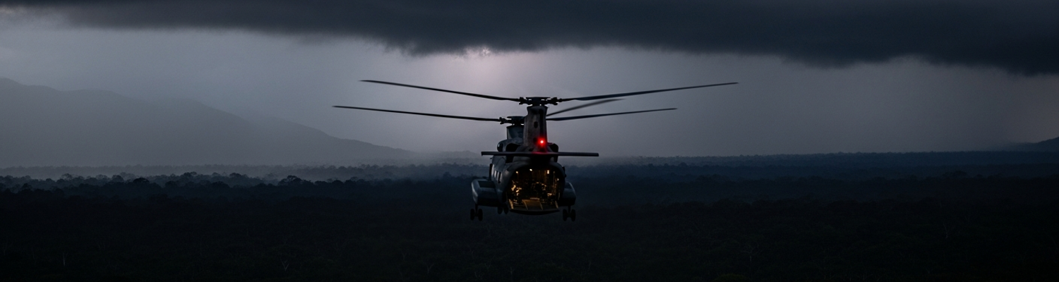
The initial distress calls triggered a response. Monsoon weather, however, had dropped the cloud ceiling below the height of the mountains. A CH-46 Sea Knight helicopter was dispatched for the extraction, a mission made profoundly dangerous by the combination of enemy fire and near-zero visibility. Aboard the rescue aircraft was the commander of the 1st Reconnaissance Battalion himself, Lieutenant Colonel William G. Leftwich, Jr. He was personally monitoring the operation from the air. The CH-46, overloaded with the battalion commander’s command group and the extraction force, attempted to navigate the treacherous terrain inside the clouds. It flew directly into the side of a mountain.
The impact and explosion killed all fifteen men aboard. This included the helicopter’s aircrew, the reinforcing Marines, and the battalion commander. The unit sent to save the compromised patrol was now destroyed. Its command structure was gone in an instant. The loss of Lt. Col. Leftwich, a highly respected leader, sent a shockwave through the 1st Marine Division. On the ground, the survivors of Rush Act were in an even more desperate position. Their rescuers were dead, the enemy was closing in, and the weather remained impassable.
The fiery impact on the mountainside instantly decapitated the 1st Reconnaissance Battalion’s command structure. The battalion’s executive officer, Major Lavoy, was now in command, but he was miles away at a command post, blind to the tactical situation. The standard procedure for an emergency extraction relied on a clear flow of information from the team on the ground, to the airborne commander, to higher headquarters. With the airborne commander and his dedicated command helicopter gone, that critical link was severed.
Confusion followed.
There was no longer a single, authoritative voice in the air to direct the complex coordination of gunships and medical evacuation helicopters. Responsibility fell to disparate command posts, from the 1st Marine Division headquarters in Da Nang to the fire support coordination centers for Operation Imperial Lake. Each headquarters was looking at the same map, but they lacked the minute-by-minute sensory input that only an on-scene commander could provide. The very doctrine of Marine reconnaissance, which depended on swift and overwhelming support, was short-circuited.
This command vacuum was amplified by the total ineffectiveness of established intelligence protocols. The intelligence picture became a black hole. High-altitude photographic reconnaissance was impossible. The same monsoon cloud cover that caused the CH-46 crash blanketed the operational area. Signals Intelligence platforms, which might have pinpointed the NVA units by their radio traffic, picked up nothing. The NVA forces in the Que Son Mountains were disciplined, relying on runners and landlines, leaving no electronic signature to intercept. The “people sniffer” missions were grounded. With every conventional intelligence, surveillance, and reconnaissance (ISR) asset neutralized, the only source of information was the very unit that needed rescuing.
Patrol Rush Act’s survival depended on its AN/PRC-77 radio. Every transmission was a struggle. The karst topography and dense jungle scattered its VHF signals, making consistent communication a matter of luck and battery life. The established protocols assumed a functioning ISR network could fill in the gaps. In the mountains south of Da Nang on November 18, 1970, all those layers had failed. Commanders were left staring at a map marked with a single, hours-old position.
The result was an agonizing wait for actionable intelligence. At the 1st Marine Division headquarters and the forward command post on Hill 510, officers were forced into a state of suspended animation. They knew a reconnaissance team was trapped. They knew the battalion commander sent to rescue them was dead. Beyond those two facts, they had almost nothing. The information flow was reduced to sporadic, broken radio transmissions relayed from an aircraft circling high above the cloud layer. These snippets offered no concrete intelligence. Planners needed to know the patrol’s exact location, its remaining numbers, and the size and disposition of the NVA force surrounding them. Without this data, sending another helicopter into the same area was not a calculated risk. It was a suicidal gesture. Every minute of radio silence increased the probability that the patrol had been overrun. This lack of information created a tactical paralysis as complete as the physical destruction of the first rescue helicopter.
Out of this impasse, an improvised directive began to form, one that departed entirely from established doctrine. The objective shifted from finding the enemy to simply creating a line of sight. The concept, later given the informal designation Project Sixty, was born from operational necessity. If a rescue helicopter could not descend through the cloud layer, and if radio signals could not penetrate the mountains, then a new, elevated position had to be established inside the operational area. This position would serve as a radio-relay station and an observation post. The mandate was not to send more reconnaissance Marines, but to physically alter the battlefield by creating a usable piece of ground where none existed.
The task fell to a combat engineer officer. An examination of the units supporting the 1st Marine Division (specifically, the 1st Engineer Battalion) reveals the origin of the plan. An unnamed captain from the battalion was presented with the problem: a landing zone had to be established on a high-altitude ridgeline deep within an enemy-controlled area, under a low cloud ceiling, with no clear intelligence. This was a complete inversion of their standard operating procedures. Combat engineers were typically employed to build bases or clear minefields in relatively secure areas. They were now being asked to pioneer a location in the blind, effectively serving as the lead element in an intelligence-gathering operation.
Project Sixty’s mandate was to insert a small team of combat engineers, equipped with high-explosive satchel charges and chainsaws, onto the highest accessible peak near Patrol Rush Act’s last known position. Their mission was to blast and cut a helicopter landing zone out of the raw jungle and rock. This “LZ” would be just large enough for a single UH-1 Huey to touch one skid. It would allow for the drop-off of a radio-relay team and, potentially, the extraction of the reconnaissance patrol one man at a time. The risks were enormous. The engineer team would be inserted by rappelling from a helicopter hovering in the clouds, with no guarantee the enemy was not waiting directly below. They would be lightly armed and would have to work while completely surrounded, advertising their position with the sound of chainsaws and explosions. This was not a combat operation. It was a desperate construction project conducted under direct threat, initiated solely to overcome a catastrophic intelligence failure.
The justification for such a radical departure from military norms was the complete failure of the entire intelligence apparatus. The command structure of the 1st Marine Division was blind. Project Sixty was not designed to rescue the patrol directly. It was designed to generate the intelligence required to make a rescue possible. The core justification was based on physics. The dense jungle and karst topography blocked the line-of-sight VHF radio signals from the patrol’s AN/PRC-77 transmitters. The only way to re-establish stable communications and get eyes on the battlefield was to seize high ground. Since no suitable natural position was accessible, one had to be created. The engineer-built landing zone would serve as a vital radio-relay station, allowing a communications team to link the trapped patrol, airborne assets, and distant headquarters. From that new vantage point, an observer could finally direct artillery and air strikes with precision and guide an extraction helicopter along a safe flight path.
The assessment of risk versus potential gain was a brutal calculation. The engineer team would be inserted with minimal intelligence into an area confirmed to be swarming with NVA. They would be vulnerable, and their work would actively advertise their position. The potential for the mission to end in a third disaster was high. Yet, the potential gains were considered worth the gamble. A successful mission would provide the first actionable intelligence in hours, enabling the precise application of air and artillery power. It offered the only viable path to recovering the surviving members of Rush Act. In the cold calculus of command, the certainty of losing the patrol if no action was taken was weighed against the high probability of losing the engineer team in an attempt to save them. The decision was made to accept the risk.