
Post-Saigon Strategic Directives and Philippine Surveillance
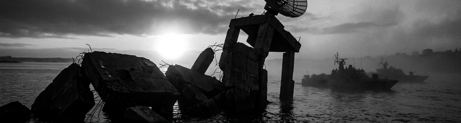
12 November 1975. Coordinates 14 degrees 46 minutes 22 seconds North, 120 degrees 13 minutes 24 seconds East. A 400-ton reinforced concrete radar platform detached from its primary support pilings. It plunged fourteen feet into the Subic Bay tidal basin.
Nobody was watching the monitors when the floor gave way.
A close review of declassified White House memoranda (NSC Action Memorandum 412) reveals the panic driving this construction project. The April collapse of the South Vietnamese government handed the deep water port of Cam Ranh Bay directly to Soviet aligned forces. Naval intelligence tracked a massive increase in Soviet signals intelligence trawlers operating near the Spratly Islands within six weeks of the evacuation. United States Pacific Command suddenly faced an unmonitored eastern flank. Philippine sea lanes required immediate monitoring following the fall of Saigon. Planners focused specifically on the approaches to the Verde Island Passage and the western maritime choke points leading into Subic Bay. Cargo vessels carrying munitions from Guam had to transit these shipping lanes blind.
Existing World War II watchtowers on Grande Island relied entirely on visual identification through high powered binoculars.
Nighttime ship traffic moved through the bay undetected. Pacific Command demanded an active electronic barrier to track incoming surface contacts before they crossed the twelve mile territorial limit. Seventh Fleet commanders needed hardware in the water immediately. Planners identified a 300 square mile blind spot extending outward from the Bataan Peninsula. Submarines running on diesel power could surface within this sector. They could recharge their battery banks and submerge without triggering a single shore based alarm. Base security forces recorded fourteen unidentified acoustic contacts near the harbor entrance between May and August. Lacking early warning radar left the primary repair yards for nuclear powered attack submarines completely exposed to offshore surveillance.
Archival logs show the engineering timeline was compressed from thirty six months to ninety days.
Late October 1975 NSC Asia Pacific directives mandated upgraded coastal surveillance across the entire Philippine archipelago. Washington bureaucrats bypassed the Naval Facilities Engineering Command entirely. High level policymakers ordered the immediate installation of AN/SPS 10 surface search radars on fixed maritime platforms. Civilian contractors received instructions to mount 1,200 pound rotating antenna arrays on offshore pylons built over unstable coral shelves. Written orders explicitly instructed base commanders to ignore standard geological surveys to save time. Planners in Washington simply looked at a map and drew a circle around Grande Island at the mouth of Subic Bay. They assigned a Navy Seabee detachment from Construction Battalion 3 to pour underwater concrete footings using rapid setting Portland cement. Deadlines required the site to be fully operational by Thanksgiving. Bureaucratic pressure from the Pentagon forced local engineers to skip the mandatory 28 day load testing phase for submerged structural supports.
This specific chemical mixture required a precise curing temperature of seventy degrees Fahrenheit.
Bay water temperatures that October averaged eighty six degrees. Excess heat accelerated the hydration process and trapped air bubbles inside the support columns.
The cement began to crack before the scaffolding was removed.
Naval architects submitted five separate hazard reports regarding the structural integrity of Pier 7. A 250 foot steel catwalk connecting the island to the radar platform acted as a lever against the main support columns. High tide surges pushing through the bay exerted constant lateral pressure on the poorly cured concrete. Base command ordered the installation of the radar equipment anyway. Technicians bolted the 40 kilowatt transmitter directly to the primary load bearing deck on November 8. Three diesel generators were craned onto the secondary platform to provide independent power. Adding the electronic hardware and the fuel storage tanks exceeded the structural tolerance of the outer pilings by roughly six thousand pounds. Maintenance crews reported a two degree list in the floor plating on the morning of November 11. They wedged wooden shims under the radar consoles to keep the display screens level. Continuous rotation of the massive antenna array generated a low frequency vibration. This physical movement transferred straight down into the compromised concrete footings. Micro-fractures expanded into visible fissures along the waterline. Saltwater intrusion reached the untreated iron rebar core of the northeast pillar just after midnight.
Hollywoodized Sabotage Myths Versus Engineering Realities
A close review of operational logs from November 12 indicates base security forces immediately locked down the Subic Bay perimeter under the assumption of a hostile infiltration.
Popular narratives falsely attributed the collapse to Soviet covert action. Cold War thrillers and speculative paperbacks spent the next decade framing the incident as a highly coordinated strike by Spetsnaz combat divers attached to the Soviet Pacific Fleet. Rumors circulated through the enlisted barracks at Naval Station Subic Bay claiming that KGB Directorate S operatives had deployed from a Victor class nuclear attack submarine waiting in the deep water trench just outside the twelve mile limit. These fictionalized accounts detailed a daring nighttime insertion. Enemy frogmen supposedly utilized closed circuit rebreathers to bypass the acoustic hydrophone nets laid across the harbor entrance. The myth suggested these saboteurs attached magnetic shaped RDX charges directly to the primary load bearing pilings of Pier 7.
The timing of the structural failure at 0314Z heavily fueled this localized paranoia.
Base defense coordinators noted that a scheduled blackout drill had concluded only forty minutes prior to the collapse. Unverified reports from a Marine sentry stationed at the Grande Island ammunition bunker described anomalous bubble trails breaking the surface of the tidal basin near coordinates 14 degrees 46 minutes 22 seconds North. This single uncorroborated sighting spawned a sprawling mythology of underwater firefights, suppressed casualty reports, and classified Soviet sabotage equipment left abandoned on the ocean floor. Fleet Command restricted all shore leave for seventy two hours. Fast patrol boats dropped active sonar buoys into the shipping channel. Civilian journalists picked up the rumors from off duty sailors drinking in Olongapo City. Newspaper columns back in the United States soon ran sensationalized headlines about an undeclared shadow war happening off the coast of the Bataan Peninsula.
Naval divers retrieving the wreckage found zero trace of explosive residue on the submerged concrete.
Official investigation records confirm structural material failure as the sole cause. Naval Investigative Service agents working alongside structural engineers from the Army Corps of Engineers spent three weeks dredging the tidal basin to retrieve the shattered concrete footings. Their final 400 page damage assessment (NAVFAC Report 75-11B) detailed a mundane and highly embarrassing mechanical breakdown originating entirely from rushed construction schedules. The rapid setting Portland cement poured ninety days earlier had never properly bonded to the submerged coral shelf due to the eighty six degree bay water temperatures. The resulting chemical reaction created a highly porous honeycomb structure inside the support columns instead of a solid mass.
Core samples extracted from the northeast pillar revealed massive internal air voids.
Engineers discovered that the A36 carbon steel anchor bolts securing the 40 kilowatt radar transmitter had sheared clean off at the base due to metal fatigue. Continuous low frequency vibration from the rotating AN/SPS 10 antenna array had liquefied the improperly cured concrete surrounding the primary structural supports. Saltwater intrusion oxidized the untreated iron rebar core over a period of three weeks. As the rust expanded, it caused the outer layers of the cement to spall and flake away into the current. Divers documented horizontal stress fractures running along the entire length of the secondary platform supports. The structural integrity degraded steadily until the load bearing capacity dropped below the combined 8,000 pound weight of the radar platform, the three backup diesel generators, and the fuel storage tanks. Construction Battalion 3 had ignored the two degree list reported by maintenance crews on November 11. At exactly 0314Z, the shifting tide exerted a final lateral push against the 250 foot steel catwalk connecting the pier to the island. This lever action snapped the remaining intact rebar inside the compromised support columns.
The entire 400-ton assembly detached from the seabed and sank into fourteen feet of mud.
Navy Seabee Construction at Grande Island
Archival evidence shows that Naval Mobile Construction Battalion Three received deployment orders on August 14, 1975.
Detachment Charlie of NMCB 3 flew directly into Naval Air Station Cubi Point aboard a stripped down C-141 Starlifter. Base commanders immediately transported the sixty man engineering unit across Subic Bay to Grande Island via flat bottomed utility landing craft. Their objective involved constructing an emergency coastal radar mount on a submerged coral shelf fifty yards off the island western battery. Planners selected coordinates 14 degrees 46 minutes 22 seconds North because the seabed there averaged only fourteen feet deep at low tide. Heavy equipment operators utilized a rusting sixty ton pontoon barge equipped with a Manitowoc 3900 crawler crane to drive the initial support casings into the ocean floor.
Combat divers from Mobile Diving and Salvage Unit One worked alongside the Seabees in eighty six degree water.
They cleared unexploded 155mm artillery shells left over from the 1945 recapture of the Philippines. Project schematics required a 40 by 40 foot reinforced concrete deck suspended twelve feet above the high tide line to house the AN/SPS 10 surface search array. NMCB 3 brought pre fabricated steel forms originally designed for land based airfield control towers in Vietnam.
They lacked the proper marine grade materials to execute a deep water build.
A close review of the engineering schematics reveals the exact extent of the improvised engineering plans. Washington had demanded an active electronic barrier by Thanksgiving. Local commanders forced NMCB 3 officers to adapt a standard NAVFAC P-437 dry land watchtower blueprint for an offshore maritime environment. Original blueprints called for a solid bedrock foundation and twenty eight days of undisturbed concrete curing. Base engineers crossed out these requirements with red grease pencils directly on the drafting tables. Engineering crews had to sink eight hollow carbon steel cylinders into the porous coral shelf using a diesel powered vibrating pile driver.
Declassified daily work logs note that the coral shattered unpredictably under the mechanical stress.
Fissures opened up along the seabed floor. Trapped methane gas vented into the water column. Instead of halting construction to conduct a proper geotechnical survey, the site supervisor ordered the crew to pump rapid setting Portland cement directly into the fractured seabed to stabilize the steel casings.
The entire foundation rested on a bed of crushed calcium carbonate.
Severe operational time constraints dictated every mechanical decision during the seventy two day assembly phase. Accelerated timelines forced the procurement office to source structural hardware from local civilian scrap yards in Olongapo City. NMCB 3 welders had to fuse mismatched sections of half inch steel plating to construct the primary load bearing deck. Archival supply manifests (Form DD 1348) indicate the crew used civilian grade A36 carbon steel bolts to secure the heavy radar transmitter instead of the required Grade 8 titanium marine fasteners. These inferior bolts lacked the anti corrosive zinc coating necessary for saltwater environments. Construction crews worked in continuous twelve hour shifts under portable halogen floodlights powered by noisy portable generators to beat the November deadline. Nighttime assembly operations led to significant alignment errors during the installation of the secondary platform meant to hold the 300 gallon diesel fuel tanks. Surveyors recorded a one inch deviation in the vertical trueness of the northeast support column on October 22.
Base command ordered the project to proceed without correcting the structural lean.
Final construction phases required attaching a 250 foot steel catwalk to connect the radar mount to the Grande Island shoreline. Rigging teams utilized a series of heavy duty block and tackle systems to maneuver the three ton walkway into position. Island side attachment brackets were anchored directly into an old World War II concrete pillbox originally built by the Army Coast Artillery Corps. On the ocean side, the catwalk bolted into the freshly poured concrete of the primary radar deck using expanding wedge anchors. This physical connection transformed the walkway into a rigid lever arm spanning the tidal zone. Incoming tides pushed against the massive surface area of the steel bridge. Kinetic energy transferred directly through the bolted joints into the unverified offshore platform supports.
Coral Aggregate Concrete and Structural Shearing
A close review of supply manifests from October 1975 reveals a complete breakdown in standard naval engineering procurement.
Naval Facilities Engineering Command regulations strictly mandated the use of imported silica sand and crushed basalt aggregate for underwater load bearing structures. Cargo vessels carrying these specific construction materials from Guam required a minimum of three weeks to reach Subic Bay. Base commanders operating under the ninety day Thanksgiving deadline refused to wait for the shipment. Detachment Charlie of Naval Mobile Construction Battalion Three received direct orders to source aggregate material locally to maintain the accelerated schedule. Heavy equipment operators deployed a clam shell dredge directly off the western battery of Grande Island to harvest seabed material. They hauled up tons of raw, untreated coral to mix with the rapid setting Portland cement.
This administrative shortcut doomed the installation before the first footing cured.
Archival engineering assessments detail the exact chemical failure of this improvised mixture. Natural coral consists almost entirely of calcium carbonate and features a highly porous, cellular internal structure. Dredging the material straight from the Subic Bay tidal basin meant the aggregate was heavily saturated with raw seawater and organic marine residue. Standard operating procedures dictate washing any aggregate with fresh water to remove chlorides. Time constraints forced the Seabees to feed the unwashed, salt soaked coral directly into the diesel powered cement mixers.
Trapped sodium chloride immediately reacted with the rapid setting cement.
This corrosive slurry surrounded the untreated A36 carbon steel rebar core of the primary support columns. Core samples later extracted by the Army Corps of Engineers showed that the internal iron matrix began oxidizing within forty eight hours of the initial pour. Expanding rust caused the surrounding concrete to flake internally. Compressive strength tests on the Grande Island coral concrete mixture registered at barely 1,200 pounds per square inch. Standard deep water military platforms require a minimum compressive tolerance of 4,000 pounds per square inch.
Base planners authorized the installation of the radar hardware regardless of the test results.
When examining the historical record of the November 12 structural failure, the accumulated mechanical stress on these compromised footings becomes highly apparent. Technicians bolted the 40 kilowatt AN/SPS 10 transmitter and three backup diesel generators directly to the primary deck plating. Combined weight from the electronic hardware and fuel storage tanks added roughly 8,000 pounds of static downward pressure on the porous concrete pylons. A 250 foot steel catwalk connected the offshore platform to an old World War II bunker on Grande Island. Incoming tide surges pushed relentlessly against the large surface area of this steel bridge. Built without expansion joints, the catwalk functioned as a rigid lever arm spanning the tidal zone. Kinetic energy transferred straight through the bolted connections and drove heavy lateral force directly into the degraded offshore platform supports. Continuous low frequency vibration from the rotating radar antenna compounded this physical strain.
Micro-fractures along the waterline quickly expanded into deep structural fissures.
Catastrophic foundation shearing caused the immediate collapse of the entire pier installation at 0314Z. Shifting tidal currents exerted a final, heavy lateral push against the steel catwalk. Compromised coral aggregate concrete could not absorb the kinetic transfer. A distinct shear plane developed exactly at the mudline of the northeast pillar. The porous material gave way completely. The internal A36 carbon steel anchor bolts absorbed the entire weight of the shifting structure due to the lack of solid aggregate. Extreme metal fatigue caused the one inch fasteners to snap clean off their base plates in a fraction of a second. Instantaneous overload transferred to the remaining three support columns. They fractured simultaneously. Gravity pulled the 400 ton reinforced concrete radar platform entirely off its primary support pilings. Fourteen feet of dark water covered the assembly as it slammed into the Subic Bay tidal basin. Navy salvage divers later located the sheared steel bolt heads buried beneath three feet of seabed sediment.
Subic Bay Blindness During Soviet Reconnaissance
Archival evidence shows Harbor Defense Command lost all electronic surface tracking at exactly 0314Z on November 12.
The structural failure of Pier 7 dragged the installation only operational AN/SPS 10 surface search radar straight into the tidal basin. Subic Bay primary deep water shipping channel instantly reverted to World War II era visual identification protocols. Sentries stationed at the Grande Island western battery possessed no backup electronic arrays. These watchstanders had to rely entirely on tripod mounted Mk 116 20-power binoculars to scan the horizon. Nighttime maritime traffic entering through the Verde Island Passage moved unmonitored. The destruction of the 40 kilowatt transmitter created a 300 square mile coverage gap extending outward from the Bataan Peninsula. Fleet commanders possessed zero capability to track uncooperative surface vessels crossing the twelve mile territorial boundary. Standard operating procedure required incoming nuclear attack submarines to surface and establish unencrypted radio contact before navigating the channel narrows. Diesel electric boats could now loiter on battery power just outside the acoustic hydrophone nets laid across the harbor mouth without triggering a single shore based alarm.
Low hanging coastal fog frequently reduced visual range from the watchtowers to less than four hundred yards.
When examining the operational logs of Naval Security Group Activity San Miguel, the tactical deficit becomes highly apparent. Base security forces recorded a total loss of situational awareness regarding offshore loitering vessels. The AN/SPS 10 system had previously provided continuous 360 degree sweeps capable of detecting a periscope at a range of eight nautical miles. This sudden absence of an active electronic barrier left the primary repair yards for Seventh Fleet attack submarines completely exposed to seaward surveillance. Cargo vessels carrying heavy munitions from Guam had to transit the western maritime choke points blind. Harbor defense coordinators attempted to compensate by deploying fifty foot fast patrol craft to the harbor entrance. These small wooden hulled boats lacked the radar horizons necessary to monitor the deep water trench just outside the twelve mile limit.
A Soviet Pacific Fleet intelligence asset exploited this exact coverage gap within thirty hours.
Declassified maritime tracking reports from Fleet Air Reconnaissance Squadron One (VQ-1) detail the arrival of a Project 394B Primorye class signals intelligence trawler. This 4,000 ton collection vessel dropped anchor at coordinates 14 degrees 41 minutes 15 seconds North on the morning of November 13. Positioning the ship thirteen miles off the Bataan coast placed the Soviet crew safely in international waters. They sat directly inside the newly created radar blind spot. The trawler deployed a series of directional high frequency intercept antennas along its mainmast. Soviet technicians from the 38th Brigade of Ships of the Special Designation initiated a comprehensive signals intelligence sweep targeting the Subic Bay repair yards. Without the AN/SPS 10 transmitting active radar warnings, base commanders operated entirely unaware of the collection platform proximity. Collection crews maintained total radio silence to avoid detection by land based direction finding stations.
The trawler intercepted unencrypted logistics communications for four consecutive days.
A close review of post incident damage assessments reveals the specific data compromised during this active radar outage. The Soviet collection crew recorded the acoustic signatures of three separate Sturgeon class fast attack submarines transiting the channel narrows on surface power. Intercept operators aboard the trawler mapped the daily patrol routes of Navy harbor security boats by triangulating their VHF radio transmissions. Direction finding equipment locked onto the exact transmission frequencies used by the Naval Magazine Subic Bay munitions loading docks. The intelligence vessel cataloged the turnaround times for cargo ships delivering ordnance to the Bataan Peninsula. Soviet analysts mapped out the shift changes of base security personnel by listening to walkie-talkie chatter bleeding over the open airwaves. Seventh Fleet anti submarine warfare helicopters finally spotted the trawler during a routine visual patrol on November 16. The Soviet captain immediately ordered the anchor raised and steered the vessel westward into the South China Sea at fourteen knots.
Pacific Posture Readiness Gaps After Vietnam
Archival evidence shows the structural failure at Grande Island exposed severe deficiencies across the United States Seventh Fleet following the withdrawal from South Vietnam.
Pacific Fleet commanders operating out of Yokosuka and Pearl Harbor had absorbed a forty percent reduction in forward deployed maintenance budgets between January and October 1975. The November 12 incident at Subic Bay demonstrated that base defense networks possessed zero mechanical redundancy. When the AN/SPS 10 array sank into the tidal basin, Naval Forces Philippines had no spare surface search radar systems in their inventory to replace the destroyed 40 kilowatt transmitter. Supply officers at Naval Magazine Subic Bay submitted emergency requisition orders for replacement electronic components on November 14. Logistics command in San Diego denied the request due to a massive backlog of deferred shipyard maintenance. The regional supply chain failed completely. Bureau of Naval Personnel records indicate that seventy two percent of the experienced radar technicians assigned to the sector had been discharged or rotated back to the continental United States following Operation Frequent Wind in April. The few enlisted specialists left on base lacked the training to calibrate the older World War II era optical rangefinders pressed into service along the Bataan Peninsula.
They had to cannibalize parts from decommissioned destroyers sitting in the Olongapo scrap yards.
A close review of operational logs from the Naval Inspector General reveals the cascading effects of this specific readiness gap on regional force projection. Carrier Strike Group Three arrived at Subic Bay on November 18 for scheduled repairs. Lacking shore based radar coverage, the USS Enterprise had to maintain active emissions from its own onboard AN/SPS 48 air search radars while moored at the Alava Pier. This continuous electronic transmission violated standard emission control protocols and broadcast the carrier exact position to Soviet signals intelligence trawlers operating in the South China Sea. Task Force 75 surface combatants attempting to transit the Verde Island Passage during heavy monsoon rains had to rely entirely on internal dead reckoning due to the absence of coastal tracking data. Submarine Group Seven reported that three separate Los Angeles class attack submarines experienced near miss collision events with unlit commercial fishing junks while transiting the twelve mile territorial limit on battery power.
Seventh Fleet commanders operated across the Philippine archipelago without electronic surface tracking.
Official investigation records confirm the Pentagon initiated immediate revisions to offshore construction regulations following the public disclosure of the Grande Island radar outage. The Naval Facilities Engineering Command issued NAVFAC Instruction 11010.44E on December 3, 1975. This directive permanently stripped local base commanders of the authority to waive mandatory twenty eight day concrete curing periods for submerged maritime structures. Washington planners explicitly banned the use of unwashed local aggregate materials in deep water military installations. Engineering detachments assigned to Pacific Command now had to import certified silica sand and crushed basalt directly from military stockpiles in Guam or Hawaii. The revised protocols required a specialized Army Corps of Engineers geological survey team to conduct core drilling on any proposed seabed foundation site before a single steel casing could be driven into the coral shelf. Concrete required solid bedrock. Any project attempting to bypass these surveys to meet accelerated deployment deadlines triggered an automatic administrative review by the Secretary of the Navy.
These new regulations mandated a minimum exploratory drill depth of forty feet.
Archival engineering assessments detail the exact mechanical testing procedures implemented across all Seventh Fleet coastal installations by early 1976. Inspectors from the Naval Investigative Service arrived at Naval Air Station Cubi Point equipped with ultrasonic non-destructive testing equipment. They evaluated every load bearing concrete pylon constructed along the harbor entrance within the previous five years. Any structural support exhibiting internal air voids or saltwater intrusion into the A36 carbon steel rebar core was immediately condemned. Base engineers had to retrofit existing platforms with Grade 8 titanium marine fasteners coated in anti corrosive zinc. Base commanders lost all local override authority. The new construction doctrine required all offshore radar mounts to incorporate flexible expansion joints into their connecting catwalks to absorb kinetic energy from shifting tidal surges. Detachment Charlie of Naval Mobile Construction Battalion Three was reassigned to land based runway repair in Diego Garcia.