
Headquarters Strategic Disconnect 1968
A division commander inside a climate-controlled tactical operations center was making decisions for soldiers wading through waist-deep, leech-infested water. The physical and psychological distance between high-level command and ground-level units was a defining point of failure. The commander's view of the conflict was a map, a collection of pins, and acetate overlays showing unit positions that were, at best, six hours old. For the combat engineer on the ground, the world was a 360-degree sphere of immediate threats defined by the treeline 50 meters away and the mud underfoot.
This was not a matter of attitude. It was a problem of physics and technology.
Strategic planning, driven by political objectives from Washington and large-scale troop movement theories from Saigon, often failed to account for the granular friction of war. A washed-out culvert, a malfunctioning AN/PRC-25 radio battery, or a localized weather pattern that never appeared on regional forecasts could invalidate an entire operation. The command structure was built on an assumption of steady information flow, an assumption that broke down constantly.
The decision cycle was hostage to its weakest link. A review of operational logs from engineer units in I Corps reveals the severe lag. A company commander observing a dangerously swollen river at 0700 hours would dispatch a runner or attempt a radio call. The radio operator, using a standard man-portable transceiver, would find the signal blocked by the dense, water-heavy jungle canopy and the iron-rich soil of the hills. The message required relay. This meant sending it to a hilltop relay station, which might be temporarily offline due to generator failure or enemy action. Each attempt added hours.
By the time a garbled, abbreviated version of the initial report, “Crossing site at grid coordinate XYZ compromised due to high water,” reached battalion headquarters, it was noon. From there, it had to be encoded, passed to a brigade-level communications hub, and then finally to the division HQ. The information that arrived, perhaps at 1800 hours, was eleven hours old and stripped of its original urgency and context.
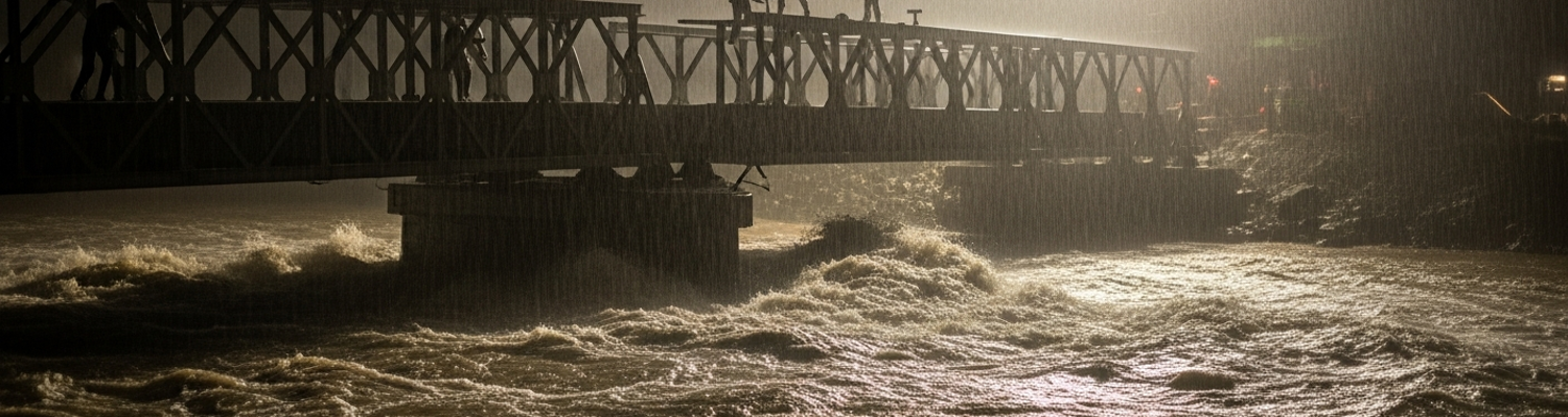
Strategic decisions, once made, gathered a momentum of their own. An order to construct a pontoon bridge, issued from a headquarters 80 miles away based on maps surveyed in the dry season, would proceed down the chain of command. The initial ground report about the flash flood, still fighting its way up the same chain, would not arrive in time to stop it. Archival evidence (NARA Record Group 472) shows instances where engineer companies were ordered to execute construction plans at locations their own reconnaissance teams had already marked as impossible. Following orders, they would move heavy bridge sections and M4T6 floating pontoons toward a river that was now a violent, debris-filled torrent. The attempt to place anchors or ferry the first sections would fail. The force of the water, far exceeding the specifications the bridge was designed for, would rip equipment from its moorings. The loss was measured in more than just equipment. The strategic plan had called for a bridge to support a subsequent infantry advance. Its failure meant the entire operation was jeopardized. The infantry units were left unsupported. The intended flanking maneuver was canceled. On the riverbank, the engineering company would be recovering what little they could of their multi-ton equipment and accounting for their dead.
Route 9 Monsoon Infrastructure Collapse
The 1968 monsoon did not arrive in I Corps; it descended with geologic force. Rainfall totals exceeded those of previous years by a significant margin. The red laterite soil of Quảng Trị Province, baked hard by the dry season, quickly became a viscous, abrasive slurry that flowed with the water. This mixture was ruthlessly effective at destroying the foundations of the bridges and culverts that made Route 9 the essential logistical artery. Standard M2 Bailey bridges, designed for rapid assembly, were not engineered to withstand the hydraulic pressure of a river cresting its banks by meters in a matter of hours. Their support foundations, often hastily prepared in the loose, unstable soil, were scoured away. Reports from engineer battalions describe bridge abutments vanishing overnight, leaving steel bridge panels sagging and then collapsing.
Concrete culverts, designed to channel smaller streams under the roadbed, became choke points. Debris clogged the openings, and the immense pressure of the dammed-up water either crushed the concrete structures or blew them out entirely. This created massive, impassable gaps in the roadway.
Within weeks, Route 9 ceased to be a road in any functional sense. It became a series of disconnected islands of pavement linked by churning waterways.
This systematic collapse of infrastructure created isolated pockets of intense combat and dwindling supplies. Fire Support Bases like Khe Sanh, the Rockpile, and Camp Carroll, strung along Route 9, were designed as interdependent hardpoints providing mutual artillery support. Their entire operational concept was predicated on the ability to be resupplied by road. With Route 9 severed, this was no longer possible. Convoys carrying 105mm and 155mm howitzer rounds, C-rations, and medical supplies could not get through. Archival evidence shows an abrupt shift to aerial resupply. The same monsoon weather that washed out the bridges grounded aircraft for days at a time. A Marine at Khe Sanh was effectively on an island, watching his unit’s stockpile of ammunition shrink with every outgoing round while knowing the road that was supposed to replenish it was gone. The enemy, unburdened by a reliance on fixed infrastructure, used this isolation to their full advantage.
The physical blindness imposed by the monsoon was compounded by an information blindness created within the chain of command itself. The primary tool for reporting a unit's status was the daily Morning Report (DA Form 1). During the Vietnam War, these reports had been streamlined to focus primarily on personnel changes. The section for a detailed “record of events” describing ground conditions had been removed. This bureaucratic alteration had massive consequences. A company commander seeing a bridge washed away had no standardized field in his official daily report to convey the severity of the situation. A pervasive “can-do” culture within the officer corps also discouraged reports that sounded like admissions of an inability to complete a mission. A captain who accurately described his unit as being immobilized in three feet of mud could be seen as failing. The result was the systematic sanitization of ground truth. “The bridge at grid coordinate YD123456 has been destroyed by flooding and the road is impassable for five kilometers” became “Route 9 affected by heavy rains, movement restricted.” Headquarters, reading the sanitized version, would see a temporary problem requiring a routine engineering task, not a fundamental collapse of the area’s logistical framework.
AN/TPQ-10 Radar Performance Degradation
An important component of the American all-weather combat strategy in I Corps was the General Electric AN/TPQ-10 Course Directing Central. Deployed and operated by Marine Air Support Squadrons, these helicopter-transportable ground radar units were designed to be the solution to bad weather, providing day-night guidance for close air support missions. An Air Support Radar Team (ASRT) using the AN/TPQ-10 could lock onto a friendly aircraft and provide precise verbal steering commands, guiding the pilot to a pre-selected ordnance release point with high accuracy, even when the target was completely obscured. The system, operating on the X-band frequency (around 8 to 12 GHz), was a significant technological asset, directing thousands of strikes during the 1968 defense of Khe Sanh.
Its own physics became its primary vulnerability.
The term “all-weather” proved to be a conditional promise. The system was engineered to penetrate clouds, but it was not designed to overcome the sheer volume of water present in a tropical monsoon surge. X-band radar signals are subject to severe attenuation, or signal degradation, when passing through dense precipitation. To the ASRT operators on the ground, a monsoon squall line was an impenetrable wall. The radar’s signal, which could reliably track aircraft up to 50 miles away in clear conditions, would degrade catastrophically. Its energy was absorbed by the deluge. The operators’ scopes would either return a chaotic mess of ground clutter from the rainfall or show nothing at all as the signal failed to return. The sophisticated guidance computer was rendered useless.
This electronic blindness was matched by a physical one. The second link in the air support chain was the forward air controller, or FAC. Flying low in light observation aircraft like the O-1 Bird Dog or O-2 Skymaster, the FAC was the human set of eyes for high-speed fighter-bombers. Their task was to loiter over the battlefield, visually acquire enemy positions, and mark them with smoke rockets for the inbound strike aircraft. This process demanded clear lines of sight. The 1968 monsoon completely negated this capability. Persistent low-visibility conditions were an operational shutdown. The cloud ceiling frequently dropped to treetop level, and dense fog reduced visibility to less than a few hundred meters. For a FAC pilot, this meant flying in a perpetual white-out, completely detached from the terrain below. Any attempt to dip below the cloud layer to acquire targets in the steep, jungle-choked valleys was exceptionally dangerous and often futile. With the FACs effectively grounded or unable to perform their mission, a massive intelligence and targeting capability was lost.
The combination of these two failures had a direct impact on Operation Arc Light, the campaign that utilized B-52 Stratofortress bombers against NVA infiltration routes. Arc Light missions depended heavily on a ground-directed bombing system known as Combat Skyspot, which used a network of radar sites, including the AN/TPQ-10, to guide the high-flying bombers. This system provided the precision needed to saturate specific target boxes. When the monsoon blinded the ground radars and the FACs, this targeting chain was broken. B-52s, flying in their three-plane cells from bases in Guam or Thailand, would arrive over a target area that their primary guidance systems could no longer accurately service. This left commanders with a stark choice: cancel the sortie and allow the enemy to move unhindered, or authorize a strike with degraded accuracy. For the North Vietnamese Army, the monsoon provided a near-impenetrable cloak for logistical movement, allowing units to surge down the Ho Chi Minh Trail while America’s most powerful conventional weapon flew blind above the clouds.
1st Engineer Battalion Bailey Bridge Efforts
A review of operational logs from the 1st Engineer Battalion, organic to the 1st Infantry Division, details the scope of their mission near Khe Sanh in 1968. Their primary task was not one of static defense but of continuous construction and repair along Route 9. This road was the lifeline for the besieged Khe Sanh Combat Base, and the engineers were tasked with keeping it open against both enemy action and the monsoon. The work was a brutal cycle. NVA sappers and artillery would target culverts and bridges at night. By morning, engineer teams would be dispatched to repair the damage. The terrain, a landscape of steep ravines and waterlogged soil, made every project a significant undertaking. Standard equipment like bulldozers and graders became bogged down in the laterite slurry, requiring teams to innovate with timber matting and extensive groundwork just to get heavy machinery into position.
The reconstruction of a washed-out Bailey bridge illustrates the tactical situation for the engineers. A standard M2 Bailey, a prefabricated truss bridge, had its abutments scoured and destroyed by a flash flood on a tributary feeding the Rao Quan River. With the bridge impassable, a Marine company conducting patrols was cut off from its primary resupply route. The 1st Engineer Battalion dispatched a platoon with replacement bridge components.
The work had to be done under direct enemy observation.
NVA spotters in the surrounding hills directed intermittent but accurate 82mm mortar fire onto the construction site. The engineering effort became a synchronized, high-stakes procedure. One squad would provide covering fire, suppressing suspected spotter positions, while another team worked to clear the destroyed abutments and prepare new footings. The Bailey components, 10-foot-long, 600-pound steel panels, were manhandled into place. The engineers used a standard launching nose, a lightweight skeleton of the bridge pushed across the gap on rollers, to guide the main structure. Each time the NVA mortars found their range, the teams would take cover in hastily dug fighting positions, emerging as soon as the barrage lifted to continue the assembly. Adding a single panel under these conditions could take an hour, a process that in a secure rear area would take minutes.
MACV Directives Versus Ground Conditions
The strategic doctrine issued from Military Assistance Command, Vietnam (MACV) headquarters in 1968 remained committed to an aggressive, large-unit war of attrition. General William C. Westmoreland’s strategy centered on maintaining constant pressure against North Vietnamese Army (NVA) and Viet Cong main force units. Following the Tet Offensive, this directive intensified. Field commanders received orders to execute relentless search-and-destroy missions. Infantry units were expected to conduct long-range patrols deep into enemy-controlled territory to interdict supply lines.
The directives coming out of Saigon envisioned a highly mobile, proactive force dominating the battlefield. For the line companies operating in the northern provinces of I Corps, these directives were functionally impossible to execute. The monsoon did not just make movement difficult; it made it a suicidal endeavor. A Marine infantry company ordered to conduct a week-long reconnaissance patrol west of Khe Sanh was facing a terrain that had dissolved into a landscape of water and mud. Patrols that would take a day in the dry season now took a week, consuming exponentially more resources. A review of operational logs shows units were frequently immobilized, unable to move from their night defensive positions for days at a time as rain turned the ground into a thigh-deep quagmire.
A single platoon on patrol required a constant feed of supplies: M16 ammunition, M79 grenade rounds, claymore mines, C-rations, and batteries for the AN/PRC-25 radios that were their only link to support. With Route 9 completely severed, this lifeline depended entirely on helicopter resupply.
The logistical chain was broken. The same torrential rains that grounded forward air controllers also grounded the CH-47 Chinook and UH-1 Huey helicopters needed to deliver those supplies. A company down to its last magazines and with exhausted radio batteries was not an offensive weapon; it was a target. After-action reports (such as AAR 3-5 CAV/25ID-7-68) document a stark divergence between orders and actions. Instead of conducting “aggressive patrolling,” company and platoon leaders were forced to adopt a defensive posture. They avoided enemy contact to conserve ammunition and established tight perimeters to wait for a break in the weather. The strategic imperative from MACV was to find and engage the enemy. The tactical necessity for survival was to hide from him.
This disconnect was a direct result of the isolation of high-level command. A division commander at his headquarters in Da Nang, or a MACV planner in Saigon, viewed the war through the sanitized lens of maps and status charts. A unit mired in mud and cut off from supply for three days would be represented on an acetate overlay as a green marker inside its designated area of operations, notionally “at full strength.” A message that should have read “Platoon is combat ineffective, immobilized by terrain, and critically low on all supplies” was rephrased on its way up the chain of command to “Movement restricted by weather, awaiting resupply.” Based on this filtered information, planners would issue new orders for offensive sweeps, creating a deadly cycle where units were pushed beyond their logistical limits based on a fundamental misunderstanding of their actual condition. The blindness at headquarters was a failure of information, dooming soldiers to missions that were impossible before they began.